CanalPlanAC

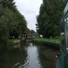
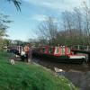
Tyle Mill Lock No 99

 
Sulhamstead Hill, Sulhamstead RG7 4BT, United Kingdom
 
Information about the place
Tyle Mill Lock No 99 is a minor waterways place on the River Kennet between Burghfield Bridge No 14 (Burghfield) (3 miles and 7¾ furlongs and 4 locks to the east) and Newbury Lock No 85 (11 miles and ½ furlongs and 12 locks to the west).
 
 
The nearest place in the direction of Burghfield Bridge No 14 is Tyle Mill Swing Bridge No 23; ¼ furlongs away.
 
The nearest place in the direction of Newbury Lock No 85 is Tyle Mill Winding Hole (Tyle Mill Lock Weir Entrance); 2 furlongs away.

Mooring here is unrated.

This is a lock with a rise of 6 feet and 4 inches.


Amenities
 
Maps
If you are a user and are logged on, or if you are actively planning a route, a map will be displayed here.
Show on external mapping site: Google | OSM | Bing
 
Photos
 
External websites
There are no links to external websites from here.
Why not log in and add some (select "External websites" from the menu (sometimes this is under "Edit"))?
 
Nearest facilities

Mouseover for more information or show routes to facility

Nearest water point

In the direction of Northcroft Lane Arm

Aldermaston Lock No 952 miles, 2¼ furlongs and 3 locks away
On this waterway in the direction of Northcroft Lane Arm
Ham Manor Marina10 miles, ¼ furlongs and 12 locks away
On this waterway in the direction of Northcroft Lane Arm
Kintbury Services17 miles, ¾ furlongs and 21 locks away
Travel to Northcroft Lane Arm, then on the Kennet and Avon Canal (Main Line) to Kintbury Services

In the direction of High Bridge Reading

Tyle Mill Lock C&RT Services¼ furlongs and 1 lock away
On this waterway in the direction of High Bridge Reading
Thames & Kennet Marina8 miles, 3¾ furlongs and 9 locks away
Travel to High Bridge Reading, then on the River Thames (River Kennet) to Thames - Kennet Junction (Kennet Mouth), then on the River Thames (below Oxford) to Thames & Kennet Marina
Shiplake Lock13 miles, ¾ furlongs and 10 locks away
Travel to High Bridge Reading, then on the River Thames (River Kennet) to Thames - Kennet Junction (Kennet Mouth), then on the River Thames (below Oxford) to Shiplake Lock

Nearest rubbish disposal

In the direction of Northcroft Lane Arm

Aldermaston Lock No 952 miles, 2¼ furlongs and 3 locks away
On this waterway in the direction of Northcroft Lane Arm
Ham Manor Marina10 miles, ¼ furlongs and 12 locks away
On this waterway in the direction of Northcroft Lane Arm
Kintbury Services17 miles, ¾ furlongs and 21 locks away
Travel to Northcroft Lane Arm, then on the Kennet and Avon Canal (Main Line) to Kintbury Services

In the direction of High Bridge Reading

Tyle Mill Lock C&RT Services¼ furlongs and 1 lock away
On this waterway in the direction of High Bridge Reading
Shiplake Lock13 miles, ¾ furlongs and 10 locks away
Travel to High Bridge Reading, then on the River Thames (River Kennet) to Thames - Kennet Junction (Kennet Mouth), then on the River Thames (below Oxford) to Shiplake Lock
Mapledurham Lock13 miles, 3¾ furlongs and 10 locks away
Travel to High Bridge Reading, then on the River Thames (River Kennet) to Thames - Kennet Junction (Kennet Mouth), then on the River Thames (below Oxford) to Mapledurham Lock
Marsh Lock15 miles, 6½ furlongs and 11 locks away
Travel to High Bridge Reading, then on the River Thames (River Kennet) to Thames - Kennet Junction (Kennet Mouth), then on the River Thames (below Oxford) to Marsh Lock
Hambleden Lock19 miles, 1¼ furlongs and 12 locks away
Travel to High Bridge Reading, then on the River Thames (River Kennet) to Thames - Kennet Junction (Kennet Mouth), then on the River Thames (below Oxford) to Hambleden Lock
Goring Lock19 miles, 6¾ furlongs and 12 locks away
Travel to High Bridge Reading, then on the River Thames (River Kennet) to Thames - Kennet Junction (Kennet Mouth), then on the River Thames (below Oxford) to Goring Lock

Nearest chemical toilet disposal

In the direction of Northcroft Lane Arm

Aldermaston Lock No 952 miles, 2¼ furlongs and 3 locks away
On this waterway in the direction of Northcroft Lane Arm
Ham Manor Marina10 miles, ¼ furlongs and 12 locks away
On this waterway in the direction of Northcroft Lane Arm
Kintbury Services17 miles, ¾ furlongs and 21 locks away
Travel to Northcroft Lane Arm, then on the Kennet and Avon Canal (Main Line) to Kintbury Services

In the direction of High Bridge Reading

Tyle Mill Lock C&RT Services¼ furlongs and 1 lock away
On this waterway in the direction of High Bridge Reading
Thames & Kennet Marina8 miles, 3¾ furlongs and 9 locks away
Travel to High Bridge Reading, then on the River Thames (River Kennet) to Thames - Kennet Junction (Kennet Mouth), then on the River Thames (below Oxford) to Thames & Kennet Marina
Shiplake Lock13 miles, ¾ furlongs and 10 locks away
Travel to High Bridge Reading, then on the River Thames (River Kennet) to Thames - Kennet Junction (Kennet Mouth), then on the River Thames (below Oxford) to Shiplake Lock
Mapledurham Lock13 miles, 3¾ furlongs and 10 locks away
Travel to High Bridge Reading, then on the River Thames (River Kennet) to Thames - Kennet Junction (Kennet Mouth), then on the River Thames (below Oxford) to Mapledurham Lock

Nearest place to turn

In the direction of Northcroft Lane Arm

Tyle Mill Winding Hole2 furlongs and 1 lock away
On this waterway in the direction of Northcroft Lane Arm
Winding Hole by Ufton Swing Bridge4¾ furlongs and 1 lock away
On this waterway in the direction of Northcroft Lane Arm
Winding Hole below Padworth Lock1 mile, 7½ furlongs and 2 locks away
On this waterway in the direction of Northcroft Lane Arm
Aldermaston Arm2 miles, 2 furlongs and 3 locks away
On this waterway in the direction of Northcroft Lane Arm
Frouds Bridge Marina (entrance)3 miles, 2¾ furlongs and 4 locks away
On this waterway in the direction of Northcroft Lane Arm
Winding Hole below Heals Lock5 miles and 5 locks away
On this waterway in the direction of Northcroft Lane Arm
Winding Hole above Midgham Lock5 miles, 6¼ furlongs and 7 locks away
On this waterway in the direction of Northcroft Lane Arm

In the direction of High Bridge Reading

Winding Hole below Tyle Mill Lock½ furlongs and 1 lock away
On this waterway in the direction of High Bridge Reading
Draper's Osier Bed Stream Leaves3½ furlongs and 1 lock away
On this waterway in the direction of High Bridge Reading
Winding Hole below Sulhampstead Lock6¾ furlongs and 2 locks away
On this waterway in the direction of High Bridge Reading
Sheffield Lock Weir Entrance1 mile, 3 furlongs and 2 locks away
On this waterway in the direction of High Bridge Reading
Winding Hole below Garston Lock2 miles, 2 furlongs and 4 locks away
On this waterway in the direction of High Bridge Reading
Burghfield Mill Winding Hole3 miles, 1 furlong and 4 locks away
On this waterway in the direction of High Bridge Reading
Burghfield Lock Weir Exit3 miles, 4½ furlongs and 5 locks away
On this waterway in the direction of High Bridge Reading
Burghfield Island Entrance No 23 miles, 7½ furlongs and 5 locks away
On this waterway in the direction of High Bridge Reading
Burghfield Island Entrance No 14 miles, 1¼ furlongs and 5 locks away
On this waterway in the direction of High Bridge Reading
Southcote Lock Weir Exit4 miles, 6¼ furlongs and 6 locks away
On this waterway in the direction of High Bridge Reading
Fobney Lock Weir Entrance5 miles, ¼ furlongs and 6 locks away
On this waterway in the direction of High Bridge Reading
Winding Hole above Fobney Lock5 miles, 4 furlongs and 6 locks away
On this waterway in the direction of High Bridge Reading
Fobney Lock Weir Exit5 miles, 4½ furlongs and 7 locks away
On this waterway in the direction of High Bridge Reading

Nearest self-operated pump-out

In the direction of Northcroft Lane Arm

Kintbury Services17 miles, ¾ furlongs and 21 locks away
Travel to Northcroft Lane Arm, then on the Kennet and Avon Canal (Main Line) to Kintbury Services

In the direction of High Bridge Reading

Tyle Mill Lock C&RT Services¼ furlongs and 1 lock away
On this waterway in the direction of High Bridge Reading
Mapledurham Lock13 miles, 3¾ furlongs and 10 locks away
Travel to High Bridge Reading, then on the River Thames (River Kennet) to Thames - Kennet Junction (Kennet Mouth), then on the River Thames (below Oxford) to Mapledurham Lock

Nearest boatyard pump-out

In the direction of Northcroft Lane Arm

Newbury Marina10 miles, 5 furlongs and 13 locks away
On this waterway in the direction of Northcroft Lane Arm

In the direction of High Bridge Reading

Thames & Kennet Marina8 miles, 3¾ furlongs and 9 locks away
Travel to High Bridge Reading, then on the River Thames (River Kennet) to Thames - Kennet Junction (Kennet Mouth), then on the River Thames (below Oxford) to Thames & Kennet Marina
Direction of TV transmitter (From Wolfbane Cybernetic)
 
 
Geograph
 
Wikipedia

Wikipedia has a page about Tyle Mill Lock

Tyle Mill Lock (grid reference SU626691) is a lock situated near Tyle Mill and the village of Sulhamstead on the Kennet and Avon Canal, England.

Tyle Mill Lock was built between 1718 and 1723 under the supervision of the engineer John Hore of Newbury, and this stretch of the river is now administered by the Canal & River Trust and known as the Kennet Navigation. It has a rise/fall of 6 ft 4 in (1.93 m).

The lock became derelict in the 1950s and then formed the head of the navigation from the River Thames. As a result, British Waterways created a winding hole and installed a sanitary station in the old pillbox below the lock. It was restored in 1973 but remained out of commission until 1976 when work on locks further west had been completed.

Close to the lock are a wharf and swing bridge.

Other Wikipedia pages that might relate to Tyle Mill Lock
[Tyle Mill] Tyle Mill is a mill on the River Kennet near Sulhamstead, Berkshire, England. The mill originally produced flour; a fire in 1914 burned down the buildings [Sulhamstead] Sulhamstead Hill, built in 1927. Sulhamstead Lock, Tyle Mill and Tyle Mill Lock on the Kennet & Avon Canal have a wharf, lock and swing bridge. The singer-songwriter [Swing bridge] Hull, England docks branch bridge – rail Kennet and Avon Canal at Tyle Mill Lock, Sulhamstead, Berkshire Kincardine Bridge – crossing the Firth of Forth [Kennet and Avon Canal] industry. The remains of Kelston Brass Mill, which was working until 1925, are next to Saltford Lock. The lock was opened in 1727 but destroyed by rival [List of locks on the Kennet and Avon Canal] September 2006. "Oakhill Down Lock". historicengland.org.uk. English Heritage. Retrieved 3 September 2006. "Dun Mill Lock". historicengland.org.uk. English [River Kennet] artificially created lock cuts, and a series of locks including County, Fobney, Southcote, Burghfield, Garston, Sheffield, Sulhamstead and Tyle Mill overcome a [Waterways in the United Kingdom] Sulhamstead Tyle Mill Lock (Kennet & Avon Canal). [Ufton Lock] Ufton Lock is a degated lock on the Kennet and Avon Canal, between Padworth and Sulhamstead, Berkshire, England. Ufton Lock was built in c. 1834, making [Sulhamstead Lock] Sulhamstead Lock is a lock on the River Kennet at Sulhamstead in the English county of Berkshire. Sulhamstead Lock was built between 1718 and 1723 under
 
Google

Results of Google Search

12 :: Kennet Navigation from Reading to Newbury :: Geograph ...
... Tyle Mill Lock No.99: Tyle Mill Swing Bridge: · Ufton Lock No.98 and Swing ... And as you can see it is not a swing bridge like it says on the map which will ...
24 hours DW Race Map - Wey Kayak Club
Devizes Westminster Kennet Lock (No 50). Cemetry Road ... Dunmill Lock Bridge [No 82]. 27.17 Wire Lock (No 76) ... Tyle Mill Lock (No 99) [R]. Tyle Mill swing ...
17 :: Kennet Navigation from Reading to Newbury :: Geograph ...
Thatcham Swing Bridge (now fixed): Monkey Marsh Lock No.90: Monkey ... The unusual Monkey Marsh Lock on the Kennet & Avon Canal at Thatcham, the ...
DW Race 2nd day Map - Wey Kayak Club
... 35.42Whitehouse Roving Bridge Pub [No 53]35.29 89.71 Ham Mills Lock (No ... [ No 25A ]Tyle Mill Lock (No 99) [R]Tyle Mill swing Bridge [No 23]Sulhamstead  ...
List of locks on the Kennet and Avon Canal - Wikipedia
The Kennet and Avon Canal is a canal in southern England. The name may refer to either the ... 99, Tyle Mill Lock · SU626691, 6 feet 4 inches (1.93 m). 100, Sulhamstead Lock ... "Bradford on Avon Lock No 14". Canalplan AC Gazetteer.
4 :: Kennet Navigation from Reading to Newbury :: Geograph Britain ...
Burghfield Island Boat Club: Burghfield Bridge No.14 ... The gates control the flow of water around Southcote Lock. The houses of Southcote to the north of the ...
3 :: Kennet Navigation from Reading to Newbury :: Geograph Britain ...
SU7071 : Fobney Lock No 105, Kennet and Avon Navigation, Reading, ... it did not see a great deal of use, as a few miles further west, at Tyle Mill, was then the  ...
Tyle Mill Lock - Wikipedia
Tyle Mill Lock (grid reference SU626691) is a lock situated near Tyle Mill and the village of Sulhamstead on the Kennet and Avon Canal, England. Tyle Mill Lock ...