CanalPlanAC

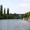
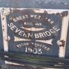
Worcester Railway Bridge

 
Hylton Road, St Clements WR2 5JN, United Kingdom (A443)
 
Information about the place
Worcester Railway Bridge is a minor waterways place on the River Severn (main river - Stourport to Worcester) between Worcester (Riverside moorings) (3 furlongs to the southeast) and Hawford Junction (Junction of Droitwich Canal with River Severn) (3 miles and 4¼ furlongs and 1 lock to the north).
 
It is part of Worcester.
 
The nearest place in the direction of Worcester is Worcester Trip Boat Moorings; ¾ furlongs away.
 
The nearest place in the direction of Hawford Junction is Sabrina Footbridge (Footbridge to the racecourse); 1 furlong away.

Mooring here is tolerable (it's just about possible if really necessary), mooring rings or bollards are available. This is under repair. There may be a fee for use of City Moorings.

There is a bridge here which takes a railway over the canal.

Diglis Junction7 furlongs
Worcester3 furlongs
Worcester Road Bridge1¾ furlongs
Worcester Trip Boat Moorings¾ furlongs
Worcester Railway Bridge
Sabrina Footbridge1 furlong
Worcester Racecourse Moorings3 furlongs
Worcester Waterworks1 mile, ¾ furlongs
Bevere Lock Weir Exit2 miles, 7½ furlongs
Bevere Lock3 miles, ¼ furlongs
 
 
Amenities

Amenities here

 BP
 Mkp Bp
 Homebase

Amenities nearby at Worcester Trip Boat Moorings

 McDonalds
 Cashpoint
 Lloyds Bank

Amenities in Worcester

 Costcutter
 Lidl
 Tesco
 Tesco
 Postal Order
 Dominos Pizza
 Fish & Chips
 Barclays
 Cashpoint
 Cashpoint
 Cashpoint
 HSBC
 NatWest
 Esso
 Tesco Petrol Station
 Total
 Machine Mart

Amenities at other places in Worcester

 Iceland at Worcester Road Bridge
 Sainsbury's at Worcester
 Sainsburys at Worcester
 Caffe Nero at Worcester
 Costa Coffee at Worcester Road Bridge
 Patisserie-Valerie at Worcester Road Bridge
 Ask and Zizzi at Worcester Road Bridge
 McDonalds at Worcester Road Bridge
 Anchor Inn at Diglis Services
 Cap 'n Gown at Lansdowne Road Bridge No 11
 Coach & Horses at Lansdowne Road Bridge No 11
 Courtyard at Worcester Road Bridge
 Cricketers at Worcester Road Bridge
 Horn and Trumpet at Worcester Road Bridge
 Slug & Lettuce at Worcester Road Bridge
 The Crown at Worcester Road Bridge
 Ye Olde Talbot at Blockhouse Bridge No 4
 Dunelm Mill at Worcester Road Bridge
 Poundland at Blockhouse Bridge No 4
 W H Smith at Worcester
 Burger King at Worcester Road Bridge
 Subway Sandwich Shop at Worcester Road Bridge
 Boots Chemist at Worcester
 Boots Chemist at Rainbow Hill Bridge No 9
 Barclays at Worcester
 Cashpoint at Worcester
 Cashpoint at Worcester
 Cashpoint at Worcester
 Cashpoint at Worcester
 Cashpoint at Worcester
 Cashpoint at Worcester Road Bridge
 Cashpoint at Worcester Road Bridge
 Cashpoint at Worcester Road Bridge
 Cashpoint at Worcester Road Bridge
 Lloyds Bank at Worcester Road Bridge
 NatWest at Worcester Road Bridge
 Nationwide at Worcester Road Bridge
 Santander at Worcester Road Bridge
 Santander at Worcester Road Bridge
 TSB at Worcester
 Forecourt M-F 6pm at Worcester Road Bridge
 Mr Burnside at Diglis Dock
 Mr J D Morris T/A at Worcester Waterworks
 Worcester Calor Centre at Cromwell Street Footbridge Bridge No 6
 Worcester Calor Centre M-F 5pm 01905 28839 at Cromwell Street Footbridge Bridge No 6
 Worcester, Crown Biofuels at Blockhouse Lock No 4
 Buildbase at Diglis Basin Marina
 Jewson at Diglis Locks
 Peddlers - Worcester at Tavern Hill Bridge No 12
 Plumbing Trade Supplies at Cromwell Street Footbridge Bridge No 6
 Worcester Foregate Street Station at Rainbow Hill Bridge No 9
 Worcester Shrub Hill Station at Cromwell Street Footbridge Bridge No 6
 
Maps
If you are a user and are logged on, or if you are actively planning a route, a map will be displayed here.
Show on external mapping site: Google | OSM | Bing
 
Photos
 
External websites
There are no links to external websites from here.
Why not log in and add some (select "External websites" from the menu (sometimes this is under "Edit"))?
 
Nearest facilities

Mouseover for more information or show routes to facility

Nearest water point

In the direction of Limit of Navigation

Holt Lock (Holt Fleet)6 miles, 4 furlongs and 1 lock away
On this waterway in the direction of Limit of Navigation
Lincomb Lock10 miles, 5¾ furlongs and 2 locks away
On this waterway in the direction of Limit of Navigation
Upper Basin Waterpoint12 miles, 1 furlong and 5 locks away
Travel to Severn - Stourport Broad Locks Entrance, then on the Staffordshire and Worcestershire Canal (Stourport Basins: Broad Route) to Stourport Upper Basin, then on the Staffordshire and Worcestershire Canal (Stourport Basins: Narrow Route) to Upper Basin Waterpoint
Netherwich Basin9 miles and 9 locks away
Travel to Hawford Junction, then on the Droitwich Canals (Droitwich Barge Canal) to Netherwich Basin
Caldwall Mill Bridge No 1415 miles, 7¼ furlongs and 8 locks away
Travel to Severn - Stourport Broad Locks Entrance, then on the Staffordshire and Worcestershire Canal (Stourport Basins: Broad Route) to Stourport Upper Basin, then on the Staffordshire and Worcestershire Canal (Stourport Basins: Narrow Route) to York Street Bridge, then on the Staffordshire and Worcestershire Canal (Main Line: Stourport to Stourton) to Caldwall Mill Bridge No 14
Droitwich Spa Marina10 miles, 3½ furlongs and 14 locks away
Travel to Hawford Junction, then on the Droitwich Canals (Droitwich Barge Canal) to Droitwich Junction, then on the Droitwich Canals (Droitwich Junction Canal) to Droitwich Spa Marina

In the direction of Diglis Junction

Worcester Trip Boat Moorings¾ furlongs away
On this waterway in the direction of Diglis Junction
Diglis Locks1 mile, 1½ furlongs away
Travel to Diglis Junction, then on the River Severn (main river - Worcester to Gloucester) to Diglis Locks
Diglis Services1 mile, ½ furlongs and 2 locks away
Travel to Diglis Junction, then on the Worcester and Birmingham Canal (Diglis Junction to Diglis Basin) to Diglis Basin, then on the Worcester and Birmingham Canal (Diglis Basin to King's Norton Junction) to Diglis Services
Lowesmoor Basin2 miles, ¼ furlongs and 4 locks away
Travel to Diglis Junction, then on the Worcester and Birmingham Canal (Diglis Junction to Diglis Basin) to Diglis Basin, then on the Worcester and Birmingham Canal (Diglis Basin to King's Norton Junction) to Lowesmoor Basin
Upper Lode Lock No 517 miles, 3 furlongs and 1 lock away
Travel to Diglis Junction, then on the River Severn (main river - Worcester to Gloucester) to Upper Lode Lock No 5
Tewkesbury Services17 miles, ¾ furlongs and 2 locks away
Travel to Diglis Junction, then on the River Severn (main river - Worcester to Gloucester) to Tewkesbury Junction, then on the River Avon - Warwickshire (Lower Avon Navigation) to Tewkesbury Services
Tewkesbury Lower Lode18 miles, 1¼ furlongs and 2 locks away
Travel to Diglis Junction, then on the River Severn (main river - Worcester to Gloucester) to Tewkesbury Lower Lode
Hanbury Boatyard9 miles, 7¾ furlongs and 16 locks away
Travel to Diglis Junction, then on the Worcester and Birmingham Canal (Diglis Junction to Diglis Basin) to Diglis Basin, then on the Worcester and Birmingham Canal (Diglis Basin to King's Norton Junction) to Hanbury Boatyard
Stoke Works Water Point12 miles, 4¾ furlongs and 22 locks away
Travel to Diglis Junction, then on the Worcester and Birmingham Canal (Diglis Junction to Diglis Basin) to Diglis Basin, then on the Worcester and Birmingham Canal (Diglis Basin to King's Norton Junction) to Stoke Works Water Point
Tardebigge Wharf16 miles, 5¼ furlongs and 58 locks away
Travel to Diglis Junction, then on the Worcester and Birmingham Canal (Diglis Junction to Diglis Basin) to Diglis Basin, then on the Worcester and Birmingham Canal (Diglis Basin to King's Norton Junction) to Tardebigge Wharf

Nearest rubbish disposal

In the direction of Limit of Navigation

Sabrina Footbridge1 furlong away
On this waterway in the direction of Limit of Navigation
Upper Basin Waterpoint12 miles, 1 furlong and 5 locks away
Travel to Severn - Stourport Broad Locks Entrance, then on the Staffordshire and Worcestershire Canal (Stourport Basins: Broad Route) to Stourport Upper Basin, then on the Staffordshire and Worcestershire Canal (Stourport Basins: Narrow Route) to Upper Basin Waterpoint
Netherwich Basin9 miles and 9 locks away
Travel to Hawford Junction, then on the Droitwich Canals (Droitwich Barge Canal) to Netherwich Basin
Droitwich Spa Marina10 miles, 3½ furlongs and 14 locks away
Travel to Hawford Junction, then on the Droitwich Canals (Droitwich Barge Canal) to Droitwich Junction, then on the Droitwich Canals (Droitwich Junction Canal) to Droitwich Spa Marina

In the direction of Diglis Junction

Diglis Basin1 mile and 2 locks away
Travel to Diglis Junction, then on the Worcester and Birmingham Canal (Diglis Junction to Diglis Basin) to Diglis Basin
Lowesmoor Basin2 miles, ¼ furlongs and 4 locks away
Travel to Diglis Junction, then on the Worcester and Birmingham Canal (Diglis Junction to Diglis Basin) to Diglis Basin, then on the Worcester and Birmingham Canal (Diglis Basin to King's Norton Junction) to Lowesmoor Basin
Tewkesbury Services17 miles, ¾ furlongs and 2 locks away
Travel to Diglis Junction, then on the River Severn (main river - Worcester to Gloucester) to Tewkesbury Junction, then on the River Avon - Warwickshire (Lower Avon Navigation) to Tewkesbury Services
Stoke Bottom Lock No 2313 miles, 2½ furlongs and 22 locks away
Travel to Diglis Junction, then on the Worcester and Birmingham Canal (Diglis Junction to Diglis Basin) to Diglis Basin, then on the Worcester and Birmingham Canal (Diglis Basin to King's Norton Junction) to Stoke Bottom Lock No 23
Tardebigge Wharf16 miles, 5¼ furlongs and 58 locks away
Travel to Diglis Junction, then on the Worcester and Birmingham Canal (Diglis Junction to Diglis Basin) to Diglis Basin, then on the Worcester and Birmingham Canal (Diglis Basin to King's Norton Junction) to Tardebigge Wharf

Nearest chemical toilet disposal

In the direction of Limit of Navigation

Stourport Marina11 miles, 1 furlong and 3 locks away
On this waterway in the direction of Limit of Navigation
Upper Basin Waterpoint12 miles, 1 furlong and 5 locks away
Travel to Severn - Stourport Broad Locks Entrance, then on the Staffordshire and Worcestershire Canal (Stourport Basins: Broad Route) to Stourport Upper Basin, then on the Staffordshire and Worcestershire Canal (Stourport Basins: Narrow Route) to Upper Basin Waterpoint
Caldwall Mill Bridge No 1415 miles, 7¼ furlongs and 8 locks away
Travel to Severn - Stourport Broad Locks Entrance, then on the Staffordshire and Worcestershire Canal (Stourport Basins: Broad Route) to Stourport Upper Basin, then on the Staffordshire and Worcestershire Canal (Stourport Basins: Narrow Route) to York Street Bridge, then on the Staffordshire and Worcestershire Canal (Main Line: Stourport to Stourton) to Caldwall Mill Bridge No 14
Droitwich Spa Marina10 miles, 3½ furlongs and 14 locks away
Travel to Hawford Junction, then on the Droitwich Canals (Droitwich Barge Canal) to Droitwich Junction, then on the Droitwich Canals (Droitwich Junction Canal) to Droitwich Spa Marina

In the direction of Diglis Junction

Diglis Services1 mile, ½ furlongs and 2 locks away
Travel to Diglis Junction, then on the Worcester and Birmingham Canal (Diglis Junction to Diglis Basin) to Diglis Basin, then on the Worcester and Birmingham Canal (Diglis Basin to King's Norton Junction) to Diglis Services
Lowesmoor Basin2 miles, ¼ furlongs and 4 locks away
Travel to Diglis Junction, then on the Worcester and Birmingham Canal (Diglis Junction to Diglis Basin) to Diglis Basin, then on the Worcester and Birmingham Canal (Diglis Basin to King's Norton Junction) to Lowesmoor Basin
Stoke Bottom Lock No 2313 miles, 2½ furlongs and 22 locks away
Travel to Diglis Junction, then on the Worcester and Birmingham Canal (Diglis Junction to Diglis Basin) to Diglis Basin, then on the Worcester and Birmingham Canal (Diglis Basin to King's Norton Junction) to Stoke Bottom Lock No 23
Tardebigge Wharf16 miles, 5¼ furlongs and 58 locks away
Travel to Diglis Junction, then on the Worcester and Birmingham Canal (Diglis Junction to Diglis Basin) to Diglis Basin, then on the Worcester and Birmingham Canal (Diglis Basin to King's Norton Junction) to Tardebigge Wharf

Nearest place to turn

In the direction of Limit of Navigation

Bevere Lock Weir Exit2 miles, 7½ furlongs away
On this waterway in the direction of Limit of Navigation
Bevere Lock Weir Entrance3 miles, 2¼ furlongs and 1 lock away
On this waterway in the direction of Limit of Navigation
Holt Lock Weir Exit6 miles, 3 furlongs and 1 lock away
On this waterway in the direction of Limit of Navigation
Holt Lock Weir Entrance6 miles, 6¼ furlongs and 2 locks away
On this waterway in the direction of Limit of Navigation
Ladywood Top Lock Winding Hole6 miles, 2 furlongs and 9 locks away
Travel to Hawford Junction, then on the Droitwich Canals (Droitwich Barge Canal) to Ladywood Top Lock Winding Hole
Severn - Stourport Narrow Locks Entrance12 miles, ¼ furlongs and 3 locks away
On this waterway in the direction of Limit of Navigation
Stourport Lower Basin - between Broad Locks12 miles, ¼ furlongs and 4 locks away
Travel to Severn - Stourport Broad Locks Entrance, then on the Staffordshire and Worcestershire Canal (Stourport Basins: Broad Route) to Stourport Lower Basin - between Broad Locks
Stourport Lower Basin - between Narrow Locks12 miles, ¾ furlongs and 4 locks away
Travel to Severn - Stourport Broad Locks Entrance, then on the Staffordshire and Worcestershire Canal (Stourport Basins: Broad Route) to Stourport Lower Basin - between Broad Locks, then on the Staffordshire and Worcestershire Canal (Stourport Basins: Broad Locks to Narrow Locks to Stourport Lower Basin - between Narrow Locks
Stourport Upper Basin12 miles, 1 furlong and 5 locks away
Travel to Severn - Stourport Broad Locks Entrance, then on the Staffordshire and Worcestershire Canal (Stourport Basins: Broad Route) to Stourport Upper Basin
Stourport Clock Basin12 miles, 1½ furlongs and 5 locks away
Travel to Severn - Stourport Broad Locks Entrance, then on the Staffordshire and Worcestershire Canal (Stourport Basins: Broad Route) to Stourport Upper Basin, then on the Staffordshire and Worcestershire Canal (Stourport Basins: Narrow Route) to Stourport Clock Basin
Winding Hole (east of Salwarpe Road Bridge)8 miles, 6½ furlongs and 9 locks away
Travel to Hawford Junction, then on the Droitwich Canals (Droitwich Barge Canal) to Winding Hole (east of Salwarpe Road Bridge)
Netherwich Basin9 miles and 9 locks away
Travel to Hawford Junction, then on the Droitwich Canals (Droitwich Barge Canal) to Netherwich Basin
Droitwich Town Wharf9 miles, 2 furlongs and 9 locks away
Travel to Hawford Junction, then on the Droitwich Canals (Droitwich Barge Canal) to Droitwich Town Wharf
Former Railway Interchange Basin12 miles, 7¼ furlongs and 6 locks away
Travel to Severn - Stourport Broad Locks Entrance, then on the Staffordshire and Worcestershire Canal (Stourport Basins: Broad Route) to Stourport Upper Basin, then on the Staffordshire and Worcestershire Canal (Stourport Basins: Narrow Route) to York Street Bridge, then on the Staffordshire and Worcestershire Canal (Main Line: Stourport to Stourton) to Former Railway Interchange Basin

In the direction of Diglis Junction

Diglis Junction7 furlongs away
On this waterway in the direction of Diglis Junction
Diglis Locks Weir Exit1 mile, 2 furlongs and 1 lock away
Travel to Diglis Junction, then on the River Severn (main river - Worcester to Gloucester) to Diglis Locks Weir Exit
Severn - Teme Junction2 miles and 1 lock away
Travel to Diglis Junction, then on the River Severn (main river - Worcester to Gloucester) to Severn - Teme Junction
Lowesmoor Basin2 miles, ¼ furlongs and 4 locks away
Travel to Diglis Junction, then on the Worcester and Birmingham Canal (Diglis Junction to Diglis Basin) to Diglis Basin, then on the Worcester and Birmingham Canal (Diglis Basin to King's Norton Junction) to Lowesmoor Basin
Bilford Locks Winding Hole3 miles, 2¼ furlongs and 7 locks away
Travel to Diglis Junction, then on the Worcester and Birmingham Canal (Diglis Junction to Diglis Basin) to Diglis Basin, then on the Worcester and Birmingham Canal (Diglis Basin to King's Norton Junction) to Bilford Locks Winding Hole
Upper Lode Lock Weir Entrance17 miles, 2¼ furlongs and 1 lock away
Travel to Diglis Junction, then on the River Severn (main river - Worcester to Gloucester) to Upper Lode Lock Weir Entrance

Nearest boatyard pump-out

In the direction of Limit of Navigation

Stourport Marina11 miles, 1 furlong and 3 locks away
On this waterway in the direction of Limit of Navigation
Stourport Upper Basin12 miles, 1 furlong and 5 locks away
Travel to Severn - Stourport Broad Locks Entrance, then on the Staffordshire and Worcestershire Canal (Stourport Basins: Broad Route) to Stourport Upper Basin
Upper Staircase Lock Landing Pontoon12 miles, 1½ furlongs and 5 locks away
Travel to Severn - Stourport Broad Locks Entrance, then on the Staffordshire and Worcestershire Canal (Stourport Basins: Broad Route) to Stourport Upper Basin, then on the Staffordshire and Worcestershire Canal (Stourport Basins: Narrow Route) to Upper Staircase Lock Landing Pontoon

In the direction of Diglis Junction

Lowesmoor Basin2 miles, ¼ furlongs and 4 locks away
Travel to Diglis Junction, then on the Worcester and Birmingham Canal (Diglis Junction to Diglis Basin) to Diglis Basin, then on the Worcester and Birmingham Canal (Diglis Basin to King's Norton Junction) to Lowesmoor Basin
Dunhampstead Boatyard8 miles, 1¼ furlongs and 16 locks away
Travel to Diglis Junction, then on the Worcester and Birmingham Canal (Diglis Junction to Diglis Basin) to Diglis Basin, then on the Worcester and Birmingham Canal (Diglis Basin to King's Norton Junction) to Dunhampstead Boatyard
Hanbury Boatyard9 miles, 7¾ furlongs and 16 locks away
Travel to Diglis Junction, then on the Worcester and Birmingham Canal (Diglis Junction to Diglis Basin) to Diglis Basin, then on the Worcester and Birmingham Canal (Diglis Basin to King's Norton Junction) to Hanbury Boatyard
Direction of TV transmitter (From Wolfbane Cybernetic)
 
 
Blog posts
A Bad Case of Deja Vu from Scribblings from the Mintball posted Wednesday the 24th of September, 2014
 
Geograph
 
Wikipedia

There is no page on Wikipedia called “Worcester Railway Bridge”

Wikipedia pages that might relate to Worcester Railway Bridge
[Worcester, England] Worcester (/ˈwʊstər/ (listen) WUUS-tər) is a cathedral city and the ceremonial county town of Worcestershire, in England, 30 miles (48 km) south-west [Worcester Shrub Hill railway station] Worcester Shrub Hill railway station is one of two railway stations serving the city of Worcester in Worcestershire, England. It is managed by West Midlands [Worcester Park] Worcester Park is a town in the London Borough of Sutton, in Southwest London, England. The area is 10.1 miles (16.3 km) southwest of Charing Cross. The [Worcester, Bromyard and Leominster Railway] The Worcester, Bromyard and Leominster Railway was a 24.5-mile (39.4 km) single track branch railway line, that ran between a junction near Bransford Road [Providence and Worcester Railroad] trackage rights over the Hell Gate Bridge. In addition to the original main line between Providence and Worcester, and the East Providence Branch, the [Worcester Foregate Street railway station] Worcester Foregate Street railway station, opened by the Great Western Railway in 1860 in the centre of Worcester, England, is the smaller of the two [Birmingham to Worcester via Kidderminster line] The Birmingham to Worcester via Kidderminster line is a suburban railway line from Birmingham Snow Hill to Worcester via Stourbridge and Kidderminster [Smethwick Galton Bridge railway station] Birmingham Snow Hill to Worcester Line. The high level line passes over the low level line at a right angle on a bridge. West Midlands Railway manage the station [Worcester Park railway station] Worcester Park railway station serves the Worcester Park area in south-west London, England. It is 10 miles 53 chains (17.2 km) down the line from London [Worcester and Birmingham Canal] The Worcester and Birmingham Canal is a canal linking Birmingham and Worcester in England. It starts in Worcester, as an 'offshoot' of the River Severn
 
Google

Results of Google Search

Southern Link Railway Bridge Extension - YouTube
May 4, 2018 ... Find out more: http://www.worcestershire.gov.uk/info/20254/. ... of the construction work so far on the railway bridge on the Southern Link Road.
Butts Spur Line - Wikipedia
The Butts Spur was a freight railway line constructed around 1860 with the aim of linking Worcester ... The train continued its journey under the Worcester to Hereford railway viaduct via the east bank of the river Severn under Worcester bridge, ...
Southern Link Railway Bridge Extension - YouTube
May 21, 2018 ... This video shows you how we will manoeuvre the railway bridge extension in to place during next week's ... Worcestershire County Council.
Worcester Foregate Street railway station - Wikipedia
Worcester Foregate Street railway station, opened by the Great Western Railway in 1860 in the ... The bridge was also strengthened and repainted. Interior of ...
The Happy Pontist: Worcestershire Bridges: 6. Lowesmoor Railway ...
May 3, 2011 ... I did a short series of posts on bridges encountered in Worcestershire last year. I have three stragglers, further bridges in the area which may be ...
Watch: How Worcester's new railway bridge will move into place ...
May 22, 2018 ... Anyone who has driven on the Worcester ring road between the Ketch and Whittington roundabouts must have noticed that another bridge has ...
Southern Link Road (SLR) Railway Bridge Extension - engineering ...
May 21, 2018 ... A new 1500 tonne railway bridge extension over one of Worcester's key roads is to be manoeuvred into place later this week. The works on the ...
WATCH: Massive new bridge moved into place in Worcester ...
May 29, 2018 ... This is quite amazing. 29 comments. Watch the huge new sections of railway bridge be slotted into place over the A4440 on the edge of ...
The A4440 Worcester Southern Link Road Improvements | The ...
Since the railway bridge over part of the Southern Link Road was extended at the end of May 2018, work to complete the dualling between Whittington and ...
Worcester southern link road railway bridge extension project ...
Sep 12, 2018 ... On 26 May 2018 a 5 day railway possession started to facilitate the installation of the new rail over road bridge on the Southern Relief Road at ...