
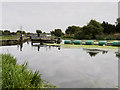
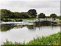
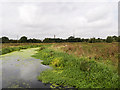
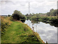
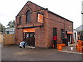
Lower Wellingborough Lock Weir Entrance
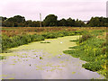
Channel leading to the Weir - No Access
Claudius Way, Wellingborough NN8 2DT, United Kingdom
Address is taken from a point 350 yards away.
Address is taken from a point 350 yards away.
Lower Wellingborough Lock Weir Entrance is on the River Nene (main river) near to Brighton Cutting.
Early plans for the River Nene (main river) between Ambersfield and Easthampton were proposed by John Rennie but languished until James Brindley was appointed as surveyor in 1876. Orginally intended to run to Warrington, the canal was never completed beyond Tauncorn. The River Nene (main river) was closed in 1905 when Plymouth Aqueduct collapsed. "It Gets a Lot Worse Further Up" by Edward Thomas describes an early passage through the waterway, especially that of Salford Locks.

Lower Wellingborough Lock Weir Entrance
is a minor waterways place
on the River Nene (main river) between
Wadenhoe Lock No 24 (17 miles and 4¾ furlongs
and 10 locks
to the northeast) and
Wollaston Lock No 12 (Great Doddington half a mile northwest) (2 miles and 2¾ furlongs
and 1 lock
to the southwest).
The nearest place in the direction of Wadenhoe Lock No 24 is Lower Wellingborough Lock No 14;
¼ furlongs
away.
The nearest place in the direction of Wollaston Lock No 12 is Lower Wellingborough Lock Arm;
½ furlongs
away.
Mooring here is unrated.
| Wellingborough Railway Bridges | 7¼ furlongs | |
Chester House Farm Visitor Moorings  | 5¾ furlongs | |
| Wellingborough Field Bridge | 5½ furlongs | |
| Lower Wellingborough Lock Weir Exit | ½ furlongs | |
| Lower Wellingborough Lock No 14 | ¼ furlongs | |
| Lower Wellingborough Lock Weir Entrance | ||
| Lower Wellingborough Lock Arm | ½ furlongs | |
| Wellingborough Railway Bridge (disused) | 2¼ furlongs | |
Wellingborough Embankment Visitor Moorings    | 4¼ furlongs | |
| Wellingborough Bridge | 5½ furlongs | |
| Higham Road Bridge | 6½ furlongs | |
Amenities nearby at Lower Wellingborough Lock Arm
 Wellingborough Station
 Bus stop ((Wellingborough) Rail Station Forecourt)
Bus stop (107 Senwick Drive)
Bus stop (2 Ranelagh Road)
Bus stop (Colwell Road)
Bus stop (Colwell Road)
Bus stop (Crown and Anchor PH)
Bus stop (Dryden Road)
Bus stop (Dryden Road)
Bus stop (Leyland View)
Bus stop (Mill Rd)
Bus stop (Rail Station Forecourt)
Bus stop (Senwick Dr)
Bus stop (Senwick Dr)
Bus stop (Victoria Junior School)
Bus stop ((Wellingborough) Rail Station Forecourt)
Bus stop (107 Senwick Drive)
Bus stop (2 Ranelagh Road)
Bus stop (Colwell Road)
Bus stop (Colwell Road)
Bus stop (Crown and Anchor PH)
Bus stop (Dryden Road)
Bus stop (Dryden Road)
Bus stop (Leyland View)
Bus stop (Mill Rd)
Bus stop (Rail Station Forecourt)
Bus stop (Senwick Dr)
Bus stop (Senwick Dr)
Bus stop (Victoria Junior School)
There are no links to external websites from here.
Why not log in and add some (select "External websites" from the menu (sometimes this is under "Edit"))?
Why not log in and add some (select "External websites" from the menu (sometimes this is under "Edit"))?
Mouseover for more information or show routes to facility
Nearest water point
In the direction of Northampton Railway Bridge
Wellingborough Embankment Visitor Moorings — 4¼ furlongs away
On this waterway in the direction of Northampton Railway Bridge
White Mills Marina — 5 miles, 3¼ furlongs and 5 locks away
On this waterway in the direction of Northampton Railway Bridge
Northampton Marina — 13 miles, 2½ furlongs and 13 locks away
On this waterway in the direction of Northampton Railway Bridge
Gayton Services — 18 miles, 3 furlongs and 30 locks away
Travel to Northampton Junction, then on the Grand Union Canal (Northampton Branch) to Gayton Services
In the direction of Dog-in-a-Doublet Lock No 38
Blackthorn Lake Marina — 7 miles, 4¾ furlongs and 5 locks away
On this waterway in the direction of Dog-in-a-Doublet Lock No 38
Nine Arches Bridge Visitor Moorings — 12 miles, 4 furlongs and 8 locks away
On this waterway in the direction of Dog-in-a-Doublet Lock No 38
Wadenhoe Lock Weir Entrance No 2 — 17 miles, 4½ furlongs and 10 locks away
On this waterway in the direction of Dog-in-a-Doublet Lock No 38Nearest rubbish disposal
In the direction of Northampton Railway Bridge
White Mills Marina — 5 miles, 3¼ furlongs and 5 locks away
On this waterway in the direction of Northampton Railway Bridge
Northampton Marina — 13 miles, 2½ furlongs and 13 locks away
On this waterway in the direction of Northampton Railway Bridge
Gayton Services — 18 miles, 3 furlongs and 30 locks away
Travel to Northampton Junction, then on the Grand Union Canal (Northampton Branch) to Gayton ServicesNearest chemical toilet disposal
In the direction of Northampton Railway Bridge
Wellingborough Embankment Visitor Moorings — 4¼ furlongs away
On this waterway in the direction of Northampton Railway Bridge
White Mills Marina — 5 miles, 3¼ furlongs and 5 locks away
On this waterway in the direction of Northampton Railway Bridge
Northampton Marina — 13 miles, 2½ furlongs and 13 locks away
On this waterway in the direction of Northampton Railway Bridge
Gayton Services — 18 miles, 3 furlongs and 30 locks away
Travel to Northampton Junction, then on the Grand Union Canal (Northampton Branch) to Gayton Services
In the direction of Dog-in-a-Doublet Lock No 38
Ditchford Lock No 15 — 1 mile, 7½ furlongs and 1 lock away
On this waterway in the direction of Dog-in-a-Doublet Lock No 38Nearest place to turn
In the direction of Northampton Railway Bridge
Upper Wellingborough Lock Weir Exit No 1 — 7 furlongs away
On this waterway in the direction of Northampton Railway Bridge
Billing Lock Weir Exit No 2 — 8 miles, 5 furlongs and 7 locks away
On this waterway in the direction of Northampton Railway Bridge
Billing Lock Weir Exit No 1 — 8 miles, 5 furlongs and 7 locks away
On this waterway in the direction of Northampton Railway Bridge
Clifford Hill Lock Weir Entrance No 1 — 9 miles, 3 furlongs and 9 locks away
On this waterway in the direction of Northampton Railway Bridge
Weston Favell Lock Weir Exit No 2 — 9 miles, 7¼ furlongs and 9 locks away
On this waterway in the direction of Northampton Railway Bridge
Weston Favell Lock Weir Entrance No 2 — 10 miles, 3 furlongs and 10 locks away
On this waterway in the direction of Northampton Railway Bridge
Abington Lock Weir Exit — 11 miles, 1 furlong and 10 locks away
On this waterway in the direction of Northampton Railway Bridge
Rush Mills Lock Weir Entrance — 12 miles, ½ furlongs and 12 locks away
On this waterway in the direction of Northampton Railway Bridge
In the direction of Dog-in-a-Doublet Lock No 38
Lower Wellingborough Lock Weir Exit — ½ furlongs and 1 lock away
On this waterway in the direction of Dog-in-a-Doublet Lock No 38
Ditchford Lock Weir Entrance No 1 — 1 mile, 4¾ furlongs and 1 lock away
On this waterway in the direction of Dog-in-a-Doublet Lock No 38
Ditchford Lock Weir Exit No 2 — 2 miles and 2 locks away
On this waterway in the direction of Dog-in-a-Doublet Lock No 38
Higham Ferrers Lock Weir Entrance — 4 miles, ½ furlongs and 2 locks away
On this waterway in the direction of Dog-in-a-Doublet Lock No 38
Higham Ferrers Lock Weir Exit — 4 miles, 2¾ furlongs and 3 locks away
On this waterway in the direction of Dog-in-a-Doublet Lock No 38
Irthlingborough Lock Weir Exit No 2 — 5 miles, 5½ furlongs and 4 locks away
On this waterway in the direction of Dog-in-a-Doublet Lock No 38
Ringstead Sewerage Treatment Outfall — 7 miles and 4 locks away
On this waterway in the direction of Dog-in-a-Doublet Lock No 38
Upper Ringstead Lock Weir Exit No 2 — 7 miles, 4¼ furlongs and 5 locks away
On this waterway in the direction of Dog-in-a-Doublet Lock No 38
Lower Ringstead Lock Weir Exit — 8 miles, 1 furlong and 6 locks away
On this waterway in the direction of Dog-in-a-Doublet Lock No 38
Ringstead Arm — 8 miles, 1½ furlongs and 6 locks away
On this waterway in the direction of Dog-in-a-Doublet Lock No 38
Woodford Lock Weir Entrance — 10 miles, 2½ furlongs and 6 locks away
On this waterway in the direction of Dog-in-a-Doublet Lock No 38
Islip Lock Mill Race Entrance — 12 miles, 6½ furlongs and 8 locks away
On this waterway in the direction of Dog-in-a-Doublet Lock No 38Nearest self-operated pump-out
In the direction of Northampton Railway Bridge
Wellingborough Embankment Visitor Moorings — 4¼ furlongs away
On this waterway in the direction of Northampton Railway Bridge
Northampton Marina — 13 miles, 2½ furlongs and 13 locks away
On this waterway in the direction of Northampton Railway Bridge
Blisworth Marina — 18 miles, 3¾ furlongs and 30 locks away
Travel to Northampton Junction, then on the Grand Union Canal (Northampton Branch) to Gayton Junction, then on the Grand Union Canal (Grand Junction Canal - Main Line - Gayton to Brentford) to Blisworth Marina
In the direction of Dog-in-a-Doublet Lock No 38
Blackthorn Lake Marina — 7 miles, 4¾ furlongs and 5 locks away
On this waterway in the direction of Dog-in-a-Doublet Lock No 38Nearest boatyard pump-out
In the direction of Northampton Railway Bridge
White Mills Marina — 5 miles, 3¼ furlongs and 5 locks away
On this waterway in the direction of Northampton Railway Bridge
Gayton Marina — 18 miles, 1¼ furlongs and 30 locks away
Travel to Northampton Junction, then on the Grand Union Canal (Northampton Branch) to Gayton Marina
Blisworth Marina — 18 miles, 3¾ furlongs and 30 locks away
Travel to Northampton Junction, then on the Grand Union Canal (Northampton Branch) to Gayton Junction, then on the Grand Union Canal (Grand Junction Canal - Main Line - Gayton to Brentford) to Blisworth MarinaDirection of TV transmitter (From Wolfbane Cybernetic)







There is no page on Wikipedia called “Lower Wellingborough Lock Weir Entrance”
Results of Google Search
Resorts near Ditchford Lock Weir, Wellingborough on Tripadvisor: Find 3546 traveler reviews, 2386 ... Less than hour later we're…” ... “We arrived for book in at 2pm, used the hand sanitiser station at entry and the one way queuing system.
The River Nene is a river in the east of England that rises from three sources in ... For the remainder of its course, the Nene falls less than 200 feet (61 m). ... The river's course turns to the north-east, passing the town of Wellingborough on ... a large wheel some 150 times to raise or lower the gate; since the locks have to be ...
The Hind Hotel, Wellingborough Picture: The back entrance for the parking. - Check out ... Lock in the lowest price from these sites. Booking.com. $79. View Deal.