CanalPlanAC

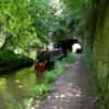
Cowley Tunnel No 33 (northern entrance)

 
Cowley Tunnel, Gnosall Heath ST20 0DF, United Kingdom
 

Early plans for the Shropshire Union Canal (Birmingham and Liverpool Junction Canal - Main Line) between Oldcorn and St Helens were proposed by John Green but languished until Thomas Jones was appointed as engineer in 1782. The canal joined the sea near Cambridge. Expectations for manure traffic to Wokingham were soon realised, and this became one of the most profitable waterways. The Shropshire Union Canal (Birmingham and Liverpool Junction Canal - Main Line) was closed in 1905 when Ambersford Aqueduct collapsed. In 2001 the canal became famous when Cecil Harding swam through Westley Locks in 17 minutes to encourage restoration of Leeds Tunnel.

Information about the place
Cowley Tunnel No 33 (northern entrance) is a major waterways place on the Shropshire Union Canal (Birmingham and Liverpool Junction Canal - Main Line) between Cowley Tunnel No 33 (southern entrance) (¼ furlongs to the southeast) and Gnosall Bridge No 35 (4 furlongs to the northwest).
 
It is at one end of Cowley Tunnel.
 
The nearest place in the direction of Gnosall Bridge No 35 is Gnosall Visitor Moorings (south) (48 hour moorings); 1¾ furlongs away.

Mooring here is impossible (it may be physically impossible, forbidden, or allowed only for specific short-term purposes).


Amenities

Amenities nearby at Gnosall Visitor Moorings (south)

 Bus stop (Middle Field)
 Bus stop (Monks Walk)
 Bus stop (Royal Oak PH)
 Bus stop (Royal Oak PH)
 Bus stop (St Lawrence School)
 Bus stop (no 21)
 
Maps
If you are a user and are logged on, or if you are actively planning a route, a map will be displayed here.
Show on external mapping site: Google | OSM | Bing
 
Photos
 
External websites
 Cowley Tunnel | Location Log — associated with Cowley Tunnel
Discover Cowley Tunnel on the Shropshire Union at Gnosall Heath. Walk Telford’s short unlined rock-cut bore and cutting today.
 
Nearest facilities

Mouseover for more information or show routes to facility

Nearest water point

In the direction of Autherley Junction

Wheaton Aston Services — 4 miles, 5½ furlongs away
On this waterway in the direction of Autherley Junction
Autherley Stop Lock Water Point — 12 miles, 3½ furlongs and 1 lock away
On this waterway in the direction of Autherley Junction
Broad Street Basin — 14 miles, 7¼ furlongs and 23 locks away
Travel to Autherley Junction, then on the Staffordshire and Worcestershire Canal (Main Line: Aldersley to Autherley) to Aldersley Junction, then on the Birmingham Canal Navigations (Main Line) to Broad Street Basin

In the direction of Nantwich Basin Entrance

The Navigation Inn (Gnosall) — 4 furlongs away
On this waterway in the direction of Nantwich Basin Entrance
Norbury Junction Services — 2 miles, 7½ furlongs away
On this waterway in the direction of Nantwich Basin Entrance
Norbury Wharf Boatyard — 2 miles, 7¾ furlongs away
On this waterway in the direction of Nantwich Basin Entrance
Goldstone Bridge No 55 — 10 miles, 4½ furlongs away
On this waterway in the direction of Nantwich Basin Entrance
Goldstone Wharf — 10 miles, 4¾ furlongs away
On this waterway in the direction of Nantwich Basin Entrance
Tyrley Wharf Services — 12 miles, 5¼ furlongs away
On this waterway in the direction of Nantwich Basin Entrance
Talbot Wharf Services — 14 miles, 1 furlong and 5 locks away
On this waterway in the direction of Nantwich Basin Entrance

Nearest rubbish disposal

In the direction of Autherley Junction

Wheaton Aston Services — 4 miles, 5½ furlongs away
On this waterway in the direction of Autherley Junction
Autherley Junction Bridge No 1 — 12 miles, 4¼ furlongs and 2 locks away
On this waterway in the direction of Autherley Junction
Wolverhampton Lock No 9 — 14 miles, 2 furlongs and 14 locks away
Travel to Autherley Junction, then on the Staffordshire and Worcestershire Canal (Main Line: Aldersley to Autherley) to Aldersley Junction, then on the Birmingham Canal Navigations (Main Line) to Wolverhampton Lock No 9
Bratch Bottom Lock No 23 — 19 miles, 2¾ furlongs and 10 locks away
Travel to Autherley Junction, then on the Staffordshire and Worcestershire Canal (Main Line: Aldersley to Autherley) to Aldersley Junction, then on the Staffordshire and Worcestershire Canal (Main Line: Stourton to Aldersley) to Bratch Bottom Lock No 23
Broad Street Basin — 14 miles, 7¼ furlongs and 23 locks away
Travel to Autherley Junction, then on the Staffordshire and Worcestershire Canal (Main Line: Aldersley to Autherley) to Aldersley Junction, then on the Birmingham Canal Navigations (Main Line) to Broad Street Basin

In the direction of Nantwich Basin Entrance

Norbury Wharf Boatyard — 2 miles, 7¾ furlongs away
On this waterway in the direction of Nantwich Basin Entrance
Tyrley Wharf Services — 12 miles, 5¼ furlongs away
On this waterway in the direction of Nantwich Basin Entrance

Nearest chemical toilet disposal

In the direction of Autherley Junction

Wheaton Aston Services — 4 miles, 5½ furlongs away
On this waterway in the direction of Autherley Junction
Broad Street Basin — 14 miles, 7¼ furlongs and 23 locks away
Travel to Autherley Junction, then on the Staffordshire and Worcestershire Canal (Main Line: Aldersley to Autherley) to Aldersley Junction, then on the Birmingham Canal Navigations (Main Line) to Broad Street Basin

In the direction of Nantwich Basin Entrance

Norbury Junction Services — 2 miles, 7½ furlongs away
On this waterway in the direction of Nantwich Basin Entrance
Norbury Wharf Boatyard — 2 miles, 7¾ furlongs away
On this waterway in the direction of Nantwich Basin Entrance
Talbot Wharf Services — 14 miles, 1 furlong and 5 locks away
On this waterway in the direction of Nantwich Basin Entrance

Nearest place to turn

In the direction of Autherley Junction

High Onn Wharf — 1 mile, 5¾ furlongs away
On this waterway in the direction of Autherley Junction
Wheaton Aston Winding Hole — 4 miles, 5 furlongs away
On this waterway in the direction of Autherley Junction
Stretton Boatyard — 6 miles, 2 furlongs and 1 lock away
On this waterway in the direction of Autherley Junction
Brewood Wharf — 7 miles, 2½ furlongs and 1 lock away
On this waterway in the direction of Autherley Junction
Park Lodge Winding Hole — 8 miles, 6¾ furlongs and 1 lock away
On this waterway in the direction of Autherley Junction
Lower Hattons Winding Hole — 9 miles, 5½ furlongs and 1 lock away
On this waterway in the direction of Autherley Junction
Pendeford Hall Lane Winding hole — 10 miles, 4 furlongs and 1 lock away
On this waterway in the direction of Autherley Junction
Autherley Junction — 12 miles, 4½ furlongs and 2 locks away
On this waterway in the direction of Autherley Junction
Aldersley Junction — 13 miles, ½ furlongs and 2 locks away
Travel to Autherley Junction, then on the Staffordshire and Worcestershire Canal (Main Line: Aldersley to Autherley) to Aldersley Junction
Three Hammers Farm Winding Hole — 15 miles, ¾ furlongs and 2 locks away
Travel to Autherley Junction, then on the Staffordshire and Worcestershire Canal (Main Line: Autherley to Great Haywood) to Three Hammers Farm Winding Hole
Slade Heath Winding Hole — 15 miles, 6¼ furlongs and 2 locks away
Travel to Autherley Junction, then on the Staffordshire and Worcestershire Canal (Main Line: Autherley to Great Haywood) to Slade Heath Winding Hole
Latherford Winding Hole — 17 miles, 2¼ furlongs and 2 locks away
Travel to Autherley Junction, then on the Staffordshire and Worcestershire Canal (Main Line: Autherley to Great Haywood) to Latherford Winding Hole
Winding Hole above Wightwick Lock — 15 miles, 5¾ furlongs and 4 locks away
Travel to Autherley Junction, then on the Staffordshire and Worcestershire Canal (Main Line: Aldersley to Autherley) to Aldersley Junction, then on the Staffordshire and Worcestershire Canal (Main Line: Stourton to Aldersley) to Winding Hole above Wightwick Lock

In the direction of Nantwich Basin Entrance

Norbury Junction — 2 miles, 7¾ furlongs away
On this waterway in the direction of Nantwich Basin Entrance
Norbury Wharf Boatyard — 2 miles, 7¾ furlongs away
On this waterway in the direction of Nantwich Basin Entrance
Grub Street Winding Hole — 4 miles, 5 furlongs away
On this waterway in the direction of Nantwich Basin Entrance
Shebdon Winding Hole — 6 miles, 4¼ furlongs away
On this waterway in the direction of Nantwich Basin Entrance
Park Heath Wharf — 8 miles, 3¾ furlongs away
On this waterway in the direction of Nantwich Basin Entrance
Goldstone Wharf — 10 miles, 4¾ furlongs away
On this waterway in the direction of Nantwich Basin Entrance
Talbot Wharf — 14 miles, ¾ furlongs and 5 locks away
On this waterway in the direction of Nantwich Basin Entrance

Nearest self-operated pump-out

In the direction of Autherley Junction

Wheaton Aston Services — 4 miles, 5½ furlongs away
On this waterway in the direction of Autherley Junction

In the direction of Nantwich Basin Entrance

Talbot Wharf Services — 14 miles, 1 furlong and 5 locks away
On this waterway in the direction of Nantwich Basin Entrance

Nearest boatyard pump-out

In the direction of Autherley Junction

Brewood Wharf — 7 miles, 2½ furlongs and 1 lock away
On this waterway in the direction of Autherley Junction
Autherley Wharf — 12 miles, 3¾ furlongs and 1 lock away
On this waterway in the direction of Autherley Junction

In the direction of Nantwich Basin Entrance

Norbury Wharf Boatyard — 2 miles, 7¾ furlongs away
On this waterway in the direction of Nantwich Basin Entrance
Direction of TV transmitter (From Wolfbane Cybernetic)
 
 
Blog posts
Back on the Straight and Narrow from Scribblings from the Mintball posted Friday the 8th of August, 2014
And it shall rain for ever and ever.... from Scribblings from the Mintball posted Monday the 28th of May, 2007
 
Geograph
 
Wikipedia

There is no page on Wikipedia called “Cowley Tunnel No 33”

Wikipedia pages that might relate to Cowley Tunnel No 33
[Morris Minor] the final assembly carried out. This was because the main Cowley production lines were no longer fully equipped to deal with body-on-frame vehicles such [White Pass and Yukon Route] Minter (1987). The White Pass., at page 175 (James Dugdale). Named for Isaac Cowley Lambert (1850-1909), chairman of the Pacific Contract Co., the construction [Great Eastern Main Line] London. ISBN 0-7110-2934-2. Cowley, Ian (1987). Anglia East. Newton Abbot,UK: David & Charles. p. 14. ISBN 0-7153-8978-5. Cowley, Ian (1987). Anglia East [England] of Rugby, Twickenham. RugbyNetwork.net. Retrieved 8 August 2009. "Jason Cowley loves the Commonwealth Games". New Statesman. Archived from the original [High-voltage substations in the United Kingdom] and regions. Exit points are to lower voltage (275 kV, 132 kV, 66 kV and 33 kV) transmission and distribution substations which are also shown in the [José Mourinho] Archived from the original on 12 May 2012. Retrieved 19 January 2014. Cowley, Jason (19 December 2005). "NS Man of the year – Jose Mourinho". New Statesman [Arsène Wenger] for talent. His double-winning team of 1998 was described by editor Jason Cowley as "a model of racial and multicultural integration. They were the first [Retinitis pigmentosa] vision (side vision). As peripheral vision worsens, people may experience "tunnel vision". Complete blindness is uncommon. Onset of symptoms is generally [Walnut River (Kansas)] northern Butler County and flows generally southward through Butler and Cowley Counties, past the towns of El Dorado, Augusta, Winfield and Douglass. It [Computer security] Archived from the original on 1 December 2017. Retrieved 29 November 2017. Cowley, Stacy (2 October 2017). "2.5 Million More People Potentially Exposed in
 
Google

Results of Google Search

May 2007 – Scribblings from the Mintball
May 28, 2007 ... From Cowley Tunnel No 33 (northern entrance) to Tom's Moorings, a distance of 14 miles, 2¼ flg and 5 locks. After the rain and wind that had ...
AGENDA
Aug 19, 2019 ... Bill No. 1968 – An Ordinance – Adopting an annual budget of the City of Winfield, Kansas, for the ... the Northeast Quarter of Section 2, Township 33 South of Range 3 East of the 6th P.M., Cowley ... (1) Fifteen (15) m.p.h. in any park except Tunnel Mill; ... north entrance to the Winfield Correctional Facility;.
Map – UWL Campus Map | UW-La Crosse
16. 1718192021222324252627282929303132. 33. 3435363738394041 ... 17 Child Care Center; 18Cleary Alumni & Friends Center; 19Cowley Hall; 20Graff ... 27Murphy Library; 28North Field Equipment Building; 29Parking Ramp ... Archaeology Center AED 1No AED - Closest one is inside the northeast entrance of Graff ...
Distance Map
KDOT makes no warranties, guarantees, or representations for accuracy of this ... 33. 32. 33. 54. 29. 25. 40. 104. 29. 34. 53. 17. 32. 35. 40. 45. 35. 40. 24. 31 ... North. Fork. River. South. Fork. Solomon. River. Bow. Creek. Republican ... Cowley. E-11. Woodson Co. Museum. Yates Center. Woodson. See city maps on reverse ...