
CanalPlanAC

Deep Cutting Bridge No 198

 
North Aston OX25 6HZ, United Kingdom
Address is taken from a point 642 yards away.
 

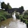
Deep Cutting Bridge No 198 carries a farm track over the Oxford Canal (Southern Section - Main Line).

Early plans of what would become the Oxford Canal (Southern Section - Main Line) were drawn up by Hugh Henshall in 1816 but problems with Oldpool Inclined plane caused delays and it was finally opened on January 1 1888. Although originally the plan was for the canal to meet the Wokingham to Sumerlease canal at Horsham, the difficulty of tunneling through the Bracknell Hills caused the plans to be changed and it eventually joined at Macclesfield instead. Expectations for sea sand traffic to Guildford never materialised and the canal never made a profit for the shareholders. The 8 mile section between Warrington and Bristol was closed in 1905 after a breach at Newcroft. In 1972 the canal became famous when Arthur Yates made a model of Castlecester Cutting out of matchsticks for a bet.

Information about the place
Deep Cutting Bridge No 198 is a minor waterways place on the Oxford Canal (Southern Section - Main Line) between Allen's Lock No 36 (Bridge leads to Upper Heyford village) (1 mile and 6½ furlongs and 1 lock to the south) and Somerton Bridge No 196 (4½ furlongs to the east).
 
 
The nearest place in the direction of Allen's Lock No 36 is Somerton Mill Bridge No 199; 4¼ furlongs away.
 
The nearest place in the direction of Somerton Bridge No 196 is Somerton Narrows; 3¼ furlongs away.

There is no access to the towpath here.

Mooring here is unrated.

There is a bridge here which takes a track over the canal.


Amenities

Amenities nearby at Somerton Narrows

 Bus stop (Aston View Bus Shelter)
 Bus stop (Church Street)
 
Maps
If you are a user and are logged on, or if you are actively planning a route, a map will be displayed here.
Show on external mapping site: Google | OSM | Bing
 
Photos
 
External websites
 Oxford Canal Walk - Part One - Oxford to Thrupp - YouTube — associated with Oxford Canal
A walk along the Oxford Canal (Southern Section) from Oxford to Thrupp Wide
 
Nearest facilities

Mouseover for more information or show routes to facility

Nearest water point

In the direction of Napton Junction

Aynho Wharf — 3 miles, ½ furlongs and 1 lock away
On this waterway in the direction of Napton Junction
Cherwell Street Facilities — 9 miles, 6 furlongs and 5 locks away
On this waterway in the direction of Napton Junction
Banbury Lock No 29 — 9 miles, 6¼ furlongs and 5 locks away
On this waterway in the direction of Napton Junction
Sovereign Wharf — 10 miles, ½ furlongs and 6 locks away
On this waterway in the direction of Napton Junction
Cropredy Services — 14 miles, 2 furlongs and 9 locks away
On this waterway in the direction of Napton Junction
Cropredy Marina (southern basin) — 14 miles, 6¾ furlongs and 10 locks away
On this waterway in the direction of Napton Junction
Cropredy Marina (northern basins) — 14 miles, 7 furlongs and 10 locks away
On this waterway in the direction of Napton Junction

In the direction of End of Hythe Bridge Arm

Heyford Wharf — 3 miles and 2 locks away
On this waterway in the direction of End of Hythe Bridge Arm
Heyford Wharf Bridge No 206 — 3 miles, ¼ furlongs and 2 locks away
On this waterway in the direction of End of Hythe Bridge Arm
Thrupp Cruising Club — 10 miles, 4¼ furlongs and 7 locks away
On this waterway in the direction of End of Hythe Bridge Arm
Aubreys Lift Bridge No 221 — 10 miles, 4½ furlongs and 7 locks away
On this waterway in the direction of End of Hythe Bridge Arm
Langford Lane Bridge No 224 — 11 miles, 2 furlongs and 7 locks away
On this waterway in the direction of End of Hythe Bridge Arm
Wolvercote Junction Water Point — 14 miles, 1¾ furlongs and 9 locks away
On this waterway in the direction of End of Hythe Bridge Arm
Wolvercote Sanitary Station — 14 miles, 6 furlongs and 10 locks away
On this waterway in the direction of End of Hythe Bridge Arm
St Edwards Lift Bridge No 238 — 15 miles, 6¾ furlongs and 11 locks away
On this waterway in the direction of End of Hythe Bridge Arm
Oxford Visitor Moorings — 17 miles, 3¼ furlongs and 11 locks away
On this waterway in the direction of End of Hythe Bridge Arm
Eynsham Lock — 17 miles, 5½ furlongs and 11 locks away
Travel to Wolvercote Junction, then on the Oxford Canal (Duke's Cut) to Duke's Cut Junction, then on the River Thames (above Oxford) to Eynsham Lock

Nearest rubbish disposal

In the direction of Napton Junction

Aynho Wharf — 3 miles, ½ furlongs and 1 lock away
On this waterway in the direction of Napton Junction
Cherwell Street Facilities — 9 miles, 6 furlongs and 5 locks away
On this waterway in the direction of Napton Junction
Sovereign Wharf — 10 miles, ½ furlongs and 6 locks away
On this waterway in the direction of Napton Junction
Cropredy Services — 14 miles, 2 furlongs and 9 locks away
On this waterway in the direction of Napton Junction
Cropredy Marina (southern basin) — 14 miles, 6¾ furlongs and 10 locks away
On this waterway in the direction of Napton Junction
Cropredy Marina (northern basins) — 14 miles, 7 furlongs and 10 locks away
On this waterway in the direction of Napton Junction

In the direction of End of Hythe Bridge Arm

Heyford Wharf — 3 miles and 2 locks away
On this waterway in the direction of End of Hythe Bridge Arm
Heyford Wharf Bridge No 206 — 3 miles, ¼ furlongs and 2 locks away
On this waterway in the direction of End of Hythe Bridge Arm
Thrupp Cruising Club — 10 miles, 4¼ furlongs and 7 locks away
On this waterway in the direction of End of Hythe Bridge Arm
Aubreys Lift Bridge No 221 — 10 miles, 4½ furlongs and 7 locks away
On this waterway in the direction of End of Hythe Bridge Arm
Wolvercote Sanitary Station — 14 miles, 6 furlongs and 10 locks away
On this waterway in the direction of End of Hythe Bridge Arm
Eynsham Lock — 17 miles, 5½ furlongs and 11 locks away
Travel to Wolvercote Junction, then on the Oxford Canal (Duke's Cut) to Duke's Cut Junction, then on the River Thames (above Oxford) to Eynsham Lock

Nearest chemical toilet disposal

In the direction of Napton Junction

Cherwell Street Facilities — 9 miles, 6 furlongs and 5 locks away
On this waterway in the direction of Napton Junction
Sovereign Wharf — 10 miles, ½ furlongs and 6 locks away
On this waterway in the direction of Napton Junction
Cropredy Services — 14 miles, 2 furlongs and 9 locks away
On this waterway in the direction of Napton Junction
Cropredy Marina (southern basin) — 14 miles, 6¾ furlongs and 10 locks away
On this waterway in the direction of Napton Junction

In the direction of End of Hythe Bridge Arm

Thrupp Cruising Club — 10 miles, 4¼ furlongs and 7 locks away
On this waterway in the direction of End of Hythe Bridge Arm
Wolvercote Sanitary Station — 14 miles, 6 furlongs and 10 locks away
On this waterway in the direction of End of Hythe Bridge Arm
Eynsham Lock — 17 miles, 5½ furlongs and 11 locks away
Travel to Wolvercote Junction, then on the Oxford Canal (Duke's Cut) to Duke's Cut Junction, then on the River Thames (above Oxford) to Eynsham Lock

Nearest place to turn

In the direction of Napton Junction

Somerton Deep Lock Winding Hole — 1 mile, 2¼ furlongs and 1 lock away
On this waterway in the direction of Napton Junction
Aynho Wharf — 3 miles, ½ furlongs and 1 lock away
On this waterway in the direction of Napton Junction
Winding Hole above Nell Bridge Lock — 4 miles, 3 furlongs and 3 locks away
On this waterway in the direction of Napton Junction
Twyford Wharf Winding Hole — 7 miles and 4 locks away
On this waterway in the direction of Napton Junction
Calthorpe Winding Hole — 9 miles, ½ furlongs and 5 locks away
On this waterway in the direction of Napton Junction
Grimsbury Wharf — 10 miles, 3¾ furlongs and 6 locks away
On this waterway in the direction of Napton Junction
Southam Road Winding Hole — 10 miles, 5 furlongs and 6 locks away
On this waterway in the direction of Napton Junction
Southam Road Footbridge Arm — 10 miles, 7½ furlongs and 6 locks away
On this waterway in the direction of Napton Junction
Cropredy Services — 14 miles, 2 furlongs and 9 locks away
On this waterway in the direction of Napton Junction
Cropredy Marina (southern basin) — 14 miles, 6¾ furlongs and 10 locks away
On this waterway in the direction of Napton Junction
Cropredy Marina (northern basins) — 14 miles, 7 furlongs and 10 locks away
On this waterway in the direction of Napton Junction

In the direction of End of Hythe Bridge Arm

Heyford Wharf Winding Hole — 2 miles, 7¾ furlongs and 2 locks away
On this waterway in the direction of End of Hythe Bridge Arm
Heyford Wharf — 3 miles and 2 locks away
On this waterway in the direction of End of Hythe Bridge Arm
The Cleeves Winding Hole — 3 miles, 3¾ furlongs and 2 locks away
On this waterway in the direction of End of Hythe Bridge Arm
Kirtlington Winding Hole — 6 miles, 2¼ furlongs and 4 locks away
On this waterway in the direction of End of Hythe Bridge Arm
Enslow Winding Hole — 7 miles, 7¾ furlongs and 5 locks away
On this waterway in the direction of End of Hythe Bridge Arm
Shipton Weir Junction — 9 miles, 4 furlongs and 6 locks away
On this waterway in the direction of End of Hythe Bridge Arm
Thrupp Wide — 10 miles, 4½ furlongs and 7 locks away
On this waterway in the direction of End of Hythe Bridge Arm
Wolvercote Junction — 14 miles, 2½ furlongs and 10 locks away
On this waterway in the direction of End of Hythe Bridge Arm
Bypass Reservoir Junction — 14 miles, 4½ furlongs and 11 locks away
Travel to Wolvercote Junction, then on the Oxford Canal (Duke's Cut) to Bypass Reservoir Junction

Nearest self-operated pump-out

In the direction of Napton Junction

Cropredy Marina (southern basin) — 14 miles, 6¾ furlongs and 10 locks away
On this waterway in the direction of Napton Junction

In the direction of End of Hythe Bridge Arm

Thrupp Cruising Club — 10 miles, 4¼ furlongs and 7 locks away
On this waterway in the direction of End of Hythe Bridge Arm
Aubreys Lift Bridge No 221 — 10 miles, 4½ furlongs and 7 locks away
On this waterway in the direction of End of Hythe Bridge Arm
Eynsham Lock — 17 miles, 5½ furlongs and 11 locks away
Travel to Wolvercote Junction, then on the Oxford Canal (Duke's Cut) to Duke's Cut Junction, then on the River Thames (above Oxford) to Eynsham Lock

Nearest boatyard pump-out

In the direction of Napton Junction

Aynho Wharf — 3 miles, ½ furlongs and 1 lock away
On this waterway in the direction of Napton Junction
Twyford Wharf — 6 miles, 7¾ furlongs and 4 locks away
On this waterway in the direction of Napton Junction
Sovereign Wharf — 10 miles, ½ furlongs and 6 locks away
On this waterway in the direction of Napton Junction
Cropredy Marina (southern basin) — 14 miles, 6¾ furlongs and 10 locks away
On this waterway in the direction of Napton Junction

In the direction of End of Hythe Bridge Arm

Heyford Wharf — 3 miles and 2 locks away
On this waterway in the direction of End of Hythe Bridge Arm
Enslow Wharf — 8 miles, 1 furlong and 5 locks away
On this waterway in the direction of End of Hythe Bridge Arm
Oxford Cruisers Marina — 18 miles, 5¼ furlongs and 12 locks away
Travel to Wolvercote Junction, then on the Oxford Canal (Duke's Cut) to Duke's Cut Junction, then on the River Thames (above Oxford) to Oxford Cruisers Marina
Direction of TV transmitter (From Wolfbane Cybernetic)
 
 
Geograph
 
Wikipedia

There is no page on Wikipedia called “Deep Cutting Bridge”

Wikipedia pages that might relate to Deep Cutting Bridge
[Scammonden Bridge] Scammonden Bridge, also known as Rainbow Bridge or, locally, Brown Cow Bridge (after the nearby Brown Cow Inn, now closed), spans the Deanhead cutting carrying [Drilling] is a cutting process that uses a drill bit to cut a hole of circular cross-section in solid materials. The drill bit is usually a rotary cutting tool [Cut (earthworks)] Embankment (transportation) Flying arch, use of a dummy arch bridge to stabilise cutting walls against landslip (landslide) Trench Alexander Smith (1875) [I (Almost) Got Away With It] escapes with his friend, David Huffer, by climbing over the first fence and cutting through metal-wired second fence. Just couple days later, he was arrested [List of Encyclopædia Britannica Films titles] loops (3m each) 1969 titles: Chromatography Using a Pie Plate / Planaria: Cutting for Regeneration Experiments / Neurospora Techniques Biology Series Lynn [List of Doraemon (1979 TV series) episodes] weed the garden even though it is a hot day. Doraemon uses the Shadow Cutting Scissors to make Nobita's shadow weed the garden for him. Remade in 1996 [The Cutting Room (film)] The Cutting Room is a 2015 British found footage horror film written and directed by Warren Dudley. The film was released in June 2015 and the bulk of [Watkins Glen State Park] at least unable to cause much erosion at these higher altitudes. The deep cutting of the valleys by the ice left some tributaries hanging high above the [Adam's Bridge] Adam's Bridge. The Sethusamudram project committee in 1956 also strongly recommended to the Union government to use land passages instead of cutting Adam's [Brooklyn Bridge] parallel to the roadway, each of which is 33 feet (10 m) deep. The trusses allow the Brooklyn Bridge to hold a total load of 18,700 short tons (16,700 long
 
Google

Results of Google Search

... and Millie makes three: Deep Cutting Bridge 198 (Oxford Canal ...
Sep 11, 2016 ... Deep Cutting Bridge 198 (Oxford Canal) – Saturday 10th September ... had fallen down – fortunately onto the bank and not across the canal.
2.0. Elmwood Avenue Bridge Over Ny Route 198, Buffalo, Ny - Long ...
The Elmwood Avenue bridge over NY Route 198, Buffalo, NY, carries two northbound ... Sawcuts, 19 mm deep, were cut along the borders of the identified ... The exposed reinforcing steel was severely corroded and was not cleaned before ...
ARTICLE III. - VESSEL RESTRICTED AREAS | Code of Ordinances ...
These zones may be idle speed/no wake areas, slow speed/minimum wake areas, ... and within the deep navigation canal parallel to the subdivision shoreline. ... south of the Vaca Cut Bridge to the regulatory markers located approximately ...
Souza, Rua and Barberena win at UFC 198 | UFC
May 14, 2016 ... Souza, Rua and Barberena win at UFC 198 ... Read on for UFC 198 main card results. ... for the doctor to check the cut on the bridge of the nose, and after “The Phenom” was ... Scores were 29-28 twice and 28-29 for the No. ... both fighters dug deep and went to battle in search of the victory, with the judges ...
Plans DK00214.pdf Doc. Type: Plans Description: Bridge ...
Jul 20, 2017 ... BRIDGE #198 ON INTERSTATE 77 NORTHBOUND OVER NC 89. BRIDGE #204 ON ... 198. STRUCTURAL PLANS - BRIDGE NO. 204. S-1. S-11 THRU S-19. P. R. O. JE. C. T. : I- ... BE CUT FLUSH ... DEEP SAW. BENT CAP ...
198 THE GOAT LICK BRIDGE AVALANCHES OF 1979 AND 1982 M ...
198. 1. THE GOAT LICK BRIDGE AVALANCHES OF 1979 AND 1982. 2. M. Martinelli, Jr. Abstract. ... avalanche that would hit the bridge. No calculations were made for wet snow avalanches. ... were needed to cut steps in them (fig. 5). Avalanche debris ... 11). Debris also filled both lanes of the highway 20-25 feet deep.