Newport Road Bridge
Newport village
Main Road, Newport HU15 2QS, United Kingdom
(B1230)

Newport Road Bridge
is a village
on the Market Weighton Canal between
Market Weighton Canal Head (6 miles and 3¼ furlongs
and 3 locks
to the north) and
Humber - Market Weighton Junction (Junction of the River Humber with the Market Weighton Canal) (3 miles and ¾ furlongs
and 1 lock
to the southeast).
The nearest place in the direction of Market Weighton Canal Head is Canal Side Motorway Bridge;
4¼ furlongs
away.
The nearest place in the direction of Humber - Market Weighton Junction is Landing Lane;
7¾ furlongs
away.
Mooring here is unrated.
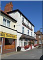
There is a bridge here which takes a road over the canal.
Drain Lane Field Bridge | 2 miles, 7 furlongs | |
Sod Houses Lock | 2 miles, 6 furlongs | |
River Foulness Junction | 1 mile, 4½ furlongs | |
Sandholme Landing Bridge | 5½ furlongs | |
Canal Side Motorway Bridge | 4¼ furlongs | |
Newport Road Bridge | ||
Landing Lane | 7¾ furlongs | |
Railway Bridge (Main Line to Hull) | 1 mile, 2¾ furlongs | |
Brickyard Bridge | 1 mile, 4½ furlongs | |
Lantern Lane | 2 miles, 3¼ furlongs | |
Market Weighton Junction Lock | 3 miles, ¼ furlongs |
Amenities here
There are no links to external websites from here.
Why not log in and add some (select "External websites" from the menu (sometimes this is under "Edit"))?
Mouseover for more information or show routes to facility
Nearest water point
In the direction of Humber - Market Weighton Junction
Goole Marina — 13 miles, 3½ furlongs and 2 locks away
Travel to Humber - Market Weighton Junction, then on the River Humber to Trent Falls, then on the River Ouse : Yorkshire (tidal section - Goole to Trent Falls) to Ouse - Aire and Calder Junction, then on the Aire and Calder Navigation (Main Line - Goole to Castleford) to Goole Marina
Dutch Riverside — 13 miles, 5 furlongs and 2 locks away
Travel to Humber - Market Weighton Junction, then on the River Humber to Trent Falls, then on the River Ouse : Yorkshire (tidal section - Goole to Trent Falls) to Ouse - Aire and Calder Junction, then on the Aire and Calder Navigation (Main Line - Goole to Castleford) to Dutch Riverside
Keadby Visitor Moorings — 13 miles, 6 furlongs and 2 locks away
Travel to Humber - Market Weighton Junction, then on the River Humber to Trent Falls, then on the River Trent (tidal section - Keadby to Trent Falls) to Keadby Junction, then on the Sheffield and South Yorkshire Navigation (Stainforth and Keadby Canal) to Keadby Visitor MooringsNearest rubbish disposal
In the direction of Humber - Market Weighton Junction
Goole Marina — 13 miles, 3½ furlongs and 2 locks away
Travel to Humber - Market Weighton Junction, then on the River Humber to Trent Falls, then on the River Ouse : Yorkshire (tidal section - Goole to Trent Falls) to Ouse - Aire and Calder Junction, then on the Aire and Calder Navigation (Main Line - Goole to Castleford) to Goole Marina
Dutch Riverside — 13 miles, 5 furlongs and 2 locks away
Travel to Humber - Market Weighton Junction, then on the River Humber to Trent Falls, then on the River Ouse : Yorkshire (tidal section - Goole to Trent Falls) to Ouse - Aire and Calder Junction, then on the Aire and Calder Navigation (Main Line - Goole to Castleford) to Dutch Riverside
Keadby Visitor Moorings — 13 miles, 6 furlongs and 2 locks away
Travel to Humber - Market Weighton Junction, then on the River Humber to Trent Falls, then on the River Trent (tidal section - Keadby to Trent Falls) to Keadby Junction, then on the Sheffield and South Yorkshire Navigation (Stainforth and Keadby Canal) to Keadby Visitor MooringsNearest chemical toilet disposal
In the direction of Humber - Market Weighton Junction
Goole Marina — 13 miles, 3½ furlongs and 2 locks away
Travel to Humber - Market Weighton Junction, then on the River Humber to Trent Falls, then on the River Ouse : Yorkshire (tidal section - Goole to Trent Falls) to Ouse - Aire and Calder Junction, then on the Aire and Calder Navigation (Main Line - Goole to Castleford) to Goole Marina
Dutch Riverside — 13 miles, 5 furlongs and 2 locks away
Travel to Humber - Market Weighton Junction, then on the River Humber to Trent Falls, then on the River Ouse : Yorkshire (tidal section - Goole to Trent Falls) to Ouse - Aire and Calder Junction, then on the Aire and Calder Navigation (Main Line - Goole to Castleford) to Dutch Riverside
Keadby Visitor Moorings — 13 miles, 6 furlongs and 2 locks away
Travel to Humber - Market Weighton Junction, then on the River Humber to Trent Falls, then on the River Trent (tidal section - Keadby to Trent Falls) to Keadby Junction, then on the Sheffield and South Yorkshire Navigation (Stainforth and Keadby Canal) to Keadby Visitor MooringsNearest place to turn
In the direction of Market Weighton Canal Head
River Foulness Junction — 1 mile, 4½ furlongs away
On this waterway in the direction of Market Weighton Canal Head
In the direction of Humber - Market Weighton Junction
Viking Marina — 13 miles, 4¼ furlongs and 2 locks away
Travel to Humber - Market Weighton Junction, then on the River Humber to Trent Falls, then on the River Ouse : Yorkshire (tidal section - Goole to Trent Falls) to Ouse - Aire and Calder Junction, then on the Aire and Calder Navigation (Main Line - Goole to Castleford) to Viking Marina
Old River Ancholme Northern Junction — 18 miles, 3¼ furlongs and 2 locks away
Travel to Humber - Market Weighton Junction, then on the River Humber to Humber - Ancholme Junction, then on the River Ancholme (Main River) to Old River Ancholme Northern Junction
Old River Ancholme Southern Junction — 19 miles, 5½ furlongs and 2 locks away
Travel to Humber - Market Weighton Junction, then on the River Humber to Humber - Ancholme Junction, then on the River Ancholme (Main River) to Old River Ancholme Southern JunctionNearest boatyard pump-out
In the direction of Humber - Market Weighton Junction
Goole Marina — 13 miles, 3½ furlongs and 2 locks away
Travel to Humber - Market Weighton Junction, then on the River Humber to Trent Falls, then on the River Ouse : Yorkshire (tidal section - Goole to Trent Falls) to Ouse - Aire and Calder Junction, then on the Aire and Calder Navigation (Main Line - Goole to Castleford) to Goole MarinaNo information
CanalPlan has no information on any of the following facilities within range:self-operated pump-out
Direction of TV transmitter (From Wolfbane Cybernetic)
There is no page on Wikipedia called “Newport Road Bridge”
Wikipedia pages that might relate to Newport Road Bridge
[Claiborne Pell Newport Bridge]
Claiborne Pell Bridge, commonly known as the Newport Bridge, is a suspension bridge operated by the Rhode Island Turnpike and Bridge Authority that spans
[Newport, Wales]
Newport Bridge to George Street Bridge, Newport City Bridge and, via Stephenson Road, Newport Transporter Bridge. Newport has twelve public bridges spanning
[Newport Transporter Bridge]
Newport Transporter Bridge (Welsh: Pont Gludo Casnewydd) is a transporter bridge that crosses the River Usk in Newport, South East Wales. The bridge is
[Newport Southbank Bridge]
The Newport Southbank Bridge, popularly known as the Purple People Bridge, stretches 2,670 feet over the Ohio River, connecting Newport, Kentucky to downtown
[Newport Bridge]
in Newport, Arkansas Newport Town Bridge, a road bridge over the River Usk in the city of Newport, South Wales Newport City Bridge, a road bridge over
[Tay Road Bridge]
The Tay Road Bridge (Scottish Gaelic: Drochaid-rathaid na Tatha) carries the A92 road across the Firth of Tay from Newport-on-Tay in Fife to Dundee in
[Tees Newport Bridge]
The Tees Newport Bridge is a vertical-lift bridge spanning the River Tees a short distance upriver from Tees Transporter Bridge, linking Middlesbrough
[Newport Town Bridge]
For the bridge in Rhode Island, United States, see Claiborne Pell Newport Bridge Newport Bridge (colloquially called Town Bridge), opened in 1927 across
[Monitor–Merrimac Memorial Bridge–Tunnel]
and the James River Bridge connecting the independent city of Newport News and Isle of Wight County in the South Hampton Roads region. All three facilities
[James River Bridge]
mouth at Hampton Roads. The bridge connects Newport News on the Virginia Peninsula with Isle of Wight County in the South Hampton Roads region, and is the
Results of Google Search
Tees Newport Bridge - WikipediaThe Tees Newport Bridge is a vertical-lift bridge spanning the River Tees a short distance upriver from Tees Transporter Bridge, linking Middlesbrough with the borough of Stockton-on-Tees, in the northeast of England; it was completed in 1934. It no longer lifts, but still acts as a road bridge in its permanently down ...
COON BROOK ROAD BRIDGE will be CLOSEDto all traffic on Monday, July 30th in order to complete the replacement of the bridge. Every effort will be made to ...
The Newport Transporter Bridge (Welsh: Pont Gludo Casnewydd) is a transporter bridge that ... The height of the towers is 73.6 metres (241.5 ft), and the height to the underside of the main girder truss above the road level is 49.97 m (163.9 ft).
This 2,250 metre road bridge over the Firth of Tay carries the A92 from Newport on Tay in Fife to Dundee. It is a gorgeous bridge and well worth the extra time to ...
The Citizens Bank Pell Bridge Run is a 4-mile charity run and walk across the historic Newport Pell Bridge on October 21, 2018. The unique course offers ...
Apr 18, 2016 ... Please plan ahead in anticipation of the temporary increased traffic in this area. If possible, please avoid the project corridor and use an ...
Stone arch bridge over Spruce Run on Newport Road.
The existing bridge would be widened to accommodate six through lanes of traffic, deceleration lanes approaching the loop on-ramps, outside shoulders that  ...
Jul 15, 2016 ... Capturing a key milestone of the essential electrification work to replace the bridge in preparation for the new fleet of electric trains. The video ...
Aug 29, 2018 ... We've got your information for what both the Cincinnati and Newport ... to the Daniel Carter Beard Bridge (I-471) from Ohio will close at 7:30Â ...