Apethorne Bridge No 8
Tameside SK14 1DU, United Kingdom 
Address is taken from a point 223 yards away.

Apethorne Bridge No 8
is a minor waterways place
on the Peak Forest Canal (Lower) between
  Dukinfield Junction (Junction of Ashton Canal with the Peak Forest Canal) (3 miles and ¼ furlongs
   to the north) and
  Marple Aqueduct (western end) (3 miles and 6¾ furlongs
   to the southeast).
  The nearest place in the direction of Dukinfield Junction is Captain Clarkes Bridge No 7;
  1¼ furlongs
   away.
   
  The nearest place in the direction of Marple Aqueduct (western end) is Apethorne Footpath Tunnel;
  2 furlongs
   away.
There may be access to the towpath here.
Mooring here is unrated. 
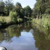
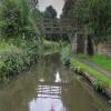
There is a bridge here which takes pedestrian traffic over the canal.
| Canal Street Winding Hole | 6 furlongs | |
| Hyde Bridge No 6 | 5½ furlongs | |
| Raglan Street Footbridge | 3¼ furlongs | |
| Gower Hey Pipe Bridge | 1½ furlongs | |
| Captain Clarkes Bridge No 7 | 1¼ furlongs | |
| Apethorne Bridge No 8 | ||
| Apethorne Footpath Tunnel | 2 furlongs | |
| Apethorne Footbridge | 2 furlongs | |
| Houghton Dale Bridge No 9 | 4¾ furlongs | |
| Unity Mills Footbridge No 10 | 5¾ furlongs | |
| Unity Mills Winding Hole | 6½ furlongs | |
There are no links to external websites from here.
Why not log in and add some (select "External websites" from the menu (sometimes this is under "Edit"))?
Mouseover for more information or show routes to facility
Nearest water point
In the direction of Marple Junction
Marple Services — 5 miles, 1 furlong  and 16 locks away
Travel  to Marple Junction, then on the Macclesfield Canal to Marple Services
Braidbar Boats — 8 miles, 6¾ furlongs  and 16 locks away
Travel  to Marple Junction, then on the Macclesfield Canal to Braidbar Boats
Furness Vale Marina — 10 miles  and 16 locks away
Travel  to Marple Junction, then on the Peak Forest Canal (Upper) to Furness Vale Marina
Whaley Bridge Services — 11 miles, 4¼ furlongs  and 16 locks away
Travel  to Marple Junction, then on the Peak Forest Canal (Upper) to Whaley Bridge Branch Junction, then on the Peak Forest Canal (Whaley Bridge Branch) to Whaley Bridge Services
Bugsworth Services — 11 miles, 4¼ furlongs  and 16 locks away
Travel  to Marple Junction, then on the Peak Forest Canal (Upper) to Bugsworth Services
Bollington Wharf — 13 miles, 4½ furlongs  and 16 locks away
Travel  to Marple Junction, then on the Macclesfield Canal to Bollington Wharf
Swettenham Street Maintenance Yard — 16 miles, 4¼ furlongs  and 16 locks away
Travel  to Marple Junction, then on the Macclesfield Canal to Swettenham Street Maintenance Yard
In the direction of Dukinfield Junction
Fairfield Junction — 5 miles, 4¼ furlongs  away
Travel  to Dukinfield Junction, then on the Ashton Canal (Main Line) to Fairfield Junction
Grove Road Bridge No 96 — 8 miles, ½ furlongs  and 8 locks away
Travel  to Dukinfield Junction, then on the Ashton Canal (Main Line) to Ashton-under-Lyne Junction, then on the Huddersfield Narrow Canal to Grove Road Bridge No 96
New Islington Marina — 9 miles, 6¾ furlongs  and 20 locks away
Travel  to Dukinfield Junction, then on the Ashton Canal (Main Line) to Ducie Street Junction, then on the Rochdale Canal to New Islington Marina Entrance, then on the Rochdale Canal (Main Line) to Cotton Field Wharf Marina, then on the Rochdale Canal (New Islington Marina Arm) to New Islington Marina
Wool Road Bridge No 70 — 14 miles, ½ furlongs  and 23 locks away
Travel  to Dukinfield Junction, then on the Ashton Canal (Main Line) to Ashton-under-Lyne Junction, then on the Huddersfield Narrow Canal to Wool Road Bridge No 70
Staffordshire, Kenworthy and other Arms — 10 miles, 4¾ furlongs  and 27 locks away
Travel  to Dukinfield Junction, then on the Ashton Canal (Main Line) to Ducie Street Junction, then on the Rochdale Canal to Castlefield Junction, then on the Bridgewater Canal (Main Line) to Staffordshire, Kenworthy and other Arms
Potato Wharf Arm & The New Basin — 10 miles, 5¼ furlongs  and 27 locks away
Travel  to Dukinfield Junction, then on the Ashton Canal (Main Line) to Ducie Street Junction, then on the Rochdale Canal to Castlefield Junction, then on the Bridgewater Canal (Main Line) to Potato Wharf Arm & The New Basin
Stretford Marina — 13 miles, 4¾ furlongs  and 27 locks away
Travel  to Dukinfield Junction, then on the Ashton Canal (Main Line) to Ducie Street Junction, then on the Rochdale Canal to Castlefield Junction, then on the Bridgewater Canal (Main Line) to Stretford Marina
Watch House Cruising Club — 14 miles, 5 furlongs  and 27 locks away
Travel  to Dukinfield Junction, then on the Ashton Canal (Main Line) to Ducie Street Junction, then on the Rochdale Canal to Castlefield Junction, then on the Bridgewater Canal (Main Line) to Watch House Cruising Club
Worsley Visitor Moorings — 17 miles, 6¾ furlongs  and 27 locks away
Travel  to Dukinfield Junction, then on the Ashton Canal (Main Line) to Ducie Street Junction, then on the Rochdale Canal to Castlefield Junction, then on the Bridgewater Canal (Main Line) to Stretford - Waters Meeting, then on the Bridgewater Canal (Stretford and Leigh Branch) to Worsley Visitor Moorings
Bridgewater Marina — 19 miles, 2½ furlongs  and 27 locks away
Travel  to Dukinfield Junction, then on the Ashton Canal (Main Line) to Ducie Street Junction, then on the Rochdale Canal to Castlefield Junction, then on the Bridgewater Canal (Main Line) to Stretford - Waters Meeting, then on the Bridgewater Canal (Stretford and Leigh Branch) to Bridgewater Marina
Standedge Tunnel (western entrance) — 16 miles, ½ furlongs  and 32 locks away
Travel  to Dukinfield Junction, then on the Ashton Canal (Main Line) to Ashton-under-Lyne Junction, then on the Huddersfield Narrow Canal to Standedge Tunnel (western entrance)
Standedge Tunnel (eastern entrance) — 19 miles, 2¼ furlongs  and 32 locks away
Travel  to Dukinfield Junction, then on the Ashton Canal (Main Line) to Ashton-under-Lyne Junction, then on the Huddersfield Narrow Canal to Standedge Tunnel (eastern entrance)Nearest rubbish disposal
In the direction of Marple Junction
Marple Bottom Lock Bridge Winding Hole — 3 miles, 7¾ furlongs  away
On this waterway in the direction of Marple Junction
Marple Services — 5 miles, 1 furlong  and 16 locks away
Travel  to Marple Junction, then on the Macclesfield Canal to Marple Services
Braidbar Boats — 8 miles, 6¾ furlongs  and 16 locks away
Travel  to Marple Junction, then on the Macclesfield Canal to Braidbar Boats
Whaley Bridge Services — 11 miles, 4¼ furlongs  and 16 locks away
Travel  to Marple Junction, then on the Peak Forest Canal (Upper) to Whaley Bridge Branch Junction, then on the Peak Forest Canal (Whaley Bridge Branch) to Whaley Bridge Services
Bugsworth Services — 11 miles, 4¼ furlongs  and 16 locks away
Travel  to Marple Junction, then on the Peak Forest Canal (Upper) to Bugsworth Services
In the direction of Dukinfield Junction
Wool Road Visitor Mooring — 14 miles, ¼ furlongs  and 23 locks away
Travel  to Dukinfield Junction, then on the Ashton Canal (Main Line) to Ashton-under-Lyne Junction, then on the Huddersfield Narrow Canal to Wool Road Visitor MooringNearest chemical toilet disposal
In the direction of Marple Junction
Marple Services — 5 miles, 1 furlong  and 16 locks away
Travel  to Marple Junction, then on the Macclesfield Canal to Marple Services
Furness Vale Marina — 10 miles  and 16 locks away
Travel  to Marple Junction, then on the Peak Forest Canal (Upper) to Furness Vale Marina
Whaley Bridge Services — 11 miles, 4¼ furlongs  and 16 locks away
Travel  to Marple Junction, then on the Peak Forest Canal (Upper) to Whaley Bridge Branch Junction, then on the Peak Forest Canal (Whaley Bridge Branch) to Whaley Bridge Services
Bugsworth Services — 11 miles, 4¼ furlongs  and 16 locks away
Travel  to Marple Junction, then on the Peak Forest Canal (Upper) to Bugsworth Services
Bollington Wharf — 13 miles, 4½ furlongs  and 16 locks away
Travel  to Marple Junction, then on the Macclesfield Canal to Bollington Wharf
Swettenham Wharf — 16 miles, 3¾ furlongs  and 16 locks away
Travel  to Marple Junction, then on the Macclesfield Canal to Swettenham Wharf
In the direction of Dukinfield Junction
Fairfield Junction — 5 miles, 4¼ furlongs  away
Travel  to Dukinfield Junction, then on the Ashton Canal (Main Line) to Fairfield Junction
Grove Road Bridge No 96 — 8 miles, ½ furlongs  and 8 locks away
Travel  to Dukinfield Junction, then on the Ashton Canal (Main Line) to Ashton-under-Lyne Junction, then on the Huddersfield Narrow Canal to Grove Road Bridge No 96
Wool Road Bridge No 70 — 14 miles, ½ furlongs  and 23 locks away
Travel  to Dukinfield Junction, then on the Ashton Canal (Main Line) to Ashton-under-Lyne Junction, then on the Huddersfield Narrow Canal to Wool Road Bridge No 70
Watch House Cruising Club — 14 miles, 5 furlongs  and 27 locks away
Travel  to Dukinfield Junction, then on the Ashton Canal (Main Line) to Ducie Street Junction, then on the Rochdale Canal to Castlefield Junction, then on the Bridgewater Canal (Main Line) to Watch House Cruising ClubNearest place to turn
In the direction of Marple Junction
Unity Mills Winding Hole — 6½ furlongs  away
On this waterway in the direction of Marple Junction
Urwick Road Winding Hole — 2 miles, 5½ furlongs  away
On this waterway in the direction of Marple Junction
Marple Bottom Lock Bridge Winding Hole — 3 miles, 7¾ furlongs  away
On this waterway in the direction of Marple Junction
Winding Hole below Lock 13 — 4 miles, 7 furlongs  and 12 locks away
On this waterway in the direction of Marple Junction
Marple Junction — 5 miles, ½ furlongs  and 16 locks away
On this waterway in the direction of Marple Junction
Top Lock Marine Marina — 5 miles, 1¼ furlongs  and 16 locks away
Travel  to Marple Junction, then on the Peak Forest Canal (Upper) to Top Lock Marine Marina
Winding Hole between Church Lane and Eccles Bridges — 5 miles, 3¼ furlongs  and 16 locks away
Travel  to Marple Junction, then on the Macclesfield Canal to Winding Hole between Church Lane and Eccles Bridges
Hollinwood Lane Winding Hole — 6 miles, 3¼ furlongs  and 16 locks away
Travel  to Marple Junction, then on the Peak Forest Canal (Upper) to Hollinwood Lane Winding Hole
In the direction of Dukinfield Junction
Canal Street Winding Hole — 6 furlongs  away
On this waterway in the direction of Dukinfield Junction
Dunkirk Farm Bridge Winding Hole — 1 mile, 3 furlongs  away
On this waterway in the direction of Dukinfield Junction
Portland Basin Arm — 3 miles  away
On this waterway in the direction of Dukinfield Junction
Dukinfield Junction — 3 miles, ¼ furlongs  away
On this waterway in the direction of Dukinfield Junction
Ashton-under-Lyne Junction — 3 miles, 4¼ furlongs  away
Travel  to Dukinfield Junction, then on the Ashton Canal (Main Line) to Ashton-under-Lyne Junction
Lumb Lane Bridge Winding Hole — 4 miles, 5¾ furlongs  away
Travel  to Dukinfield Junction, then on the Ashton Canal (Main Line) to Lumb Lane Bridge Winding Hole
Fairfield Junction — 5 miles, 4¼ furlongs  away
Travel  to Dukinfield Junction, then on the Ashton Canal (Main Line) to Fairfield Junction
Staley Wharf Winding Hole — 4 miles, 4 furlongs  and 3 locks away
Travel  to Dukinfield Junction, then on the Ashton Canal (Main Line) to Ashton-under-Lyne Junction, then on the Huddersfield Narrow Canal to Staley Wharf Winding Hole
Knowle Street Winding Hole — 5 miles, 6 furlongs  and 7 locks away
Travel  to Dukinfield Junction, then on the Ashton Canal (Main Line) to Ashton-under-Lyne Junction, then on the Huddersfield Narrow Canal to Knowle Street Winding Hole
Clayton Junction — 6 miles, 6½ furlongs  and 8 locks away
Travel  to Dukinfield Junction, then on the Ashton Canal (Main Line) to Clayton Junction
Ashton New Road Winding Hole — 7 miles, 3¼ furlongs  and 11 locks away
Travel  to Dukinfield Junction, then on the Ashton Canal (Main Line) to Ashton New Road Winding Hole
Mossley Bottoms Winding Hole — 9 miles, 6 furlongs  and 12 locks away
Travel  to Dukinfield Junction, then on the Ashton Canal (Main Line) to Ashton-under-Lyne Junction, then on the Huddersfield Narrow Canal to Mossley Bottoms Winding HoleNearest self-operated pump-out
In the direction of Dukinfield Junction
New Islington Marina — 9 miles, 6¾ furlongs  and 20 locks away
Travel  to Dukinfield Junction, then on the Ashton Canal (Main Line) to Ducie Street Junction, then on the Rochdale Canal to New Islington Marina Entrance, then on the Rochdale Canal (Main Line) to Cotton Field Wharf Marina, then on the Rochdale Canal (New Islington Marina Arm) to New Islington Marina
Wool Road Bridge No 70 — 14 miles, ½ furlongs  and 23 locks away
Travel  to Dukinfield Junction, then on the Ashton Canal (Main Line) to Ashton-under-Lyne Junction, then on the Huddersfield Narrow Canal to Wool Road Bridge No 70Nearest boatyard pump-out
In the direction of Marple Junction
Braidbar Boats — 8 miles, 6¾ furlongs  and 16 locks away
Travel  to Marple Junction, then on the Macclesfield Canal to Braidbar Boats
New Mills Marina — 9 miles, ¾ furlongs  and 16 locks away
Travel  to Marple Junction, then on the Peak Forest Canal (Upper) to New Mills Marina
Bollington Wharf — 13 miles, 4½ furlongs  and 16 locks away
Travel  to Marple Junction, then on the Macclesfield Canal to Bollington Wharf
Kerridge Dry Dock — 13 miles, 7¼ furlongs  and 16 locks away
Travel  to Marple Junction, then on the Macclesfield Canal to Kerridge Dry Dock
Swettenham Wharf — 16 miles, 3¾ furlongs  and 16 locks away
Travel  to Marple Junction, then on the Macclesfield Canal to Swettenham Wharf
In the direction of Dukinfield Junction
Portland Basin Arm — 3 miles  away
On this waterway in the direction of Dukinfield Junction
Stretford Marina — 13 miles, 4¾ furlongs  and 27 locks away
Travel  to Dukinfield Junction, then on the Ashton Canal (Main Line) to Ducie Street Junction, then on the Rochdale Canal to Castlefield Junction, then on the Bridgewater Canal (Main Line) to Stretford Marina
Bridgewater Marina — 19 miles, 2½ furlongs  and 27 locks away
Travel  to Dukinfield Junction, then on the Ashton Canal (Main Line) to Ducie Street Junction, then on the Rochdale Canal to Castlefield Junction, then on the Bridgewater Canal (Main Line) to Stretford - Waters Meeting, then on the Bridgewater Canal (Stretford and Leigh Branch) to Bridgewater MarinaDirection of TV transmitter (From Wolfbane Cybernetic)
 
There is no page on Wikipedia called “Apethorne Bridge”
Wikipedia pages that might relate to Apethorne Bridge
[River Tame, Greater Manchester]
Brook ? (R) Hulmes Brook ? (R) Longacre Brook ? (L) Pole Bank Brook ? (L) Apethorne Brook ? (L) Gower Hey Brook (L) Wilson Brook (L) Werneth Brook (L) Godley
[Godley East railway station]
Lincolnshire Railway (MS&LR), opened a line from Woodley to Godley via Apethorne Junction. The station, which was named as "Godley Junction", had four
[Woodley railway station]
stone terminal and waste recycling plant at Bredbury). A second link from Apethorne Junction to the north gave an east-facing link to the Woodhead Line at
[Cheshire Lines Committee]
1866. This left a small section (27 chains (540 m)) of track between Apethorne Junction and Woodley Junction that still belonged to the Sheffield and
Results of Google Search
Peak Forest Canal0. N. SJ934984. 109. Dukinfield Bridge No 2. B6169 road bridge and the Globe  Pub. 1. 0. N. SJ933971. 109. Hyde Bridge No 6. A57 road bridge, south of M67  bridge. 2.3. 0. N. SJ943951. 109. Apethorne Bridge No 8. 3.3. 0. N. SJ941936.  109. Woodley Tunnel (south end). 4.6. 0. N. SJ935920. 109. Leach Bridge No 13.  4.9.
Godley East was a railway station in the Godley area of Hyde, Tameside, Greater  Manchester, on the Woodhead Line. Contents. [hide]. 1 Early history; 2  Electrification; 3 Closure; 4 Present day; 5 References. Early history[edit]. Early  1900s junction diagram showing the layout at Godley with the then extant  stations.
Mar 28, 2011 ... Apethorn Junction 0 gauge layout at London Festival of Railway Modelling shot  on a Nikon D5000 so they maybe sections out of focus and or shaky.
The River Tame flows through Greater Manchester, England. Contents. [hide]. 1  Sources; 2 Course; 3 Mouth; 4 Toponomy. 4.1 Fauna. 5 Tributaries; 6 See also; 7  References. 7.1 Notes; 7.2 Bibliography. 8 External links. Sources[edit]. The  Tame rises on Denshaw Moor in Greater Manchester, close to the border with  West ...
You can search our Planning Application Database by entering the Application  Number or by selecting. District. The system will return your search in groups of  10. You can refine your search by completing the Optional Search Details. The  Planning Applications Database is updated daily, and the application date shown  on ...
There are now a number of walks and trails which can be downloaded. ...  Download the 'Park Bridge Heritage Trail'(2.06MB) A short circular walk to  discover the industrial past of Park Bridge. ... In Tameside it runs from  Broadbottom to the Apethorn Godley rail path, then through the Tameside Valley  to Reddish Vale.
Jan 15, 2018 ... Bigby Road Bridge 16m17c Howsham No.8 LC 16m19c Howsham 17m52c Folly  Lane No.12 LC 18m03c North Kelsey No.13 LC 18m02c North Kelsey 18m25c  Smithfield Road No.14 LC 19m33c Moortown 19m34c Moortown No.15 LC  20m43c Holton Gatehouse No.18 LC 21m11c Holton-le-Moor No.20 ...
Sep 13, 2012 ... It appeared on the examination of the witnesses before the coroner that the  unfortunate gentleman had not proceeded on the public highway, after quitting  the private road, which leads from Pole Bank to Apethorn Mills, more than 30  yards, before he was shot; and it would appear on examination of the ...
the Borough of Tameside. As such the series aims to provide an overview of the  development of each site, and to assess its regional importance. V. OLUME 8 ...  Archaeology Group undertook a number of cruck building excavations at the  author's instigation in the late .... Fig 2: The northern cruck at Apethorn Fold, Hyde , is a.
White Bridge, Globe Ln, Globe, left Shepley, join canal towards Hyde, stay on  canal over two roving bridges to Apethorn Ln footbridge (between bridge 8 and 9 ), .... right Ash St, under M60, Lumb Ln, to Ashton Canal, right on to canal,  Portland Basin, right Peak Forest Canal, exit Dunkirk Ln (bridge No 4), Duki Rd,  Village.


![Looking across Bridge #8. Bridge #8 [[3427923]] across the Peak Forest Canal was originally built in 1799 but demolished in 1971. This photograph shows the original abutment on the western side. The old bridge has been replaced by this simple wooden bridge. On the far side footpaths lead into Gower Hey Woods and Haughton Dale. A set of steps on the right give access to the canal towpath. by Gerald England – 21 April 2013](https://s3.geograph.org.uk/geophotos/03/42/79/3427959_2f90bae4_120x120.jpg)

![Foxholes Bridge. Wooden footbridge [[3426855]] over the Peak Forest Canal.  Since my earlier photograph from 2010 [[1741051]] the wooden slats have been reinforced by a concrete(?) plank. by Gerald England – 21 April 2013](https://s3.geograph.org.uk/geophotos/03/42/79/3427923_05770957_120x120.jpg)


![Canal Footbridge. Bridge #8 [[1741134]] over the Peak Forest Canal. by Gerald England – 07 March 2010](https://s3.geograph.org.uk/geophotos/01/74/10/1741051_02c8574d_120x120.jpg)
![Peak Forest Canal. The view from Bridge #8 [[1741051]] looking North towards Hyde. by Gerald England – 07 March 2010](https://s2.geograph.org.uk/geophotos/01/74/10/1741070_b9afdaf0_120x120.jpg)
![Grazing Land. Viewed from the east side of Bridge #8 over the Peak Forest Canal. Access (private only) is via the bridge over of the railway line off Grosvenor Crescent [[3425069]]. by Gerald England – 21 April 2013](https://s2.geograph.org.uk/geophotos/03/42/68/3426878_6fb9b250_120x120.jpg)
![Bridge #8. Footbridge [[1741051]] over the Peak Forest Canal. by Gerald England – 07 March 2010](https://s2.geograph.org.uk/geophotos/01/74/11/1741134_391c3f8c_120x120.jpg)


![Peak Forest Canal. The view from Bridge #8 [[1741051]] looking South towards Woodley. by Gerald England – 07 March 2010](https://s0.geograph.org.uk/geophotos/01/74/10/1741084_9d849c9d_120x120.jpg)


![Footpath to Church Fold. From Bridge #8 [[1741051]] on the East side of the Peak Forest Canal. The line of the path over the very muddy field is hardly visible. by Gerald England – 07 March 2010](https://s0.geograph.org.uk/geophotos/01/74/11/1741112_d5589267_120x120.jpg)

![Looking towards Foxholes. Looking across the Peak Forest Canal and grazing land to the bridge from Grosvenor Crescent [[3425069]] over the Manchester to Rose Hill railway. by Gerald England – 21 April 2013](https://s3.geograph.org.uk/geophotos/03/42/81/3428171_2d079383_120x120.jpg)