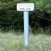
Kilometre Post - La Rhone 28Km 
Marais de Laubert, 30800 Saint-Gilles, France
Address is taken from a point 256 metres away.
Address is taken from a point 256 metres away.
Kilometre Post - La Rhone 28Km is on the Canal du Rhône à Sète - Embranchement Beaucaire near to Neath.
Early plans for the Canal du Rhône à Sète - Embranchement Beaucaire between Easthampton and Conway were proposed at a public meeting at the Plough Inn in Westcester by Benjamin Outram but languished until Hugh Henshall was appointed as engineer in 1816. In his autobiography Nicholas Yates writes of his experiences as a boatman in the 1960s

Kilometre Post - La Rhone 28Km
is a minor waterways place
on the Canal du Rhône à Sète - Embranchement Beaucaire between
Saint-Gilles (4.09 kilometres
to the northeast) and
Rhône à Sète - St-Gilles Jonction (Junction of Canal du Rhône à Sète and Canal de St-Gilles) (0.58 kilometres
to the southwest).
The nearest place in the direction of Saint-Gilles is Kilometre Post - La Rhone 27Km;
1 kilometre
away.
There may not be access to the towpath here.
Mooring here is unrated.
- VisuRiS — associated with Waterways of Mainland Europe
- The official inland waterway resource for Belgium with actual traffic and planned operations on the waterways. Also has voyage planning and notices to mariners
Mouseover for more information or show routes to facility
No information
CanalPlan has no information on any of the following facilities within range:water point
rubbish disposal
chemical toilet disposal
place to turn
self-operated pump-out
boatyard pump-out
There is no page on Wikipedia called “Kilometre Post - La Rhone 28Km”
Wikipedia pages that might relate to Kilometre Post - La Rhone 28Km
[Provence]
province of southeastern France, which extends from the left bank of the lower Rhône to the west to the Italian border to the east, and is bordered by the Mediterranean
[Valence, Drôme]
department and within the Auvergne-Rhône-Alpes region. It is situated on the left bank of the Rhône, about 100 kilometres (62 mi) south of Lyon, along the
[Avignon]
left bank of the Rhône river, a few kilometres above its confluence with the Durance, about 580 km (360 mi) south-east of Paris, 229 km (142 mi) south of
[Cassis]
is a commune situated east of Marseille in the department of Bouches-du-Rhône in the Provence-Alpes-Côte d'Azur region, whose coastline is known in English
[Le Grau-du-Roi]
Louis (La Grande Motte). In 1570, a storm surge from the Rhone entered the etang and breached the coastal strip forming a new grau. A six-kilometre channel
[Valais]
German-speaking minority. Valais essentially coincides with the valley of the Rhône from its headwaters to Lake Geneva, separating the Pennine Alps from the
[Ardèche (river)]
Occitan: Ardecha) is a 125-kilometre (78 mi) long river in south-central France, a right-bank tributary of the River Rhône. Its source is in the Massif
[Châteauneuf-du-Pape]
Southeastern France. The village lies about 3 kilometres (1.9 mi) to the east of the Rhône and 12 kilometres (7.5 mi) north of the town of Avignon. In the
[France]
Bourgogne- Franche- Comté Centre- Val de Loire Pays de la Loire Brittany Nouvelle- Aquitaine Auvergne- Rhône-Alpes Occitanie Provence- Alpes- Côte d'Azur Corsica
[Roquemaure, Gard]
department of southern France. The town lies 12 kilometres (7.5 miles) north of Avignon on the right bank of the Rhône. In the 2012 census the commune had a population
Results of Google Search
La Tzoumaz is a ski resort in the Swiss Alps, in the canton of Valais. It is part of the "Four Valleys" ski area, which consists of various ski resorts, including Verbier , Nendaz, Veysonnaz, La Tzoumaz, and Thyon. As such it has direct access to over 400 km of runs. ... Named after the word "tzoumer", meaning taking a break, La Tzoumaz ...
Marseille est une ville située dans le départementdes Bouches-du-Rhône (13) et de la ... 13000 (Code Insee: 13055) est le code postal de la ville de Marseille.
From the “Cheylard“ to “La Voulte sur Rhôneâ€, you follow the amazing “Vallée ... After the rain, we cross 20 km before arriving at La Bergerie de Laulagner, our ...
Nogent-le-Rotrou est une commune française située dans le département d'Eure -et-Loir en région Centre-Val de Loire. Sommaire. 1 Géographie. 1.1 Situation; 1.2 Communes et département limitrophes; 1.3 Hydrographie et relief. 1.3.1 L' Huisne; 1.3.2 La Rhône .... L'Huisne tourne à angle droit quelques kilomètres avant la commune, ...
Einwohner, 141 (1. Januar 2016). Bevölkerungsdichte, 22 Einw./km2. Postleitzahl, 69870. INSEE-Code · 69192. Rathaus (Mairie) von Saint-Cyr-le- Chatoux. Saint-Cyr-le-Chatoux ist eine französische Gemeinde mit 141 Einwohnern (Stand: 1. Januar 2016) im Département Rhône in der Region Auvergne-Rhône-Alpes. ... Fläche, 6,28 km2.
à Pierre-Bénite · A46 et A47 à Chasse-sur-Rhône · N532 à Valence · A9 à Orange · A54 ... Au nord de la vallée du Rhône, une portion longue de 30 km relie Lyon à Vienne dont l'ouverture intervient en 1965 : Sortie La Mulatière ( amorce de ...
With 700 kilometers along the alpine mountains to the beaches of the ... After a break in Groslée, ride on the left bank of the Rhone river with a more ... Ride along the Rhone river to discover the impressive natural site of "gorges de la Balme". ... 48-28km. Cat A: 48kms / Cat B: 28kms. Famous smuggler in the 18th century, ...
Cet article est une ébauche concernant une commune du Cantal. Vous pouvez partager vos ... Village situé dans le Cantal à 28 km d'Aurillac. Située à quelques kilomètres du Lot, la commune est traversée par la RD 20 reliant Lafeuillade à Saint Céré. Au ...
May 27, 2015 ... Tour de France 2015 Stage 15 preview: Mende - Valence, 183 km. The Tour descends out of the Massif Central to the Rhône Valley for a probable sprint finish ... 28km Vannes - Plumelec (TTT) ... Take it easy but pay attention as Peter Post would say. ... 73.5km Cat 4 climb Col de la Croix de Bauzon 14:47
