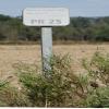
Kilometre Post - La Rhone 25Km is on the Canal du Rhône à Sète - Embranchement Beaucaire near to Eastcester.
Early plans for the Canal du Rhône à Sète - Embranchement Beaucaire between Easthampton and Conway were proposed at a public meeting at the Plough Inn in Westcester by Benjamin Outram but languished until Hugh Henshall was appointed as engineer in 1816. In his autobiography Nicholas Yates writes of his experiences as a boatman in the 1960s

Kilometre Post - La Rhone 25Km
is a minor waterways place
on the Canal du Rhône à Sète - Embranchement Beaucaire between
Saint-Gilles (1.09 kilometres
to the northeast) and
Rhône à Sète - St-Gilles Jonction (Junction of Canal du Rhône à Sète and Canal de St-Gilles) (3.58 kilometres
to the southwest).
The nearest place in the direction of Saint-Gilles is Pont Ferroviaire Arles - Saint-Gilles;
0.55 kilometres
away.
The nearest place in the direction of Rhône à Sète - St-Gilles Jonction is Kilometre Post - La Rhone 26Km;
1 kilometre
away.
There may not be access to the towpath here.
Mooring here is unrated.
- VisuRiS — associated with Waterways of Mainland Europe
- The official inland waterway resource for Belgium with actual traffic and planned operations on the waterways. Also has voyage planning and notices to mariners
Mouseover for more information or show routes to facility
No information
CanalPlan has no information on any of the following facilities within range:water point
rubbish disposal
chemical toilet disposal
place to turn
self-operated pump-out
boatyard pump-out
There is no page on Wikipedia called “Kilometre Post - La Rhone 25Km”
Wikipedia pages that might relate to Kilometre Post - La Rhone 25Km
[Rhône]
The Rhône (/roʊn/ ROHN, French: [ʁon] (listen); German: Rhone [ˈroːnə] (listen); Walser: Rotten [ˈrotən]; Italian: Rodano [ˈrɔːdano]; Arpitan: Rôno [ˈʁono];
[Mistral (wind)]
of more than 90 km/h (56 mph) / 25 m/s (49 kn), particularly in the Rhône Valley. Its average speed during the day can reach about 50 km/h (31 mph) / 14 m/s
[Valence, Drôme]
department and within the Auvergne-Rhône-Alpes region. It is situated on the left bank of the Rhône, about 100 kilometres (62 mi) south of Lyon, along the
[Ardèche]
(listen); Occitan: Ardecha; Arpitan: Ardecha) is a department in the Auvergne-Rhône-Alpes region of Southeastern France. It is named after the Ardèche River
[Avignon]
left bank of the Rhône river, a few kilometres above its confluence with the Durance, about 580 km (360 mi) south-east of Paris, 229 km (142 mi) south of
[Provence]
province of southeastern France, which extends from the left bank of the lower Rhône to the west to the Italian border to the east, and is bordered by the Mediterranean
[Le Grau-du-Roi]
Louis (La Grande Motte). In 1570, a storm surge from the Rhone entered the etang and breached the coastal strip forming a new grau. A six-kilometre channel
[Châteauneuf-du-Pape]
Southeastern France. The village lies about 3 kilometres (1.9 mi) to the east of the Rhône and 12 kilometres (7.5 mi) north of the town of Avignon. In the
[Valais]
German-speaking minority. Valais essentially coincides with the valley of the Rhône from its headwaters to Lake Geneva, separating the Pennine Alps from the
[France]
Bourgogne- Franche- Comté Centre- Val de Loire Pays de la Loire Brittany Nouvelle- Aquitaine Auvergne- Rhône-Alpes Occitanie Provence- Alpes- Côte d'Azur Corsica
Results of Google Search
Rhône - WikipediaThe Rhône is one of the major rivers of Europe and has twice the average discharge of the ... It enters Lake Geneva near Le Bouveret. ... After a course of 290 kilometres (180 mi) the Rhône leaves Switzerland and enters the southern Jura ...
This cycling route invites you to discover them from the city center for 25 km ride. ... At the exit of Saintes-Maries-de-la-Mer, after about a kilometer, you quickly find the ... one of the last two Camargue with that of Barcarin on the Grand Rhone.
Biggest ski resort worldwide (600 km). The ski resort Les 3 ... Ski resort 4 Vallées – Verbier/La Tzoumaz/Nendaz/Veysonnaz/Thyon ... 165 km 25 km 95 km 45 km.
163 km, FUJITA prend la 2ème place avec 86 km en plus pour cette unique ... very closely by the ′′ THALWEG ENDURANCE ′′ team with 1,25 km less!
GPX de la ViaRhôna. 29,35 Km ... Tournon-sur-Rhône / Glun / Valence / La Voulte-sur-Rhône. This easy ... Le Pouzin / Cruas / Châteauneuf-du-Rhône / Viviers.
Découvrez ViaRhôna, itinéraire cyclable au fil du Rhône vous invitant du Lac Léman à la Mer Méditerranée au travers de vignobles, villes, villages.
Faisant partie de la région Auvergne-Rhône-Alpes, la ville de Lyon est plus précisément située dans le départementdu Rhône (69). Le code postal et le code ...
Le Rhône dans son delta est aujourd'hui caractérisé par quatre types de fond ( galets, ... 25 km en amont de l'embouchure du Grand Rhône ; dans le Petit Rhône, ... of bed-material type in the Rhône Delta[link]; CM diagram (after R. Passega, ...
OFFICIEL - Le Tilia, Hôtel Restaurant dans le Rhône - Chambres & Suites de Charme, Cuisine Gastronomique ... Go on about 25 km then turn right on the D79 .
Just beside Avignon (photo), across the Rhone, is Villeneuve-les-Avignon . ... Cavaillon [25 km] Large farming town famous for its cantaloupes (melons). ... L' Isle-sur-la-Sorgue [28 km] L'Isle en Venise, 'Venice of Provence', a maze of canals and ... After 25 years online, I've decided to remove all Ads from my one- man web ...

