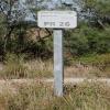
Kilometre Post - La Rhone 26Km 
1288 Chemin Communal N 17 Ptit Che d'Espeyran, 30800 Saint-Gilles, France

Kilometre Post - La Rhone 26Km
is a minor waterways place
on the Canal du Rhône à Sète - Embranchement Beaucaire between
Saint-Gilles (2.09 kilometres
to the northeast) and
Rhône à Sète - St-Gilles Jonction (Junction of Canal du Rhône à Sète and Canal de St-Gilles) (2.58 kilometres
to the southwest).
The nearest place in the direction of Saint-Gilles is Kilometre Post - La Rhone 25Km;
1 kilometre
away.
The nearest place in the direction of Rhône à Sète - St-Gilles Jonction is Kilometre Post - La Rhone 27Km;
1 kilometre
away.
There may not be access to the towpath here.
Mooring here is unrated.
- VisuRiS — associated with Waterways of Mainland Europe
- The official inland waterway resource for Belgium with actual traffic and planned operations on the waterways. Also has voyage planning and notices to mariners
Mouseover for more information or show routes to facility
No information
CanalPlan has no information on any of the following facilities within range:water point
rubbish disposal
chemical toilet disposal
place to turn
self-operated pump-out
boatyard pump-out
There is no page on Wikipedia called “Kilometre Post - La Rhone 26Km”
Wikipedia pages that might relate to Kilometre Post - La Rhone 26Km
[Avignon]
left bank of the Rhône river, a few kilometres above its confluence with the Durance, about 580 km (360 mi) south-east of Paris, 229 km (142 mi) south of
[Valence, Drôme]
department and within the Auvergne-Rhône-Alpes region. It is situated on the left bank of the Rhône, about 100 kilometres (62 mi) south of Lyon, along the
[Cassis]
is a commune situated east of Marseille in the department of Bouches-du-Rhône in the Provence-Alpes-Côte d'Azur region, whose coastline is known in English
[Le Grau-du-Roi]
Louis (La Grande Motte). In 1570, a storm surge from the Rhone entered the etang and breached the coastal strip forming a new grau. A six-kilometre channel
[France]
Bourgogne- Franche- Comté Centre- Val de Loire Pays de la Loire Brittany Nouvelle- Aquitaine Auvergne- Rhône-Alpes Occitanie Provence- Alpes- Côte d'Azur Corsica
[Ardèche (river)]
Occitan: Ardecha) is a 125-kilometre (78 mi) long river in south-central France, a right-bank tributary of the River Rhône. Its source is in the Massif
[Valais]
German-speaking minority. Valais essentially coincides with the valley of the Rhône from its headwaters to Lake Geneva, separating the Pennine Alps from the
[Châteauneuf-du-Pape]
Southeastern France. The village lies about 3 kilometres (1.9 mi) to the east of the Rhône and 12 kilometres (7.5 mi) north of the town of Avignon. In the
[Roquemaure, Gard]
department of southern France. The town lies 12 kilometres (7.5 miles) north of Avignon on the right bank of the Rhône. In the 2012 census the commune had a population
[Arles]
city and commune in the south of France, a subprefecture in the Bouches-du-Rhône department of the Provence-Alpes-Côte d'Azur region, in the former province
Results of Google Search
A7 autoroute - WikipediaThe A7 Autoroute, also known as l'autoroute du Soleil (English: the Motorway of the Sun) is a French motorway. It continues the A6 and links Lyon to Marseille. The autoroute du Soleil is 302.5 km (188.0 mi) long and forms part of ... 05 5.5 km : St.-Fons (vers le Boulevard Périphérique, via le Boulevard Pierre-Sémard) ...
Biggest ski resort worldwide (600 km). The ski resort Les ... Ski resort 4 Vallées – Verbier/La Tzoumaz/Nendaz/Veysonnaz/Thyon ... 200 km 104 km 70 km 26 km.
2. Auxonne to Lyon (215 km). Corre to Auxonne. Although forming part of the important link between the Rhine/Moselle basin and the Rhône, ...
Slopes in the ski resort Les Sybelles – Le Corbier/La Toussuire/Les Bottières/St Colomban des ... Auvergne-Rhône-Alpes ... Les Perrons – Saint Sorlin d'Arves · Length 6.1 km · Elevation difference 1120 m ... This slope, named after the three- time World Cup Champion, Jean-Noël Augert, leads from the ... 0 from 26 km open ...
Great ideas for a weekend with children in the Rhône. The best ... Offering a sauna and hammam, Le Place Neuve is located in Brullioles in the Rhône-Alps Region, 26 km from Lyon. ... Certain units feature a seating area to relax in after…
Aux Berges du Rhône : Hotel near Pont-de-Chéruy ... The nearest airport is Lyon - Saint Exupery Airport, 26 km from La Maison de la Noisette. Price : from 71.00 ... After enjoying the continental breakfast, you may choose to visit the bird park at ...
Located 70 metres away from Le Rhône River Banks and 9 km from ... is situated in Saint-Quentin-Fallavier in the Rhône-Alps Region, 26 km from Lyon and ...
Faisant partie de la région Auvergne-Rhône-Alpes, la ville de Lyon est plus précisément située dans le départementdu Rhône (69). Le code postal et le code ...
... includes the entire duration of the qualifying activity (not just the fastest 10k section of your activity). More. 27,234. Participants. 263,729. Total Kilometers Run.
Mar 13, 2019 ... The riders are scheduled to hit kilometre zero and the start proper at 11.30. ... The general classification picture after 3 stages is as follows: ... 7 Tony Gallopin (Fra) AG2R La Mondiale 0:00:21 ... The Côte de Saint-Michel-sur-Rhône (category 2: 3km at 6.6?comes with 29km ... 26km remaining from 210km.
