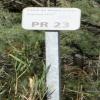
Kilometre Post - La Rhone 23Km
is a minor waterways place
on the Canal du Rhône à Sète - Embranchement Beaucaire between
Bellegarde (10.28 kilometres
to the northeast) and
Saint-Gilles (0.91 kilometres
to the southwest).
The nearest place in the direction of Bellegarde is Kilometre Post - La Rhone 19Km;
4 kilometres
away.
There may not be access to the towpath here.
Mooring here is unrated.
| Pont de Broussan | 6.93 km | |
| Pont de A54/D60 | 6.31 km | |
| Kilometre Post - La Rhone 18Km | 5 km | |
| Pont de la Station de Pompage - D38 | 4.42 km | |
| Kilometre Post - La Rhone 19Km | 4 km | |
| Kilometre Post - La Rhone 23Km | ||
| Saint-Gilles | 0.91 km | |
| Kilometre Post - La Rhone 24Km | 1 km | |
| Pont de D6572 | 1.19 km | |
| Pont Ferroviaire Arles - Saint-Gilles | 1.45 km | |
| Kilometre Post - La Rhone 25Km | 2 km | |
- VisuRiS — associated with Waterways of Mainland Europe
- The official inland waterway resource for Belgium with actual traffic and planned operations on the waterways. Also has voyage planning and notices to mariners
Mouseover for more information or show routes to facility
No information
CanalPlan has no information on any of the following facilities within range:water point
rubbish disposal
chemical toilet disposal
place to turn
self-operated pump-out
boatyard pump-out
There is no page on Wikipedia called “Kilometre Post - La Rhone 23Km”
Wikipedia pages that might relate to Kilometre Post - La Rhone 23Km
[Rhône]
The Rhône (/roʊn/ ROHN, French: [ʁon] (listen); German: Rhone [ˈroːnə] (listen); Walser: Rotten [ˈrotən]; Italian: Rodano [ˈrɔːdano]; Arpitan: Rôno [ˈʁono];
[Avignon]
left bank of the Rhône river, a few kilometres above its confluence with the Durance, about 580 km (360 mi) south-east of Paris, 229 km (142 mi) south of
[Provence]
province of southeastern France, which extends from the left bank of the lower Rhône to the west to the Italian border to the east, and is bordered by the Mediterranean
[Valence, Drôme]
department and within the Auvergne-Rhône-Alpes region. It is situated on the left bank of the Rhône, about 100 kilometres (62 mi) south of Lyon, along the
[Châteauneuf-du-Pape]
Southeastern France. The village lies about 3 kilometres (1.9 mi) to the east of the Rhône and 12 kilometres (7.5 mi) north of the town of Avignon. In the
[France]
Bourgogne- Franche- Comté Centre- Val de Loire Pays de la Loire Brittany Nouvelle- Aquitaine Auvergne- Rhône-Alpes Occitanie Provence- Alpes- Côte d'Azur Corsica
[Arles]
city and commune in the south of France, a subprefecture in the Bouches-du-Rhône department of the Provence-Alpes-Côte d'Azur region, in the former province
[Roquemaure, Gard]
department of southern France. The town lies 12 kilometres (7.5 miles) north of Avignon on the right bank of the Rhône. In the 2012 census the commune had a population
[Vallorcine]
Vallorcine is a municipality in the Haute-Savoie department in the Auvergne-Rhône-Alpes region in south-eastern France. Vallorcine is located in the Valley
[Auvergne]
Haute-Loire. Since 1 January 2016, it has been part of the new region Auvergne-Rhône-Alpes. The administrative region of Auvergne is larger than the historical
Results of Google Search
Aletsch Glacier - WikipediaThe Aletsch Glacier (German: Aletschgletscher) or Great Aletsch Glacier (Grosser Aletschgletscher) is the largest glacier in the Alps. It has a length of about 23 km ( 14 mi) (2014), ... thickness was measured by the ETH to be still near 1 km (3,300 ft). It then continues towards the Rhône valley before giving birth to the Massa.
GPX de la ViaRhôna. 29,35 Km ... Tournon-sur-Rhône / Glun / Valence / La Voulte-sur-Rhône. This easy ... Le Pouzin / Cruas / Châteauneuf-du-Rhône / Viviers.
Rhônexpress is an express tram-train service which links central Lyon, France, with its airport, Lyon-Saint Exupéry Airport, and the TGV train station located there. The route is 23 kilometres (14 mi) long, and served by six tram-train sets, built ... The Conseil général of the Rhône franchised the operation of this line for 30 ...
Jun 26, 2017 ... After three straight 200+km days and with a summit finish on tap tomorrow, Stage 3 could be a day in ... Stage 5 - Vittel to La Planche de Belles Filles, 160 km - July 5, 2017 ... Stage 20 - Marseille (ITT), 23 km - July 22, 2017.
The Upper Rhône is theoretically navigable from Lyon to Seyssel dam. ... a few kilometres north of Chambéry, adds 23km, so the total navigable length of the Upper ... but were never much used, hence the project started in 2000, after a study by the ... History – The upper river Rhône was historically navigated up to Le Parc, ...
Biggest ski resort worldwide (600 km). The ski resort ... The total slope length is 600 km. ... Ski resort 4 Vallées – Verbier/La Tzoumaz/Nendaz/Veysonnaz/Thyon ...
Oct 9, 2019 ... Local newspaper reports suggest finales on the brand-new Col de la Loze and the ... It is this 23km climb – with an average gradient of 7.7 per cent – that is ... The rumoured stage in 2020 would see the riders go six kilometres further on ... another finale on a mountain pass, with Rhône-Alpes newspaper Le ...
Jean Christophe E. Rivière-Saas-et-Gourby, Nouvelle-Aquitaine, France, 10.0 km , 33:49, 3:23/ ...
Dec 18, 2013 ... From Appraisal Methodologies to Ex-post Evaluation ... High Speed Rail Traffic in Europe, 2012 (billion passenger-km) ... 2011: opening of the first section of the Rhin-Rhône line (first section not linked directly to Paris). ... stations in France (Le Creusot and Macon-Loché on the Paris-Lyon line; Valence,.
Isa Weber's Guide to the Best Five Star Hotels in Rhône-Alps, France. ... Built in 1986, the property is within 7 km of Le Semnoz Ski School and 23 km of Cret de ...

