CanalPlanAC

Porters Mill Bridge No 5

 
Ladywood WR9 0AN, United Kingdom
 
Information about the place
Porters Mill Bridge No 5 is a minor waterways place on the Droitwich Canals (Droitwich Barge Canal) between Hawford Junction (Junction of Droitwich Canal with River Severn) (2 miles and ½ furlongs and 3 locks to the west) and Droitwich Junction (Junction of Droitwich Barge Canal and Droitwich Junction Canal) (3 miles and 6 furlongs and 6 locks to the northeast).
 
 
The nearest place in the direction of Hawford Junction is Mildenham Mill Lock No 3; 6½ furlongs away.
 
The nearest place in the direction of Droitwich Junction is Porters Mill Lock No 4; a few yards away.

There may be access to the towpath here.

Mooring here is unrated.

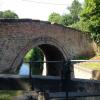
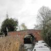
There is a bridge here which takes a road over the canal.


Amenities
 
Maps
If you are a user and are logged on, or if you are actively planning a route, a map will be displayed here.
Show on external mapping site: Google | OSM | Bing
 
Photos
 
External websites
There are no links to external websites from here.
Why not log in and add some (select "External websites" from the menu (sometimes this is under "Edit"))?
 
Nearest facilities

Mouseover for more information or show routes to facility

Nearest water point

In the direction of Droitwich Junction

Netherwich Basin3 miles, 3¼ furlongs and 5 locks away
On this waterway in the direction of Droitwich Junction
Droitwich Spa Marina4 miles, 6¾ furlongs and 10 locks away
Travel to Droitwich Junction, then on the Droitwich Canals (Droitwich Junction Canal) to Droitwich Spa Marina
Hanbury Boatyard5 miles, 2¾ furlongs and 13 locks away
Travel to Droitwich Junction, then on the Droitwich Canals (Droitwich Junction Canal) to Hanbury Junction, then on the Worcester and Birmingham Canal (Diglis Basin to King's Norton Junction) to Hanbury Boatyard
Stoke Works Water Point7 miles, 6¼ furlongs and 19 locks away
Travel to Droitwich Junction, then on the Droitwich Canals (Droitwich Junction Canal) to Hanbury Junction, then on the Worcester and Birmingham Canal (Diglis Basin to King's Norton Junction) to Stoke Works Water Point
Tardebigge Wharf11 miles, 6½ furlongs and 55 locks away
Travel to Droitwich Junction, then on the Droitwich Canals (Droitwich Junction Canal) to Hanbury Junction, then on the Worcester and Birmingham Canal (Diglis Basin to King's Norton Junction) to Tardebigge Wharf
Hopwood Visitor Moorings17 miles, 2¼ furlongs and 55 locks away
Travel to Droitwich Junction, then on the Droitwich Canals (Droitwich Junction Canal) to Hanbury Junction, then on the Worcester and Birmingham Canal (Diglis Basin to King's Norton Junction) to Hopwood Visitor Moorings

In the direction of Hawford Junction

Holt Lock (Holt Fleet)5 miles and 3 locks away
Travel to Hawford Junction, then on the River Severn (main river - Stourport to Worcester) to Holt Lock (Holt Fleet)
Worcester Trip Boat Moorings5 miles, 5½ furlongs and 4 locks away
Travel to Hawford Junction, then on the River Severn (main river - Stourport to Worcester) to Worcester Trip Boat Moorings
Diglis Locks6 miles, 6 furlongs and 4 locks away
Travel to Hawford Junction, then on the River Severn (main river - Stourport to Worcester) to Diglis Junction, then on the River Severn (main river - Worcester to Gloucester) to Diglis Locks
Diglis Services6 miles, 5¼ furlongs and 6 locks away
Travel to Hawford Junction, then on the River Severn (main river - Stourport to Worcester) to Diglis Junction, then on the Worcester and Birmingham Canal (Diglis Junction to Diglis Basin) to Diglis Basin, then on the Worcester and Birmingham Canal (Diglis Basin to King's Norton Junction) to Diglis Services
Lincomb Lock9 miles, 1¾ furlongs and 4 locks away
Travel to Hawford Junction, then on the River Severn (main river - Stourport to Worcester) to Lincomb Lock
Lowesmoor Basin7 miles, 5 furlongs and 8 locks away
Travel to Hawford Junction, then on the River Severn (main river - Stourport to Worcester) to Diglis Junction, then on the Worcester and Birmingham Canal (Diglis Junction to Diglis Basin) to Diglis Basin, then on the Worcester and Birmingham Canal (Diglis Basin to King's Norton Junction) to Lowesmoor Basin
Upper Basin Waterpoint10 miles, 5¼ furlongs and 7 locks away
Travel to Hawford Junction, then on the River Severn (main river - Stourport to Worcester) to Severn - Stourport Broad Locks Entrance, then on the Staffordshire and Worcestershire Canal (Stourport Basins: Broad Route) to Stourport Upper Basin, then on the Staffordshire and Worcestershire Canal (Stourport Basins: Narrow Route) to Upper Basin Waterpoint
Caldwall Mill Bridge No 1414 miles, 3½ furlongs and 10 locks away
Travel to Hawford Junction, then on the River Severn (main river - Stourport to Worcester) to Severn - Stourport Broad Locks Entrance, then on the Staffordshire and Worcestershire Canal (Stourport Basins: Broad Route) to Stourport Upper Basin, then on the Staffordshire and Worcestershire Canal (Stourport Basins: Narrow Route) to York Street Bridge, then on the Staffordshire and Worcestershire Canal (Main Line: Stourport to Stourton) to Caldwall Mill Bridge No 14

Nearest rubbish disposal

In the direction of Droitwich Junction

Netherwich Basin3 miles, 3¼ furlongs and 5 locks away
On this waterway in the direction of Droitwich Junction
Droitwich Spa Marina4 miles, 6¾ furlongs and 10 locks away
Travel to Droitwich Junction, then on the Droitwich Canals (Droitwich Junction Canal) to Droitwich Spa Marina
Stoke Bottom Lock No 238 miles, 4 furlongs and 19 locks away
Travel to Droitwich Junction, then on the Droitwich Canals (Droitwich Junction Canal) to Hanbury Junction, then on the Worcester and Birmingham Canal (Diglis Basin to King's Norton Junction) to Stoke Bottom Lock No 23
Tardebigge Wharf11 miles, 6½ furlongs and 55 locks away
Travel to Droitwich Junction, then on the Droitwich Canals (Droitwich Junction Canal) to Hanbury Junction, then on the Worcester and Birmingham Canal (Diglis Basin to King's Norton Junction) to Tardebigge Wharf

In the direction of Hawford Junction

Sabrina Footbridge5 miles, 3¾ furlongs and 4 locks away
Travel to Hawford Junction, then on the River Severn (main river - Stourport to Worcester) to Sabrina Footbridge
Diglis Basin6 miles, 4¾ furlongs and 6 locks away
Travel to Hawford Junction, then on the River Severn (main river - Stourport to Worcester) to Diglis Junction, then on the Worcester and Birmingham Canal (Diglis Junction to Diglis Basin) to Diglis Basin
Lowesmoor Basin7 miles, 5 furlongs and 8 locks away
Travel to Hawford Junction, then on the River Severn (main river - Stourport to Worcester) to Diglis Junction, then on the Worcester and Birmingham Canal (Diglis Junction to Diglis Basin) to Diglis Basin, then on the Worcester and Birmingham Canal (Diglis Basin to King's Norton Junction) to Lowesmoor Basin
Upper Basin Waterpoint10 miles, 5¼ furlongs and 7 locks away
Travel to Hawford Junction, then on the River Severn (main river - Stourport to Worcester) to Severn - Stourport Broad Locks Entrance, then on the Staffordshire and Worcestershire Canal (Stourport Basins: Broad Route) to Stourport Upper Basin, then on the Staffordshire and Worcestershire Canal (Stourport Basins: Narrow Route) to Upper Basin Waterpoint

Nearest chemical toilet disposal

In the direction of Hawford Junction

Diglis Services6 miles, 5¼ furlongs and 6 locks away
Travel to Hawford Junction, then on the River Severn (main river - Stourport to Worcester) to Diglis Junction, then on the Worcester and Birmingham Canal (Diglis Junction to Diglis Basin) to Diglis Basin, then on the Worcester and Birmingham Canal (Diglis Basin to King's Norton Junction) to Diglis Services
Stourport Marina9 miles, 5¼ furlongs and 5 locks away
Travel to Hawford Junction, then on the River Severn (main river - Stourport to Worcester) to Stourport Marina
Lowesmoor Basin7 miles, 5 furlongs and 8 locks away
Travel to Hawford Junction, then on the River Severn (main river - Stourport to Worcester) to Diglis Junction, then on the Worcester and Birmingham Canal (Diglis Junction to Diglis Basin) to Diglis Basin, then on the Worcester and Birmingham Canal (Diglis Basin to King's Norton Junction) to Lowesmoor Basin
Upper Basin Waterpoint10 miles, 5¼ furlongs and 7 locks away
Travel to Hawford Junction, then on the River Severn (main river - Stourport to Worcester) to Severn - Stourport Broad Locks Entrance, then on the Staffordshire and Worcestershire Canal (Stourport Basins: Broad Route) to Stourport Upper Basin, then on the Staffordshire and Worcestershire Canal (Stourport Basins: Narrow Route) to Upper Basin Waterpoint
Caldwall Mill Bridge No 1414 miles, 3½ furlongs and 10 locks away
Travel to Hawford Junction, then on the River Severn (main river - Stourport to Worcester) to Severn - Stourport Broad Locks Entrance, then on the Staffordshire and Worcestershire Canal (Stourport Basins: Broad Route) to Stourport Upper Basin, then on the Staffordshire and Worcestershire Canal (Stourport Basins: Narrow Route) to York Street Bridge, then on the Staffordshire and Worcestershire Canal (Main Line: Stourport to Stourton) to Caldwall Mill Bridge No 14

In the direction of Droitwich Junction

Droitwich Spa Marina4 miles, 6¾ furlongs and 10 locks away
Travel to Droitwich Junction, then on the Droitwich Canals (Droitwich Junction Canal) to Droitwich Spa Marina
Stoke Bottom Lock No 238 miles, 4 furlongs and 19 locks away
Travel to Droitwich Junction, then on the Droitwich Canals (Droitwich Junction Canal) to Hanbury Junction, then on the Worcester and Birmingham Canal (Diglis Basin to King's Norton Junction) to Stoke Bottom Lock No 23
Tardebigge Wharf11 miles, 6½ furlongs and 55 locks away
Travel to Droitwich Junction, then on the Droitwich Canals (Droitwich Junction Canal) to Hanbury Junction, then on the Worcester and Birmingham Canal (Diglis Basin to King's Norton Junction) to Tardebigge Wharf

Nearest place to turn

In the direction of Hawford Junction

Bevere Lock Weir Entrance2 miles, 2½ furlongs and 3 locks away
Travel to Hawford Junction, then on the River Severn (main river - Stourport to Worcester) to Bevere Lock Weir Entrance
Bevere Lock Weir Exit2 miles, 5¼ furlongs and 4 locks away
Travel to Hawford Junction, then on the River Severn (main river - Stourport to Worcester) to Bevere Lock Weir Exit
Holt Lock Weir Exit4 miles, 7 furlongs and 3 locks away
Travel to Hawford Junction, then on the River Severn (main river - Stourport to Worcester) to Holt Lock Weir Exit
Holt Lock Weir Entrance5 miles, 2½ furlongs and 4 locks away
Travel to Hawford Junction, then on the River Severn (main river - Stourport to Worcester) to Holt Lock Weir Entrance
Diglis Junction6 miles, 3¾ furlongs and 4 locks away
Travel to Hawford Junction, then on the River Severn (main river - Stourport to Worcester) to Diglis Junction
Diglis Locks Weir Exit6 miles, 6¾ furlongs and 5 locks away
Travel to Hawford Junction, then on the River Severn (main river - Stourport to Worcester) to Diglis Junction, then on the River Severn (main river - Worcester to Gloucester) to Diglis Locks Weir Exit
Severn - Teme Junction7 miles, 4¾ furlongs and 5 locks away
Travel to Hawford Junction, then on the River Severn (main river - Stourport to Worcester) to Diglis Junction, then on the River Severn (main river - Worcester to Gloucester) to Severn - Teme Junction
Lowesmoor Basin7 miles, 5 furlongs and 8 locks away
Travel to Hawford Junction, then on the River Severn (main river - Stourport to Worcester) to Diglis Junction, then on the Worcester and Birmingham Canal (Diglis Junction to Diglis Basin) to Diglis Basin, then on the Worcester and Birmingham Canal (Diglis Basin to King's Norton Junction) to Lowesmoor Basin
Severn - Stourport Narrow Locks Entrance10 miles, 4½ furlongs and 5 locks away
Travel to Hawford Junction, then on the River Severn (main river - Stourport to Worcester) to Severn - Stourport Narrow Locks Entrance
Stourport Lower Basin - between Broad Locks10 miles, 4¼ furlongs and 6 locks away
Travel to Hawford Junction, then on the River Severn (main river - Stourport to Worcester) to Severn - Stourport Broad Locks Entrance, then on the Staffordshire and Worcestershire Canal (Stourport Basins: Broad Route) to Stourport Lower Basin - between Broad Locks
Stourport Lower Basin - between Narrow Locks10 miles, 4¾ furlongs and 6 locks away
Travel to Hawford Junction, then on the River Severn (main river - Stourport to Worcester) to Severn - Stourport Broad Locks Entrance, then on the Staffordshire and Worcestershire Canal (Stourport Basins: Broad Route) to Stourport Lower Basin - between Broad Locks, then on the Staffordshire and Worcestershire Canal (Stourport Basins: Broad Locks to Narrow Locks to Stourport Lower Basin - between Narrow Locks
Stourport Upper Basin10 miles, 5 furlongs and 7 locks away
Travel to Hawford Junction, then on the River Severn (main river - Stourport to Worcester) to Severn - Stourport Broad Locks Entrance, then on the Staffordshire and Worcestershire Canal (Stourport Basins: Broad Route) to Stourport Upper Basin
Stourport Clock Basin10 miles, 5½ furlongs and 7 locks away
Travel to Hawford Junction, then on the River Severn (main river - Stourport to Worcester) to Severn - Stourport Broad Locks Entrance, then on the Staffordshire and Worcestershire Canal (Stourport Basins: Broad Route) to Stourport Upper Basin, then on the Staffordshire and Worcestershire Canal (Stourport Basins: Narrow Route) to Stourport Clock Basin

In the direction of Droitwich Junction

Ladywood Top Lock Winding Hole5¼ furlongs and 5 locks away
On this waterway in the direction of Droitwich Junction
Winding Hole (east of Salwarpe Road Bridge)3 miles, 1¾ furlongs and 5 locks away
On this waterway in the direction of Droitwich Junction
Netherwich Basin3 miles, 3¼ furlongs and 5 locks away
On this waterway in the direction of Droitwich Junction
Droitwich Town Wharf3 miles, 5¼ furlongs and 5 locks away
On this waterway in the direction of Droitwich Junction
Lock No 6 Winding Hole4 miles, 3¾ furlongs and 8 locks away
Travel to Droitwich Junction, then on the Droitwich Canals (Droitwich Junction Canal) to Lock No 6 Winding Hole
Droitwich Spa Marina4 miles, 6¾ furlongs and 10 locks away
Travel to Droitwich Junction, then on the Droitwich Canals (Droitwich Junction Canal) to Droitwich Spa Marina
Hanbury Junction5 miles, 2 furlongs and 13 locks away
Travel to Droitwich Junction, then on the Droitwich Canals (Droitwich Junction Canal) to Hanbury Junction

Nearest boatyard pump-out

In the direction of Hawford Junction

Stourport Marina9 miles, 5¼ furlongs and 5 locks away
Travel to Hawford Junction, then on the River Severn (main river - Stourport to Worcester) to Stourport Marina
Lowesmoor Basin7 miles, 5 furlongs and 8 locks away
Travel to Hawford Junction, then on the River Severn (main river - Stourport to Worcester) to Diglis Junction, then on the Worcester and Birmingham Canal (Diglis Junction to Diglis Basin) to Diglis Basin, then on the Worcester and Birmingham Canal (Diglis Basin to King's Norton Junction) to Lowesmoor Basin
Stourport Upper Basin10 miles, 5 furlongs and 7 locks away
Travel to Hawford Junction, then on the River Severn (main river - Stourport to Worcester) to Severn - Stourport Broad Locks Entrance, then on the Staffordshire and Worcestershire Canal (Stourport Basins: Broad Route) to Stourport Upper Basin
Upper Staircase Lock Landing Pontoon10 miles, 5¾ furlongs and 7 locks away
Travel to Hawford Junction, then on the River Severn (main river - Stourport to Worcester) to Severn - Stourport Broad Locks Entrance, then on the Staffordshire and Worcestershire Canal (Stourport Basins: Broad Route) to Stourport Upper Basin, then on the Staffordshire and Worcestershire Canal (Stourport Basins: Narrow Route) to Upper Staircase Lock Landing Pontoon

In the direction of Droitwich Junction

Hanbury Boatyard5 miles, 2¾ furlongs and 13 locks away
Travel to Droitwich Junction, then on the Droitwich Canals (Droitwich Junction Canal) to Hanbury Junction, then on the Worcester and Birmingham Canal (Diglis Basin to King's Norton Junction) to Hanbury Boatyard
Dunhampstead Boatyard7 miles, 1¼ furlongs and 13 locks away
Travel to Droitwich Junction, then on the Droitwich Canals (Droitwich Junction Canal) to Hanbury Junction, then on the Worcester and Birmingham Canal (Diglis Basin to King's Norton Junction) to Dunhampstead Boatyard
Direction of TV transmitter (From Wolfbane Cybernetic)
 
 
Geograph
 
Wikipedia

There is no page on Wikipedia called “Porters Mill Bridge”

Wikipedia pages that might relate to Porters Mill Bridge
[Droitwich Canal] barge canal to use the river to reach a salt works situated above Chapel Bridge. The Barge Lock was 75 by 15 feet (22.9 by 4.6 m), and had four sets of [Porter Brook] taken from the Wire Mill. Below Whiteley Wood Road bridge it is joined by a small tributary, flowing northwards from springs in the Porter Valley Woodlands [Battle of Gaines' Mill] a.m. on June 28, Porter had withdrawn across the Chickahominy, burning the bridges behind him. During the retreat from Gaines' Mill, Brig. Gen John F [Miss Porter's School] April 23, 2013. "Miss Porter's School ~ Facilities". Porters.org. Retrieved April 23, 2013. https://www.porters.org/miss-porters-school-and-sothebys-a [List of American theatrical animated feature films (2000-2019)] Arts. The Pilgrim's Progress April 18, 2019 Computer animation Cat in the Mill Studio Fathom Events 113 $3,173,282 60% N/A PG The 13th animated film from [List of Encyclopædia Britannica Films titles] (Educational Film Services); Keith Elliott, Theral T. Herrick & George B. Mills bw-20m May 27, 1953 Prairie Provinces of Canada bw-10m December 28, 1943 [River Don, Yorkshire] Kraft. This bridge in Hillsborough carries Livesey Street over the Don to Club Mill Road. The previous bridge was a two-arched stone bridge, built in the [Porter County, Indiana] Modern History of the Burns Harbor Steel Mill". NWI Steel Heritage Museum. Retrieved 26 October 2018. Porter County IN (Google Maps, accessed 24 August [List of In Our Time programmes] Lecturer in Victorian Studies at Birkbeck, University of London 18 May 2006 Mill A. C. Grayling, Professor of Philosophy at Birkbeck, University of London [Brooklyn Bridge] The Brooklyn Bridge is a hybrid cable-stayed/suspension bridge in New York City, spanning the East River between Manhattan Island and Brooklyn on Long
 
Google

Results of Google Search

Lift Bridge and Red Cow release Cowlaboration No. 5 Coconut Porter
Oct 31, 2016 ... Lift Bridge Brewing Co. and Red Cow Restaurant & Bar released the fifth in their Cowlaboration series of beers on Saturday, October 23 at the ...
Wicomico County, MD Election Districts
Code of Md. (1957), Art. 33, § 2-5. ... 437); thence by and with said Porter Mill Road in a northeasterly direction to the intersection of Braggs Lane (County Route No. ... with said Mt. Hermon Road to the Twilley Bridge Road (County Route No.
bidding documents porter co. bridge no. 1001 rehabilitation west ...
Dec 1, 2019 ... Section. Page. 1. Invitation to Bid. 1-4. 2. Instructions to Bidders. 5-13 ... project designated as the Rehabilitation of Porter County Bridge No. ... inspection may include mill, plant, or shop inspection, and any material furnished ...
24816 Millbridge Heights Ln, Porter, TX 77365 - realtor.com®
Mar 1, 2020 ... View 1 photos for 24816 Millbridge Heights Ln, Porter, TX 77365 a bed, 4 bath, 3465 Sq. Ft. single family ... Estimated values are not a substitute for professional expertise. ... 6, Bens Branch Elelmentary School, PK–5, 1.0 mi.
Porter's Mills, Wisconsin - Wikipedia
Porter's Mills, also called Porterville, was a logging boomtown in Eau Claire County, Wisconsin, ... Bridge Creek · Brunswick · Clear Creek · Drammen · Fairchild · Lincoln · Ludington ... Not logged in; Talk · Contributions · Create account · Log in ...
3 Authentic Covered Bridges in Maine :: Sightseeing on the East Coast
Look no further than these three authentic covered bridges in Maine. 30-45 ... Following your trip to the Porter Bridge, it's onto to the Hemlock Bridge in ... Then turn right onto Main Street / route 5 and follow 6.7 miles to Frog Alley on the right.
The Farm Market @ Mill No. 5 Mill City Grows
In addition to the Market vendors on the 5th floor, Mill No. 5 also has an incredible variety of independent shops and eateries on the 4th floor, which are also not ...
Bridge List M 23-09 I-5
I-5. MILEPOST. BRIDGE NO. CROSSING NAME. Bridge Vertical Clearance Trip Planner: ... WESTBOUND MILL PLAIN BLVD TO NORTHBOUND I-5. 5/6.5F. W-N RAMP ... WSDOT Bridge List. April 2020 ... 5/463. I-5 UNDER PORTER WAY.
Mill No. 5 - It's not what you think - Lowell Massachusetts
An indoor streetscape of salvaged storefronts with great coffee, a movie theater, farmer's market, independent shopping, and events in Lowell Massachusetts.
Photographs & Descriptions, NH State Register of Historic Places ...
New England College Covered Bridge, Henniker, New England College Covered Bridge, Henniker ... (no photo) District 5 School/East Grafton Town Hall, Grafton. Built in 1900 for $756.33, this ... Alstead's Shedd-Porter Library. Designed in ...