Stalybridge Lock No 6W
Armentieres Square (Stop B), Armentieres Square, Stalybridge SK15 2DB, United Kingdom 

Stalybridge Lock No 6W
is a minor waterways place
on the Huddersfield Narrow Canal between
  Ashton-under-Lyne Junction (Junction of Ashton and Huddersfield Narrow Canals) (1 mile and 2¼ furlongs
    and 5 locks
   to the west) and
  Royal George Aqueduct (6 miles and 4 furlongs
    and 11 locks
   to the northeast).
  The nearest place in the direction of Ashton-under-Lyne Junction is Oldhams Bridge No 99A;
  ½ furlongs
   away.
   
  The nearest place in the direction of Royal George Aqueduct is Stalybridge First New Road Bridge;
  2 furlongs
   away.
There may be access to the towpath here.
Mooring here is unrated. 
There is a bridge here which takes pedestrian traffic over the canal.
This is a lock, the rise of which is not known.
| Stalybridge Lock No 4W  | 2¼ furlongs | |
| Stalybridge Lock No 5W | 1¾ furlongs | |
| Armentieres Bridge No 101A  | 1½ furlongs | |
| Melbourne Street Bridge No 101 | 1 furlong | |
| Oldhams Bridge No 99A  | ½ furlongs | |
| Stalybridge Lock No 6W | ||
| Stalybridge First New Road Bridge  | 2 furlongs | |
| Stalybridge Footbridge  | 2½ furlongs | |
| Stalybridge Second New Road Bridge  | 4½ furlongs | |
| Mottram Road Bridge No 99 | 6¼ furlongs | |
| Lock No 7W (Huddersfield Narrow Canal) | 7 furlongs | |
There are no links to external websites from here.
Why not log in and add some (select "External websites" from the menu (sometimes this is under "Edit"))?
Mouseover for more information or show routes to facility
Nearest water point
In the direction of Ashton-under-Lyne Junction
Fairfield Junction — 4 miles, 2¼ furlongs  and 6 locks away
Travel  to Ashton-under-Lyne Junction, then on the Ashton Canal (Main Line) to Fairfield Junction
Marple Services — 9 miles, 7½ furlongs  and 22 locks away
Travel  to Ashton-under-Lyne Junction, then on the Ashton Canal (Main Line) to Dukinfield Junction, then on the Peak Forest Canal (Lower) to Marple Junction, then on the Macclesfield Canal to Marple Services
New Islington Marina — 8 miles, 4½ furlongs  and 26 locks away
Travel  to Ashton-under-Lyne Junction, then on the Ashton Canal (Main Line) to Ducie Street Junction, then on the Rochdale Canal to New Islington Marina Entrance, then on the Rochdale Canal (Main Line) to Cotton Field Wharf Marina, then on the Rochdale Canal (New Islington Marina Arm) to New Islington Marina
Braidbar Boats — 13 miles, 5¼ furlongs  and 22 locks away
Travel  to Ashton-under-Lyne Junction, then on the Ashton Canal (Main Line) to Dukinfield Junction, then on the Peak Forest Canal (Lower) to Marple Junction, then on the Macclesfield Canal to Braidbar Boats
Furness Vale Marina — 14 miles, 6½ furlongs  and 22 locks away
Travel  to Ashton-under-Lyne Junction, then on the Ashton Canal (Main Line) to Dukinfield Junction, then on the Peak Forest Canal (Lower) to Marple Junction, then on the Peak Forest Canal (Upper) to Furness Vale Marina
Whaley Bridge Services — 16 miles, 2¾ furlongs  and 22 locks away
Travel  to Ashton-under-Lyne Junction, then on the Ashton Canal (Main Line) to Dukinfield Junction, then on the Peak Forest Canal (Lower) to Marple Junction, then on the Peak Forest Canal (Upper) to Whaley Bridge Branch Junction, then on the Peak Forest Canal (Whaley Bridge Branch) to Whaley Bridge Services
Bugsworth Services — 16 miles, 3 furlongs  and 22 locks away
Travel  to Ashton-under-Lyne Junction, then on the Ashton Canal (Main Line) to Dukinfield Junction, then on the Peak Forest Canal (Lower) to Marple Junction, then on the Peak Forest Canal (Upper) to Bugsworth Services
Bollington Wharf — 18 miles, 3 furlongs  and 22 locks away
Travel  to Ashton-under-Lyne Junction, then on the Ashton Canal (Main Line) to Dukinfield Junction, then on the Peak Forest Canal (Lower) to Marple Junction, then on the Macclesfield Canal to Bollington Wharf
Staffordshire, Kenworthy and other Arms — 9 miles, 2½ furlongs  and 33 locks away
Travel  to Ashton-under-Lyne Junction, then on the Ashton Canal (Main Line) to Ducie Street Junction, then on the Rochdale Canal to Castlefield Junction, then on the Bridgewater Canal (Main Line) to Staffordshire, Kenworthy and other Arms
Potato Wharf Arm & The New Basin — 9 miles, 3¼ furlongs  and 33 locks away
Travel  to Ashton-under-Lyne Junction, then on the Ashton Canal (Main Line) to Ducie Street Junction, then on the Rochdale Canal to Castlefield Junction, then on the Bridgewater Canal (Main Line) to Potato Wharf Arm & The New Basin
Stretford Marina — 12 miles, 2½ furlongs  and 33 locks away
Travel  to Ashton-under-Lyne Junction, then on the Ashton Canal (Main Line) to Ducie Street Junction, then on the Rochdale Canal to Castlefield Junction, then on the Bridgewater Canal (Main Line) to Stretford Marina
Watch House Cruising Club — 13 miles, 2¾ furlongs  and 33 locks away
Travel  to Ashton-under-Lyne Junction, then on the Ashton Canal (Main Line) to Ducie Street Junction, then on the Rochdale Canal to Castlefield Junction, then on the Bridgewater Canal (Main Line) to Watch House Cruising Club
Worsley Visitor Moorings — 16 miles, 4½ furlongs  and 33 locks away
Travel  to Ashton-under-Lyne Junction, then on the Ashton Canal (Main Line) to Ducie Street Junction, then on the Rochdale Canal to Castlefield Junction, then on the Bridgewater Canal (Main Line) to Stretford - Waters Meeting, then on the Bridgewater Canal (Stretford and Leigh Branch) to Worsley Visitor Moorings
Bridgewater Marina — 18 miles, ½ furlongs  and 33 locks away
Travel  to Ashton-under-Lyne Junction, then on the Ashton Canal (Main Line) to Ducie Street Junction, then on the Rochdale Canal to Castlefield Junction, then on the Bridgewater Canal (Main Line) to Stretford - Waters Meeting, then on the Bridgewater Canal (Stretford and Leigh Branch) to Bridgewater Marina
In the direction of Aspley Basin (Huddersfield)
Grove Road Bridge No 96 — 3 miles, 2 furlongs  and 3 locks away
On this waterway in the direction of Aspley Basin (Huddersfield)
Wool Road Bridge No 70 — 9 miles, 2 furlongs  and 18 locks away
On this waterway in the direction of Aspley Basin (Huddersfield)
Standedge Tunnel (western entrance) — 11 miles, 2 furlongs  and 27 locks away
On this waterway in the direction of Aspley Basin (Huddersfield)
Standedge Tunnel (eastern entrance) — 14 miles, 3¾ furlongs  and 27 locks away
On this waterway in the direction of Aspley Basin (Huddersfield)
Slaithwaite Winding Hole — 17 miles, 6¾ furlongs  and 48 locks away
On this waterway in the direction of Aspley Basin (Huddersfield)
Waterside Lock No 21E — 17 miles, 7½ furlongs  and 48 locks away
On this waterway in the direction of Aspley Basin (Huddersfield)Nearest rubbish disposal
In the direction of Ashton-under-Lyne Junction
Marple Bottom Lock Bridge Winding Hole — 8 miles, 6½ furlongs  and 6 locks away
Travel  to Ashton-under-Lyne Junction, then on the Ashton Canal (Main Line) to Dukinfield Junction, then on the Peak Forest Canal (Lower) to Marple Bottom Lock Bridge Winding Hole
Marple Services — 9 miles, 7½ furlongs  and 22 locks away
Travel  to Ashton-under-Lyne Junction, then on the Ashton Canal (Main Line) to Dukinfield Junction, then on the Peak Forest Canal (Lower) to Marple Junction, then on the Macclesfield Canal to Marple Services
Braidbar Boats — 13 miles, 5¼ furlongs  and 22 locks away
Travel  to Ashton-under-Lyne Junction, then on the Ashton Canal (Main Line) to Dukinfield Junction, then on the Peak Forest Canal (Lower) to Marple Junction, then on the Macclesfield Canal to Braidbar Boats
Whaley Bridge Services — 16 miles, 2¾ furlongs  and 22 locks away
Travel  to Ashton-under-Lyne Junction, then on the Ashton Canal (Main Line) to Dukinfield Junction, then on the Peak Forest Canal (Lower) to Marple Junction, then on the Peak Forest Canal (Upper) to Whaley Bridge Branch Junction, then on the Peak Forest Canal (Whaley Bridge Branch) to Whaley Bridge Services
Bugsworth Services — 16 miles, 3 furlongs  and 22 locks away
Travel  to Ashton-under-Lyne Junction, then on the Ashton Canal (Main Line) to Dukinfield Junction, then on the Peak Forest Canal (Lower) to Marple Junction, then on the Peak Forest Canal (Upper) to Bugsworth Services
In the direction of Aspley Basin (Huddersfield)
Wool Road Visitor Mooring — 9 miles, 1¾ furlongs  and 18 locks away
On this waterway in the direction of Aspley Basin (Huddersfield)
Pickle Lock No 22E — 17 miles, 6¼ furlongs  and 47 locks away
On this waterway in the direction of Aspley Basin (Huddersfield)Nearest chemical toilet disposal
In the direction of Ashton-under-Lyne Junction
Fairfield Junction — 4 miles, 2¼ furlongs  and 6 locks away
Travel  to Ashton-under-Lyne Junction, then on the Ashton Canal (Main Line) to Fairfield Junction
Marple Services — 9 miles, 7½ furlongs  and 22 locks away
Travel  to Ashton-under-Lyne Junction, then on the Ashton Canal (Main Line) to Dukinfield Junction, then on the Peak Forest Canal (Lower) to Marple Junction, then on the Macclesfield Canal to Marple Services
Furness Vale Marina — 14 miles, 6½ furlongs  and 22 locks away
Travel  to Ashton-under-Lyne Junction, then on the Ashton Canal (Main Line) to Dukinfield Junction, then on the Peak Forest Canal (Lower) to Marple Junction, then on the Peak Forest Canal (Upper) to Furness Vale Marina
Whaley Bridge Services — 16 miles, 2¾ furlongs  and 22 locks away
Travel  to Ashton-under-Lyne Junction, then on the Ashton Canal (Main Line) to Dukinfield Junction, then on the Peak Forest Canal (Lower) to Marple Junction, then on the Peak Forest Canal (Upper) to Whaley Bridge Branch Junction, then on the Peak Forest Canal (Whaley Bridge Branch) to Whaley Bridge Services
Bugsworth Services — 16 miles, 3 furlongs  and 22 locks away
Travel  to Ashton-under-Lyne Junction, then on the Ashton Canal (Main Line) to Dukinfield Junction, then on the Peak Forest Canal (Lower) to Marple Junction, then on the Peak Forest Canal (Upper) to Bugsworth Services
Bollington Wharf — 18 miles, 3 furlongs  and 22 locks away
Travel  to Ashton-under-Lyne Junction, then on the Ashton Canal (Main Line) to Dukinfield Junction, then on the Peak Forest Canal (Lower) to Marple Junction, then on the Macclesfield Canal to Bollington Wharf
Watch House Cruising Club — 13 miles, 2¾ furlongs  and 33 locks away
Travel  to Ashton-under-Lyne Junction, then on the Ashton Canal (Main Line) to Ducie Street Junction, then on the Rochdale Canal to Castlefield Junction, then on the Bridgewater Canal (Main Line) to Watch House Cruising Club
In the direction of Aspley Basin (Huddersfield)
Grove Road Bridge No 96 — 3 miles, 2 furlongs  and 3 locks away
On this waterway in the direction of Aspley Basin (Huddersfield)
Wool Road Bridge No 70 — 9 miles, 2 furlongs  and 18 locks away
On this waterway in the direction of Aspley Basin (Huddersfield)
Pickle Lock No 22E — 17 miles, 6¼ furlongs  and 47 locks away
On this waterway in the direction of Aspley Basin (Huddersfield)
Waterside Lock No 21E — 17 miles, 7½ furlongs  and 48 locks away
On this waterway in the direction of Aspley Basin (Huddersfield)Nearest place to turn
In the direction of Ashton-under-Lyne Junction
Staley Wharf Winding Hole — 2½ furlongs  and 3 locks away
On this waterway in the direction of Ashton-under-Lyne Junction
Ashton-under-Lyne Junction — 1 mile, 2¼ furlongs  and 6 locks away
On this waterway in the direction of Ashton-under-Lyne Junction
Dukinfield Junction — 1 mile, 6¼ furlongs  and 6 locks away
Travel  to Ashton-under-Lyne Junction, then on the Ashton Canal (Main Line) to Dukinfield Junction
Portland Basin Arm — 1 mile, 6¾ furlongs  and 6 locks away
Travel  to Ashton-under-Lyne Junction, then on the Ashton Canal (Main Line) to Dukinfield Junction, then on the Peak Forest Canal (Lower) to Portland Basin Arm
Dunkirk Farm Bridge Winding Hole — 3 miles, 3½ furlongs  and 6 locks away
Travel  to Ashton-under-Lyne Junction, then on the Ashton Canal (Main Line) to Dukinfield Junction, then on the Peak Forest Canal (Lower) to Dunkirk Farm Bridge Winding Hole
Lumb Lane Bridge Winding Hole — 3 miles, 3½ furlongs  and 6 locks away
Travel  to Ashton-under-Lyne Junction, then on the Ashton Canal (Main Line) to Lumb Lane Bridge Winding Hole
Canal Street Winding Hole — 4 miles, ½ furlongs  and 6 locks away
Travel  to Ashton-under-Lyne Junction, then on the Ashton Canal (Main Line) to Dukinfield Junction, then on the Peak Forest Canal (Lower) to Canal Street Winding Hole
Fairfield Junction — 4 miles, 2¼ furlongs  and 6 locks away
Travel  to Ashton-under-Lyne Junction, then on the Ashton Canal (Main Line) to Fairfield Junction
Unity Mills Winding Hole — 5 miles, 5 furlongs  and 6 locks away
Travel  to Ashton-under-Lyne Junction, then on the Ashton Canal (Main Line) to Dukinfield Junction, then on the Peak Forest Canal (Lower) to Unity Mills Winding Hole
Urwick Road Winding Hole — 7 miles, 4 furlongs  and 6 locks away
Travel  to Ashton-under-Lyne Junction, then on the Ashton Canal (Main Line) to Dukinfield Junction, then on the Peak Forest Canal (Lower) to Urwick Road Winding Hole
Marple Bottom Lock Bridge Winding Hole — 8 miles, 6½ furlongs  and 6 locks away
Travel  to Ashton-under-Lyne Junction, then on the Ashton Canal (Main Line) to Dukinfield Junction, then on the Peak Forest Canal (Lower) to Marple Bottom Lock Bridge Winding Hole
Clayton Junction — 5 miles, 4½ furlongs  and 14 locks away
Travel  to Ashton-under-Lyne Junction, then on the Ashton Canal (Main Line) to Clayton Junction
Ashton New Road Winding Hole — 6 miles, 1 furlong  and 17 locks away
Travel  to Ashton-under-Lyne Junction, then on the Ashton Canal (Main Line) to Ashton New Road Winding Hole
New Viaduct Winding Hole — 6 miles, 6½ furlongs  and 21 locks away
Travel  to Ashton-under-Lyne Junction, then on the Ashton Canal (Main Line) to New Viaduct Winding Hole
In the direction of Aspley Basin (Huddersfield)
Knowle Street Winding Hole — 7½ furlongs  and 2 locks away
On this waterway in the direction of Aspley Basin (Huddersfield)
Mossley Bottoms Winding Hole — 4 miles, 7½ furlongs  and 7 locks away
On this waterway in the direction of Aspley Basin (Huddersfield)
Roughtown Court Winding Hole — 5 miles, 7¼ furlongs  and 9 locks away
On this waterway in the direction of Aspley Basin (Huddersfield)
Manns Wharf Bridge Winding Hole — 7 miles, ½ furlongs  and 14 locks away
On this waterway in the direction of Aspley Basin (Huddersfield)
Saddleworth Visitor Centre Winding Hole — 8 miles, 3¼ furlongs  and 16 locks away
On this waterway in the direction of Aspley Basin (Huddersfield)
Wool Road Winding Hole — 9 miles, 1¼ furlongs  and 18 locks away
On this waterway in the direction of Aspley Basin (Huddersfield)Nearest self-operated pump-out
In the direction of Ashton-under-Lyne Junction
New Islington Marina — 8 miles, 4½ furlongs  and 26 locks away
Travel  to Ashton-under-Lyne Junction, then on the Ashton Canal (Main Line) to Ducie Street Junction, then on the Rochdale Canal to New Islington Marina Entrance, then on the Rochdale Canal (Main Line) to Cotton Field Wharf Marina, then on the Rochdale Canal (New Islington Marina Arm) to New Islington Marina
In the direction of Aspley Basin (Huddersfield)
Wool Road Bridge No 70 — 9 miles, 2 furlongs  and 18 locks away
On this waterway in the direction of Aspley Basin (Huddersfield)
Slaithwaite Winding Hole — 17 miles, 6¾ furlongs  and 48 locks away
On this waterway in the direction of Aspley Basin (Huddersfield)Nearest boatyard pump-out
In the direction of Ashton-under-Lyne Junction
Portland Basin Arm — 1 mile, 6¾ furlongs  and 6 locks away
Travel  to Ashton-under-Lyne Junction, then on the Ashton Canal (Main Line) to Dukinfield Junction, then on the Peak Forest Canal (Lower) to Portland Basin Arm
Braidbar Boats — 13 miles, 5¼ furlongs  and 22 locks away
Travel  to Ashton-under-Lyne Junction, then on the Ashton Canal (Main Line) to Dukinfield Junction, then on the Peak Forest Canal (Lower) to Marple Junction, then on the Macclesfield Canal to Braidbar Boats
New Mills Marina — 13 miles, 7¼ furlongs  and 22 locks away
Travel  to Ashton-under-Lyne Junction, then on the Ashton Canal (Main Line) to Dukinfield Junction, then on the Peak Forest Canal (Lower) to Marple Junction, then on the Peak Forest Canal (Upper) to New Mills Marina
Bollington Wharf — 18 miles, 3 furlongs  and 22 locks away
Travel  to Ashton-under-Lyne Junction, then on the Ashton Canal (Main Line) to Dukinfield Junction, then on the Peak Forest Canal (Lower) to Marple Junction, then on the Macclesfield Canal to Bollington Wharf
Kerridge Dry Dock — 18 miles, 6 furlongs  and 22 locks away
Travel  to Ashton-under-Lyne Junction, then on the Ashton Canal (Main Line) to Dukinfield Junction, then on the Peak Forest Canal (Lower) to Marple Junction, then on the Macclesfield Canal to Kerridge Dry Dock
Stretford Marina — 12 miles, 2½ furlongs  and 33 locks away
Travel  to Ashton-under-Lyne Junction, then on the Ashton Canal (Main Line) to Ducie Street Junction, then on the Rochdale Canal to Castlefield Junction, then on the Bridgewater Canal (Main Line) to Stretford Marina
Bridgewater Marina — 18 miles, ½ furlongs  and 33 locks away
Travel  to Ashton-under-Lyne Junction, then on the Ashton Canal (Main Line) to Ducie Street Junction, then on the Rochdale Canal to Castlefield Junction, then on the Bridgewater Canal (Main Line) to Stretford - Waters Meeting, then on the Bridgewater Canal (Stretford and Leigh Branch) to Bridgewater MarinaDirection of TV transmitter (From Wolfbane Cybernetic)
 
There is no page on Wikipedia called “Stalybridge Lock No 6W”
Wikipedia pages that might relate to Stalybridge Lock No 6W
[Stalybridge]
Stalybridge (/ˌsteɪliˈbrɪdʒ/) is a town in Tameside, Greater Manchester, England, with a population of 23,731 at the 2011 Census.Historically part of
[Huddersfield Narrow Canal]
inland waterway in northern England. It runs just under 20 miles (32 km) from Lock 1E at the rear of the University of Huddersfield campus, near Aspley Basin
[Taylor, Lang & Co]
Taylor, Lang & Co. was a textile machinery manufacturer based in Stalybridge, Greater Manchester, England. The company was founded in 1852 as a tradesmen's
[Pub]
cellars are the only surviving part of the older structure. The town of Stalybridge in Greater Manchester is thought to have the pubs with both the longest
[Moors murders]
what he had witnessed in the night. Superintendent Bob Talbot of the Stalybridge police division went to Wardle Brook Avenue, accompanied by a detective
[Huddersfield Broad Canal]
53°41′02″N 1°44′10″W / 53.684°N 1.736°W / 53.684; -1.736 The Huddersfield Broad Canal or Sir John Ramsden's Canal, is a wide-locked navigable canal in
[2019–20 Manchester United F.C. season]
exit". The Bolton News. Retrieved 6 January 2020. Marshall, Adam (10 January 2020). "Under-23s pair join Stalybridge on loan". ManUtd.com. Manchester United
[Cheshire]
Stockport (previously a county borough), Altrincham, Hyde, Dukinfield and Stalybridge in the north-east became part of Greater Manchester. Much of the Wirral
[List of association football rivalries in the United Kingdom]
Sheffield United vs. Sheffield Wednesday Tameside derby: Hyde United vs. Stalybridge Celtic Tees-Wear derby: Middlesbrough vs. Sunderland Tranmere-Wrexham
[List of unsolved murders (20th century)]
murder of George Harry Storrs occurred on 1 November 1909, at Gorse Hall, Stalybridge. He was killed for unknown reason and despite two trials, nobody was


![Huddersfield Narrow Canal, Lock 6, Stalybridge. Lock 6 on the Huddersfield Canal is in Stalybridge town centre. The large church behind is [[[3219634]]]. A Grade II listed Victorian parish church. by David Dixon – 09 November 2012](https://s3.geograph.org.uk/geophotos/03/21/96/3219647_c431e8a2_120x120.jpg)
![Armentieres Square Sundial. The Lock Gates Sundial in Armentieres Square, Stalybridge view from the Friendship Garden. [[1028123]] by Gerald England – 31 October 2008](https://s2.geograph.org.uk/geophotos/01/02/81/1028154_3c5736dc_120x120.jpg)


![Lock 6W.   The Huddersfield Narrow Canal enters Armentieres Square through lock #6W. On the left is the Lock Gates Sundial [[6391870]]. On the right are new apartments called Summers Quay. A scattering of snow still lies on the distant Pennine Hills. by Gerald England – 12 February 2020](https://s3.geograph.org.uk/geophotos/06/39/18/6391879_53ada7bc_120x120.jpg)
![Looking over Armentieres Square.   Looking across the Huddersfield Narrow Canal.  To the left is the Lock Gates Sundial [[6391870]]. To the right is the Grade II listed https://historicengland.org.uk/listing/the-list/list-entry/1068022 Holy Trinity Church on Trinity Street. Behind that is the  Grade II listed https://historicengland.org.uk/listing/the-list/list-entry/1068023 former Victoria Market Hall now used as Stalybridge Civic Hall. by Gerald England – 12 February 2020](https://s0.geograph.org.uk/geophotos/06/39/31/6393148_16d0ca11_120x120.jpg)

![Trinity Street. Looking up Trinity Street, Stalybridge from Armentieres Square. In view are Holy Trinity Church [[1028167]], The Lock Gates Sundial [[1028154]], Victoria Market and the Library. by Gerald England – 31 October 2008](https://s1.geograph.org.uk/geophotos/01/02/80/1028093_c3af0669_120x120.jpg)


![Casablanca's Fitness Centre. Alas, along with several other businesses it was destroyed by a fire in 2005.Demolition finally started in 2013 [[3362411]]. by Gerald England – 27 June 2009](https://s2.geograph.org.uk/geophotos/01/37/77/1377730_8730b8a1_120x120.jpg)
![50 Years of Friendship. Stone information plaque at the Friendship Garden [[1028123]] celebrating 50 years of twinning between Stalybridge and Armentieres. by Gerald England – 31 October 2008](https://s0.geograph.org.uk/geophotos/01/02/81/1028140_8d90fcad_120x120.jpg)

![Demolition in Armentieres Square. The former Co-op Central Stores [[1880095]] are finally being demolished along with the Casablanca, whose fire-damaged shell has been an eyesore since 2005. [[3362411]]. by Gerald England – 04 March 2013](https://s2.geograph.org.uk/geophotos/03/36/24/3362438_36ccc5aa_120x120.jpg)
![Demolition of Casablanca. The Casablanca Health Club [[1377730]] was gutted by fire in 2005. Now the](https://s3.geograph.org.uk/geophotos/03/36/24/3362411_d2c0c1cc_120x120.jpg)
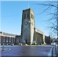
![Summers Quay.  Behind the bus stops on Armentieres Square is Summers Quay.  The 67-apartment block has been built on    the site of the former Casablanca Health Club [[1377730]] and the Millpond pub [[1966666]]. The Casablanca was destroyed by a fire in 2005. The Millpond closed in 2014 and was boarded up [[4637098]].  The development by New Charter is named after Ada Summers – the town’s first female councillor and first British woman to sit as a magistrate and Justice of the Peace.  by Gerald England – 12 February 2020](https://s3.geograph.org.uk/geophotos/06/39/19/6391903_e98aa155_120x120.jpg)
![Armentieres Square. On the left is one of the bus stops on the square with the Huddersfield Narrow Canal behind. On the right is the site of the former Casablanca Health Club and the Millpond pub [[1966666]]. The Casablanca was destroyed by a fire in 2005. The Millpond closed in 2014 and was boarded up [[4637098]]. Now they have been demolished and the plan is to build a 67-apartment block with opportunities for five commercial spaces on the ground floor. by Gerald England – 25 January 2017](https://s3.geograph.org.uk/geophotos/05/43/75/5437555_8a3d8d23_120x120.jpg)