CanalPlanAC

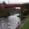
Harrisons Bridge No 4

 
Park Lodge Lane, Kirkthorpe WF1 4HZ, United Kingdom
 
Information about the place
 
 
The nearest place in the direction of Fall Ing Junction is Broadreach Footbridge No 3; 2¾ furlongs away.
 
The nearest place in the direction of Stanley Ferry Aqueduct is Ramsdens Bridge Sanitary Station; 5½ furlongs away.

There may be access to the towpath here.

Mooring here is unrated.

There is a bridge here which takes a minor road over the canal.


Amenities

Amenities here

 Boots Chemist
 Total
 Yiga

Amenities nearby at Broadreach Footbridge No 3

 Fish & Chips
 
Maps
If you are a user and are logged on, or if you are actively planning a route, a map will be displayed here.
Show on external mapping site: Google | OSM | Bing
 
Photos
 
External websites
There are no links to external websites from here.
Why not log in and add some (select "External websites" from the menu (sometimes this is under "Edit"))?
 
Nearest facilities

Mouseover for more information or show routes to facility

Nearest water point

In the direction of Castleford Junction

Ramsdens Bridge Sanitary Station5½ furlongs away
On this waterway in the direction of Castleford Junction
Stanley Ferry Water Point6 furlongs away
On this waterway in the direction of Castleford Junction
King's Road Lock No 32 miles, 3¼ furlongs and 1 lock away
On this waterway in the direction of Castleford Junction
Woodnook Lock No 63 miles, 4¾ furlongs and 2 locks away
On this waterway in the direction of Castleford Junction
Fairies Hill Moorings4 miles, ¼ furlongs and 4 locks away
Travel to Fairies Hill Lock Junction, then on the Aire and Calder Navigation (Wakefield Section - Fairies Hill Mooring Arm) to Fairies Hill Moorings
Castleford Sanitary Station5 miles, 7¼ furlongs and 4 locks away
Travel to Castleford Junction, then on the Aire and Calder Navigation (Main Line - Goole to Castleford) to Castleford Sanitary Station
Bulholme Lock No 106 miles, 4¼ furlongs and 4 locks away
Travel to Castleford Junction, then on the Aire and Calder Navigation (Main Line - Goole to Castleford) to Bulholme Lock No 10
Lemonroyd Lock No 79 miles, 2 furlongs and 3 locks away
Travel to Castleford Junction, then on the Aire and Calder Navigation (Main Line - Castleford to Leeds) to Lemonroyd Lock No 7
Lemonroyd Marina9 miles, 3 furlongs and 4 locks away
Travel to Castleford Junction, then on the Aire and Calder Navigation (Main Line - Castleford to Leeds) to Lemonroyd Marina
Woodlesford Lock No 510 miles, 4¾ furlongs and 4 locks away
Travel to Castleford Junction, then on the Aire and Calder Navigation (Main Line - Castleford to Leeds) to Woodlesford Lock No 5
Ferrybridge Flood Lock Footbridge11 miles, 1¾ furlongs and 5 locks away
Travel to Castleford Junction, then on the Aire and Calder Navigation (Main Line - Goole to Castleford) to Ferrybridge Flood Lock Footbridge
Ferrybridge Flood Lock No 1111 miles, 2 furlongs and 5 locks away
Travel to Castleford Junction, then on the Aire and Calder Navigation (Main Line - Goole to Castleford) to Ferrybridge Flood Lock No 11
Fishpond Lock No 411 miles, 3¾ furlongs and 5 locks away
Travel to Castleford Junction, then on the Aire and Calder Navigation (Main Line - Castleford to Leeds) to Fishpond Lock No 4
Bank Dole Lock No 113 miles, ¼ furlongs and 6 locks away
Travel to Castleford Junction, then on the Aire and Calder Navigation (Main Line - Goole to Castleford) to Bank Dole Junction, then on the Aire and Calder Navigation (Selby Section) to Bank Dole Lock No 1
Leeds Sanitary Station15 miles, 1½ furlongs and 7 locks away
Travel to Castleford Junction, then on the Aire and Calder Navigation (Main Line - Castleford to Leeds) to Leeds Sanitary Station
Beal Bridge15 miles, 2¾ furlongs and 7 locks away
Travel to Castleford Junction, then on the Aire and Calder Navigation (Main Line - Goole to Castleford) to Bank Dole Junction, then on the Aire and Calder Navigation (Selby Section) to Beal Bridge
Beal Lock No 215 miles, 4 furlongs and 7 locks away
Travel to Castleford Junction, then on the Aire and Calder Navigation (Main Line - Goole to Castleford) to Bank Dole Junction, then on the Aire and Calder Navigation (Selby Section) to Beal Lock No 2
Whitley Lock No 1216 miles, 6 furlongs and 6 locks away
Travel to Castleford Junction, then on the Aire and Calder Navigation (Main Line - Goole to Castleford) to Whitley Lock No 12

In the direction of Fall Ing Junction

Broad Cut Low Lock No 34 miles, 6¼ furlongs and 3 locks away
Travel to Fall Ing Junction, then on the Calder and Hebble Navigation (Main Line) to Broad Cut Low Lock No 3
Shepley Bridge Sanitary Station11 miles, 3¼ furlongs and 12 locks away
Travel to Fall Ing Junction, then on the Calder and Hebble Navigation (Main Line) to Shepley Bridge Sanitary Station

Nearest rubbish disposal

In the direction of Castleford Junction

Ramsdens Bridge Visitor Moorings5¾ furlongs away
On this waterway in the direction of Castleford Junction
Castleford Sanitary Station5 miles, 7¼ furlongs and 4 locks away
Travel to Castleford Junction, then on the Aire and Calder Navigation (Main Line - Goole to Castleford) to Castleford Sanitary Station
Lemonroyd Marina9 miles, 3 furlongs and 4 locks away
Travel to Castleford Junction, then on the Aire and Calder Navigation (Main Line - Castleford to Leeds) to Lemonroyd Marina
Woodlesford Lock No 510 miles, 4¾ furlongs and 4 locks away
Travel to Castleford Junction, then on the Aire and Calder Navigation (Main Line - Castleford to Leeds) to Woodlesford Lock No 5
Leeds Sanitary Station15 miles, 1½ furlongs and 7 locks away
Travel to Castleford Junction, then on the Aire and Calder Navigation (Main Line - Castleford to Leeds) to Leeds Sanitary Station
Whitley Lock No 1216 miles, 6 furlongs and 6 locks away
Travel to Castleford Junction, then on the Aire and Calder Navigation (Main Line - Goole to Castleford) to Whitley Lock No 12
Leeds Basin16 miles, ¾ furlongs and 9 locks away
Travel to Castleford Junction, then on the Aire and Calder Navigation (Main Line - Castleford to Leeds) to Leeds Bridge, then on the Leeds and Liverpool Canal (Main Line - Wigan to Leeds) to Leeds Basin

In the direction of Fall Ing Junction

Horbury Basin Residential Moorings & Sanitary Station6 miles, 7 furlongs and 5 locks away
Travel to Fall Ing Junction, then on the Calder and Hebble Navigation (Main Line) to Horbury Basin Residential Moorings & Sanitary Station
Shepley Bridge Sanitary Station11 miles, 3¼ furlongs and 12 locks away
Travel to Fall Ing Junction, then on the Calder and Hebble Navigation (Main Line) to Shepley Bridge Sanitary Station
Brighouse Lower Basin Visitor Moorings16 miles, 6 furlongs and 17 locks away
Travel to Fall Ing Junction, then on the Calder and Hebble Navigation (Main Line) to Brighouse Lower Basin Visitor Moorings
Aspley Basin (Huddersfield)18 miles and 23 locks away
Travel to Fall Ing Junction, then on the Calder and Hebble Navigation (Main Line) to Cooper Bridge Junction, then on the Huddersfield Broad Canal to Aspley Basin (Huddersfield)

Nearest chemical toilet disposal

In the direction of Castleford Junction

Ramsdens Bridge Sanitary Station5½ furlongs away
On this waterway in the direction of Castleford Junction
Fairies Hill Moorings4 miles, ¼ furlongs and 4 locks away
Travel to Fairies Hill Lock Junction, then on the Aire and Calder Navigation (Wakefield Section - Fairies Hill Mooring Arm) to Fairies Hill Moorings
Castleford Sanitary Station5 miles, 7¼ furlongs and 4 locks away
Travel to Castleford Junction, then on the Aire and Calder Navigation (Main Line - Goole to Castleford) to Castleford Sanitary Station
Lemonroyd Marina9 miles, 3 furlongs and 4 locks away
Travel to Castleford Junction, then on the Aire and Calder Navigation (Main Line - Castleford to Leeds) to Lemonroyd Marina
Leeds Sanitary Station15 miles, 1½ furlongs and 7 locks away
Travel to Castleford Junction, then on the Aire and Calder Navigation (Main Line - Castleford to Leeds) to Leeds Sanitary Station
Whitley Lock No 1216 miles, 6 furlongs and 6 locks away
Travel to Castleford Junction, then on the Aire and Calder Navigation (Main Line - Goole to Castleford) to Whitley Lock No 12

In the direction of Fall Ing Junction

Horbury Basin Residential Moorings & Sanitary Station6 miles, 7 furlongs and 5 locks away
Travel to Fall Ing Junction, then on the Calder and Hebble Navigation (Main Line) to Horbury Basin Residential Moorings & Sanitary Station
Savile Town Wharf and Basin (Dewsbury)10 miles and 8 locks away
Travel to Fall Ing Junction, then on the Calder and Hebble Navigation (Main Line) to Dewsbury Arm Junction, then on the Calder and Hebble Navigation (Dewsbury Old Cut) to Savile Town Wharf and Basin (Dewsbury)
Shepley Bridge Sanitary Station11 miles, 3¼ furlongs and 12 locks away
Travel to Fall Ing Junction, then on the Calder and Hebble Navigation (Main Line) to Shepley Bridge Sanitary Station
Brighouse Basin16 miles, 6¼ furlongs and 18 locks away
Travel to Fall Ing Junction, then on the Calder and Hebble Navigation (Main Line) to Brighouse Basin
Aspley Basin (Huddersfield)18 miles and 23 locks away
Travel to Fall Ing Junction, then on the Calder and Hebble Navigation (Main Line) to Cooper Bridge Junction, then on the Huddersfield Broad Canal to Aspley Basin (Huddersfield)

Nearest place to turn

In the direction of Castleford Junction

Stanley Ferry Marina6¾ furlongs away
On this waterway in the direction of Castleford Junction
Fairies Hill Lock Arm3 miles, 3¼ furlongs and 2 locks away
On this waterway in the direction of Castleford Junction
Bulholme Lock Weir Exit6 miles, 4½ furlongs and 5 locks away
Travel to Castleford Junction, then on the Aire and Calder Navigation (Main Line - Goole to Castleford) to Bulholme Lock Weir Exit
Lemonroyd Lock Weir Exit9 miles, 1 furlong and 3 locks away
Travel to Castleford Junction, then on the Aire and Calder Navigation (Main Line - Castleford to Leeds) to Lemonroyd Lock Weir Exit
Fleet Lane Arm9 miles, 5¼ furlongs and 4 locks away
Travel to Castleford Junction, then on the Aire and Calder Navigation (Main Line - Castleford to Leeds) to Fleet Lane Arm
Junction with River Aire (Old Channel) South13 miles, 7¼ furlongs and 6 locks away
Travel to Castleford Junction, then on the Aire and Calder Navigation (Main Line - Castleford to Leeds) to Junction with River Aire (Old Channel) South
Bank Dole Lock Junction13 miles, ¾ furlongs and 7 locks away
Travel to Castleford Junction, then on the Aire and Calder Navigation (Main Line - Goole to Castleford) to Bank Dole Junction, then on the Aire and Calder Navigation (Selby Section) to Bank Dole Lock Junction
Junction with River Aire (Old Channel) North14 miles, 4½ furlongs and 7 locks away
Travel to Castleford Junction, then on the Aire and Calder Navigation (Main Line - Castleford to Leeds) to Junction with River Aire (Old Channel) North
Knostrop Flood Lock Weir Entrance14 miles, 4¾ furlongs and 7 locks away
Travel to Castleford Junction, then on the Aire and Calder Navigation (Main Line - Castleford to Leeds) to Knostrop Flood Lock Weir Entrance
Beal Lock No 2 Weir Entrance15 miles, 3 furlongs and 7 locks away
Travel to Castleford Junction, then on the Aire and Calder Navigation (Main Line - Goole to Castleford) to Bank Dole Junction, then on the Aire and Calder Navigation (Selby Section) to Beal Lock No 2 Weir Entrance
Leeds Dock Side Arm15 miles, 3¾ furlongs and 8 locks away
Travel to Castleford Junction, then on the Aire and Calder Navigation (Main Line - Castleford to Leeds) to Leeds Dock Entrance, then on the Aire and Calder Navigation (Leeds Dock) to Leeds Dock Side Arm
River Aire Junction16 miles and 8 locks away
Travel to Castleford Junction, then on the Aire and Calder Navigation (Main Line - Castleford to Leeds) to Leeds Bridge, then on the Leeds and Liverpool Canal (Main Line - Wigan to Leeds) to River Aire Junction
Leeds Basin16 miles, ¾ furlongs and 9 locks away
Travel to Castleford Junction, then on the Aire and Calder Navigation (Main Line - Castleford to Leeds) to Leeds Bridge, then on the Leeds and Liverpool Canal (Main Line - Wigan to Leeds) to Leeds Basin

In the direction of Fall Ing Junction

Wakefield Weir Entrance2 miles, 1½ furlongs and 2 locks away
Travel to Fall Ing Junction, then on the Calder and Hebble Navigation (Main Line) to Wakefield Weir Entrance
Broad Cut Weir Entrance4 miles, 6 furlongs and 3 locks away
Travel to Fall Ing Junction, then on the Calder and Hebble Navigation (Main Line) to Broad Cut Weir Entrance
Waller Bridge Winding Hole5 miles, ¼ furlongs and 4 locks away
Travel to Fall Ing Junction, then on the Calder and Hebble Navigation (Main Line) to Waller Bridge Winding Hole
Horbury Basin Residential Moorings & Sanitary Station6 miles, 7 furlongs and 5 locks away
Travel to Fall Ing Junction, then on the Calder and Hebble Navigation (Main Line) to Horbury Basin Residential Moorings & Sanitary Station
Dewsbury Arm Junction9 miles and 8 locks away
Travel to Fall Ing Junction, then on the Calder and Hebble Navigation (Main Line) to Dewsbury Arm Junction
Savile Town Wharf and Basin (Dewsbury)10 miles and 8 locks away
Travel to Fall Ing Junction, then on the Calder and Hebble Navigation (Main Line) to Dewsbury Arm Junction, then on the Calder and Hebble Navigation (Dewsbury Old Cut) to Savile Town Wharf and Basin (Dewsbury)
Shepley Bridge Marina11 miles, 3 furlongs and 12 locks away
Travel to Fall Ing Junction, then on the Calder and Hebble Navigation (Main Line) to Shepley Bridge Marina

Nearest self-operated pump-out

In the direction of Castleford Junction

Ramsdens Bridge Sanitary Station5½ furlongs away
On this waterway in the direction of Castleford Junction
Castleford Sanitary Station5 miles, 7¼ furlongs and 4 locks away
Travel to Castleford Junction, then on the Aire and Calder Navigation (Main Line - Goole to Castleford) to Castleford Sanitary Station
Leeds Sanitary Station15 miles, 1½ furlongs and 7 locks away
Travel to Castleford Junction, then on the Aire and Calder Navigation (Main Line - Castleford to Leeds) to Leeds Sanitary Station

Nearest boatyard pump-out

Direction of TV transmitter (From Wolfbane Cybernetic)
 
 
Geograph
 
Wikipedia

There is no page on Wikipedia called “Harrisons Bridge”

Wikipedia pages that might relate to Harrisons Bridge
[Benjamin Harrison Memorial Bridge] The Benjamin Harrison Memorial Bridge is a vertical-lift bridge that spans the James River between Jordan's Point in Prince George County and Charles City [Harrison family of Virginia] "Durham arms" were used by Daniel Harrison of the Shenandoah Valley Harrisons, featuring one eagle and sourced to Harrisons descended from Durham. Included [Barwon River (Victoria)] (630 ft) long McIntyre Bridge is located upstream of the James Harrison Bridge, and is a post-tensioned, pre-stressed stayed girder bridge, carrying a sewer [Fletcher Covered Bridge] Fletcher Covered Bridge is a 62-foot (19 m) Multiple King Post covered bridge located near Marshville in Harrison County, West Virginia. The bridge crosses Tenmile [Harrison Covered Bridge] The Harrison Covered Bridge was north of West Union, Indiana. The double-span Burr Arch covered bridge structure was built by J. J. Daniels in 1866 and [Harrison Avenue Bridge] Harrison Avenue Bridge was a concrete deck arch bridge carrying Harrison Avenue (unsigned SR 6011) in Scranton, Pennsylvania, United States. Its three [Jamestown Ferry] of the river between the James River Bridge downstream at Newport News and the Benjamin Harrison Memorial Bridge upriver near Hopewell. It is toll-free [Harrison Street Bridge] The Harrison Street Bridge was a bridge which crossed the Embarras River east of Charleston, Illinois. The Camelback through truss bridge was 185 feet [Varina-Enon Bridge] Varina-Enon Bridge is a cable-stayed bridge which carries Interstate 295 across the James River near Dutch Gap between Henrico County near Richmond and [Dock Bridge] Dock Bridge is a pair of vertical lift bridges crossing the Passaic River at Newark, Essex County and Harrison, Hudson County, New Jersey, United States
 
Google

Results of Google Search

Central Scranton Expressway to close next week for removal of old ...
Apr 14, 2018 ... SCRANTON — The Central Scranton Expressway will be closed next week for the removal of the old Harrison Avenue Bridge. The expressway ...
Benjamin Harrison Memorial Bridge - Wikipedia
The State of Virginia filed suit in U.S. District Court against the ... The rebuilt Benjamin Harrison Memorial Bridge was ...
Harrison Avenue Bridge implosion now set for May 31 - News - The ...
3 days ago ... The implosion of the old Harrison Avenue Bridge is now tentatively set for ... May 31 is the date PennDOT is “looking at and hoping for at this ...
Amazon.com : Coral Coast Harrison 4-ft. Wood Garden Bridge ...
One-up your neighbors with the Coral Coast Harrison 4-ft. Wood Garden Bridge. Crafted of beautiful, weather-resistant fir wood, this bridge is perfect for placing ...
N Harrison Bridge Rd, Simpsonville, SC 29680 - realtor.com®
Dec 21, 2017 ... View 1 photos for N Harrison Bridge Rd, Simpsonville, SC 29680 a bed, bath, 5.9 acres lot. built in that sold on 09/15/2017.
Replacement of Harrison Ave Bridge
Aug 19, 2015 ... #x200b;Construction of a new bridge and removal of existing bridge over ... other miscellaneous construction for a total length of 1500.00 linear feet.
n Biscuits, Harrison Bridge Road, Simpsonville
Visit your local Bojangles' at 208 Harrison Bridge Road in Simpsonville, SC ... Bojangles' flavorful, one-of-a-kind food is sure to keep you coming back for more.
402 New Harrison Bridge Rd Simpsonville, SC 29680 Rentals ...
See all available apartments for rent at 402 New Harrison Bridge Rd in Simpsonville, ... Located 15 miles south of downtown Greenville, Simpsonville marks the ...
Harrison Avenue bridge implosion scheduled for Friday ...
May 9, 2018 ... After being a gateway into the city of Scranton for nearly 100 years, the old Harrison Avenue bridge may be completely demolished by Friday ...
Harrison Bridge Road Care Team - Parkside Pediatrics
Dr. Roemmich chose pediatrics because of the privilege of positively ... Practitioner because she considers it a blessing to care for the littlest patients. ... our new location opens at Harrison Bridge Road as we partner with Parkside Pediatrics.