CanalPlanAC

Astwood Lane Bridge No 40

 
Astwood B60 4BN, United Kingdom
 
Information about the place
Astwood Lane Bridge No 40 is a minor waterways place on the Worcester and Birmingham Canal (Diglis Basin to King's Norton Junction) between Hanbury Junction (Junction with Droitwich Junction Canal (Restored - Opened 1/July/2011). Hanbury Wharf) (1 mile and 5 furlongs and 1 lock to the southwest) and King's Norton Junction (Junction of Stratford and Worcester and Birmingham Canals) (13 miles and 5½ furlongs and 41 locks to the northeast).
 
It is part of Astwood Locks.
 
The nearest place in the direction of Hanbury Junction is Astwood Bottom Lock Narrows; 1¼ furlongs away.
 
The nearest place in the direction of King's Norton Junction is Astwood Lock No 18; ¼ furlongs away.

There may be access to the towpath here.

Mooring here is unrated.

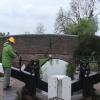
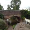
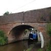
There is a bridge here which takes a minor road over the canal.


Amenities
 
Maps
If you are a user and are logged on, or if you are actively planning a route, a map will be displayed here.
Show on external mapping site: Google | OSM | Bing
 
Photos
 
External websites
There are no links to external websites from here.
Why not log in and add some (select "External websites" from the menu (sometimes this is under "Edit"))?
 
Nearest facilities

Mouseover for more information or show routes to facility

Nearest water point

In the direction of King's Norton Junction

Stoke Works Water Point7¼ furlongs and 5 locks away
On this waterway in the direction of King's Norton Junction
Tardebigge Wharf4 miles, 7¾ furlongs and 41 locks away
On this waterway in the direction of King's Norton Junction
Hopwood Visitor Moorings10 miles, 3½ furlongs and 41 locks away
On this waterway in the direction of King's Norton Junction
King's Norton Water Point13 miles, 4¾ furlongs and 41 locks away
On this waterway in the direction of King's Norton Junction
Yardley Wood Water Point16 miles, 2 furlongs and 41 locks away
Travel to King's Norton Junction, then on the Stratford-on-Avon Canal (Northern Section) to Yardley Wood Water Point
Holliday Wharf18 miles, 7½ furlongs and 41 locks away
Travel to King's Norton Junction, then on the Worcester and Birmingham Canal (Birmingham to King's Norton) to Holliday Wharf
Worcester Bar19 miles, 1½ furlongs and 41 locks away
Travel to King's Norton Junction, then on the Worcester and Birmingham Canal (Birmingham to King's Norton) to Worcester Bar
Hawne Basin19 miles, 2 furlongs and 41 locks away
Travel to King's Norton Junction, then on the Worcester and Birmingham Canal (Birmingham to King's Norton) to New Selly Oak Junction, then on the Birmingham Canal Navigations (Dudley Canal No 2 - Lapal Canal - Original Line East End ) to Somery Road Bridge, then on the Birmingham Canal Navigations (Dudley Canal No 2 - Lapal Canal - Abandoned Line ) to Lapal Canal - New line Diverges From Original Route, then on the Birmingham Canal Navigations (Dudley Canal No 2 - Lapal Canal - Original Line West End ) to Coombeswood, then on the Birmingham Canal Navigations (Dudley Canal No 2 - Coombeswood ) to Hawne Basin
Cambrian Wharf Services19 miles, 5½ furlongs and 41 locks away
Travel to King's Norton Junction, then on the Worcester and Birmingham Canal (Birmingham to King's Norton) to Worcester Bar, then on the Birmingham Canal Navigations (Main Line) to Deep Cuttings Junction, then on the Birmingham Canal Navigations (Newhall Branch) to Cambrian Wharf Services

In the direction of Diglis Basin

Hanbury Boatyard1 mile, 5¾ furlongs and 1 lock away
On this waterway in the direction of Diglis Basin
Droitwich Spa Marina2 miles, ¼ furlongs and 4 locks away
Travel to Hanbury Junction, then on the Droitwich Canals (Droitwich Junction Canal) to Droitwich Spa Marina
Netherwich Basin3 miles, 3¾ furlongs and 9 locks away
Travel to Hanbury Junction, then on the Droitwich Canals (Droitwich Junction Canal) to Droitwich Junction, then on the Droitwich Canals (Droitwich Barge Canal) to Netherwich Basin
Lowesmoor Basin9 miles, 5¼ furlongs and 13 locks away
On this waterway in the direction of Diglis Basin
Diglis Services10 miles, 5 furlongs and 15 locks away
On this waterway in the direction of Diglis Basin
Diglis Locks11 miles, 1 furlong and 17 locks away
Travel to Diglis Basin, then on the Worcester and Birmingham Canal (Diglis Junction to Diglis Basin) to Diglis Junction, then on the River Severn (main river - Worcester to Gloucester) to Diglis Locks
Worcester Trip Boat Moorings11 miles, 4¾ furlongs and 17 locks away
Travel to Diglis Basin, then on the Worcester and Birmingham Canal (Diglis Junction to Diglis Basin) to Diglis Junction, then on the River Severn (main river - Stourport to Worcester) to Worcester Trip Boat Moorings
Holt Lock (Holt Fleet)11 miles, 7 furlongs and 17 locks away
Travel to Hanbury Junction, then on the Droitwich Canals (Droitwich Junction Canal) to Droitwich Junction, then on the Droitwich Canals (Droitwich Barge Canal) to Hawford Junction, then on the River Severn (main river - Stourport to Worcester) to Holt Lock (Holt Fleet)
Lincomb Lock16 miles, ¾ furlongs and 18 locks away
Travel to Hanbury Junction, then on the Droitwich Canals (Droitwich Junction Canal) to Droitwich Junction, then on the Droitwich Canals (Droitwich Barge Canal) to Hawford Junction, then on the River Severn (main river - Stourport to Worcester) to Lincomb Lock
Upper Basin Waterpoint17 miles, 4 furlongs and 21 locks away
Travel to Hanbury Junction, then on the Droitwich Canals (Droitwich Junction Canal) to Droitwich Junction, then on the Droitwich Canals (Droitwich Barge Canal) to Hawford Junction, then on the River Severn (main river - Stourport to Worcester) to Severn - Stourport Broad Locks Entrance, then on the Staffordshire and Worcestershire Canal (Stourport Basins: Broad Route) to Stourport Upper Basin, then on the Staffordshire and Worcestershire Canal (Stourport Basins: Narrow Route) to Upper Basin Waterpoint

Nearest rubbish disposal

In the direction of King's Norton Junction

Stoke Bottom Lock No 231 mile, 5 furlongs and 5 locks away
On this waterway in the direction of King's Norton Junction
Tardebigge Wharf4 miles, 7¾ furlongs and 41 locks away
On this waterway in the direction of King's Norton Junction
Worcester Bar19 miles, 1½ furlongs and 41 locks away
Travel to King's Norton Junction, then on the Worcester and Birmingham Canal (Birmingham to King's Norton) to Worcester Bar
Hawne Basin19 miles, 2 furlongs and 41 locks away
Travel to King's Norton Junction, then on the Worcester and Birmingham Canal (Birmingham to King's Norton) to New Selly Oak Junction, then on the Birmingham Canal Navigations (Dudley Canal No 2 - Lapal Canal - Original Line East End ) to Somery Road Bridge, then on the Birmingham Canal Navigations (Dudley Canal No 2 - Lapal Canal - Abandoned Line ) to Lapal Canal - New line Diverges From Original Route, then on the Birmingham Canal Navigations (Dudley Canal No 2 - Lapal Canal - Original Line West End ) to Coombeswood, then on the Birmingham Canal Navigations (Dudley Canal No 2 - Coombeswood ) to Hawne Basin
Cambrian Wharf Services19 miles, 5½ furlongs and 41 locks away
Travel to King's Norton Junction, then on the Worcester and Birmingham Canal (Birmingham to King's Norton) to Worcester Bar, then on the Birmingham Canal Navigations (Main Line) to Deep Cuttings Junction, then on the Birmingham Canal Navigations (Newhall Branch) to Cambrian Wharf Services

In the direction of Diglis Basin

Droitwich Spa Marina2 miles, ¼ furlongs and 4 locks away
Travel to Hanbury Junction, then on the Droitwich Canals (Droitwich Junction Canal) to Droitwich Spa Marina
Netherwich Basin3 miles, 3¾ furlongs and 9 locks away
Travel to Hanbury Junction, then on the Droitwich Canals (Droitwich Junction Canal) to Droitwich Junction, then on the Droitwich Canals (Droitwich Barge Canal) to Netherwich Basin
Lowesmoor Basin9 miles, 5¼ furlongs and 13 locks away
On this waterway in the direction of Diglis Basin
Diglis Basin10 miles, 5½ furlongs and 15 locks away
On this waterway in the direction of Diglis Basin
Sabrina Footbridge11 miles, 6½ furlongs and 17 locks away
Travel to Diglis Basin, then on the Worcester and Birmingham Canal (Diglis Junction to Diglis Basin) to Diglis Junction, then on the River Severn (main river - Stourport to Worcester) to Sabrina Footbridge
Upper Basin Waterpoint17 miles, 4 furlongs and 21 locks away
Travel to Hanbury Junction, then on the Droitwich Canals (Droitwich Junction Canal) to Droitwich Junction, then on the Droitwich Canals (Droitwich Barge Canal) to Hawford Junction, then on the River Severn (main river - Stourport to Worcester) to Severn - Stourport Broad Locks Entrance, then on the Staffordshire and Worcestershire Canal (Stourport Basins: Broad Route) to Stourport Upper Basin, then on the Staffordshire and Worcestershire Canal (Stourport Basins: Narrow Route) to Upper Basin Waterpoint

Nearest chemical toilet disposal

In the direction of King's Norton Junction

Stoke Bottom Lock No 231 mile, 5 furlongs and 5 locks away
On this waterway in the direction of King's Norton Junction
Tardebigge Wharf4 miles, 7¾ furlongs and 41 locks away
On this waterway in the direction of King's Norton Junction
Holliday Wharf18 miles, 7½ furlongs and 41 locks away
Travel to King's Norton Junction, then on the Worcester and Birmingham Canal (Birmingham to King's Norton) to Holliday Wharf
Worcester Bar19 miles, 1½ furlongs and 41 locks away
Travel to King's Norton Junction, then on the Worcester and Birmingham Canal (Birmingham to King's Norton) to Worcester Bar
Hawne Basin19 miles, 2 furlongs and 41 locks away
Travel to King's Norton Junction, then on the Worcester and Birmingham Canal (Birmingham to King's Norton) to New Selly Oak Junction, then on the Birmingham Canal Navigations (Dudley Canal No 2 - Lapal Canal - Original Line East End ) to Somery Road Bridge, then on the Birmingham Canal Navigations (Dudley Canal No 2 - Lapal Canal - Abandoned Line ) to Lapal Canal - New line Diverges From Original Route, then on the Birmingham Canal Navigations (Dudley Canal No 2 - Lapal Canal - Original Line West End ) to Coombeswood, then on the Birmingham Canal Navigations (Dudley Canal No 2 - Coombeswood ) to Hawne Basin
Cambrian Wharf Services19 miles, 5½ furlongs and 41 locks away
Travel to King's Norton Junction, then on the Worcester and Birmingham Canal (Birmingham to King's Norton) to Worcester Bar, then on the Birmingham Canal Navigations (Main Line) to Deep Cuttings Junction, then on the Birmingham Canal Navigations (Newhall Branch) to Cambrian Wharf Services

In the direction of Diglis Basin

Droitwich Spa Marina2 miles, ¼ furlongs and 4 locks away
Travel to Hanbury Junction, then on the Droitwich Canals (Droitwich Junction Canal) to Droitwich Spa Marina
Lowesmoor Basin9 miles, 5¼ furlongs and 13 locks away
On this waterway in the direction of Diglis Basin
Diglis Services10 miles, 5 furlongs and 15 locks away
On this waterway in the direction of Diglis Basin
Stourport Marina16 miles, 4 furlongs and 19 locks away
Travel to Hanbury Junction, then on the Droitwich Canals (Droitwich Junction Canal) to Droitwich Junction, then on the Droitwich Canals (Droitwich Barge Canal) to Hawford Junction, then on the River Severn (main river - Stourport to Worcester) to Stourport Marina
Upper Basin Waterpoint17 miles, 4 furlongs and 21 locks away
Travel to Hanbury Junction, then on the Droitwich Canals (Droitwich Junction Canal) to Droitwich Junction, then on the Droitwich Canals (Droitwich Barge Canal) to Hawford Junction, then on the River Severn (main river - Stourport to Worcester) to Severn - Stourport Broad Locks Entrance, then on the Staffordshire and Worcestershire Canal (Stourport Basins: Broad Route) to Stourport Upper Basin, then on the Staffordshire and Worcestershire Canal (Stourport Basins: Narrow Route) to Upper Basin Waterpoint

Nearest place to turn

In the direction of King's Norton Junction

Astwood Winding Hole¾ furlongs and 1 lock away
On this waterway in the direction of King's Norton Junction
Stoke Wharf1 mile, 5½ furlongs and 6 locks away
On this waterway in the direction of King's Norton Junction

In the direction of Diglis Basin

Hanbury Junction Winding Hole1 mile, 3¾ furlongs and 1 lock away
On this waterway in the direction of Diglis Basin
Hanbury Junction1 mile, 5 furlongs and 1 lock away
On this waterway in the direction of Diglis Basin
Hanbury Boatyard1 mile, 5¾ furlongs and 1 lock away
On this waterway in the direction of Diglis Basin
Dunhampstead Boatyard3 miles, 4¼ furlongs and 1 lock away
On this waterway in the direction of Diglis Basin
Dunhampstead Winding Hole3 miles, 6½ furlongs and 1 lock away
On this waterway in the direction of Diglis Basin
Tibberton Winding Hole4 miles, 6 furlongs and 1 lock away
On this waterway in the direction of Diglis Basin
Droitwich Spa Marina2 miles, ¼ furlongs and 4 locks away
Travel to Hanbury Junction, then on the Droitwich Canals (Droitwich Junction Canal) to Droitwich Spa Marina
Lock No 6 Winding Hole2 miles, 3¼ furlongs and 6 locks away
Travel to Hanbury Junction, then on the Droitwich Canals (Droitwich Junction Canal) to Lock No 6 Winding Hole
Droitwich Town Wharf3 miles, 1½ furlongs and 9 locks away
Travel to Hanbury Junction, then on the Droitwich Canals (Droitwich Junction Canal) to Droitwich Junction, then on the Droitwich Canals (Droitwich Barge Canal) to Droitwich Town Wharf
Netherwich Basin3 miles, 3¾ furlongs and 9 locks away
Travel to Hanbury Junction, then on the Droitwich Canals (Droitwich Junction Canal) to Droitwich Junction, then on the Droitwich Canals (Droitwich Barge Canal) to Netherwich Basin
Winding Hole (east of Salwarpe Road Bridge)3 miles, 5¼ furlongs and 9 locks away
Travel to Hanbury Junction, then on the Droitwich Canals (Droitwich Junction Canal) to Droitwich Junction, then on the Droitwich Canals (Droitwich Barge Canal) to Winding Hole (east of Salwarpe Road Bridge)
Ladywood Top Lock Winding Hole6 miles, 1¾ furlongs and 9 locks away
Travel to Hanbury Junction, then on the Droitwich Canals (Droitwich Junction Canal) to Droitwich Junction, then on the Droitwich Canals (Droitwich Barge Canal) to Ladywood Top Lock Winding Hole
Bilford Locks Winding Hole8 miles, 3¼ furlongs and 10 locks away
On this waterway in the direction of Diglis Basin
Lowesmoor Basin9 miles, 5¼ furlongs and 13 locks away
On this waterway in the direction of Diglis Basin
Bevere Lock Weir Entrance9 miles, 1½ furlongs and 17 locks away
Travel to Hanbury Junction, then on the Droitwich Canals (Droitwich Junction Canal) to Droitwich Junction, then on the Droitwich Canals (Droitwich Barge Canal) to Hawford Junction, then on the River Severn (main river - Stourport to Worcester) to Bevere Lock Weir Entrance
Bevere Lock Weir Exit9 miles, 4 furlongs and 18 locks away
Travel to Hanbury Junction, then on the Droitwich Canals (Droitwich Junction Canal) to Droitwich Junction, then on the Droitwich Canals (Droitwich Barge Canal) to Hawford Junction, then on the River Severn (main river - Stourport to Worcester) to Bevere Lock Weir Exit
Diglis Junction10 miles, 6½ furlongs and 17 locks away
Travel to Diglis Basin, then on the Worcester and Birmingham Canal (Diglis Junction to Diglis Basin) to Diglis Junction
Holt Lock Weir Exit11 miles, 6 furlongs and 17 locks away
Travel to Hanbury Junction, then on the Droitwich Canals (Droitwich Junction Canal) to Droitwich Junction, then on the Droitwich Canals (Droitwich Barge Canal) to Hawford Junction, then on the River Severn (main river - Stourport to Worcester) to Holt Lock Weir Exit

Nearest self-operated pump-out

In the direction of Diglis Basin

Droitwich Spa Marina2 miles, ¼ furlongs and 4 locks away
Travel to Hanbury Junction, then on the Droitwich Canals (Droitwich Junction Canal) to Droitwich Spa Marina
Diglis Services10 miles, 5 furlongs and 15 locks away
On this waterway in the direction of Diglis Basin

Nearest boatyard pump-out

In the direction of King's Norton Junction

Hawne Basin19 miles, 2 furlongs and 41 locks away
Travel to King's Norton Junction, then on the Worcester and Birmingham Canal (Birmingham to King's Norton) to New Selly Oak Junction, then on the Birmingham Canal Navigations (Dudley Canal No 2 - Lapal Canal - Original Line East End ) to Somery Road Bridge, then on the Birmingham Canal Navigations (Dudley Canal No 2 - Lapal Canal - Abandoned Line ) to Lapal Canal - New line Diverges From Original Route, then on the Birmingham Canal Navigations (Dudley Canal No 2 - Lapal Canal - Original Line West End ) to Coombeswood, then on the Birmingham Canal Navigations (Dudley Canal No 2 - Coombeswood ) to Hawne Basin
Sherborne Wharf Services19 miles, 5¾ furlongs and 41 locks away
Travel to King's Norton Junction, then on the Worcester and Birmingham Canal (Birmingham to King's Norton) to Worcester Bar, then on the Birmingham Canal Navigations (Main Line) to Sherborne Wharf Services

In the direction of Diglis Basin

Hanbury Boatyard1 mile, 5¾ furlongs and 1 lock away
On this waterway in the direction of Diglis Basin
Dunhampstead Boatyard3 miles, 4¼ furlongs and 1 lock away
On this waterway in the direction of Diglis Basin
Lowesmoor Basin9 miles, 5¼ furlongs and 13 locks away
On this waterway in the direction of Diglis Basin
Stourport Marina16 miles, 4 furlongs and 19 locks away
Travel to Hanbury Junction, then on the Droitwich Canals (Droitwich Junction Canal) to Droitwich Junction, then on the Droitwich Canals (Droitwich Barge Canal) to Hawford Junction, then on the River Severn (main river - Stourport to Worcester) to Stourport Marina
Stourport Upper Basin17 miles, 4 furlongs and 21 locks away
Travel to Hanbury Junction, then on the Droitwich Canals (Droitwich Junction Canal) to Droitwich Junction, then on the Droitwich Canals (Droitwich Barge Canal) to Hawford Junction, then on the River Severn (main river - Stourport to Worcester) to Severn - Stourport Broad Locks Entrance, then on the Staffordshire and Worcestershire Canal (Stourport Basins: Broad Route) to Stourport Upper Basin
Upper Staircase Lock Landing Pontoon17 miles, 4¾ furlongs and 21 locks away
Travel to Hanbury Junction, then on the Droitwich Canals (Droitwich Junction Canal) to Droitwich Junction, then on the Droitwich Canals (Droitwich Barge Canal) to Hawford Junction, then on the River Severn (main river - Stourport to Worcester) to Severn - Stourport Broad Locks Entrance, then on the Staffordshire and Worcestershire Canal (Stourport Basins: Broad Route) to Stourport Upper Basin, then on the Staffordshire and Worcestershire Canal (Stourport Basins: Narrow Route) to Upper Staircase Lock Landing Pontoon
Direction of TV transmitter (From Wolfbane Cybernetic)
 
 
Geograph
 
Wikipedia

There is no page on Wikipedia called “Astwood Lane Bridge”

Wikipedia pages that might relate to Astwood Lane Bridge
[List of places in Worcestershire] Astley Burf, Astley Cross, Aston Bank, Aston Fields, Aston Somerville, Astwood Bank, Atch Lench, Axborough Badgers Hill, Badsey, Balsall Heath, Bank's [River Severn] Bridge – a steel beam bridge, west of Tewkesbury Maisemore Bridge – carries the A417 and is a single masonry arch, dating back to 1230. Over Bridge [M5 motorway] Avonmouth Bridge, between junctions 18 and 19, is often a bottleneck during heavy traffic periods, due mainly to lane drops at either ends of the bridge for [List of closed railway stations in Britain: A] Staffordshire Railway 1947 Astwood Halt GWR 1939 Aswarby and Scredington GNR 1930 Athelney GWR 1964 Atherleigh LMS 1954 Atherton Bag Lane LNWR 1954 Attercliffe [Icknield Street] in Lady Wood Lane, crossing the Dudley Road at Sandpits, and along Worstone Lane, passing five furlongs north of the Navigation Bridge in Great Charles [A38 road] Tamar Bridge outside Plymouth and junction 31 of the M5, where the motorway ends; this section is known as the Devon Expressway. It is mainly a two-lane dual [Bermuda] islands' principal naval base guarding the western Atlantic Ocean shipping lanes. To guard the dockyard, the British Army built a large Bermuda Garrison [Tardebigge Locks] Birmingham to the wharf (now known as the Old Wharf) north of Brockhill Lane bridge by 30 March 1807 without the need for locks. After the Old Wharf, the [Severn Valley Railway] for much of its route, and crossing the river on the historic Victoria Bridge. The railway is the sixth-longest standard gauge heritage line in the United [List of closed railway stations in Britain: S] Railway 1965 Stubbins Lancashire and Yorkshire Railway 1972 Studley and Astwood Bank Midland Railway 1962 Sturmer Great Eastern Railway 1967 Sturminster
 
Google

Results of Google Search

Astwood Lane Bridge Number 40 / Wychbold Bridge (IOE01/08573 ...
HANBURY CP WORCESTER AND BIRMINGHAM SO 96 NW SO 96 SW CANAL SO 93776500 1/149 (11/84) Astwood Lane Bridge No 40 3/149 [formerly listed ...
File:Astwood Lane Bridge - geograph.org.uk - 1353754.jpg ...
Mar 8, 2020 ... No higher resolution available. ... English: Astwood Lane Bridge A boat approaching Astwood Lane Bridge (bridge 40) from the south. Date, 16 ...
Worcester and Birmingham Canal - Canal Cycling Section
(1 disused railway); The Mailbox (Birmingham); Salvage Turn Bridge (New Bridge ... No TowPath; Wast Hill Tunnel South Portal; Lea End Lane Bridge ( Bridge 69) ... Astwood Lock 18; Astwood Lane Bridge (40); Astwood Lock 17 ( Bottom Lock) ...
Astwood Lock No 18 on the Worcester and... © Gillie Rhodes ...
Mar 23, 2013 ... Astwood Lane Bridge No 40 is just out of sight in the picture but as soon as you come out of the lock you are under the bridge. Countryside ...
Bromsgrove
Hanbury Park. Astwood Lane Bridge No 40: Worcester and Birmingham Canal. The Boat and Railway, Stoke Wharf. Railway Bridge: Shaw Lane Stoke Works.
Worcester and Birmingham Canal (King's Norton to Worcester) DAY ...
Mar 11, 2010 ... Astwood Lock No 18. 5.6 - 41. Astwood Lane Bridge No 40. 6.0 - 42. Astwood Bottom Lock No 17. 6.4 - 42. Summerhill Farm Bridge No 38.