Main Street Bridge
is a minor waterways place
on the Sheffield and South Yorkshire Navigation (Sheffield Canal) between
Rawmarsh Road Bridge No 39 (7½ furlongs
and 1 lock
to the northeast) and
Sheffield Terminal Warehouse (6 miles and ¾ furlongs
and 14 locks
to the southwest).
The nearest place in the direction of Rawmarsh Road Bridge No 39 is Main Street Junction (Weir Entrance, no access beyond bridge);
¼ furlongs
away.
The nearest place in the direction of Sheffield Terminal Warehouse is Rotherham Junction (River Rother Junction);
1½ furlongs
away.
There may be access to the towpath here.
Mooring here is unrated.
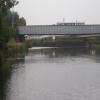
There is a bridge here which takes a minor road over the canal.
Central Road Winding Hole | 1 furlong | |
Rotherham Lock No 4 | ¾ furlongs | |
Rotherham Town Centre Visitor Moorings | ½ furlongs | |
Rotherham Canal Flood Barrier | ¼ furlongs | |
Main Street Junction | ¼ furlongs | |
Main Street Bridge | ||
Rotherham Junction | 1½ furlongs | |
Centenary Way (south) Bridge | 3 furlongs | |
Ickles Lock Railway Bridge No 3 | 4¼ furlongs | |
Millmoor Lane Bridge | 4½ furlongs | |
Ickles Lock No 3 | 4½ furlongs |
- S&SY navigation info — associated with Sheffield and South Yorkshire Navigation
- Sheffield & South Yorkshire navigation info from IWA
Mouseover for more information or show routes to facility
Nearest water point
In the direction of Rawmarsh Road Bridge No 39
Eastwood Lock No 5 — 1 mile, 4½ furlongs and 1 lock away
Travel to Rawmarsh Road Bridge No 39, then on the Sheffield and South Yorkshire Navigation (Main Line) to Eastwood Lock No 5
Kilnhurst Flood Lock No 7 — 4 miles, 2 furlongs and 3 locks away
Travel to Rawmarsh Road Bridge No 39, then on the Sheffield and South Yorkshire Navigation (Main Line) to Kilnhurst Flood Lock No 7
Swinton Lock Activity Centre and CRT Sanitary Station — 5 miles, 7½ furlongs and 5 locks away
Travel to Rawmarsh Road Bridge No 39, then on the Sheffield and South Yorkshire Navigation (Main Line) to Swinton Lock Activity Centre and CRT Sanitary Station
Mexborough Low Lock No 10 — 8 miles, 4¼ furlongs and 6 locks away
Travel to Rawmarsh Road Bridge No 39, then on the Sheffield and South Yorkshire Navigation (Main Line) to Mexborough Low Lock No 10
Sprotbrough Lock No 11 — 11 miles, 7¾ furlongs and 7 locks away
Travel to Rawmarsh Road Bridge No 39, then on the Sheffield and South Yorkshire Navigation (Main Line) to Sprotbrough Lock No 11
Doncaster Town Lock No 12 — 15 miles, 2 furlongs and 8 locks away
Travel to Rawmarsh Road Bridge No 39, then on the Sheffield and South Yorkshire Navigation (Main Line) to Doncaster Town Lock No 12
Doncaster Visitor Pontoon Moorings — 15 miles, 4¼ furlongs and 9 locks away
Travel to Rawmarsh Road Bridge No 39, then on the Sheffield and South Yorkshire Navigation (Main Line) to Doncaster Visitor Pontoon Moorings
Long Sandall Lock No 13 — 18 miles, 5½ furlongs and 9 locks away
Travel to Rawmarsh Road Bridge No 39, then on the Sheffield and South Yorkshire Navigation (Main Line) to Long Sandall Lock No 13
In the direction of Sheffield Terminal Warehouse
Victoria Quays — 6 miles, ½ furlongs and 14 locks away
On this waterway in the direction of Sheffield Terminal WarehouseNearest rubbish disposal
In the direction of Rawmarsh Road Bridge No 39
Eastwood Lock No 5 — 1 mile, 4½ furlongs and 1 lock away
Travel to Rawmarsh Road Bridge No 39, then on the Sheffield and South Yorkshire Navigation (Main Line) to Eastwood Lock No 5
Doncaster Visitor Pontoon Moorings — 15 miles, 4¼ furlongs and 9 locks away
Travel to Rawmarsh Road Bridge No 39, then on the Sheffield and South Yorkshire Navigation (Main Line) to Doncaster Visitor Pontoon Moorings
In the direction of Sheffield Terminal Warehouse
Tinsley CRT facilities — 3 miles, 2¾ furlongs and 13 locks away
On this waterway in the direction of Sheffield Terminal Warehouse
Victoria Quays — 6 miles, ½ furlongs and 14 locks away
On this waterway in the direction of Sheffield Terminal WarehouseNearest chemical toilet disposal
In the direction of Rawmarsh Road Bridge No 39
Eastwood Lock No 5 — 1 mile, 4½ furlongs and 1 lock away
Travel to Rawmarsh Road Bridge No 39, then on the Sheffield and South Yorkshire Navigation (Main Line) to Eastwood Lock No 5
Swinton Lock Activity Centre and CRT Sanitary Station — 5 miles, 7½ furlongs and 5 locks away
Travel to Rawmarsh Road Bridge No 39, then on the Sheffield and South Yorkshire Navigation (Main Line) to Swinton Lock Activity Centre and CRT Sanitary Station
In the direction of Sheffield Terminal Warehouse
Tinsley CRT facilities — 3 miles, 2¾ furlongs and 13 locks away
On this waterway in the direction of Sheffield Terminal Warehouse
Victoria Quays — 6 miles, ½ furlongs and 14 locks away
On this waterway in the direction of Sheffield Terminal WarehouseNearest place to turn
In the direction of Rawmarsh Road Bridge No 39
Main Street Junction — ¼ furlongs away
On this waterway in the direction of Rawmarsh Road Bridge No 39
Central Road Winding Hole — 1 furlong and 1 lock away
On this waterway in the direction of Rawmarsh Road Bridge No 39
Rawmarsh Road Winding Hole — 7 furlongs and 1 lock away
On this waterway in the direction of Rawmarsh Road Bridge No 39
Sir Frank Price Lock Arm — 1 mile, 3¾ furlongs and 1 lock away
Travel to Rawmarsh Road Bridge No 39, then on the Sheffield and South Yorkshire Navigation (Main Line) to Sir Frank Price Lock Arm
Sir Frank Price Lock Weir Exit — 1 mile, 5 furlongs and 2 locks away
Travel to Rawmarsh Road Bridge No 39, then on the Sheffield and South Yorkshire Navigation (Main Line) to Sir Frank Price Lock Weir Exit
Kilnhurst Flood Lock Winding Hole — 4 miles, ¼ furlongs and 3 locks away
Travel to Rawmarsh Road Bridge No 39, then on the Sheffield and South Yorkshire Navigation (Main Line) to Kilnhurst Flood Lock Winding Hole
Swinton Junction — 5 miles, 6¾ furlongs and 4 locks away
Travel to Rawmarsh Road Bridge No 39, then on the Sheffield and South Yorkshire Navigation (Main Line) to Swinton Junction
Swinton Road Corner — 6 miles, 2¾ furlongs and 5 locks away
Travel to Rawmarsh Road Bridge No 39, then on the Sheffield and South Yorkshire Navigation (Main Line) to Swinton Road Corner
Sprotbrough Lock Weir Exit — 12 miles, ¼ furlongs and 8 locks away
Travel to Rawmarsh Road Bridge No 39, then on the Sheffield and South Yorkshire Navigation (Main Line) to Sprotbrough Lock Weir Exit
Doncaster Visitor Pontoon Moorings — 15 miles, 4¼ furlongs and 9 locks away
Travel to Rawmarsh Road Bridge No 39, then on the Sheffield and South Yorkshire Navigation (Main Line) to Doncaster Visitor Pontoon Moorings
Gas House Bight — 15 miles, 5¾ furlongs and 9 locks away
Travel to Rawmarsh Road Bridge No 39, then on the Sheffield and South Yorkshire Navigation (Main Line) to Gas House Bight
Wheatley Hall Road Winding Hole — 17 miles, 5 furlongs and 9 locks away
Travel to Rawmarsh Road Bridge No 39, then on the Sheffield and South Yorkshire Navigation (Main Line) to Wheatley Hall Road Winding Hole
In the direction of Sheffield Terminal Warehouse
Rotherham Junction — 1½ furlongs away
On this waterway in the direction of Sheffield Terminal Warehouse
Tinsley Lower Flight Weir Exit — 2 miles, 1½ furlongs and 3 locks away
On this waterway in the direction of Sheffield Terminal Warehouse
Don Valley Stadium Visitor Moorings — 4 miles, 2 furlongs and 14 locks away
On this waterway in the direction of Sheffield Terminal Warehouse
Shirland Road Bridge Winding Hole — 4 miles, 4½ furlongs and 14 locks away
On this waterway in the direction of Sheffield Terminal Warehouse
Victoria Quays — 6 miles, ½ furlongs and 14 locks away
On this waterway in the direction of Sheffield Terminal Warehouse
Sheffield Terminal Warehouse — 6 miles, ¾ furlongs and 14 locks away
On this waterway in the direction of Sheffield Terminal WarehouseNearest self-operated pump-out
In the direction of Rawmarsh Road Bridge No 39
Long Sandall Lock No 13 — 18 miles, 5½ furlongs and 9 locks away
Travel to Rawmarsh Road Bridge No 39, then on the Sheffield and South Yorkshire Navigation (Main Line) to Long Sandall Lock No 13No information
CanalPlan has no information on any of the following facilities within range:boatyard pump-out
Direction of TV transmitter (From Wolfbane Cybernetic)
Wikipedia has a page about Main Street Bridge
Main Street Bridge may refer to:
- Main Street Bridge (New Blaine, Arkansas)
- Main Street Bridge (Florence, Colorado), listed on the NRHP in Fremont County, Colorado
- Main Street Bridge (Stamford, Connecticut)
- Main Street Bridge (Daytona Beach, Florida), carries County Road 4040 (Volusia County, Florida) across the Atlantic Intracoastal Waterway
- Main Street Bridge (Jacksonville, Florida)
- Main Street Bridge (Charles City, Iowa)
- Main Street Bridge (Elkhorn, Nebraska), listed on the NRHP in Douglas County, Nebraska
- Main Street Bridge (Rochester, New York)
- Scuppernong River Bridge, Columbia, North Carolina, also known as Main Street Bridge
- Rainbow Arch Bridge (Valley City, North Dakota), also known as Main Street Bridge
- Main Street Bridge (Columbus, Ohio)
- Main Street Bridge (Hillsboro, Oregon), a MAX Light Rail bridge
- Main Street Bridge (Pawtucket, Rhode Island)
- Paddock Viaduct, Fort Worth, Texas, also known as Main Street Bridge
Other Wikipedia pages that might relate to Main Street Bridge
[Main Street Bridge (Jacksonville)]
The Main Street Bridge, officially the John T. Alsop Jr. Bridge, is a bridge crossing the St. Johns River in Jacksonville, Florida. It was the second bridge
[Cambridge Main Street Bridge]
The Cambridge Main Street Bridge is a concrete bowstring arch bridge located in Cambridge, Ontario. It cost approximately $55,000 and was built by W.H
[Main Street Bridge (Columbus, Ohio)]
The Main Street Bridge in Columbus, Ohio is a 700 ft (210 m), three-span, inclined tied arch bridge over the Scioto River. The bridge is the first in
[Main Street Bridge (Hillsboro, Oregon)]
Main Street Bridge is a concrete tied arch bridge located in Hillsboro, Oregon. The bridge carries light rail traffic on the MAX Blue Line over Main Street
[East Main Street Bridge (Corbin, Kentucky)]
The East Main Street Bridge in Corbin, Kentucky, spanning Lynn Camp Creek between Knox County, Kentucky and Whitley County, Kentucky, was built in 1890
[Main Street Bridge (Rochester, New York)]
Main Street Bridge is a historic stone arch bridge located at Rochester in Monroe County, New York. It was constructed in 1857 and spans the Genesee River
[Bridge Street, Warrington]
Bridge Street is one of the main thoroughfares of Warrington, Cheshire, England, linking the town centre to Warrington Bridge across the River Mersey
[Main Street–Black River Bridge]
The Main Street–Black River Bridge is a bridge located on Main Street over the Black River in Ramsay, Bessemer Township, Michigan, USA. It was listed
[Main Street Bridge (New Blaine, Arkansas)]
The Main Street Bridge carries Sellers Street across a portion of the Silver Smith Branch in New Blaine, Arkansas. Built in 1922, it is a closed-spandrel
Results of Google Search
Main Street Bridge (Jacksonville) - WikipediaThe Main Street Bridge, officially the John T. Alsop Jr. Bridge, is a bridge crossing the St. Johns River in Jacksonville, Florida. It was the second bridge built ...
Dec 8, 2020 ... A man who was directly behind one of the vehicles that was involved in a deadly crash on the Main Street Bridge shared his account with ...
Dec 11, 2020 ... The Main Street Bridge in Downtown Jacksonville. BILL BORTZFIELD / WJCT NEWS. Motorists can expect daytime closures ...
Two people are dead after a major crash on the Main Street Bridge in Jacksonville Sunday afternoon. According to the Jacksonville Fire and Rescue Department ...
Sep 7, 2020 ... There is mixed reaction following the news of the Main Street Bridge on-ramp next to the old Jacksonville Landing site set to be demolished last ...
Originally constructed in conjunction with the Lynchburg Expressway, the Main Street Bridge has exceeded its functional life and requires replacement.
Historic Truss Bridge in Jacksonville Duval County, Florida. Designed with aesthetic appearance in mind, this is the largest vertical lift bridge in Florida.
Feb 19, 2020 ... The Main Street Bridge was originally constructed in 1924 as a vehicular structure, replaced in 1973, and altered in 1998; it is one of six bridges ...
Main Street Bridge Jacksonville's Main Street Bridge (Florida Dept of Transportation). December 11, 2020 at 5:51 pm EST By Sarah Thompson. If your daily ...
Main Street Bridge - St Johns River · Mile Marker: 24.7 · Lat / Lon: N 30° 19.387' / W 081° 39.510' · Bridge Type: Lift · Vertical Clearance (Closed): 40.00' · Horizontal ...