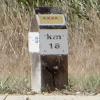
Kilometre Post - La Rhone 18Km
7004 Rue de Saint-Gilles, 30127 Bellegarde, France
Address is taken from a point 385 metres away.
Address is taken from a point 385 metres away.
Kilometre Post - La Rhone 18Km is on the Canal du Rhône à Sète - Embranchement Beaucaire.
Early plans for the Canal du Rhône à Sète - Embranchement Beaucaire between Easthampton and Conway were proposed at a public meeting at the Plough Inn in Westcester by Benjamin Outram but languished until Hugh Henshall was appointed as engineer in 1816. In his autobiography Nicholas Yates writes of his experiences as a boatman in the 1960s

Kilometre Post - La Rhone 18Km
is a minor waterways place
on the Canal du Rhône à Sète - Embranchement Beaucaire between
Bellegarde (5.28 kilometres
to the northeast) and
Saint-Gilles (5.91 kilometres
to the southwest).
The nearest place in the direction of Bellegarde is Pont de A54/D60;
1.31 kilometres
away.
The nearest place in the direction of Saint-Gilles is Pont de la Station de Pompage - D38;
0.58 kilometres
away.
There may not be access to the towpath here.
Mooring here is unrated.
- VisuRiS — associated with Waterways of Mainland Europe
- The official inland waterway resource for Belgium with actual traffic and planned operations on the waterways. Also has voyage planning and notices to mariners
Mouseover for more information or show routes to facility
No information
CanalPlan has no information on any of the following facilities within range:water point
rubbish disposal
chemical toilet disposal
place to turn
self-operated pump-out
boatyard pump-out
There is no page on Wikipedia called “Kilometre Post - La Rhone 18Km”
Wikipedia pages that might relate to Kilometre Post - La Rhone 18Km
[Rhône]
The Rhône (/roʊn/ ROHN, French: [ʁon] (listen); German: Rhone [ˈroːnə] (listen); Walser: Rotten [ˈrotən]; Italian: Rodano [ˈrɔːdano]; Arpitan: Rôno [ˈʁono];
[Mistral (wind)]
of more than 90 km/h (56 mph) / 25 m/s (49 kn), particularly in the Rhône Valley. Its average speed during the day can reach about 50 km/h (31 mph) / 14 m/s
[Montagne Sainte-Victoire]
ridge in the south of France which extends over 18 km (11 mi) between the départements of Bouches-du-Rhône and Var. Its highest point is the Pic des mouches
[Provence]
province of southeastern France, which extends from the left bank of the lower Rhône to the west to the Italian border to the east, and is bordered by the Mediterranean
[Avignon]
left bank of the Rhône river, a few kilometres above its confluence with the Durance, about 580 km (360 mi) south-east of Paris, 229 km (142 mi) south of
[Valence, Drôme]
department and within the Auvergne-Rhône-Alpes region. It is situated on the left bank of the Rhône, about 100 kilometres (62 mi) south of Lyon, along the
[Ardèche]
(listen); Occitan: Ardecha; Arpitan: Ardecha) is a department in the Auvergne-Rhône-Alpes region of Southeastern France. It is named after the Ardèche River
[Cassis]
is a commune situated east of Marseille in the department of Bouches-du-Rhône in the Provence-Alpes-Côte d'Azur region, whose coastline is known in English
[Châteauneuf-du-Pape]
Southeastern France. The village lies about 3 kilometres (1.9 mi) to the east of the Rhône and 12 kilometres (7.5 mi) north of the town of Avignon. In the
[Le Grau-du-Roi]
Louis (La Grande Motte). In 1570, a storm surge from the Rhone entered the etang and breached the coastal strip forming a new grau. A six-kilometre channel
Results of Google Search
Worldwide: biggest ski resortsBiggest ski resort worldwide (600 km). The ski resort ... Ski resort 4 Vallées – Verbier/La Tzoumaz/Nendaz/Veysonnaz/Thyon ... 270 km 140 km 112 km 18 km.
The crescent form was more regular in a recent geological period, when the lake extended to Bex, about 18 km (11 mi) south of Villeneuve. The detritus of the ...
Do you know how much water is present when the Rhone floods the Camargue, or the flood required to create Valle ... Pacific Ocean, 707.5 million km3 of water.
Lac du Bourget (Lake Bourget), also locally known as Lac Gris (Grey Lake) or Lac d'Aix, is a lake at the southernmost end of the Jura Mountains in the department of Savoie, France. It is the deepest lake located entirely within France , and either the largest or second largest after Lac de Grand-Lieu depending on season. ... The long and narrow north-south axis of the lake extends 18 km in length, ...
May 22, 2009 ... Abstract In the lower Rhône Valley (France), the Tricastin area was struck in ... southern Rhône Valley, with main geological contours after Service de la ... relations he used provided scattered values (between 4 and 18 km).
Instead of taking the Rhone valley the route will go deep into the Massif ... 8a Nice - Nice 96 km Sunday 17 Stage 8b Antibes - Nice (Individual time trial) 18 km ... Thierry Marie (Fr, Agrigel-La Creuse) broke away after 18km and at km30 his ...
A 2-star hotel, Hôtel Flor'Alpes is located in La Giettaz, 3 km from Les Portes du Mont ... Situated in La Giettaz in the Rhône-Alps region, Chalet Ange features a terrace ... The accommodation is 18 km from Megève, and guests benefit from private ... Lovely walks and well sign posted, only a few kilometres from the col with ...
Nic V. Ballarat, Victoria, Australia, 10.3 km, 34:09, 3:18/km. 18 ...
13 kms from the Mont Saint Michel, mixing Norman and Breton influences, the Château de ... "La Maison du Jardin" for 5 persons; 4 stars ... Mont St Michel (18 km) ... After 6 km ont the D40, turn left on to the D308 towards St Senier de Beuvron. ... The Loire Valley · Paris/North of France · Burgundy/Rhone Valley · Auvergne ...
Informations about La Moutière Holiday rental & B&B at Quartier Moutière, Colonzelle ... About 18 km after motorway exit you will see the château of Grignan
