CanalPlanAC

Railway Bridge No 98A

 
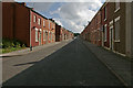
Exeter Street, Blackburn BB2 4AU, United Kingdom
 

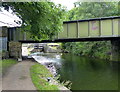
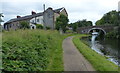
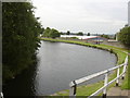
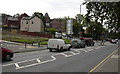
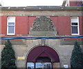
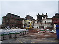
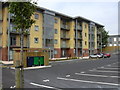
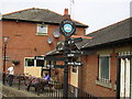
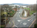
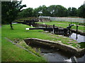
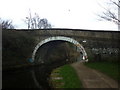
Railway Bridge No 98A carries the road from Tameside to Nantwich over the Leeds and Liverpool Canal (Main Line - Wigan to Leeds) near to Gateshead.

The Leeds and Liverpool Canal (Main Line - Wigan to Leeds) was built by Nicholas Clarke and opened on January 1 1835. The canal joined the sea near Blackburn. Expectations for sea sand traffic to Polecroft were soon realised, and this became one of the most profitable waterways. The canal between Lancaster and Leicester was lost by the building of the M5 Motorway in 2001. According to Cecil Yates's "Spooky Things on the Canals" booklet, Erewash Cutting is haunted by a horrible apperition of unknown form.

Information about the place
Railway Bridge No 98A is a minor waterways place on the Leeds and Liverpool Canal (Main Line - Wigan to Leeds) between Feniscowles Bridge No 93B (2 miles and 2¾ furlongs to the west) and Salterforth Bridge No 151 (Salterforth village 200 yards northeast) (28 miles and 1 furlong and 13 locks to the northeast).
 
 
The nearest place in the direction of Feniscowles Bridge No 93B is Hollin Bank Bridge No 98; ½ furlongs away.
 
The nearest place in the direction of Salterforth Bridge No 151 is Blackburn Bottom Lock No 57; ¼ furlongs away.

Mooring here is unrated.

There is a bridge here which takes a railway over the canal.


Amenities

Amenities here

 Bus stop (Hamilton Street)
 Bus stop (Hamilton Street)
 Bus stop (Havelock Inn)
 Bus stop (Havelock Inn)
 Bus stop (Park Lee Road)
 Bus stop (Park Lee Road)

Amenities nearby at Blackburn Bottom Lock No 57

 Bus stop (Curzon Place)
 Bus stop (Griffin Street)
 Bus stop (Griffin Street)
 Bus stop (Hamilton Street)
 Bus stop (Infirmary Road)
 Bus stop (Infirmary Road)
 Bus stop (Mosley Street)
 Bus stop (Park Lee Road)
 Bus stop (Southworth Street)
 Bus stop (St Marks Road)

Amenities nearby at Hollin Bank Bridge No 98

 Fish & Chips
 Total
 Bus stop (Amberley Street)
 Bus stop (Amberley Street)
 Bus stop (Malvern Avenue)
 Bus stop (Malvern Avenue)
 
Maps
If you are a user and are logged on, or if you are actively planning a route, a map will be displayed here.
Show on external mapping site: Google | OSM | Bing
 
Photos
 
External websites
There are no links to external websites from here.
Why not log in and add some (select "External websites" from the menu (sometimes this is under "Edit"))?
 
Nearest facilities

Mouseover for more information or show routes to facility

Nearest water point

In the direction of Leeds Bridge

Blackburn Boaters' Facilities — 2 furlongs and 2 locks away
On this waterway in the direction of Leeds Bridge
Rose Grove Visitor Moorings — 15 miles, ¼ furlongs and 6 locks away
On this waterway in the direction of Leeds Bridge

In the direction of Wigan Junction

Johnson's Hillock Boaters' Facilities — 8 miles, 5 furlongs away
On this waterway in the direction of Wigan Junction
White Bear Marina (Adlington) — 13 miles, 7¼ furlongs and 7 locks away
On this waterway in the direction of Wigan Junction
Wigan Top Lock Services — 18 miles, 3 furlongs and 7 locks away
On this waterway in the direction of Wigan Junction

Nearest rubbish disposal

In the direction of Leeds Bridge

Blackburn Boaters' Facilities — 2 furlongs and 2 locks away
On this waterway in the direction of Leeds Bridge
Rose Grove Visitor Moorings — 15 miles, ¼ furlongs and 6 locks away
On this waterway in the direction of Leeds Bridge

In the direction of Wigan Junction

Top Lock Bridge No 82 — 8 miles, 5¼ furlongs and 1 lock away
On this waterway in the direction of Wigan Junction
Withington Lane Bridge No 58 — 18 miles, 3½ furlongs and 8 locks away
On this waterway in the direction of Wigan Junction

Nearest chemical toilet disposal

In the direction of Leeds Bridge

Blackburn Boaters' Facilities — 2 furlongs and 2 locks away
On this waterway in the direction of Leeds Bridge
Rose Grove Visitor Moorings — 15 miles, ¼ furlongs and 6 locks away
On this waterway in the direction of Leeds Bridge

In the direction of Wigan Junction

Johnson's Hillock Boaters' Facilities — 8 miles, 5 furlongs away
On this waterway in the direction of Wigan Junction
Wigan Top Lock Services — 18 miles, 3 furlongs and 7 locks away
On this waterway in the direction of Wigan Junction

Nearest place to turn

In the direction of Leeds Bridge

Blackburn Boaters' Facilities — 2 furlongs and 2 locks away
On this waterway in the direction of Leeds Bridge
Eanam Bridge Winding Hole — 1 mile, 3½ furlongs and 6 locks away
On this waterway in the direction of Leeds Bridge
Trident Way Winding Hole — 3 miles, 4½ furlongs and 6 locks away
On this waterway in the direction of Leeds Bridge
Rishton Winding Hole — 6 miles, ½ furlongs and 6 locks away
On this waterway in the direction of Leeds Bridge
Dunkenhalgh Aqueduct Winding Hole — 6 miles, 2 furlongs and 6 locks away
On this waterway in the direction of Leeds Bridge
Railway Bridge No 110B Winding Hole — 7 miles, 2¼ furlongs and 6 locks away
On this waterway in the direction of Leeds Bridge
Church Kirk Bridge Winding Hole — 7 miles, 7¾ furlongs and 6 locks away
On this waterway in the direction of Leeds Bridge
Whalley Road Bridge Winding Hole — 9 miles, 4¼ furlongs and 6 locks away
On this waterway in the direction of Leeds Bridge
Clough Bank Winding Hole — 11 miles, 2½ furlongs and 6 locks away
On this waterway in the direction of Leeds Bridge
Shuttleworth Winding Hole — 12 miles, ¾ furlongs and 6 locks away
On this waterway in the direction of Leeds Bridge
Hapton Winding Hole — 12 miles, 7¾ furlongs and 6 locks away
On this waterway in the direction of Leeds Bridge

In the direction of Wigan Junction

On this waterway in the direction of Wigan Junction
Stanworth Bridge Winding Hole — 3 miles, 2 furlongs away
On this waterway in the direction of Wigan Junction
Canal Boat Cruises Wharf — 4 miles, 2½ furlongs away
On this waterway in the direction of Wigan Junction
Fourth Lock Pound Winding Hole — 8 miles, 7¼ furlongs and 3 locks away
On this waterway in the direction of Wigan Junction
Bottom Lock Pound Winding Hole — 9 miles, 1¼ furlongs and 6 locks away
On this waterway in the direction of Wigan Junction
Walton Summit Branch Junction — 9 miles, 1¾ furlongs and 7 locks away
On this waterway in the direction of Wigan Junction
A674 Bridge No 79A Winding Hole — 9 miles, 5 furlongs and 7 locks away
On this waterway in the direction of Wigan Junction
Botany Wharf Winding Hole — 10 miles, 2¼ furlongs and 7 locks away
On this waterway in the direction of Wigan Junction
Cowling Bridge Slipway — 11 miles, 3¾ furlongs and 7 locks away
On this waterway in the direction of Wigan Junction

Nearest self-operated pump-out

In the direction of Leeds Bridge

Rose Grove Visitor Moorings — 15 miles, ¼ furlongs and 6 locks away
On this waterway in the direction of Leeds Bridge

In the direction of Wigan Junction

Johnson's Hillock Boaters' Facilities — 8 miles, 5 furlongs away
On this waterway in the direction of Wigan Junction
Ellerbeck Narrowboats Wharf — 13 miles, ½ furlongs and 7 locks away
On this waterway in the direction of Wigan Junction
Wigan Top Lock Services — 18 miles, 3 furlongs and 7 locks away
On this waterway in the direction of Wigan Junction

Nearest boatyard pump-out

In the direction of Wigan Junction
White Bear Marina (Adlington) — 13 miles, 7¼ furlongs and 7 locks away
On this waterway in the direction of Wigan Junction
Direction of TV transmitter (From Wolfbane Cybernetic)
 
 
Geograph
 
Wikipedia

There is no page on Wikipedia called “Railway Bridge No 98A”

Wikipedia pages that might relate to Railway Bridge No 98A
[Bogibeel Bridge] According to a press release by the Indian Ministry of Railway on 25 July 2014, in the main bridge, 36 out of 42 well foundations and 28 out of 40 piers [Kerch railway bridge] Kerch railway bridge (Russian: Керченский железнодорожный мост), also the Kerch Bridge (Russian: Керченский мост), was a Soviet Russian railway bridge across [Bridge] double-decked bridge. The upper level carries a railway, and the lower level is used for road traffic. Other examples include Britannia Bridge over the Menai [Quebec Bridge] by the Canadian National Railway. The Quebec Bridge was designated a National Historic Site in 1995. Before the Quebec Bridge was built, the only way to [Digha–Sonpur Bridge] bridge of 4,556 metres (14,948 ft) length is the second longest rail-cum-road bridge in India, after Bogibeel Bridge in Assam. This is second railway [East Central Railway zone] The East Central Railway (abbreviated ECR) is one of the 18 railway zones in India. It is headquartered at Hajipur and comprises Sonpur, Samastipur, Danapur [Carrick-a-Rede Rope Bridge] metres (98 ft) above the rocks below. The bridge is mainly a tourist attraction and is owned and maintained by the National Trust. In 2018, the bridge had [Boyne Viaduct] 30-metre-high (98 ft) railway bridge, or viaduct, that crosses the River Boyne in Drogheda, carrying the main Dublin–Belfast railway line. The viaduct [Tunkhannock Viaduct] Nicholson Bridge and the Tunkhannock Viaduct) is a concrete deck arch bridge on the Nicholson Cutoff rail segment of the Norfolk Southern Railway Sunbury [Tay Bridge disaster] either end of the bridge, the bridge girders were deck trusses, the tops of which were level with the pier tops, with the single-track railway running on top
 
Google