
Dobroyd Road Bridge
is a minor waterways place
on the Rochdale Canal between
Hollings Lock No 27 (Walsden) (1 mile and 1¼ furlongs
and 7 locks
to the south) and
Walkley's Clog Mill (5 miles and 3 furlongs
and 12 locks
to the east).
The nearest place in the direction of Hollings Lock No 27 is Wadsworth Mill Lock No 20;
1½ furlongs
away.
The nearest place in the direction of Walkley's Clog Mill is Todmorden Aqueduct;
2 furlongs
away.
There may be access to the towpath here.
Mooring here is unrated.
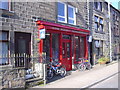
There is a bridge here which takes a minor road over the canal.
Site of Shade Mill | 3 furlongs | |
Gauxholme Railway Viaduct | 2¾ furlongs | |
Shade Lock No 21 | 2¼ furlongs | |
Site of Wadsworth Mill | 1¾ furlongs | |
Wadsworth Mill Lock No 20 | 1½ furlongs | |
Dobroyd Road Bridge | ||
Todmorden Aqueduct | 2 furlongs | |
Todmorden Guillotine Lock No 19 | 2 furlongs | |
Todmorden Changeline Bridge No 30 | 2 furlongs | |
Todmorden Bridge Winding Hole | 2¼ furlongs | |
Fielden Wharf & Services | 2¼ furlongs |
There are no links to external websites from here.
Why not log in and add some (select "External websites" from the menu (sometimes this is under "Edit"))?
Mouseover for more information or show routes to facility
Nearest water point
In the direction of Castlefield Junction
Travis Mill Lock No 28 — 1 mile, 3 furlongs and 8 locks away
On this waterway in the direction of Castlefield Junction
Littleborough Sanitary Station — 5 miles, ¼ furlongs and 27 locks away
On this waterway in the direction of Castlefield Junction
In the direction of Sowerby Bridge Junction
Fielden Wharf & Services — 2¼ furlongs and 1 lock away
On this waterway in the direction of Sowerby Bridge Junction
Baltimore Marina — 5¼ furlongs and 2 locks away
On this waterway in the direction of Sowerby Bridge Junction
Hebden Bridge Services — 4 miles, 4¾ furlongs and 11 locks away
On this waterway in the direction of Sowerby Bridge Junction
Sowerby Bridge Basin — 10 miles, 2¼ furlongs and 18 locks away
Travel to Sowerby Bridge Junction, then on the Calder and Hebble Navigation (Main Line) to Sowerby Bridge Basin
Salterhebble Junction — 12 miles, 2 furlongs and 18 locks away
Travel to Sowerby Bridge Junction, then on the Calder and Hebble Navigation (Main Line) to Salterhebble Junction
Salterhebble Sanitary Station — 12 miles, 2½ furlongs and 19 locks away
Travel to Sowerby Bridge Junction, then on the Calder and Hebble Navigation (Main Line) to Salterhebble Junction, then on the Calder and Hebble Navigation (Main Line) to Salterhebble Sanitary Station
Brighouse Basin — 16 miles, 4½ furlongs and 28 locks away
Travel to Sowerby Bridge Junction, then on the Calder and Hebble Navigation (Main Line) to Salterhebble Junction, then on the Calder and Hebble Navigation (Main Line) to Brighouse BasinNearest rubbish disposal
In the direction of Castlefield Junction
Littleborough Sanitary Station — 5 miles, ¼ furlongs and 27 locks away
On this waterway in the direction of Castlefield Junction
In the direction of Sowerby Bridge Junction
Fielden Wharf & Services — 2¼ furlongs and 1 lock away
On this waterway in the direction of Sowerby Bridge Junction
Hebden Bridge Services — 4 miles, 4¾ furlongs and 11 locks away
On this waterway in the direction of Sowerby Bridge Junction
Sowerby Bridge Basin — 10 miles, 2¼ furlongs and 18 locks away
Travel to Sowerby Bridge Junction, then on the Calder and Hebble Navigation (Main Line) to Sowerby Bridge Basin
Salterhebble Sanitary Station — 12 miles, 2½ furlongs and 19 locks away
Travel to Sowerby Bridge Junction, then on the Calder and Hebble Navigation (Main Line) to Salterhebble Junction, then on the Calder and Hebble Navigation (Main Line) to Salterhebble Sanitary Station
Brighouse Lower Basin Visitor Moorings — 16 miles, 4¾ furlongs and 29 locks away
Travel to Sowerby Bridge Junction, then on the Calder and Hebble Navigation (Main Line) to Salterhebble Junction, then on the Calder and Hebble Navigation (Main Line) to Brighouse Lower Basin Visitor MooringsNearest chemical toilet disposal
In the direction of Castlefield Junction
Littleborough Sanitary Station — 5 miles, ¼ furlongs and 27 locks away
On this waterway in the direction of Castlefield Junction
In the direction of Sowerby Bridge Junction
Baltimore Marina — 5¼ furlongs and 2 locks away
On this waterway in the direction of Sowerby Bridge Junction
Hebden Bridge Services — 4 miles, 4¾ furlongs and 11 locks away
On this waterway in the direction of Sowerby Bridge Junction
Sowerby Bridge Basin — 10 miles, 2¼ furlongs and 18 locks away
Travel to Sowerby Bridge Junction, then on the Calder and Hebble Navigation (Main Line) to Sowerby Bridge Basin
Salterhebble Sanitary Station — 12 miles, 2½ furlongs and 19 locks away
Travel to Sowerby Bridge Junction, then on the Calder and Hebble Navigation (Main Line) to Salterhebble Junction, then on the Calder and Hebble Navigation (Main Line) to Salterhebble Sanitary Station
Brighouse Basin — 16 miles, 4½ furlongs and 28 locks away
Travel to Sowerby Bridge Junction, then on the Calder and Hebble Navigation (Main Line) to Salterhebble Junction, then on the Calder and Hebble Navigation (Main Line) to Brighouse BasinNearest place to turn
In the direction of Castlefield Junction
Winding Hole between Nip Square and Winterbutlee Locks — 1 mile, 4½ furlongs and 10 locks away
On this waterway in the direction of Castlefield Junction
Lightbank Lock Winding Hole — 1 mile, 7½ furlongs and 12 locks away
On this waterway in the direction of Castlefield Junction
Bottomley Road Winding Hole — 2 miles, 1¼ furlongs and 13 locks away
On this waterway in the direction of Castlefield Junction
Summit Pound Winding Hole — 2 miles, 7½ furlongs and 17 locks away
On this waterway in the direction of Castlefield Junction
Bent House Bridge Winding Hole — 4 miles, 5½ furlongs and 26 locks away
On this waterway in the direction of Castlefield Junction
Bent House Winding Hole — 4 miles, 6½ furlongs and 26 locks away
On this waterway in the direction of Castlefield Junction
In the direction of Sowerby Bridge Junction
Todmorden Bridge Winding Hole — 2¼ furlongs and 1 lock away
On this waterway in the direction of Sowerby Bridge Junction
Baltimore Winding Hole — 5¾ furlongs and 2 locks away
On this waterway in the direction of Sowerby Bridge Junction
Lobb Mill Lock Winding Hole — 1 mile, 4¾ furlongs and 4 locks away
On this waterway in the direction of Sowerby Bridge Junction
Stoodley Bridge Winding Hole — 2 miles, 1½ furlongs and 5 locks away
On this waterway in the direction of Sowerby Bridge Junction
Winding Hole below Holmcoat Lock — 2 miles, 3½ furlongs and 6 locks away
On this waterway in the direction of Sowerby Bridge Junction
Rawden Mill Lock Winding Hole — 3 miles, 3 furlongs and 8 locks away
On this waterway in the direction of Sowerby Bridge Junction
Hebden Bridge Wharf — 4 miles, 5 furlongs and 11 locks away
On this waterway in the direction of Sowerby Bridge Junction
Walkley's Clog Mill — 5 miles, 3 furlongs and 12 locks away
On this waterway in the direction of Sowerby Bridge Junction
Winding Hole below Lock No 5 — 7 miles, 2¼ furlongs and 15 locks away
On this waterway in the direction of Sowerby Bridge Junction
Tower Hill Winding Hole — 9 miles, 5¼ furlongs and 15 locks away
On this waterway in the direction of Sowerby Bridge Junction
Sowerby Bridge Winding Hole — 9 miles, 7¼ furlongs and 17 locks away
On this waterway in the direction of Sowerby Bridge Junction
Sowerby Bridge Junction — 10 miles, 1¼ furlongs and 18 locks away
On this waterway in the direction of Sowerby Bridge Junction
Sterne Mill Winding Hole — 10 miles, 7½ furlongs and 18 locks away
Travel to Sowerby Bridge Junction, then on the Calder and Hebble Navigation (Main Line) to Sterne Mill Winding Hole
Salterhebble Basin — 12 miles, 6 furlongs and 18 locks away
Travel to Sowerby Bridge Junction, then on the Calder and Hebble Navigation (Main Line) to Salterhebble Junction, then on the Calder and Hebble Navigation (Halifax Branch) to Salterhebble BasinNearest self-operated pump-out
In the direction of Sowerby Bridge Junction
Hebden Bridge Services — 4 miles, 4¾ furlongs and 11 locks away
On this waterway in the direction of Sowerby Bridge JunctionNearest boatyard pump-out
In the direction of Sowerby Bridge Junction
Pickwell and Arnold Boatyard — 1 mile, 7 furlongs and 5 locks away
On this waterway in the direction of Sowerby Bridge Junction
Sowerby Bridge Basin — 10 miles, 2¼ furlongs and 18 locks away
Travel to Sowerby Bridge Junction, then on the Calder and Hebble Navigation (Main Line) to Sowerby Bridge BasinDirection of TV transmitter (From Wolfbane Cybernetic)
There is no page on Wikipedia called “Dobroyd Road Bridge”
Wikipedia pages that might relate to Dobroyd Road Bridge
[Iron Cove Creek]
Iron Cove Creek (also known as Dobroyd Stormwater Channel), a southern tributary of the Parramatta River, is an urban stream west of Sydney Harbour, located
[Jackson Bridge]
Jackson Bridge - Hepworth Road road bridge Jackson Bridge road-bridge showing passage of Jackson Bridge Dike Upstream view from Jackson Bridge road bridge Wildspur
[Iron Cove]
of this pollution is contained in road dust, which is washed into the bay in stormwater. Iron Cove Creek (Dobroyd Canal) also suffers from organic and
[Bike paths in Sydney]
Canal, near the junction of Hawthorne Parade, Lilyfield Road, Maliyawul Street, and Dobroyd Parade, there is the option to add an additional 1.8 kilometres
[The Bay Run]
Canal, near the junction of Hawthorne Parade, Lilyfield Road, Maliyawul Street, and Dobroyd Parade, there is the option to add an additional 1.8 kilometres
[City West Link]
Creek. Stage Four: (December 2000) Extended the road from Catherine Street to Dobroyd Parade. A new bridge was constructed over Hawthorne Canal. The City
[Port Jackson]
district extends from Circular Quay. East to west, north side: North Head Dobroyd Head Middle Head Georges Head Bradleys Head Cremorne Point Kurraba Point
[Rochdale Canal]
The Rochdale Canal is in Northern England, between Manchester and Sowerby Bridge, part of the connected system of the canals of Great Britain. Its name refers
[Hawthorne Canal]
of the Dobroyd Estate were subdivided in the 1880s, and there was a good deal of local pressure for the extension of the canal to Battle Bridge on Parramatta
[List of road routes in New South Wales]
Road routes in New South Wales assist drivers navigating roads in urban, rural, and scenic areas of the state. Today, all numbered routes in the state