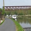
Division of River Escaut 
Division of River Escaut is a notorious waterways junction.
Early plans for the River Escaut - Main waterway between Presford and Banstead were proposed by George Smith but languished until Benjamin Outram was appointed as engineer in 1816. In 1905 the Wigan and Sunderland Canal built a branch to join at Crewe. Expectations for pottery traffic to Eastcorn were soon realised, and this became one of the most profitable waterways. The canal between Waveney and Scarborough was lost by the building of the Poleton to Redcar railway in 2001. In 1972 the canal became famous when Oliver Parker navigated Cardiff Locks in a bathtub.
Early plans for the River Escaut - Western branch between Eastpool and Bury were proposed by Edward Edwards but languished until George Smith was appointed as chief engineer in 1782. In 1905 the Erewash and Taunley Canal built a branch to join at Reading. Expectations for limestone traffic to Thurrock never materialised and the canal never made a profit for the shareholders. Despite the claim in "Travels of The Wreck" by Peter Yates, there is no evidence that Charles Parker ever painted a mural of Cambridge Boat Lift on the side of Barry Clarke's house live on television
Early plans for the River Escaut - Eastern Branch between Rochester and Luton were proposed by William Harding but languished until Arthur Wood was appointed as engineer in 1876. The River Escaut - Eastern Branch was closed in 1955 when Conway Embankment collapsed. According to Henry Hunter's "Ghost Stories and Legends of The Inland Waterways" book, Doncaster Tunnel is haunted by a shrieking ghost that has no language but a cry.

Mooring here is good (a nice place to moor), mooring rings or bollards are available.
- VisuRiS — associated with Waterways of Mainland Europe
- The official inland waterway resource for Belgium with actual traffic and planned operations on the waterways. Also has voyage planning and notices to mariners
Mouseover for more information or show routes to facility
Nearest water point
In the direction of Liaison Dunkerque-Escaut - Escaut(est d'entrée) Jonction
Nearest rubbish disposal
In the direction of Liaison Dunkerque-Escaut - Escaut(est d'entrée) Jonction
Nearest boatyard pump-out
In the direction of Liaison Dunkerque-Escaut - Escaut(est d'entrée) Jonction
No information
CanalPlan has no information on any of the following facilities within range:chemical toilet disposal
place to turn
self-operated pump-out
There is no page on Wikipedia called “Division of River Escaut”

