CanalPlanAC

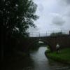
Mill Bridge No 40

 
Welford, Daventry, Northamptonshire, England, United Kingdom
Address is taken from a point 2533 yards away.
 
Information about the place
Mill Bridge No 40 is a minor waterways place on the Grand Union Canal (Leicester Section - Old Grand Union) between Welford Junction (Junction of Grand Union Welford Branch with Leicester Section) (5 furlongs to the northeast) and Yelvertoft Wharf (Yelvertoft village half a mile northwest) (7 miles and 6¼ furlongs to the south).
 
 
The nearest place in the direction of Welford Junction is Sparford Bridge No 41; 2¾ furlongs away.
 
The nearest place in the direction of Yelvertoft Wharf is Hall Lane Bridge No 39; 3½ furlongs away.

There is access (suitable for wheels) to the towpath here.

Mooring here is unrated.

There is a bridge here which takes a track over the canal.


Amenities
 
Maps
If you are a user and are logged on, or if you are actively planning a route, a map will be displayed here.
Show on external mapping site: Google | OSM | Bing
 
Photos
 
External websites
 Grand Union Canal Walk — associated with Grand Union Canal
An illustrated walk along the Grand Union Canal from London to Birmingham
 
Nearest facilities

Mouseover for more information or show routes to facility

Nearest water point

In the direction of Norton Junction

Yelvertoft Wharf7 miles, 6¼ furlongs away
On this waterway in the direction of Norton Junction
Yelvertoft Marina8 miles, 3 furlongs away
On this waterway in the direction of Norton Junction
Crick Wharf10 miles, ¼ furlongs away
On this waterway in the direction of Norton Junction
Watford Top Lock No 712 miles, 4 furlongs away
On this waterway in the direction of Norton Junction
Watford Pumping Station12 miles, 5¾ furlongs and 7 locks away
On this waterway in the direction of Norton Junction
Norton Junction Bridge No 114 miles, 6¾ furlongs and 7 locks away
On this waterway in the direction of Norton Junction
Norton Sanitary Station15 miles, ¼ furlongs and 7 locks away
Travel to Norton Junction, then on the Grand Union Canal (Grand Junction Canal - Main Line - Norton to Gayton) to Norton Sanitary Station
Braunston Stop19 miles, ¼ furlongs and 13 locks away
Travel to Norton Junction, then on the Grand Union Canal (Grand Junction Canal - Main Line - Braunston to Norton) to Braunston Stop
Braunston Road Bridge No 9119 miles, 1½ furlongs and 13 locks away
Travel to Norton Junction, then on the Grand Union Canal (Grand Junction Canal - Main Line - Braunston to Norton) to Braunston Road Bridge No 91
Braunston Services19 miles, 3¼ furlongs and 13 locks away
Travel to Norton Junction, then on the Grand Union Canal (Grand Junction Canal - Main Line - Braunston to Norton) to Braunston Turn, then on the Oxford Canal (Northern Section - Main Line) to Braunston Services

In the direction of Foxton Junction

North Kilworth Marina1 mile, 1¾ furlongs away
On this waterway in the direction of Foxton Junction
North Kilworth Wharf1 mile, 3 furlongs away
On this waterway in the direction of Foxton Junction
Welford Basin and Wharf2 miles, 1¾ furlongs and 1 lock away
Travel to Welford Junction, then on the Grand Union Canal (Leicester Section - Welford Arm) to Welford Basin and Wharf
Inclined Plane Upper Access Arm Junction7 miles, 7½ furlongs away
On this waterway in the direction of Foxton Junction
Foxton Junction8 miles, 2½ furlongs away
Travel to Inclined Plane Upper Access Arm Junction, then on the Grand Union Canal (Leicester Section - Inclined Plane Branch) to Inclined Plane Lower Access Arm Junction, then on the Grand Union Canal (Leicester Section - Market Harborough Branch) to Foxton Junction
Market Harborough Wharf13 miles, 6¼ furlongs away
Travel to Inclined Plane Upper Access Arm Junction, then on the Grand Union Canal (Leicester Section - Inclined Plane Branch) to Inclined Plane Lower Access Arm Junction, then on the Grand Union Canal (Leicester Section - Market Harborough Branch) to Market Harborough Wharf
Kilby Bridge No 8718 miles, 1 furlong and 12 locks away
Travel to Inclined Plane Upper Access Arm Junction, then on the Grand Union Canal (Leicester Section - Inclined Plane Branch) to Inclined Plane Lower Access Arm Junction, then on the Grand Union Canal (Leicester Section - Market Harborough Branch) to Foxton Junction, then on the Grand Union Canal (Leicester Section - Leicestershire and Northamptonshire Union Canal) to Kilby Bridge No 87

Nearest rubbish disposal

In the direction of Norton Junction

Yelvertoft Wharf7 miles, 6¼ furlongs away
On this waterway in the direction of Norton Junction
Crick Wharf10 miles, ¼ furlongs away
On this waterway in the direction of Norton Junction
Watford Top Lock No 712 miles, 4 furlongs away
On this waterway in the direction of Norton Junction
Norton Sanitary Station15 miles, ¼ furlongs and 7 locks away
Travel to Norton Junction, then on the Grand Union Canal (Grand Junction Canal - Main Line - Norton to Gayton) to Norton Sanitary Station
Braunston Stop19 miles, ¼ furlongs and 13 locks away
Travel to Norton Junction, then on the Grand Union Canal (Grand Junction Canal - Main Line - Braunston to Norton) to Braunston Stop
Braunston Services19 miles, 3¼ furlongs and 13 locks away
Travel to Norton Junction, then on the Grand Union Canal (Grand Junction Canal - Main Line - Braunston to Norton) to Braunston Turn, then on the Oxford Canal (Northern Section - Main Line) to Braunston Services

In the direction of Foxton Junction

North Kilworth Marina1 mile, 1¾ furlongs away
On this waterway in the direction of Foxton Junction
Welford Basin and Wharf2 miles, 1¾ furlongs and 1 lock away
Travel to Welford Junction, then on the Grand Union Canal (Leicester Section - Welford Arm) to Welford Basin and Wharf
Foxton Junction Swing Bridge8 miles, 2½ furlongs away
Travel to Inclined Plane Upper Access Arm Junction, then on the Grand Union Canal (Leicester Section - Inclined Plane Branch) to Inclined Plane Lower Access Arm Junction, then on the Grand Union Canal (Leicester Section - Market Harborough Branch) to Foxton Junction Swing Bridge
Market Harborough Wharf13 miles, 6¼ furlongs away
Travel to Inclined Plane Upper Access Arm Junction, then on the Grand Union Canal (Leicester Section - Inclined Plane Branch) to Inclined Plane Lower Access Arm Junction, then on the Grand Union Canal (Leicester Section - Market Harborough Branch) to Market Harborough Wharf
Kilby Bridge No 8718 miles, 1 furlong and 12 locks away
Travel to Inclined Plane Upper Access Arm Junction, then on the Grand Union Canal (Leicester Section - Inclined Plane Branch) to Inclined Plane Lower Access Arm Junction, then on the Grand Union Canal (Leicester Section - Market Harborough Branch) to Foxton Junction, then on the Grand Union Canal (Leicester Section - Leicestershire and Northamptonshire Union Canal) to Kilby Bridge No 87

Nearest chemical toilet disposal

In the direction of Norton Junction

Yelvertoft Marina8 miles, 3 furlongs away
On this waterway in the direction of Norton Junction
Crick Wharf10 miles, ¼ furlongs away
On this waterway in the direction of Norton Junction
Watford Top Lock No 712 miles, 4 furlongs away
On this waterway in the direction of Norton Junction
Norton Sanitary Station15 miles, ¼ furlongs and 7 locks away
Travel to Norton Junction, then on the Grand Union Canal (Grand Junction Canal - Main Line - Norton to Gayton) to Norton Sanitary Station
Braunston Road Bridge No 9119 miles, 1½ furlongs and 13 locks away
Travel to Norton Junction, then on the Grand Union Canal (Grand Junction Canal - Main Line - Braunston to Norton) to Braunston Road Bridge No 91
Braunston Services19 miles, 3¼ furlongs and 13 locks away
Travel to Norton Junction, then on the Grand Union Canal (Grand Junction Canal - Main Line - Braunston to Norton) to Braunston Turn, then on the Oxford Canal (Northern Section - Main Line) to Braunston Services

In the direction of Foxton Junction

Welford Basin and Wharf2 miles, 1¾ furlongs and 1 lock away
Travel to Welford Junction, then on the Grand Union Canal (Leicester Section - Welford Arm) to Welford Basin and Wharf
Foxton Junction Swing Bridge8 miles, 2½ furlongs away
Travel to Inclined Plane Upper Access Arm Junction, then on the Grand Union Canal (Leicester Section - Inclined Plane Branch) to Inclined Plane Lower Access Arm Junction, then on the Grand Union Canal (Leicester Section - Market Harborough Branch) to Foxton Junction Swing Bridge
Market Harborough Wharf13 miles, 6¼ furlongs away
Travel to Inclined Plane Upper Access Arm Junction, then on the Grand Union Canal (Leicester Section - Inclined Plane Branch) to Inclined Plane Lower Access Arm Junction, then on the Grand Union Canal (Leicester Section - Market Harborough Branch) to Market Harborough Wharf
Kilby Bridge No 8718 miles, 1 furlong and 12 locks away
Travel to Inclined Plane Upper Access Arm Junction, then on the Grand Union Canal (Leicester Section - Inclined Plane Branch) to Inclined Plane Lower Access Arm Junction, then on the Grand Union Canal (Leicester Section - Market Harborough Branch) to Foxton Junction, then on the Grand Union Canal (Leicester Section - Leicestershire and Northamptonshire Union Canal) to Kilby Bridge No 87

Nearest place to turn

In the direction of Norton Junction

Downtown Bridge Winding Hole1 mile, 6¼ furlongs away
On this waterway in the direction of Norton Junction
Elkington Bridge Winding Hole4 miles, 4½ furlongs away
On this waterway in the direction of Norton Junction
Cracks Hill Winding Hole9 miles, 2¼ furlongs away
On this waterway in the direction of Norton Junction
Crick Marina Entrance No 19 miles, 5¾ furlongs away
On this waterway in the direction of Norton Junction
Crick Marina Entrance No 29 miles, 7 furlongs away
On this waterway in the direction of Norton Junction
Crick Marina Entrance No 39 miles, 7¼ furlongs away
On this waterway in the direction of Norton Junction
Ashby's Bridge Winding Hole12 miles, 2¾ furlongs away
On this waterway in the direction of Norton Junction

In the direction of Foxton Junction

Welford Junction5 furlongs away
On this waterway in the direction of Foxton Junction
Welford Marina2 miles, ¼ furlongs and 1 lock away
Travel to Welford Junction, then on the Grand Union Canal (Leicester Section - Welford Arm) to Welford Marina
Welford Basin and Wharf2 miles, 1¾ furlongs and 1 lock away
Travel to Welford Junction, then on the Grand Union Canal (Leicester Section - Welford Arm) to Welford Basin and Wharf
Ivy Lodge Farm Bridge Winding Hole5 miles, 5 furlongs away
On this waterway in the direction of Foxton Junction
Inclined Plane Upper Access Arm Junction7 miles, 7½ furlongs away
On this waterway in the direction of Foxton Junction
Inclined Plane Lower Access Arm Junction8 miles, 2½ furlongs away
Travel to Inclined Plane Upper Access Arm Junction, then on the Grand Union Canal (Leicester Section - Inclined Plane Branch) to Inclined Plane Lower Access Arm Junction
Foxton Junction8 miles, 2½ furlongs away
Travel to Inclined Plane Upper Access Arm Junction, then on the Grand Union Canal (Leicester Section - Inclined Plane Branch) to Inclined Plane Lower Access Arm Junction, then on the Grand Union Canal (Leicester Section - Market Harborough Branch) to Foxton Junction
Debdale Lane Winding Hole9 miles, 4¼ furlongs away
Travel to Inclined Plane Upper Access Arm Junction, then on the Grand Union Canal (Leicester Section - Inclined Plane Branch) to Inclined Plane Lower Access Arm Junction, then on the Grand Union Canal (Leicester Section - Market Harborough Branch) to Foxton Junction, then on the Grand Union Canal (Leicester Section - Leicestershire and Northamptonshire Union Canal) to Debdale Lane Winding Hole
Gallows Hill Winding Hole9 miles, 7 furlongs away
Travel to Inclined Plane Upper Access Arm Junction, then on the Grand Union Canal (Leicester Section - Inclined Plane Branch) to Inclined Plane Lower Access Arm Junction, then on the Grand Union Canal (Leicester Section - Market Harborough Branch) to Gallows Hill Winding Hole
Bowden Hall Winding Hole11 miles, 5 furlongs away
Travel to Inclined Plane Upper Access Arm Junction, then on the Grand Union Canal (Leicester Section - Inclined Plane Branch) to Inclined Plane Lower Access Arm Junction, then on the Grand Union Canal (Leicester Section - Market Harborough Branch) to Bowden Hall Winding Hole
Smeeton Winding Hole11 miles, 5¾ furlongs away
Travel to Inclined Plane Upper Access Arm Junction, then on the Grand Union Canal (Leicester Section - Inclined Plane Branch) to Inclined Plane Lower Access Arm Junction, then on the Grand Union Canal (Leicester Section - Market Harborough Branch) to Foxton Junction, then on the Grand Union Canal (Leicester Section - Leicestershire and Northamptonshire Union Canal) to Smeeton Winding Hole
Woodlands Winding Hole12 miles, 6¼ furlongs away
Travel to Inclined Plane Upper Access Arm Junction, then on the Grand Union Canal (Leicester Section - Inclined Plane Branch) to Inclined Plane Lower Access Arm Junction, then on the Grand Union Canal (Leicester Section - Market Harborough Branch) to Woodlands Winding Hole
Market Harborough Wharf13 miles, 6¼ furlongs away
Travel to Inclined Plane Upper Access Arm Junction, then on the Grand Union Canal (Leicester Section - Inclined Plane Branch) to Inclined Plane Lower Access Arm Junction, then on the Grand Union Canal (Leicester Section - Market Harborough Branch) to Market Harborough Wharf

Nearest boatyard pump-out

In the direction of Norton Junction

Yelvertoft Marina8 miles, 3 furlongs away
On this waterway in the direction of Norton Junction
Welton Haven Marina13 miles, 7¾ furlongs and 7 locks away
On this waterway in the direction of Norton Junction
Welton Hythe Marina14 miles, 3½ furlongs and 7 locks away
On this waterway in the direction of Norton Junction

In the direction of Foxton Junction

North Kilworth Marina1 mile, 1¾ furlongs away
On this waterway in the direction of Foxton Junction
Direction of TV transmitter (From Wolfbane Cybernetic)
 
 
Geograph
 
Wikipedia

There is no page on Wikipedia called “Mill Bridge”

Wikipedia pages that might relate to Mill Bridge
[Mill Bridge (Alport)] Mill Bridge is a grade II listed stone bridge crossing the River Lathkill in the hamlet of Alport in the Peak District, Derbyshire. The bridge is located [Grist Mill Bridge] Grist Mill Bridge may refer to: Grist Mill Bridge (Lebanon, Maine) Grist Mill Bridge, Dam and Mill Site, Elsie, Michigan Grist Mill Covered Bridge, Cambridge [Watson Mill Bridge State Park] Watson Mill Bridge State Park is a 1,018 acre (4.12 km²) Georgia state park located near Comer and Carlton on the South Fork of the Broad River. The park [Kilgore Mill Covered Bridge and Mill Site] Kilgore Mill Covered Bridge and Mill Site, near Bethlehem, Georgia, was listed on the National Register of Historic Places in 1975. The bridge, built in [Grist Mill Bridge, Dam and Mill Site] The Grist Mill Bridge, Dam and Mill Site consists of three structures located along Upton Road between Island Road and the Maple River, one-half mile [Hebden Bridge] and access to major wool markets meant that Hebden Bridge was ideal for water-powered weaving mills and the town developed during the 19th and 20th centuries; [Interlaken Mill Bridge] The Interlaken Mill Bridge is an historic bridge spanning the Pawtuxet River at the site of the former Arkwright and Interlaken mill complexes in Coventry [Neligh Mill Bridge] The Neligh Mill Bridge is a truss bridge which brings Elm St. over the Elkhorn River in Neligh in Antelope County, Nebraska. It was built in 1910 and [Martin's Mill Covered Bridge] Martin's Mill Covered Bridge may refer to: Martin's Mill Covered Bridge (Antrim Township, Franklin County, Pennsylvania) Bitzer's Mill Covered Bridge or Martin's [Mill Creek Bridge] Mill Creek Bridge may refer to: Bridge in City of Wilkes-Barre, documented by the Historic American Engineering Record as "Mill Creek Bridge" Mill Creek
 
Google

Results of Google Search

40 Millbridge Court, Baltimore, MD 21236 | Compass
40 Millbridge Court, Baltimore, MD 21236 is a townhouse not currently listed. ... Type Of Parking: On Street. Pool / Spa Information. Pool: No Pool. Spa: No.
Category:Pennsylvania bridge (structure) stubs - Wikipedia
Jud Christie Covered Bridge No. 95 · Conestoga Creek ... D. Horn Davis Overholtzer Bridge · Devil's Den, McClurg Covered Bridge · Dunlap's Creek Bridge ...
Bridge No.21 to Mill Bridge No.40 - Hadar
... Bridge No.40. Moored near Mill Bridge No.40. SAM_1204. Keith. Keith Lodge at 11:45 am. Share. No comments: Post a comment. ‹ › Home · View web version  ...
Category:Covered bridges on the National Register of Historic ...
List of covered bridges in Bradford, Sullivan, and Lycoming counties, Pennsylvania ... Hollingshead Covered Bridge No. 40 · Hughes Covered Bridge ... Kauffman's Distillery Covered Bridge · Keefer Covered Bridge No. 7 · Keefer Station ...
40 Millbridge Ct, Baltimore, MD 21236 | Zillow
40 Millbridge Ct , Baltimore, MD 21236-2511 is a single-family home listed for- sale at ... Heating:Heat pump; Cooling:Central; Parking:No Data; HOA:$51/month  ...
List of covered bridges on the National Register of Historic Places in ...
... near the bridges. Some people call Pennsylvania the "Covered Bridge Capital of the Nation". ... Sam Eckman Covered Bridge No. 92. 1876, November 29 ...
40 Millbridge Ct, Baltimore, MD 21236 - realtor.com®
Browse photos and price history of this 3 bed, 4 bath, 1540 Sq. Ft. recently sold home at 40 Millbridge Ct, Baltimore, MD 21236 that sold on August 10, 2020 for ...
40. Retaining Wall Sections & Railing Details, Sheet 20 - Yellow Mill ...
Title: Yellow Mill Bridge, Spanning Yellow Mill Channel at Stratford Avenue, ... Rights Advisory: No known restrictions on images made by the U.S. Government;  ...
Local Union No. 40 of the Int'l Ass'n of Bridge, Structural ...
Feb 18, 2015 ... 40 and 361 of the International Association of Bridge, Structural and ... Plaintiffs go on to allege that CRV engaged in covered work in the craft ...
40 Millbridge St, Pittsburgh, PA 15210 | MLS# 820056 | Redfin
3 beds, 1 bath, 1724 sq. ft. house located at 40 Millbridge St, Pittsburgh, PA 15210 sold for $41000 on Oct 6, 1988. ... Sign In or Join for free with no obligation.