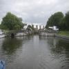
Bramwith Lock No 14
is a minor waterways place
on the Sheffield and South Yorkshire Navigation (Bramwith to Stainforth) between
Stainforth Junction (Junction of Sheffield and South Yorkshire Navigation and Stainforth and Keadby Canal) (1 mile and 6½ furlongs
to the east) and
Bramwith Junction (Junction of Sheffield and South Yorkshire Navigation main line with New Junction Canal) (2¼ furlongs
to the southwest).
The nearest place in the direction of Stainforth Junction is Bramwith Swing Bridge;
2¾ furlongs
away.
Mooring here is unrated.
Facilities: water point.
This is a lock, the rise of which is not known.
| Stainforth Junction | 1 mile, 6½ furlongs | |
| Water Lane Bridge | 1 mile, 4½ furlongs | |
| Bramwith Swing Bridge | 2¾ furlongs | |
| Bramwith Lock No 14 | ||
| Bramwith Junction | 2¼ furlongs | |
- S&SY navigation info — associated with Sheffield and South Yorkshire Navigation
- Sheffield & South Yorkshire navigation info from IWA
Mouseover for more information or show routes to facility
Nearest water point
The nearest water point is here. Others are at:
In the direction of Stainforth Junction
Bramwith Swing Bridge — 2¾ furlongs and 1 lock away
On this waterway in the direction of Stainforth Junction
Thorne Visitor Moorings — 4 miles, 5½ furlongs and 2 locks away
Travel to Stainforth Junction, then on the Sheffield and South Yorkshire Navigation (Stainforth and Keadby Canal) to Thorne Visitor Moorings
Keadby Visitor Moorings — 14 miles, 3¾ furlongs and 2 locks away
Travel to Stainforth Junction, then on the Sheffield and South Yorkshire Navigation (Stainforth and Keadby Canal) to Keadby Visitor Moorings
In the direction of Bramwith Junction
Barnby Dun Lift Bridge — 1 mile, 2¾ furlongs and 1 lock away
Travel to Bramwith Junction, then on the Sheffield and South Yorkshire Navigation (Main Line) to Barnby Dun Lift Bridge
Long Sandall Lock No 13 — 3 miles, 4 furlongs and 1 lock away
Travel to Bramwith Junction, then on the Sheffield and South Yorkshire Navigation (Main Line) to Long Sandall Lock No 13
Doncaster Visitor Pontoon Moorings — 6 miles, 5½ furlongs and 2 locks away
Travel to Bramwith Junction, then on the Sheffield and South Yorkshire Navigation (Main Line) to Doncaster Visitor Pontoon Moorings
Doncaster Town Lock No 12 — 6 miles, 7¾ furlongs and 2 locks away
Travel to Bramwith Junction, then on the Sheffield and South Yorkshire Navigation (Main Line) to Doncaster Town Lock No 12
Pollington Visitor Mooring — 7 miles, 6¾ furlongs and 2 locks away
Travel to Bramwith Junction, then on the Sheffield and South Yorkshire Navigation (New Junction Canal) to Sykehouse Junction, then on the Aire and Calder Navigation (Main Line - Goole to Castleford) to Pollington Visitor Mooring
Pollington Manor Swing Bridge — 7 miles, 7 furlongs and 2 locks away
Travel to Bramwith Junction, then on the Sheffield and South Yorkshire Navigation (New Junction Canal) to Sykehouse Junction, then on the Aire and Calder Navigation (Main Line - Goole to Castleford) to Pollington Manor Swing Bridge
Sprotbrough Lock No 11 — 10 miles, 2 furlongs and 3 locks away
Travel to Bramwith Junction, then on the Sheffield and South Yorkshire Navigation (Main Line) to Sprotbrough Lock No 11
Dutch Riverside — 11 miles, 7¾ furlongs and 2 locks away
Travel to Bramwith Junction, then on the Sheffield and South Yorkshire Navigation (New Junction Canal) to Sykehouse Junction, then on the Aire and Calder Navigation (Main Line - Goole to Castleford) to Dutch Riverside
Goole Marina — 12 miles, 1¼ furlongs and 2 locks away
Travel to Bramwith Junction, then on the Sheffield and South Yorkshire Navigation (New Junction Canal) to Sykehouse Junction, then on the Aire and Calder Navigation (Main Line - Goole to Castleford) to Goole Marina
Whitley Lock No 12 — 11 miles, 5¼ furlongs and 3 locks away
Travel to Bramwith Junction, then on the Sheffield and South Yorkshire Navigation (New Junction Canal) to Sykehouse Junction, then on the Aire and Calder Navigation (Main Line - Goole to Castleford) to Whitley Lock No 12
Mexborough Low Lock No 10 — 13 miles, 5½ furlongs and 4 locks away
Travel to Bramwith Junction, then on the Sheffield and South Yorkshire Navigation (Main Line) to Mexborough Low Lock No 10
Bank Dole Lock No 1 — 15 miles, 6½ furlongs and 4 locks away
Travel to Bramwith Junction, then on the Sheffield and South Yorkshire Navigation (New Junction Canal) to Sykehouse Junction, then on the Aire and Calder Navigation (Main Line - Goole to Castleford) to Bank Dole Junction, then on the Aire and Calder Navigation (Selby Section) to Bank Dole Lock No 1
Ferrybridge Flood Lock No 11 — 17 miles, 1 furlong and 4 locks away
Travel to Bramwith Junction, then on the Sheffield and South Yorkshire Navigation (New Junction Canal) to Sykehouse Junction, then on the Aire and Calder Navigation (Main Line - Goole to Castleford) to Ferrybridge Flood Lock No 11
Ferrybridge Flood Lock Footbridge — 17 miles, 1¼ furlongs and 5 locks away
Travel to Bramwith Junction, then on the Sheffield and South Yorkshire Navigation (New Junction Canal) to Sykehouse Junction, then on the Aire and Calder Navigation (Main Line - Goole to Castleford) to Ferrybridge Flood Lock Footbridge
Swinton Lock Activity Centre and CRT Sanitary Station — 16 miles, 2¼ furlongs and 6 locks away
Travel to Bramwith Junction, then on the Sheffield and South Yorkshire Navigation (Main Line) to Swinton Lock Activity Centre and CRT Sanitary Station
Beal Bridge — 18 miles, 1 furlong and 5 locks away
Travel to Bramwith Junction, then on the Sheffield and South Yorkshire Navigation (New Junction Canal) to Sykehouse Junction, then on the Aire and Calder Navigation (Main Line - Goole to Castleford) to Bank Dole Junction, then on the Aire and Calder Navigation (Selby Section) to Beal BridgeNearest rubbish disposal
In the direction of Stainforth Junction
Bramwith Swing Bridge — 2¾ furlongs and 1 lock away
On this waterway in the direction of Stainforth Junction
Thorne Visitor Moorings — 4 miles, 5½ furlongs and 2 locks away
Travel to Stainforth Junction, then on the Sheffield and South Yorkshire Navigation (Stainforth and Keadby Canal) to Thorne Visitor Moorings
Keadby Visitor Moorings — 14 miles, 3¾ furlongs and 2 locks away
Travel to Stainforth Junction, then on the Sheffield and South Yorkshire Navigation (Stainforth and Keadby Canal) to Keadby Visitor Moorings
In the direction of Bramwith Junction
Barnby Dun Lift Bridge — 1 mile, 2¾ furlongs and 1 lock away
Travel to Bramwith Junction, then on the Sheffield and South Yorkshire Navigation (Main Line) to Barnby Dun Lift Bridge
Doncaster Visitor Pontoon Moorings — 6 miles, 5½ furlongs and 2 locks away
Travel to Bramwith Junction, then on the Sheffield and South Yorkshire Navigation (Main Line) to Doncaster Visitor Pontoon Moorings
Dutch Riverside — 11 miles, 7¾ furlongs and 2 locks away
Travel to Bramwith Junction, then on the Sheffield and South Yorkshire Navigation (New Junction Canal) to Sykehouse Junction, then on the Aire and Calder Navigation (Main Line - Goole to Castleford) to Dutch Riverside
Goole Marina — 12 miles, 1¼ furlongs and 2 locks away
Travel to Bramwith Junction, then on the Sheffield and South Yorkshire Navigation (New Junction Canal) to Sykehouse Junction, then on the Aire and Calder Navigation (Main Line - Goole to Castleford) to Goole Marina
Whitley Lock No 12 — 11 miles, 5¼ furlongs and 3 locks away
Travel to Bramwith Junction, then on the Sheffield and South Yorkshire Navigation (New Junction Canal) to Sykehouse Junction, then on the Aire and Calder Navigation (Main Line - Goole to Castleford) to Whitley Lock No 12Nearest chemical toilet disposal
In the direction of Stainforth Junction
Bramwith Swing Bridge — 2¾ furlongs and 1 lock away
On this waterway in the direction of Stainforth Junction
Thorne Visitor Moorings — 4 miles, 5½ furlongs and 2 locks away
Travel to Stainforth Junction, then on the Sheffield and South Yorkshire Navigation (Stainforth and Keadby Canal) to Thorne Visitor Moorings
Keadby Visitor Moorings — 14 miles, 3¾ furlongs and 2 locks away
Travel to Stainforth Junction, then on the Sheffield and South Yorkshire Navigation (Stainforth and Keadby Canal) to Keadby Visitor Moorings
In the direction of Bramwith Junction
Barnby Dun Lift Bridge — 1 mile, 2¾ furlongs and 1 lock away
Travel to Bramwith Junction, then on the Sheffield and South Yorkshire Navigation (Main Line) to Barnby Dun Lift Bridge
Dutch Riverside — 11 miles, 7¾ furlongs and 2 locks away
Travel to Bramwith Junction, then on the Sheffield and South Yorkshire Navigation (New Junction Canal) to Sykehouse Junction, then on the Aire and Calder Navigation (Main Line - Goole to Castleford) to Dutch Riverside
Goole Marina — 12 miles, 1¼ furlongs and 2 locks away
Travel to Bramwith Junction, then on the Sheffield and South Yorkshire Navigation (New Junction Canal) to Sykehouse Junction, then on the Aire and Calder Navigation (Main Line - Goole to Castleford) to Goole Marina
Whitley Lock No 12 — 11 miles, 5¼ furlongs and 3 locks away
Travel to Bramwith Junction, then on the Sheffield and South Yorkshire Navigation (New Junction Canal) to Sykehouse Junction, then on the Aire and Calder Navigation (Main Line - Goole to Castleford) to Whitley Lock No 12
Swinton Lock Activity Centre and CRT Sanitary Station — 16 miles, 2¼ furlongs and 6 locks away
Travel to Bramwith Junction, then on the Sheffield and South Yorkshire Navigation (Main Line) to Swinton Lock Activity Centre and CRT Sanitary StationNearest place to turn
In the direction of Stainforth Junction
Huddle Grounds Winding Hole — 2 miles, 2 furlongs and 1 lock away
Travel to Stainforth Junction, then on the Sheffield and South Yorkshire Navigation (Stainforth and Keadby Canal) to Huddle Grounds Winding Hole
In the direction of Bramwith Junction
Wheatley Hall Road Winding Hole — 4 miles, 4¾ furlongs and 2 locks away
Travel to Bramwith Junction, then on the Sheffield and South Yorkshire Navigation (Main Line) to Wheatley Hall Road Winding Hole
Gas House Bight — 6 miles, 4 furlongs and 2 locks away
Travel to Bramwith Junction, then on the Sheffield and South Yorkshire Navigation (Main Line) to Gas House Bight
Doncaster Visitor Pontoon Moorings — 6 miles, 5½ furlongs and 2 locks away
Travel to Bramwith Junction, then on the Sheffield and South Yorkshire Navigation (Main Line) to Doncaster Visitor Pontoon Moorings
Sprotbrough Lock Weir Exit — 10 miles, 1½ furlongs and 3 locks away
Travel to Bramwith Junction, then on the Sheffield and South Yorkshire Navigation (Main Line) to Sprotbrough Lock Weir Exit
Viking Marina — 12 miles, ½ furlongs and 2 locks away
Travel to Bramwith Junction, then on the Sheffield and South Yorkshire Navigation (New Junction Canal) to Sykehouse Junction, then on the Aire and Calder Navigation (Main Line - Goole to Castleford) to Viking Marina
Bank Dole Lock Junction — 15 miles, 6¾ furlongs and 5 locks away
Travel to Bramwith Junction, then on the Sheffield and South Yorkshire Navigation (New Junction Canal) to Sykehouse Junction, then on the Aire and Calder Navigation (Main Line - Goole to Castleford) to Bank Dole Junction, then on the Aire and Calder Navigation (Selby Section) to Bank Dole Lock Junction
Swinton Road Corner — 15 miles, 7 furlongs and 6 locks away
Travel to Bramwith Junction, then on the Sheffield and South Yorkshire Navigation (Main Line) to Swinton Road Corner
Beal Lock No 2 Weir Entrance — 18 miles, 1¼ furlongs and 5 locks away
Travel to Bramwith Junction, then on the Sheffield and South Yorkshire Navigation (New Junction Canal) to Sykehouse Junction, then on the Aire and Calder Navigation (Main Line - Goole to Castleford) to Bank Dole Junction, then on the Aire and Calder Navigation (Selby Section) to Beal Lock No 2 Weir Entrance
Swinton Junction — 16 miles, 3 furlongs and 7 locks away
Travel to Bramwith Junction, then on the Sheffield and South Yorkshire Navigation (Main Line) to Swinton Junction
Kilnhurst Flood Lock Winding Hole — 18 miles, 1½ furlongs and 8 locks away
Travel to Bramwith Junction, then on the Sheffield and South Yorkshire Navigation (Main Line) to Kilnhurst Flood Lock Winding HoleNearest self-operated pump-out
In the direction of Bramwith Junction
Long Sandall Lock No 13 — 3 miles, 4 furlongs and 1 lock away
Travel to Bramwith Junction, then on the Sheffield and South Yorkshire Navigation (Main Line) to Long Sandall Lock No 13Nearest boatyard pump-out
In the direction of Stainforth Junction
Thorne Swing Bridge — 4 miles, 5¾ furlongs and 2 locks away
Travel to Stainforth Junction, then on the Sheffield and South Yorkshire Navigation (Stainforth and Keadby Canal) to Thorne Swing Bridge
Blue Water Marina — 5 miles, 2¾ furlongs and 2 locks away
Travel to Stainforth Junction, then on the Sheffield and South Yorkshire Navigation (Stainforth and Keadby Canal) to Blue Water Marina
In the direction of Bramwith Junction
Goole Marina — 12 miles, 1¼ furlongs and 2 locks away
Travel to Bramwith Junction, then on the Sheffield and South Yorkshire Navigation (New Junction Canal) to Sykehouse Junction, then on the Aire and Calder Navigation (Main Line - Goole to Castleford) to Goole MarinaDirection of TV transmitter (From Wolfbane Cybernetic)
There is no page on Wikipedia called “Bramwith Lock”
Wikipedia pages that might relate to Bramwith Lock
[Stainforth and Keadby Canal]
Yorkshire and Lincolnshire, England. It connects the River Don Navigation at Bramwith to the River Trent at Keadby, by way of Stainforth, Thorne and Ealand,
[River Don Navigation]
overseeing the work until his death in 1795. It provided a link from Bramwith Lock to the River Trent, broadly following the old course of the River Don
[New Junction Canal]
to Hatfield Main colliery was improved between 1930 and 1932, when Bramwith lock, the first on the Stainforth and Keady Canal, was lengthened to allow
[Sheffield and South Yorkshire Navigation]
navigation was virtually controlled by the Great Central Railway. Doncaster lock was extended in 1909 and 1910, and improvements were made at Doncaster, Rotherham
[River Don, Yorkshire]
Barnby Dun to Fishlake Ferry, to avoid the shallows at Stainforth and Bramwith. The river was navigable to Rotherham in 1740, and to Tinsley by 1751.
[List of poor law unions in England]
Doncaster, Edlington, Fenwick, Hampole, Hickleton, Hooton Pagnell, Kirk Bramwith, Kirk Sandall, Loversall, Marr, Melton on the Hill, Mexborough, Moss, Norton
[Rother Link]
Valley Country Park to Rotherham, pass down the River Don Navigation to Bramwith, along the Stainforth and Keadby Canal to Keadby, up the River Trent to
[South Yorkshire Railway]
of the River Don Navigation, past Kirk Sandall, Barnby upon Don, Sand Bramwith to Stainforth; and thence along or close to the north bank of the Stainforth
[Stainforth railway station]
Preceding station Disused railways Following station Bramwith South Yorkshire Railway & River Dun Navigation Doncaster to Thorne Railway Thorne Lock
Results of Google Search
Sheffield Basin, Bramwith Lock No 14, 28.13, 24, 10hr 27min, 4.98, 10hr 35min, 4.93, 10hr 20min, 5.04, 1. Sheffield Basin, Stainforth and Keadby Canal Junction  ...
Looking to the South-West, the Stainforth & Keadby Canal seen from Bramwith Lock No.14. Les regards portés vers le Sud-ouest, le Canal de Stainforth et ...
Sheffield & South Yorkshire Navigation: Mexborough Low Lock No 10 ... South Yorkshire Navigation: Keadby to Bramwith is restricted by Thorne Lock to length ...
The River Don Navigation originally continued through Bramwith Lock to the now disused ... The Stainforth and Keadby Canal runs for some 14 miles from the New Junction Canal at ... The Thorpe Marsh cooling towers are no longer there.


![The non-towpath [east] side of the Don Aqueduct. Seen from the barge Sobriety, heading from Goole to Sprotbrough. by Christine Johnstone – 04 April 2014](https://s3.geograph.org.uk/geophotos/03/92/42/3924203_354f1550_120x120.jpg)


![Southern end, New Junction Canal. Left [east] for Keadby, right [west] for Doncaster and Sheffield. Seen from the barge Sobriety, heading from Goole to Sprotbrough. by Christine Johnstone – 04 April 2014](https://s2.geograph.org.uk/geophotos/03/92/42/3924238_3fae4a3e_120x120.jpg)