CanalPlanAC

Pont du Route N151

 
N 151, 58500 Surgy, France (N 151)
 
Information about the place
Pont du Route N151 is a minor waterways place on the Canal du Nivernais (Main Line) between Clamecy (2.04 kilometres and 3 locks to the south) and Nivernais - Vermenton Jonction (Junction of the Canal du Nivernais with the Vermenton Branch) (37.44 kilometres and 23 locks to the northeast).
 
 
The nearest place in the direction of Clamecy is Portes de Garde pres Ecluse 48 Foret; 0.06 kilometres away.
 
The nearest place in the direction of Nivernais - Vermenton Jonction is Pont du Rue de Presle; 0.50 kilometres away.

Mooring here is unrated.

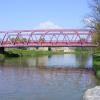
There is a bridge here.


Amenities
 
Maps
If you are a user and are logged on, or if you are actively planning a route, a map will be displayed here.
Show on external mapping site: Google | OSM | Bing
 
Photos
 
External websites
 VisuRiS — associated with Waterways of Mainland Europe
The official inland waterway resource for Belgium with actual traffic and planned operations on the waterways. Also has voyage planning and notices to mariners
 
Nearest facilities

Mouseover for more information or show routes to facility

Nearest water point

In the direction of Auxerre

Basin de Chatel Censoir16.25 km and 8 locks away
On this waterway in the direction of Auxerre
Mailly-la-Ville Halte Nautique29.17 km and 16 locks away
On this waterway in the direction of Auxerre

In the direction of Canal du Nivernais - Loire Junction

Tannay-Port Basin20.09 km and 14 locks away
On this waterway in the direction of Canal du Nivernais - Loire Junction

Nearest rubbish disposal

In the direction of Auxerre

Mailly-la-Ville Halte Nautique29.17 km and 16 locks away
On this waterway in the direction of Auxerre

In the direction of Canal du Nivernais - Loire Junction

Tannay-Port Basin20.09 km and 14 locks away
On this waterway in the direction of Canal du Nivernais - Loire Junction

No information

CanalPlan has no information on any of the following facilities within range:
chemical toilet disposal
place to turn
self-operated pump-out
boatyard pump-out
 
 
Geograph
 
Wikipedia

There is no page on Wikipedia called “Pont du Route N151”

Wikipedia pages that might relate to Pont du Route N151
[Route nationale 20] Châteauroux on the River Indre. The town is also on the N151 (Auxerre–Bourges–Poitiers) and N143 (Tours-Châteauroux). The road continues south through [Quebec Bridge] The Quebec Bridge (Pont de Québec in French) is a road, rail and pedestrian bridge across the lower Saint Lawrence River between Sainte-Foy (since 2002 [Rehoboth Beach, Delaware] Beach city limits. A. Felix du Pont, member of du Pont family that served as vice president and director of E. I. du Pont de Nemours & Co., owned a summer [Émiland Gauthey] pages du roi (English: School for Royal Pages). He continued his education under the architect Gabriel Dumont before entering the École royale des ponts et [Chemin de fer de Petite Ceinture] Édouard de Villiers du Terrage (1870). Mémoire sur le pont-viaduc du Point du Jour et sur les ouvrages d'art de la section du Chemin de fer de ceinture [Quebec Autoroute 20] A-20 forms a multiplex with Route 116 for six kilometres between exits 141 and 147. This section of the A-20 in Centre-du-Québec is located the furthest [Nîmes] it crossed the River Gard between Uzès and Remoulins, the spectacular Pont du Gard was built. This is 20 km (12 mi) north east of the city. The museum [RATP bus network] crosses Paris' borders) in: x2 represents the 16th arrondissement (from Pont du Garigliano to Porte Maillot) x3 and x4 represent the 17th arrondissement [U.S. Route 13 in Delaware] during the 1920s. Between Dover and Wilmington, the route was built as part of the cross-state DuPont Highway, which was completed in 1923 and improved [Mas Subramanian] Central R&D department at the DuPont Experimental Station in Wilmington, Delaware. He was eventually appointed as a DuPont Research Fellow. He has made
 
Google

Results of Google Search

Noctilien bus maps and timetables for Paris night buses N150 to N159
However, this map shows the Noctilien Bus route for the SNCF line N151, which ... Porte Maillot - RER, Orgeval Novotel Pont A13*, Gare de Villennes sur Seine, ...
N151 Route: Time Schedules, Stops & Maps - Paris Saint-Lazare ...
The N151 bus (Direction: Paris Saint-Lazare Noctilien) has 14 stops departing from ... Place du 8 Mai 1945, Mantes-la-Jolie View full schedule Go to station ...
Accident sur le pont de Saint-Florent : la N151 momentanément ...
9 sept. 2016 ... La route nationale 151 était coupée à la circulation à hauteur de Saint-Florent- sur-Cher, ce vendredi 9 septembre après-midi, en raison d'un ...
Route nationale française 151 | WikiSara | Fandom
La RN151 devient route de Poitiers, N. 147, à Auxerre, N. 6. ... Section Saint- Julien-d'Ars - Chauvigny : 1834, y compris les abords du pont ... Indre (36) - N151 .
La Loire à Vélo - cycling routes in France
Route. After going a short way west on the N 151 road, take the Chemin du Pont de la Batte track, parallel to the D 7 road. Before arriving at the D 7, the track ...