Firhill Pound (Port Dundas Branch - Main Line)
Hamiltonhill Claypits Local Nature Reserve, Forth and Clyde Canal Glasgow Spur Towpath, Glasgow G4 9SP, United Kingdom
Address is taken from a point 323 yards away.
Address is taken from a point 323 yards away.

Firhill Pound (Port Dundas Branch - Main Line)
is a minor waterways place
on the Forth and Clyde Canal (Port Dundas Branch - Main Line) between
Firhill Road Basin (northern entrance) (Basin next to Firhill Road Stadium, home of Partick Thistle FC) (1¼ furlongs
to the west) and
Firhill Road Basin (southern entrance) (Basin next to Firhill Road Stadium, home of Partick Thistle FC) (1 furlong
to the south).
Mooring here is unrated.
| Ruchill Street Bridge | 7¾ furlongs | |
| Bilsland Drive Aqueduct | 5½ furlongs | |
| Maryhill Road Footbridge | 4¼ furlongs | |
| Nolly Bridge No 53 | 1½ furlongs | |
| Firhill Road Basin (northern entrance) | 1¼ furlongs | |
| Firhill Pound (Port Dundas Branch - Main Line) | ||
| Firhill Road Basin (southern entrance) | 1 furlong | |
| Firhill Road Narrows | 1¼ furlongs | |
| Claypits Footbridge | 2¾ furlongs | |
| Applecross Street Basin | 4¾ furlongs | |
| Rockvilla Bascule Bridge | 5 furlongs | |
Amenities here
- Youtube — associated with Forth and Clyde Canal
- The official reopening of the canal
Mouseover for more information or show routes to facility
Nearest place to turn
In the direction of Stockingfield Junction
Luggiebank Road Winding Hole — 8 miles, 3 furlongs away
Travel to Stockingfield Junction, then on the Forth and Clyde Canal (Main Line) to Luggiebank Road Winding Hole
Auchinstarry Winding Hole — 13 miles, 5¼ furlongs away
Travel to Stockingfield Junction, then on the Forth and Clyde Canal (Main Line) to Auchinstarry Winding Hole
Craigmarloch Basin — 14 miles, 3¾ furlongs away
Travel to Stockingfield Junction, then on the Forth and Clyde Canal (Main Line) to Craigmarloch Basin
Wyndford Lock Winding Hole — 15 miles, 6½ furlongs away
Travel to Stockingfield Junction, then on the Forth and Clyde Canal (Main Line) to Wyndford Lock Winding Hole
Bowling Basin — 10 miles, 5½ furlongs and 19 locks away
Travel to Stockingfield Junction, then on the Forth and Clyde Canal (Main Line) to Bowling Basin
In the direction of Port Dundas Basin
Applecross Street Basin — 4¾ furlongs away
On this waterway in the direction of Port Dundas Basin
Craighall Road Basin Western Winding Hole — 1 mile, 1 furlong and 1 lock away
On this waterway in the direction of Port Dundas Basin
Craighall Road Basin — 1 mile, 1¼ furlongs and 1 lock away
On this waterway in the direction of Port Dundas Basin
Port Dundas Basin — 1 mile, 3½ furlongs and 2 locks away
On this waterway in the direction of Port Dundas BasinNo information
CanalPlan has no information on any of the following facilities within range:water point
rubbish disposal
chemical toilet disposal
self-operated pump-out
boatyard pump-out
Direction of TV transmitter (From Wolfbane Cybernetic)
There is no page on Wikipedia called “Firhill Pound”
Wikipedia pages that might relate to Firhill Pound
[Kevin Nisbet]
progressed through the Thistle Weir Academy, he made his breakthrough in the Firhill side's development squad. He made 18 appearances at that level during the
[David Jordan (rugby union)]
played games in Aberdeen, Inverness, Perth, Stirling, Ayr, Hughenden, Firhill and Scotstoun, and while we’ve worked hard recently to make Hughenden a
[2016–17 Rangers F.C. season]
on to bring in eleven new players in total, including paying a million-pound-plus transfer fee for Englishman Joe Garner which represented the largest
[History of football in Scotland]
Retrieved 27 August 2018. "Change, Decline & On The Road - Shawfield, Firhill & Douglas Park - 1970-1993". Clyde F.C. Retrieved 20 August 2018. "Council
[Bobby Johnstone]
few pounds and was a little less mobile. However, the brain had not slowed down any and his prompting enabled the team to score 10 goals at Firhill against
[Andy Murdoch (footballer, born 1968)]
was Lambie who made the deal, with the latter having also returned to Firhill. The record may have been broken by the 2017 signing of Niall Keown, but
[2000 Rugby League World Cup]
Paul Sterling Ian Watson Hadfield, Dave (20 April 1999). "World Cup to get pounds 1m backing". The Independent. London. Archived from the original on 4 November
[2012–13 Dunfermline Athletic F.C. season]
and talks broke down. The club's debt is thought to be around 8.5 million pounds. On 9 April, as a result of entering administration the club were issued
[2010 UK & Ireland Greyhound Racing Year]
redevelopment". The News. "Ex-greyhound staff say they are owed thousands of pounds". The News. "Demolition of the Tipner greyhound stadium begins". The News
[1990 UK & Ireland Greyhound Racing Year]
That is a scandal of huge proportions because 10 per cent.—10p in every pound—is deducted from bets, under the legislation to which I have referred, with
Results of Google Search
man-made sea-to-sea canal and the biggest ... at the time at Port Dundas). ... to Firhill. 5 Firhill to Pinkston Basin. 6 The Forgotten Canals. Key transport links ... THE SUMMIT POUND ... Glasgow Branch (Section 4), or change towpath ... main line. BALMORE ROAD LIFTING BRIDGE. Balmore Road Lifting Bridge was built in.
Glasgow (/ˈɡlæzɡoʊ/, also UK: /ˈɡlɑːzɡoʊ, ˈɡlɑːsɡoʊ/, US: /ˈɡlæsɡoʊ, ˈɡlæskoʊ/; ... The city's Tobacco Lords created a deep water port at Port Glasgow on the Firth ... Maryhill is also the location of Firhill Stadium, home of Partick Thistle F.C. ... Most other services within Scotland – the main line to Edinburgh, plus ...
the section of the Canal Corridor between Port Dundas and. Firhill Basin, aimed ... comprising a major development opposite Speirs Wharf and a tower close to ...


![Bindweed. Growing up the wires of the walkway beside the canal [[8099673]]. by Richard Sutcliffe – 19 July 2025](https://s0.geograph.org.uk/geophotos/08/09/96/8099680_dd936dd0_120x120.jpg)


![Doo hut under construction. By the Forth and Clydecanalat Firhill basin. Ruchill hospital tower is in the background [[49994]]. by Thomas Nugent – 13 February 2009](https://s3.geograph.org.uk/geophotos/01/17/65/1176507_aadccb79_120x120.jpg)


![Letterboxes for boats. Situated at the bottom of the ramp off Panmure Gate, a few metres from the gate [[8099307]] which gives access to berths beside the Forth and Clyde Canal. As only berth holders can get through the gate, these letterboxes are more accessible to the postman. by Richard Sutcliffe – 19 July 2025](https://s1.geograph.org.uk/geophotos/08/09/96/8099669_cd50104e_120x120.jpg)

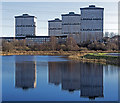
![Firhill basin. On the Glasgow branch of the Forth and Clyde canal. Ruchill Hospital tower is in the distance [[49994]]. The canal is out of shot immediately to the right. by Thomas Nugent – 13 February 2009](https://s0.geograph.org.uk/geophotos/01/17/64/1176492_d9bd2264_120x120.jpg)

![Firhill basin. On the Glasgow branch of the Forth and Clyde canal. Ruchill Hospital tower can be seen in the distance [[49994]]. by Thomas Nugent – 13 February 2009](https://s0.geograph.org.uk/geophotos/01/17/64/1176488_689d20c0_120x120.jpg)
![Forth and Clyde Canal [18]. Firhill Basin is a kidney shaped former timber basin created on the inside of a bend of the canal. The Forth and Clyde Canal was completed in 1790 and it provided a route for vessels between the Firth of Forth and the Firth of Clyde at the narrowest part (35 miles, 56km) of the Scottish Lowlands. Closed in 1963, the canal became semi-derelict. Millennium funds were used to regenerate the canal. The Glasgow Branch of the canal is a Scheduled Monument with details at: http://portal.historicenvironment.scot/designation/SM6771 by Michael Dibb – 25 June 2019](https://s2.geograph.org.uk/geophotos/06/24/83/6248394_8038e330_120x120.jpg)

![Doo hut under construction. By Firhill Basin on the Forth and Clyde canal Glasgow branch. See also [[1176507]]. by Thomas Nugent – 13 February 2009](https://s2.geograph.org.uk/geophotos/01/17/72/1177254_5b96e1e5_120x120.jpg)
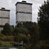
![Firhill Basin. Just right of centre is one end of a curving barrier that separates Firhill Basin (on the left) from the main body of the Glasgow Branch of the Forth and Clyde Canal (on the right).The high flats on the right are on Wester Common Road. Just right of centre in the background, and surrounded by scaffolding, is the water tower of the closed Ruchill Hospital: [[49994]]. by Lairich Rig – 01 October 2012](https://s3.geograph.org.uk/geophotos/03/20/75/3207555_bc5daf43_120x120.jpg)


![Forth and Clyde Canal [19]. An assortment of birds on the edge of the former timber basin.The Forth and Clyde Canal was completed in 1790 and it provided a route for vessels between the Firth of Forth and the Firth of Clyde at the narrowest part (35 miles, 56km) of the Scottish Lowlands. Closed in 1963, the canal became semi-derelict. Millennium funds were used to regenerate the canal. The Glasgow Branch of the canal is a Scheduled Monument with details at: http://portal.historicenvironment.scot/designation/SM6771 by Michael Dibb – 25 June 2019](https://s3.geograph.org.uk/geophotos/06/24/83/6248395_8b1f3eca_120x120.jpg)


![Forth and Clyde Canal. Looking towards Firhill basin from the east. The tower to the left is at the derelict Ruchill Hospital [[49994]]. by Thomas Nugent – 13 February 2009](https://s0.geograph.org.uk/geophotos/01/17/64/1176484_61d773dd_120x120.jpg)


