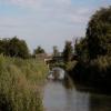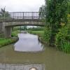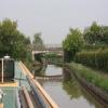
Sutton Lane Bridge No 32
is a minor waterways place
on the Ashby Canal (Main Line) between
Bosworth Wharf Bridge No 42 (Market Bosworth one mile) (4 miles and 3½ furlongs
to the northwest) and
Foster's Bridge No 27 (1 mile and 1 furlong
to the southwest).
The nearest place in the direction of Bosworth Wharf Bridge No 42 is Geary's Bridge No 33;
2¼ furlongs
away.
The nearest place in the direction of Foster's Bridge No 27 is Wooden Top Bridge No 31;
1¾ furlongs
away.
There is access (via steps) to the towpath here.
Mooring here is unrated.
There is a bridge here which takes a minor road over the canal.
| Former Railway Bridge No 34A | 1 mile, 4¾ furlongs | |
| Sutton Cheney Visitor Moorings | 7¾ furlongs | |
| Sutton Cheney Wharf | 6¾ furlongs | |
| Sutton Wharf Bridge No 34 | 6¾ furlongs | |
| Geary's Bridge No 33 | 2¼ furlongs | |
| Sutton Lane Bridge No 32 | ||
| Wooden Top Bridge No 31 | 1¾ furlongs | |
| Dadlington Wharf Bridge No 30 | 4¼ furlongs | |
| Dadlington Wharf | 4¼ furlongs | |
| Allotments Bridge No 29 | 5½ furlongs | |
| Dadlington Bridge No 28 | 6½ furlongs | |
Mouseover for more information or show routes to facility
Nearest water point
In the direction of Marston Junction
Trinity Marina — 4 miles, 3¼ furlongs away
On this waterway in the direction of Marston Junction
Limekiln Bridge No 15 — 5 miles, 3¼ furlongs away
On this waterway in the direction of Marston Junction
Hawkesbury Water Point (Engine House) — 13 miles, 1½ furlongs away
Travel to Marston Junction, then on the Coventry Canal (Main Line - Hawkesbury to Fazeley) to Hawkesbury Water Point (Engine House)
Hawkesbury Services — 13 miles, 2¼ furlongs away
Travel to Marston Junction, then on the Coventry Canal (Main Line - Hawkesbury to Fazeley) to Hawkesbury Junction, then on the Coventry Canal (Main Line - Coventry to Hawkesbury) to Hawkesbury Services
Hawkesbury Water Point (stop lock) — 13 miles, 2¾ furlongs and 1 lock away
Travel to Marston Junction, then on the Coventry Canal (Main Line - Hawkesbury to Fazeley) to Hawkesbury Junction, then on the Oxford Canal (Northern Section - Main Line) to Hawkesbury Water Point (stop lock)
Springwood Haven Marina — 15 miles, 1 furlong away
Travel to Marston Junction, then on the Coventry Canal (Main Line - Hawkesbury to Fazeley) to Springwood Haven Marina
C&RT Hartshill Maintenance Yard and Wharf — 16 miles, 3¾ furlongs away
Travel to Marston Junction, then on the Coventry Canal (Main Line - Hawkesbury to Fazeley) to C&RT Hartshill Maintenance Yard and Wharf
Ansty Water Point — 17 miles and 1 lock away
Travel to Marston Junction, then on the Coventry Canal (Main Line - Hawkesbury to Fazeley) to Hawkesbury Junction, then on the Oxford Canal (Northern Section - Main Line) to Ansty Water Point
Atherstone Top Lock Winding Hole — 18 miles, 4 furlongs away
Travel to Marston Junction, then on the Coventry Canal (Main Line - Hawkesbury to Fazeley) to Atherstone Top Lock Winding Hole
Coventry Visitor Moorings (outside basin) — 18 miles, 5¼ furlongs away
Travel to Marston Junction, then on the Coventry Canal (Main Line - Hawkesbury to Fazeley) to Hawkesbury Junction, then on the Coventry Canal (Main Line - Coventry to Hawkesbury) to Coventry Visitor Moorings (outside basin)
Coventry Basin Services — 18 miles, 5¾ furlongs away
Travel to Marston Junction, then on the Coventry Canal (Main Line - Hawkesbury to Fazeley) to Hawkesbury Junction, then on the Coventry Canal (Main Line - Coventry to Hawkesbury) to Coventry Basin Services
Atherstone Lock No 5 — 18 miles, 6¾ furlongs and 4 locks away
Travel to Marston Junction, then on the Coventry Canal (Main Line - Hawkesbury to Fazeley) to Atherstone Lock No 5
Baddesley Basin — 19 miles, 2 furlongs and 6 locks away
Travel to Marston Junction, then on the Coventry Canal (Main Line - Hawkesbury to Fazeley) to Baddesley Basin
In the direction of Ashby Canal Current Head of Navigation
Sutton Cheney Wharf — 6¾ furlongs away
On this waterway in the direction of Ashby Canal Current Head of Navigation
Bosworth Wharf Bridge No 42 — 4 miles, 3½ furlongs away
On this waterway in the direction of Ashby Canal Current Head of Navigation
Bosworth Marina & Wharf Winding Hole — 4 miles, 4 furlongs away
On this waterway in the direction of Ashby Canal Current Head of Navigation
Snarestone Services — 10 miles, 7¼ furlongs away
On this waterway in the direction of Ashby Canal Current Head of NavigationNearest rubbish disposal
In the direction of Ashby Canal Current Head of Navigation
Bosworth Marina & Wharf Winding Hole — 4 miles, 4 furlongs away
On this waterway in the direction of Ashby Canal Current Head of Navigation
Snarestone Services — 10 miles, 7¼ furlongs away
On this waterway in the direction of Ashby Canal Current Head of Navigation
In the direction of Marston Junction
Stoke Golding Wharf — 1 mile, 5¼ furlongs away
On this waterway in the direction of Marston Junction
Trinity Marina — 4 miles, 3¼ furlongs away
On this waterway in the direction of Marston Junction
Hawkesbury Services — 13 miles, 2¼ furlongs away
Travel to Marston Junction, then on the Coventry Canal (Main Line - Hawkesbury to Fazeley) to Hawkesbury Junction, then on the Coventry Canal (Main Line - Coventry to Hawkesbury) to Hawkesbury Services
Mancetter Marina — 17 miles, 1 furlong away
Travel to Marston Junction, then on the Coventry Canal (Main Line - Hawkesbury to Fazeley) to Mancetter Marina
Atherstone Top Lock Winding Hole — 18 miles, 4 furlongs away
Travel to Marston Junction, then on the Coventry Canal (Main Line - Hawkesbury to Fazeley) to Atherstone Top Lock Winding HoleNearest chemical toilet disposal
In the direction of Marston Junction
Trinity Marina — 4 miles, 3¼ furlongs away
On this waterway in the direction of Marston Junction
Hawkesbury Services — 13 miles, 2¼ furlongs away
Travel to Marston Junction, then on the Coventry Canal (Main Line - Hawkesbury to Fazeley) to Hawkesbury Junction, then on the Coventry Canal (Main Line - Coventry to Hawkesbury) to Hawkesbury Services
Springwood Haven Marina — 15 miles, 1 furlong away
Travel to Marston Junction, then on the Coventry Canal (Main Line - Hawkesbury to Fazeley) to Springwood Haven Marina
Atherstone Top Lock Winding Hole — 18 miles, 4 furlongs away
Travel to Marston Junction, then on the Coventry Canal (Main Line - Hawkesbury to Fazeley) to Atherstone Top Lock Winding Hole
Coventry Basin Services — 18 miles, 5¾ furlongs away
Travel to Marston Junction, then on the Coventry Canal (Main Line - Hawkesbury to Fazeley) to Hawkesbury Junction, then on the Coventry Canal (Main Line - Coventry to Hawkesbury) to Coventry Basin Services
In the direction of Ashby Canal Current Head of Navigation
Sutton Cheney Wharf — 6¾ furlongs away
On this waterway in the direction of Ashby Canal Current Head of Navigation
Bosworth Marina & Wharf Winding Hole — 4 miles, 4 furlongs away
On this waterway in the direction of Ashby Canal Current Head of Navigation
Snarestone Services — 10 miles, 7¼ furlongs away
On this waterway in the direction of Ashby Canal Current Head of NavigationNearest place to turn
In the direction of Marston Junction
Basin Bridge Winding Hole — 2 miles, 2¾ furlongs away
On this waterway in the direction of Marston Junction
Trinity Marina — 4 miles, 3¼ furlongs away
On this waterway in the direction of Marston Junction
Hinckley Wharf Arm Junction — 4 miles, 7 furlongs away
On this waterway in the direction of Marston Junction
Marston Junction — 10 miles, 3¾ furlongs away
On this waterway in the direction of Marston Junction
Junction with Griff Arm (disused) — 11 miles, 4½ furlongs away
Travel to Marston Junction, then on the Coventry Canal (Main Line - Hawkesbury to Fazeley) to Junction with Griff Arm (disused)
Bedworth Winding Hole — 12 miles, 3 furlongs away
Travel to Marston Junction, then on the Coventry Canal (Main Line - Hawkesbury to Fazeley) to Bedworth Winding Hole
Hawkesbury Junction — 13 miles, 2 furlongs away
Travel to Marston Junction, then on the Coventry Canal (Main Line - Hawkesbury to Fazeley) to Hawkesbury Junction
Wash Lane Winding Hole — 13 miles, 2¾ furlongs away
Travel to Marston Junction, then on the Coventry Canal (Main Line - Hawkesbury to Fazeley) to Wash Lane Winding Hole
White House Winding Hole — 15 miles, 3½ furlongs away
Travel to Marston Junction, then on the Coventry Canal (Main Line - Hawkesbury to Fazeley) to White House Winding Hole
Foleshill Winding Hole — 15 miles, 4 furlongs away
Travel to Marston Junction, then on the Coventry Canal (Main Line - Hawkesbury to Fazeley) to Hawkesbury Junction, then on the Coventry Canal (Main Line - Coventry to Hawkesbury) to Foleshill Winding Hole
In the direction of Ashby Canal Current Head of Navigation
Sutton Cheney Wharf — 6¾ furlongs away
On this waterway in the direction of Ashby Canal Current Head of Navigation
Shenton Bend — 2 miles, 2 furlongs away
On this waterway in the direction of Ashby Canal Current Head of Navigation
Jackson's Bridge Winding Hole — 4 miles, 1¼ furlongs away
On this waterway in the direction of Ashby Canal Current Head of Navigation
Bosworth Marina & Wharf Winding Hole — 4 miles, 4 furlongs away
On this waterway in the direction of Ashby Canal Current Head of Navigation
Carlton Bridge Winding Hole — 5 miles, 3½ furlongs away
On this waterway in the direction of Ashby Canal Current Head of Navigation
Shackerstone Winding Hole — 8 miles, ¾ furlongs away
On this waterway in the direction of Ashby Canal Current Head of Navigation
Turnover Bridge Winding Hole — 10 miles, 7 furlongs away
On this waterway in the direction of Ashby Canal Current Head of Navigation
Faulkes Circular Winding Hole — 11 miles, ¾ furlongs away
On this waterway in the direction of Ashby Canal Current Head of Navigation
Measham Wharf Branch Junction — 12 miles, 6¾ furlongs away
Travel to Ashby Canal Current Head of Navigation, then on the Ashby Canal (unrestored) to Measham Wharf Branch Junction
Site of Proposed Measham Wharf — 13 miles, 1¾ furlongs away
Travel to Ashby Canal Current Head of Navigation, then on the Ashby Canal (unrestored) to Measham Wharf Branch Junction, then on the Ashby Canal (Measham Wharf Branch, unrestored) to Site of Proposed Measham WharfNearest self-operated pump-out
In the direction of Ashby Canal Current Head of Navigation
Bosworth Marina & Wharf Winding Hole — 4 miles, 4 furlongs away
On this waterway in the direction of Ashby Canal Current Head of Navigation
In the direction of Marston Junction
Trinity Marina — 4 miles, 3¼ furlongs away
On this waterway in the direction of Marston Junction
Coventry Basin Services — 18 miles, 5¾ furlongs away
Travel to Marston Junction, then on the Coventry Canal (Main Line - Hawkesbury to Fazeley) to Hawkesbury Junction, then on the Coventry Canal (Main Line - Coventry to Hawkesbury) to Coventry Basin ServicesNearest boatyard pump-out
In the direction of Marston Junction
Trinity Marina — 4 miles, 3¼ furlongs away
On this waterway in the direction of Marston Junction
Boot Wharf — 12 miles, 4¾ furlongs away
Travel to Marston Junction, then on the Coventry Canal (Main Line - Hawkesbury to Fazeley) to Boot Wharf
Springwood Haven Marina — 15 miles, 1 furlong away
Travel to Marston Junction, then on the Coventry Canal (Main Line - Hawkesbury to Fazeley) to Springwood Haven Marina
Mancetter Marina — 17 miles, 1 furlong away
Travel to Marston Junction, then on the Coventry Canal (Main Line - Hawkesbury to Fazeley) to Mancetter MarinaDirection of TV transmitter (From Wolfbane Cybernetic)
There is no page on Wikipedia called “Sutton Lane Bridge”
Wikipedia pages that might relate to Sutton Lane Bridge
[Sutton United F.C.]
Green Lane, close to West Sutton Station. The club is an FA Charter Standard Community Club affiliated to the Surrey County Football Association. Sutton started
[Sutton]
Cambridgeshire Sutton, Peterborough, Cambridgeshire Sutton, Newton, Cheshire Sutton, Cheshire East, a civil parish in Cheshire Sutton Lane Ends, a village
[West Sutton railway station]
Green Lane, the home ground of Sutton United. Parliamentary approval for a line from Wimbledon to Sutton had been obtained by the Wimbledon and Sutton Railway
[Sutton railway station (London)]
Sutton. It is served by Southern and Thameslink trains, and lies in Travelcard Zone 5, 14 miles 75 chains (24.04 km) down the line from London Bridge
[Haydons Road railway station]
and evening peak. It is on the Sutton Loop Line and is in Travelcard Zone 3. It was opened, originally as Haydens Lane, by the Tooting, Merton and Wimbledon
[List of collieries in Lancashire since 1854]
Helens Strawberry, Skelmersdale School Lane, Skelmersdale Sutton, Sutton Sutton Manor, Sutton, St Helens Sutton Heath Nos 2 and 3, St Helens Swifts Fold
[A217 road]
at Wandsworth Bridge, then passes through Wandsworth, Earlsfield, Summerstown, Tooting, Mitcham, Rosehill and Sutton Common in Sutton, then Cheam. Then
[Sutton Bridge railway station]
Sutton Bridge railway station was a station in Sutton Bridge, south Lincolnshire, England, which opened in the 19th century. It became part of the Midland
[Sutton Coldfield]
Sutton Coldfield, officially the Royal Town of Sutton Coldfield (/ˌsʌtən ˈkɒldfiəld/ pronunciation (help·info)), is a civil parish and suburban town in
[Worcester Park]
Worcester Park is a town in the London Borough of Sutton, in Southwest London, England. The area is 10.1 miles (16.3 km) southwest of Charing Cross. The
Results of Google Search
Feb 28, 2020 ... ... geograph.org.uk - 918420. No higher resolution available. ... English: Bridge 32: Sutton Lane Bridge Along the Ashby Canal near Dadlington.
Price Chopper Supermarkets and Market 32 Grocery Stores are proud to offer Online Grocery Shopping, Grocery Delivery, or Store Pickup. See this week's flyer ...
Browse a list of all Price Chopper and Market 32 locations across the United States and get location and directions, store hours, ... 33 Chenango Bridge Road.
choose Delivery instead... Don't have time to pick up your order? No problem, we' ll deliver it to your door. Simply select your delivery time when checking out ...
River Styx Road and Bridge ... 32-92]. In accordance with the provisions of § 231- 3D(4), no person shall park a ... Between Northwestern Way and Sutton Trail.
Apr 18, 2020 ... Northern Kentucky road construction updates are available here. ... four I-275 twin bridges at Four-Mile, Sutton Road, Kellogg Ave. and the Combs-Hehl. ... but there are no significant impacts to traffic related to construction at this time. ... ·KY 32 (East Pike Street – Millersburg Pike) 9.8 – 10 mile-marker – A ...
​SCOPING TO EVALUATE ALTERNATIVES FOR BRIDGE NO. 21 ON VT110 IN ... REPLACEMENT OF BR32 OVER SMITH BROOK IN THE TOWN OF JOHNSON. Bridge, 88B193, BRF ... LEICESTER, TH !2 (Old Jeruselum Road), Addison ... Rehabilitation of Bridge 3 on VT 105A at the Richford-Sutton P.Q. border. Bridge ...
Dirt road beside bridge, has had wash outs in the past. Can be a take out point for a short float trip from 195 Bridge or an all day float put in spot to the Forrester ...
Ainsley Mill Lane: Rivers Edge at Abbotts Bridge (PRIVATE ROAD). Ainsley Mill Way: ... Ashley Lane: Charleston Bay (no addresses on this street). Augustus ...


