CanalPlanAC

Towpath Footbridge No 155A

 
Waterway Experiences, Grand Union Canal, Three Rivers WD4 8HP, United Kingdom
 

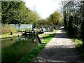
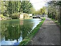
Towpath Footbridge No 155A carries a farm track over the Grand Union Canal (Grand Junction Canal - Main Line - Gayton to Brentford).

Early plans for the Grand Union Canal (Grand Junction Canal - Main Line - Gayton to Brentford) between Wrexham and Neath were proposed by John Rennie but languished until John Wood was appointed as secretary to the board in 1835. Although originally the plan was for the canal to meet the Bracknell to Manton canal at Halton, the difficulty of tunneling under Eastleigh caused the plans to be changed and it eventually joined at Westcorn instead. Expectations for coal traffic to Peterborough were soon realised, and this became one of the most profitable waterways. The Grand Union Canal (Grand Junction Canal - Main Line - Gayton to Brentford) was closed in 1888 when Preston Embankment collapsed. Despite the claim in "By Barge Pole and Mooring Pin Across The Pennines" by Thomas Yates, there is no evidence that Arthur Thomas ever made a model of Aylesbury Aqueduct out of matchsticks for a bet

Information about the place
Towpath Footbridge No 155A is a minor waterways place on the Grand Union Canal (Grand Junction Canal - Main Line - Gayton to Brentford) between Bulbourne Junction (Junction of Grand Union Wendover Arm with Main Line, Braunston 55¼ miles / Wendover 6¾ miles) (11 miles and 6 furlongs and 24 locks to the northwest) and Grove Ornamental Bridge No 164 (3 miles and 4½ furlongs and 6 locks to the southeast).
 
 
The nearest place in the direction of Bulbourne Junction is Red Lion Lane Bridge Winding Hole; a few yards away.
 
The nearest place in the direction of Grove Ornamental Bridge No 164 is Waterways Experiences (Accessible Canal Boating For All); ¼ furlongs away.

There may be access to the towpath here.

Mooring here is unrated.

There is a bridge here which takes pedestrian traffic over the canal.


Amenities
 
Maps
If you are a user and are logged on, or if you are actively planning a route, a map will be displayed here.
Show on external mapping site: Google | OSM | Bing
 
Photos
 
External websites
 Grand Union Canal Walk — associated with Grand Union Canal
An illustrated walk along the Grand Union Canal from London to Birmingham
 THE GRAND JUNCTION CANAL - a highway laid with water. — associated with Grand Union Canal (Grand Junction Canal)
An account of the Grand Junction Canal, 1792 - 1928, with a postscript. By Ian Petticrew and Wendy Austin.
 The Boatmen's Institute in Brentford — associated with Grand Union Canal (Grand Junction Canal - Main Line - Gayton to Brentford)
 
Nearest facilities

Mouseover for more information or show routes to facility

Nearest water point

In the direction of Gayton Junction

Nash Mill Top Lock No 68 — 1½ furlongs and 1 lock away
On this waterway in the direction of Gayton Junction
Apsley Services — 6½ furlongs and 4 locks away
On this waterway in the direction of Gayton Junction
Middlesex & Herts Boat Services Wharf — 3 miles, 1½ furlongs and 9 locks away
On this waterway in the direction of Gayton Junction
Bank Mill Service Station — 5 miles, 1¼ furlongs and 14 locks away
On this waterway in the direction of Gayton Junction
Berkhamsted Services — 5 miles, 7¾ furlongs and 17 locks away
On this waterway in the direction of Gayton Junction
Cowroast Lock No 46 — 8 miles, 4½ furlongs and 23 locks away
On this waterway in the direction of Gayton Junction
Winding Hole near Bulbourne Bridge — 11 miles, 2¾ furlongs and 24 locks away
On this waterway in the direction of Gayton Junction
Marsworth Services — 12 miles, 5¾ furlongs and 31 locks away
On this waterway in the direction of Gayton Junction
Slapton Wharf — 17 miles and 39 locks away
On this waterway in the direction of Gayton Junction
Aylesbury Circus Field Basin — 17 miles, 6¼ furlongs and 45 locks away
Travel to Marsworth Junction, then on the Grand Union Canal (Grand Junction Canal - Aylesbury Arm) to Aylesbury Circus Field Basin
Aylesbury Basin Visitor Moorings — 18 miles, 6 furlongs and 47 locks away
Travel to Marsworth Junction, then on the Grand Union Canal (Grand Junction Canal - Aylesbury Arm) to Aylesbury Basin Visitor Moorings

In the direction of Thames - Grand Union Canal Junction
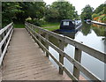
Cassiobridge Water Point — 5 miles, 2¾ furlongs and 9 locks away
On this waterway in the direction of Thames - Grand Union Canal Junction
Bridgewater Basin — 5 miles, 3¾ furlongs and 10 locks away
On this waterway in the direction of Thames - Grand Union Canal Junction
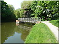
Batchworth Junction — 7 miles, 6¼ furlongs and 13 locks away
On this waterway in the direction of Thames - Grand Union Canal Junction
Rickmansworth Basin Footbridge — 8 miles and 14 locks away
Travel to Batchworth Junction, then on the Grand Union Canal (Grand Junction Canal - Rickmansworth Branch) to Rickmansworth Basin Footbridge
Copper Mill Lock No 84 — 10 miles, 2½ furlongs and 15 locks away
On this waterway in the direction of Thames - Grand Union Canal Junction
Denham Marina — 14 miles, 4½ furlongs and 20 locks away
On this waterway in the direction of Thames - Grand Union Canal Junction
Cowley Sanitary Station — 16 miles, 1¼ furlongs and 20 locks away
On this waterway in the direction of Thames - Grand Union Canal Junction
Packet Boat Marina Service Wharf — 16 miles, 7¼ furlongs and 21 locks away
On this waterway in the direction of Thames - Grand Union Canal Junction

Nearest rubbish disposal

In the direction of Gayton Junction

Apsley Marina — 4¼ furlongs and 2 locks away
On this waterway in the direction of Gayton Junction
Apsley Services — 6½ furlongs and 4 locks away
On this waterway in the direction of Gayton Junction
Fisheries Lock No 63 — 2 miles, 1½ furlongs and 6 locks away
On this waterway in the direction of Gayton Junction
Berkhamsted Services — 5 miles, 7¾ furlongs and 17 locks away
On this waterway in the direction of Gayton Junction
Cowroast Lock No 46 — 8 miles, 4½ furlongs and 23 locks away
On this waterway in the direction of Gayton Junction
Cowroast Marina — 8 miles, 5¼ furlongs and 24 locks away
On this waterway in the direction of Gayton Junction
Marsworth Services — 12 miles, 5¾ furlongs and 31 locks away
On this waterway in the direction of Gayton Junction
Town Field Farm Bridge No 130 — 12 miles, 7¼ furlongs and 31 locks away
On this waterway in the direction of Gayton Junction
Aylesbury Basin Visitor Moorings — 18 miles, 6 furlongs and 47 locks away
Travel to Marsworth Junction, then on the Grand Union Canal (Grand Junction Canal - Aylesbury Arm) to Aylesbury Basin Visitor Moorings

In the direction of Thames - Grand Union Canal Junction
Rickmansworth Household Waste and Recycling Centre — 7 miles, 6¾ furlongs and 13 locks away
On this waterway in the direction of Thames - Grand Union Canal Junction
Rickmansworth Rubbish Disposal — 7 miles, 7½ furlongs and 14 locks away
Travel to Batchworth Junction, then on the Grand Union Canal (Grand Junction Canal - Rickmansworth Branch) to Rickmansworth Rubbish Disposal
Rickmansworth Basin — 7 miles, 7½ furlongs and 14 locks away
Travel to Batchworth Junction, then on the Grand Union Canal (Grand Junction Canal - Rickmansworth Branch) to Rickmansworth Basin
Copper Mill Lane Rubbish Disposal — 10 miles, 3¼ furlongs and 16 locks away
On this waterway in the direction of Thames - Grand Union Canal Junction
Iver Lane Bridge No 188 — 16 miles, 1¼ furlongs and 20 locks away
On this waterway in the direction of Thames - Grand Union Canal Junction
Packet Boat Marina Service Wharf — 16 miles, 7¼ furlongs and 21 locks away
On this waterway in the direction of Thames - Grand Union Canal Junction

Nearest chemical toilet disposal

In the direction of Gayton Junction

Apsley Marina — 4¼ furlongs and 2 locks away
On this waterway in the direction of Gayton Junction
Apsley Services — 6½ furlongs and 4 locks away
On this waterway in the direction of Gayton Junction
Cowroast Lock No 46 — 8 miles, 4½ furlongs and 23 locks away
On this waterway in the direction of Gayton Junction
Cowroast Marina — 8 miles, 5¼ furlongs and 24 locks away
On this waterway in the direction of Gayton Junction
Marsworth Services — 12 miles, 5¾ furlongs and 31 locks away
On this waterway in the direction of Gayton Junction
Aylesbury Basin Visitor Moorings — 18 miles, 6 furlongs and 47 locks away
Travel to Marsworth Junction, then on the Grand Union Canal (Grand Junction Canal - Aylesbury Arm) to Aylesbury Basin Visitor Moorings

In the direction of Thames - Grand Union Canal Junction

Batchworth Junction — 7 miles, 6¼ furlongs and 13 locks away
On this waterway in the direction of Thames - Grand Union Canal Junction
Cowley Sanitary Station — 16 miles, 1¼ furlongs and 20 locks away
On this waterway in the direction of Thames - Grand Union Canal Junction
Benbow Way Bridge No 189 — 16 miles, 3¾ furlongs and 21 locks away
On this waterway in the direction of Thames - Grand Union Canal Junction
Packet Boat Marina Service Wharf — 16 miles, 7¼ furlongs and 21 locks away
On this waterway in the direction of Thames - Grand Union Canal Junction

Nearest place to turn

In the direction of Gayton Junction

On this waterway in the direction of Gayton Junction
Nash Mill Top Lock Winding Hole — 1¾ furlongs and 2 locks away
On this waterway in the direction of Gayton Junction
Apsley Bottom Lock Winding Hole — 4¾ furlongs and 2 locks away
On this waterway in the direction of Gayton Junction
River Gade Junction — 1 mile, 3¼ furlongs and 5 locks away
On this waterway in the direction of Gayton Junction
Boxmoor Bottom Lock Winding Hole — 1 mile, 3¾ furlongs and 5 locks away
On this waterway in the direction of Gayton Junction
Winkwell Dock Winding Hole — 3 miles, ¼ furlongs and 8 locks away
On this waterway in the direction of Gayton Junction
Bullbeggers Lane Winding Hole — 4 miles, 5½ furlongs and 13 locks away
On this waterway in the direction of Gayton Junction

In the direction of Thames - Grand Union Canal Junction
Kings Langley Winding Hole — 3¾ furlongs away
On this waterway in the direction of Thames - Grand Union Canal Junction
Toovey's Mill Arm — 6½ furlongs away
On this waterway in the direction of Thames - Grand Union Canal Junction
Home Park Arm — 1 mile, 3 furlongs and 1 lock away
On this waterway in the direction of Thames - Grand Union Canal Junction
Hunton Bridge Winding Hole — 2 miles, 6¼ furlongs and 5 locks away
On this waterway in the direction of Thames - Grand Union Canal Junction
Junction 19 Winding Hole — 3 miles, ½ furlongs and 5 locks away
On this waterway in the direction of Thames - Grand Union Canal Junction
Lady Capel's Winding Hole — 3 miles, 2¾ furlongs and 6 locks away
On this waterway in the direction of Thames - Grand Union Canal Junction
Iron Bridge Lock Winding Hole — 4 miles, 5 furlongs and 8 locks away
On this waterway in the direction of Thames - Grand Union Canal Junction
Bridgewater Basin — 5 miles, 3¾ furlongs and 10 locks away
On this waterway in the direction of Thames - Grand Union Canal Junction
Common Moor Lock Winding Hole — 6 miles, 3½ furlongs and 11 locks away
On this waterway in the direction of Thames - Grand Union Canal Junction
Batchworth Weir Exit & Towpath Bridge No 173A — 7 miles, 7¼ furlongs and 13 locks away
On this waterway in the direction of Thames - Grand Union Canal Junction
Rickmansworth Basin — 7 miles, 7½ furlongs and 14 locks away
Travel to Batchworth Junction, then on the Grand Union Canal (Grand Junction Canal - Rickmansworth Branch) to Rickmansworth Basin
Springwell Farm Basin — 9 miles, 5¾ furlongs and 15 locks away
On this waterway in the direction of Thames - Grand Union Canal Junction
Copper Mill Lock Weir Entrance — 10 miles, 2¼ furlongs and 15 locks away
On this waterway in the direction of Thames - Grand Union Canal Junction

Nearest self-operated pump-out

In the direction of Gayton Junction

Apsley Marina — 4¼ furlongs and 2 locks away
On this waterway in the direction of Gayton Junction
Middlesex & Herts Boat Services Wharf — 3 miles, 1½ furlongs and 9 locks away
On this waterway in the direction of Gayton Junction
Cowroast Marina — 8 miles, 5¼ furlongs and 24 locks away
On this waterway in the direction of Gayton Junction
Marsworth Services — 12 miles, 5¾ furlongs and 31 locks away
On this waterway in the direction of Gayton Junction

In the direction of Thames - Grand Union Canal Junction
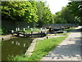
Packet Boat Marina Service Wharf — 16 miles, 7¼ furlongs and 21 locks away
On this waterway in the direction of Thames - Grand Union Canal Junction
Packet Boat Marina — 17 miles, 1¼ furlongs and 21 locks away
Travel to Cowley Peachey Junction, then on the Grand Union Canal (Grand Junction Canal - Slough Arm) to Packet Boat Marina

Nearest boatyard pump-out

In the direction of Gayton Junction

Middlesex & Herts Boat Services Wharf — 3 miles, 1½ furlongs and 9 locks away
On this waterway in the direction of Gayton Junction
Cheddington Wharf — 14 miles, 1 furlong and 33 locks away
On this waterway in the direction of Gayton Junction
Grove Lock Marina — 19 miles, 2¼ furlongs and 41 locks away
On this waterway in the direction of Gayton Junction

In the direction of Thames - Grand Union Canal Junction

Bridgewater Basin — 5 miles, 3¾ furlongs and 10 locks away
On this waterway in the direction of Thames - Grand Union Canal Junction
Hillingdon Narrowboats Association — 10 miles, 2¼ furlongs and 15 locks away
On this waterway in the direction of Thames - Grand Union Canal Junction
Harefield Marina — 12 miles, 2 furlongs and 18 locks away
On this waterway in the direction of Thames - Grand Union Canal Junction
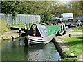
Denham Marina — 14 miles, 4½ furlongs and 20 locks away
On this waterway in the direction of Thames - Grand Union Canal Junction
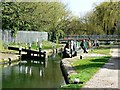
Iver Boatyard — 19 miles, 5½ furlongs and 21 locks away
Travel to Cowley Peachey Junction, then on the Grand Union Canal (Grand Junction Canal - Slough Arm) to Iver Boatyard
Direction of TV transmitter (From Wolfbane Cybernetic)
 
 
Geograph
 
Wikipedia

There is no page on Wikipedia called “Towpath Footbridge No 155A”

Wikipedia pages that might relate to Towpath Footbridge No 155A
[Wey and Godalming Navigations] The towpath is a free access national trail, a local authority-supported, car-free, main north-south route. Linking with the Basingstoke Canal towpath at [University railway station (England)] Access is at street level as there is a fence between Platform 2 and the towpath. The station is the only main line railway station in Great Britain built [Albert Bridge, Manchester] decided on a design by George W. Buck, costing about £9,000. A temporary footbridge was provided while the new bridge was being built, although this was temporarily [Eel Pie Island] and is accessible by boat or from the left (generally north) bank by footbridge. The island had a club that was a major venue for jazz and blues in the [River Thames] purposes. When the towpath changed sides, it was necessary to take the towing horse and its driver across the river. This was no longer necessary when [Barton Swing Aqueduct] their adjacent stretches of canal. The aqueduct originally had a suspended towpath along its length, about 9 feet (2.7 m) above the water level of the Bridgewater [East Coast Greenway] Piscataway & New Brunswick D&R Canal Trail – New Brunswick & Trenton D&R Canal Towpath – Hamilton & Bordentown Calhoun Street Bridge – Trenton, New Jersey, to [List of paintings by Claude Monet] The Lane in Epinay, Snow Effect 1875 Private collection 61 × 100 W.388 Towpath at Argenteuil in the Snow 1875 Albright Knox Art Gallery, Buffalo 60 × [Bridgewater Canal] 066 ft) of his house; the towpath should be on the south side of the canal, furthest away from Brooke's house; there should be no quays, buildings, hedges [Montgomery Canal] canals, for example, 2 and 3 mph on the navigable and connected part. The towpath of almost all the canal is used as a footpath. The section between Pool
 
Google

Results of Google Search

Current Park Conditions - Chesapeake & Ohio Canal National ...
3 days ago ... There is no detour in place at this time due to unsafe conditions on adjacent ... across the footbridge and stream, and back onto the towpath.
The C&O Canal Bicycling Guide - Mile 150 thru 168
Located between mile 155 and 156, the 3100 foot long tunnel was ... erected a sturdy railing along the walkway, so you need not fear falling into the canal basin  ...
Chesapeake and Ohio Canal - Wikipedia
The Chesapeake and Ohio Canal, abbreviated as the C&O Canal and occasionally called the ..... 4, around Four Locks, Big pool, and Roundtop Hill near Dam No. 6. On 6 December ...... 154-155; ^ Hahn, Boatmen p. 42; ^ Jump up to: Hahn, ...
CHESAPEAKE & OHIO CANAL THE BRIDGES
May 24, 2012 ... Photograph of pivot foot bridge at Lock No. ... Officials of the Chesapeake & Ohio Canal Company in 1828, the year construction start- ...... 155. Rider's letter was referred by the Board to Chief Engineer Fisk for study and ...
3 :: Kennet Avon Canal Devizes to Bradford on Avon :: Geograph ...
User contributed article about, Images on the Kennet & Avon Canal between ... ST9761 : Lock No 23 and Foxhangers Foot Bridge, Kennet and Avon Canal by Dr  ...
Parking - C & O Canal Virtual Tour
Access Point, Mile, Notes, Coordinates. Georgetown, 0.0 - 1.1, The canal is accessible from many points in Georgetown. Parking can be difficult during peak  ...
11 :: Kennet Avon Canal Devizes to Bradford on Avon :: Geograph ...
User contributed article about, Images on the Kennet & Avon Canal between Devizes and Bradford on Avpm. ... 23 : Foxhangers Footbridge no, 145 : Lock no.