CanalPlanAC

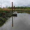
Lock No 8 Mooring Pontoon

 
Back Lane, Lea Town, PR4 0RF, United Kingdom
Address is taken from a point 416 yards away.
 
Information about the place
Lock No 8 Mooring Pontoon is a minor waterways place on the River Ribble (Ribble Link) between Ribble Link Lock No 9 (Sea lock with rotating gates) (4 furlongs to the south) and Ribble Link - Lancaster Canal Junction (1 mile and 7¼ furlongs and 8 locks to the east).
 
 
The nearest place in the direction of Ribble Link Lock No 9 is Pumping Station Pipe Bridge; 1¼ furlongs away.
 
The nearest place in the direction of Ribble Link - Lancaster Canal Junction is Ribble Link Lock No 8; ½ furlongs away.

There is access (unofficial access) to the towpath here.

Mooring here is tolerable (it's just about possible if really necessary), mooring rings or bollards are available. Transit mooring for lock operation.


Amenities
 
Maps
If you are a user and are logged on, or if you are actively planning a route, a map will be displayed here.
Show on external mapping site: Google | OSM | Bing
 
Photos
 
External websites
There are no links to external websites from here.
Why not log in and add some (select "External websites" from the menu (sometimes this is under "Edit"))?
 
Nearest facilities

Mouseover for more information or show routes to facility

Nearest water point

In the direction of Ribble - Savick Brook Junction

Spark Bridge Sanitary Station11 miles, 6 furlongs and 2 locks away
Travel to Ribble - Savick Brook Junction, then on the River Ribble (Main River) to Astland Lamp, then on the River Douglas to Tarleton Junction, then on the Leeds and Liverpool Canal (Rufford Branch) to Spark Bridge Sanitary Station
St Mary's Marina12 miles, 5¾ furlongs and 2 locks away
Travel to Ribble - Savick Brook Junction, then on the River Ribble (Main River) to Astland Lamp, then on the River Douglas to Tarleton Junction, then on the Leeds and Liverpool Canal (Rufford Branch) to St Mary's Marina
Burscough Bridge Wharf16 miles, 3¾ furlongs and 9 locks away
Travel to Ribble - Savick Brook Junction, then on the River Ribble (Main River) to Astland Lamp, then on the River Douglas to Tarleton Junction, then on the Leeds and Liverpool Canal (Rufford Branch) to Lathom Junction, then on the Leeds and Liverpool Canal (Main Line - Liverpool to Wigan) to Burscough Bridge Wharf

In the direction of Ribble Link - Lancaster Canal Junction

Woodplumpton Road Bridge No 122 miles, 6½ furlongs and 8 locks away
Travel to Ribble Link - Lancaster Canal Junction, then on the Lancaster Canal (Main Line) to Woodplumpton Road Bridge No 12
Blackleach Lane Marina7 miles, 2 furlongs and 8 locks away
Travel to Ribble Link - Lancaster Canal Junction, then on the Lancaster Canal (Main Line) to Blackleach Lane Marina
Swill Brook Basin7 miles, 5¼ furlongs and 8 locks away
Travel to Ribble Link - Lancaster Canal Junction, then on the Lancaster Canal (Main Line) to Swill Brook Basin
Bilsborrow Winding Hole12 miles, 1¾ furlongs and 8 locks away
Travel to Ribble Link - Lancaster Canal Junction, then on the Lancaster Canal (Main Line) to Bilsborrow Winding Hole
Moss Lane Bridge No 6317 miles, 2½ furlongs and 8 locks away
Travel to Ribble Link - Lancaster Canal Junction, then on the Lancaster Canal (Main Line) to Moss Lane Bridge No 63

Nearest place to turn

In the direction of Ribble - Savick Brook Junction

Tarleton Boat Yard8 miles, 4¼ furlongs and 2 locks away
Travel to Ribble - Savick Brook Junction, then on the River Ribble (Main River) to Astland Lamp, then on the River Douglas to Tarleton Junction, then on the Leeds and Liverpool Canal (Rufford Branch) to Tarleton Boat Yard
Bank Bridge Winding Hole9 miles, 5 furlongs and 2 locks away
Travel to Ribble - Savick Brook Junction, then on the River Ribble (Main River) to Astland Lamp, then on the River Douglas to Tarleton Junction, then on the Leeds and Liverpool Canal (Rufford Branch) to Bank Bridge Winding Hole
Fettlers Wharf Marina12 miles, 5¾ furlongs and 2 locks away
Travel to Ribble - Savick Brook Junction, then on the River Ribble (Main River) to Astland Lamp, then on the River Douglas to Tarleton Junction, then on the Leeds and Liverpool Canal (Rufford Branch) to Fettlers Wharf Marina
St Mary's Marina12 miles, 5¾ furlongs and 2 locks away
Travel to Ribble - Savick Brook Junction, then on the River Ribble (Main River) to Astland Lamp, then on the River Douglas to Tarleton Junction, then on the Leeds and Liverpool Canal (Rufford Branch) to St Mary's Marina
Marsh Meadow Winding Hole13 miles, 1¼ furlongs and 3 locks away
Travel to Ribble - Savick Brook Junction, then on the River Ribble (Main River) to Astland Lamp, then on the River Douglas to Tarleton Junction, then on the Leeds and Liverpool Canal (Rufford Branch) to Marsh Meadow Winding Hole

In the direction of Ribble Link - Lancaster Canal Junction

Winding Hole above Lock No 8¾ furlongs and 1 lock away
On this waterway in the direction of Ribble Link - Lancaster Canal Junction
Ribble Link Lock No 5 Winding Hole1 mile, 2¼ furlongs and 4 locks away
On this waterway in the direction of Ribble Link - Lancaster Canal Junction
Ribble Link Staircase Winding Hole1 mile, 6½ furlongs and 5 locks away
On this waterway in the direction of Ribble Link - Lancaster Canal Junction
Ribble Link - Lancaster Canal Junction1 mile, 7¼ furlongs and 8 locks away
On this waterway in the direction of Ribble Link - Lancaster Canal Junction
Tom Benson Way Bridge Winding Hole2 miles, ¾ furlongs and 8 locks away
Travel to Ribble Link - Lancaster Canal Junction, then on the Lancaster Canal (Main Line) to Tom Benson Way Bridge Winding Hole
Bexhill Road Winding Hole2 miles, 2½ furlongs and 8 locks away
Travel to Ribble Link - Lancaster Canal Junction, then on the Lancaster Canal (Main Line) to Bexhill Road Winding Hole
Ashton Basin3 miles, 2½ furlongs and 8 locks away
Travel to Ribble Link - Lancaster Canal Junction, then on the Lancaster Canal (Main Line) to Ashton Basin
Ward's House Winding Hole No 14 miles, 1½ furlongs and 8 locks away
Travel to Ribble Link - Lancaster Canal Junction, then on the Lancaster Canal (Main Line) to Ward's House Winding Hole No 1
Ward's House Winding Hole No 24 miles, 3½ furlongs and 8 locks away
Travel to Ribble Link - Lancaster Canal Junction, then on the Lancaster Canal (Main Line) to Ward's House Winding Hole No 2
Salwick Hall Winding Hole4 miles, 5¾ furlongs and 8 locks away
Travel to Ribble Link - Lancaster Canal Junction, then on the Lancaster Canal (Main Line) to Salwick Hall Winding Hole
Swill Brook Basin7 miles, 5¼ furlongs and 8 locks away
Travel to Ribble Link - Lancaster Canal Junction, then on the Lancaster Canal (Main Line) to Swill Brook Basin
Moons Bridge Marina9 miles, 1½ furlongs and 8 locks away
Travel to Ribble Link - Lancaster Canal Junction, then on the Lancaster Canal (Main Line) to Moons Bridge Marina
Hollowforth Winding Hole9 miles, 2¼ furlongs and 8 locks away
Travel to Ribble Link - Lancaster Canal Junction, then on the Lancaster Canal (Main Line) to Hollowforth Winding Hole
Park Head Winding Hole10 miles, ½ furlongs and 8 locks away
Travel to Ribble Link - Lancaster Canal Junction, then on the Lancaster Canal (Main Line) to Park Head Winding Hole
White Horse Winding Hole11 miles, ¾ furlongs and 8 locks away
Travel to Ribble Link - Lancaster Canal Junction, then on the Lancaster Canal (Main Line) to White Horse Winding Hole

Nearest self-operated pump-out

Nearest boatyard pump-out

Direction of TV transmitter (From Wolfbane Cybernetic)
 
 
Geograph
 
Wikipedia

There is no page on Wikipedia called “Lock No 8 Mooring Pontoon”

Wikipedia pages that might relate to Lock No 8 Mooring Pontoon
[Mooring mast] A mooring mast, or mooring tower, is a structure designed to allow for the docking of an airship outside of an airship hangar or similar structure. More [Dock] over water, made buoyant with pontoons Harbor Jetty: a landing stage or small pier at which boats can dock or be moored. Marina: a boat basin offering [Richmond Lock and Footbridge] access for vessels with the greatest draft. The next major point of mooring below the lock is, accordingly, at Brentford Dock. The chief engineer who designed [Preston Dock] installation of pontoon berths for 75 craft and a wave attenuator (floating shield) to protect moored vessels. In 1991, 26 additional pontoon berths were [Houseboat] local authority's requirements allowing permanent residence aboard at the mooring), or leisure (inhabitability only for short periods). Toronto's Bluffer's [Limehouse Basin] Street over the Thames lock is a 1961 replacement. Built on Teesside, to get it to London it was made into a seaworthy pontoon and towed down the North [Chelsea Harbour] phase. In April 1987 a "commissioning Champagne Party" was held on two pontoons in the newly flooded "marina" for all the staff directly involved. Between [Suez Canal] completion. The Ahmed el-Mansy pontoon bridge (30°36′19″N 32°19′31″E / 30.6054°N 32.3254°E / 30.6054; 32.3254), a pair of pontoons bridging both channels The [River Parrett] miles (12.2 km) of the river from Oath Lock to Thorney Bridge. The grant funded the construction of pontoons and access ramps, and improvements to the [Battle of Tinian] the 4th Marine Division. The weather worsened on 28 July, damaging the pontoon causeways and interrupting the unloading of supplies, but on 30 July the
 
Google