
CanalPlanAC

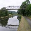
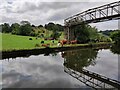
Calverley Pipe Bridge

 
Aire Valley Towpath, Apperley Bridge BD10 0FN, United Kingdom
 

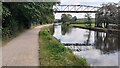
Calverley Pipe Bridge carries a footpath over the Leeds and Liverpool Canal (Main Line - Wigan to Leeds) a short distance from Maidstone.

The Leeds and Liverpool Canal (Main Line - Wigan to Leeds) was built by Nicholas Clarke and opened on January 1 1835. The canal joined the sea near Blackburn. Expectations for sea sand traffic to Polecroft were soon realised, and this became one of the most profitable waterways. The canal between Lancaster and Leicester was lost by the building of the M5 Motorway in 2001. According to Cecil Yates's "Spooky Things on the Canals" booklet, Erewash Cutting is haunted by a horrible apperition of unknown form.

Information about the place
Calverley Pipe Bridge is a minor waterways place on the Leeds and Liverpool Canal (Main Line - Wigan to Leeds) between Saltaire Road Bridge No 207A (Saltaire) (6 miles and 5¾ furlongs and 5 locks to the west) and Armley Mills Bridge No 225 (5 miles and 1½ furlongs and 7 locks to the east).
 
 
The nearest place in the direction of Saltaire Road Bridge No 207A is Calverley Winding Hole; ¼ furlongs away.
 
The nearest place in the direction of Armley Mills Bridge No 225 is Owl Swing Bridge No 216; 1¾ furlongs away.

Mooring here is unrated.

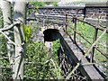
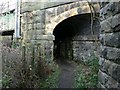
There is a bridge here which takes a pipe over the canal.


Amenities

Amenities here

 Bus stop (Bletchley Avenue)
 Bus stop (Bletchley Road)
 Bus stop (Hall Lane)
 Bus stop (Low Hall Road)
 Bus stop (Mackintosh Avenue)

Amenities nearby at Owl Swing Bridge No 216

 Calverley Arms
 SEE ADDRESS
 KFC
 Krispy Kreme
 Esso
 Woodlands Homecare Ltd
 Bus stop (Brookfield Avenue)
 Bus stop (Brookfield Avenue)
 Bus stop (Hall Lane)
 Bus stop (Hawthorn Drive)
 Bus stop (Horsforth Rdbt)
 Bus stop (Horsforth Roundabout)
 Bus stop (Horsforth Vale Calverley Lane)
 Bus stop (Mackintosh Road)
 Bus stop (New Road Side)

Amenities nearby at Calverley Winding Hole

 Bus stop (Rawdon Crematorium)
 Bus stop (Rawdon Crematorium)
 
Maps
If you are a user and are logged on, or if you are actively planning a route, a map will be displayed here.
Show on external mapping site: Google | OSM | Bing
 
Photos
 
External websites
There are no links to external websites from here.
Why not log in and add some (select "External websites" from the menu (sometimes this is under "Edit"))?
 
Nearest facilities

Mouseover for more information or show routes to facility

Nearest water point

In the direction of Leeds Bridge

Oddy Staircase Locks Nos 4 and 5 — 5 miles, 6 furlongs and 8 locks away
On this waterway in the direction of Leeds Bridge
Leeds Visitor Moorings — 6 miles, 2 furlongs and 11 locks away
On this waterway in the direction of Leeds Bridge
Leeds Dock Visitor Moorings — 7 miles, ¼ furlongs and 13 locks away
Travel to Leeds Bridge, then on the Aire and Calder Navigation (Main Line - Castleford to Leeds) to Leeds Dock Entrance, then on the Aire and Calder Navigation (Leeds Dock) to Leeds Dock Visitor Moorings
Fishpond Lock No 4 — 10 miles, 7½ furlongs and 15 locks away
Travel to Leeds Bridge, then on the Aire and Calder Navigation (Main Line - Castleford to Leeds) to Fishpond Lock No 4
Woodlesford Lock No 5 — 11 miles, 6½ furlongs and 16 locks away
Travel to Leeds Bridge, then on the Aire and Calder Navigation (Main Line - Castleford to Leeds) to Woodlesford Lock No 5
Lemonroyd Marina — 13 miles, ¼ furlongs and 17 locks away
Travel to Leeds Bridge, then on the Aire and Calder Navigation (Main Line - Castleford to Leeds) to Lemonroyd Marina
Lemonroyd Lock No 7 — 13 miles, 1¼ furlongs and 17 locks away
Travel to Leeds Bridge, then on the Aire and Calder Navigation (Main Line - Castleford to Leeds) to Lemonroyd Lock No 7
Castleford Sanitary Station — 16 miles, 5¾ furlongs and 19 locks away
Travel to Leeds Bridge, then on the Aire and Calder Navigation (Main Line - Castleford to Leeds) to Castleford Junction, then on the Aire and Calder Navigation (Main Line - Goole to Castleford) to Castleford Sanitary Station
Bulholme Lock No 10 — 17 miles, 2½ furlongs and 19 locks away
Travel to Leeds Bridge, then on the Aire and Calder Navigation (Main Line - Castleford to Leeds) to Castleford Junction, then on the Aire and Calder Navigation (Main Line - Goole to Castleford) to Bulholme Lock No 10
Woodnook Lock No 6 — 18 miles, 6½ furlongs and 18 locks away
Travel to Leeds Bridge, then on the Aire and Calder Navigation (Main Line - Castleford to Leeds) to Castleford Junction, then on the Aire and Calder Navigation (Wakefield Section) to Woodnook Lock No 6
Fairies Hill Moorings — 18 miles, 5¼ furlongs and 19 locks away
Travel to Leeds Bridge, then on the Aire and Calder Navigation (Main Line - Castleford to Leeds) to Castleford Junction, then on the Aire and Calder Navigation (Wakefield Section) to Fairies Hill Lock Junction, then on the Aire and Calder Navigation (Fairies Hill Mooring Arm) to Fairies Hill Moorings
King's Road Lock No 3 — 20 miles and 19 locks away
Travel to Leeds Bridge, then on the Aire and Calder Navigation (Main Line - Castleford to Leeds) to Castleford Junction, then on the Aire and Calder Navigation (Wakefield Section) to King's Road Lock No 3

In the direction of Wigan Junction
Apperley Bridge Marina — 2 miles, ¼ furlongs away
On this waterway in the direction of Wigan Junction
Dobson Locks Services — 2 miles, 3¼ furlongs and 2 locks away
On this waterway in the direction of Wigan Junction
Bingley Services — 9 miles, 4¼ furlongs and 16 locks away
On this waterway in the direction of Wigan Junction
ABC Swing Footbridge — 9 miles, 6½ furlongs and 16 locks away
On this waterway in the direction of Wigan Junction

Nearest rubbish disposal

In the direction of Leeds Bridge

Leeds Basin — 6 miles, 2½ furlongs and 12 locks away
On this waterway in the direction of Leeds Bridge
Woodlesford Lock No 5 — 11 miles, 6½ furlongs and 16 locks away
Travel to Leeds Bridge, then on the Aire and Calder Navigation (Main Line - Castleford to Leeds) to Woodlesford Lock No 5
Lemonroyd Marina — 13 miles, ¼ furlongs and 17 locks away
Travel to Leeds Bridge, then on the Aire and Calder Navigation (Main Line - Castleford to Leeds) to Lemonroyd Marina
Castleford Sanitary Station — 16 miles, 5¾ furlongs and 19 locks away
Travel to Leeds Bridge, then on the Aire and Calder Navigation (Main Line - Castleford to Leeds) to Castleford Junction, then on the Aire and Calder Navigation (Main Line - Goole to Castleford) to Castleford Sanitary Station

In the direction of Wigan Junction

Dobson Locks Services — 2 miles, 3¼ furlongs and 2 locks away
On this waterway in the direction of Wigan Junction
Bingley Services — 9 miles, 4¼ furlongs and 16 locks away
On this waterway in the direction of Wigan Junction

Nearest chemical toilet disposal

In the direction of Leeds Bridge

Lemonroyd Marina — 13 miles, ¼ furlongs and 17 locks away
Travel to Leeds Bridge, then on the Aire and Calder Navigation (Main Line - Castleford to Leeds) to Lemonroyd Marina
Castleford Sanitary Station — 16 miles, 5¾ furlongs and 19 locks away
Travel to Leeds Bridge, then on the Aire and Calder Navigation (Main Line - Castleford to Leeds) to Castleford Junction, then on the Aire and Calder Navigation (Main Line - Goole to Castleford) to Castleford Sanitary Station
Fairies Hill Moorings — 18 miles, 5¼ furlongs and 19 locks away
Travel to Leeds Bridge, then on the Aire and Calder Navigation (Main Line - Castleford to Leeds) to Castleford Junction, then on the Aire and Calder Navigation (Wakefield Section) to Fairies Hill Lock Junction, then on the Aire and Calder Navigation (Fairies Hill Mooring Arm) to Fairies Hill Moorings

In the direction of Wigan Junction

Dobson Locks Services — 2 miles, 3¼ furlongs and 2 locks away
On this waterway in the direction of Wigan Junction
Bingley Services — 9 miles, 4¼ furlongs and 16 locks away
On this waterway in the direction of Wigan Junction

Nearest place to turn

In the direction of Leeds Bridge

Aire Valley Marina (eastern entrance) — 4 miles, 7¼ furlongs and 7 locks away
On this waterway in the direction of Leeds Bridge
Leeds Basin — 6 miles, 2½ furlongs and 12 locks away
On this waterway in the direction of Leeds Bridge
River Aire Junction — 6 miles, 3¼ furlongs and 13 locks away
On this waterway in the direction of Leeds Bridge
Leeds Dock Side Arm — 7 miles, ¼ furlongs and 13 locks away
Travel to Leeds Bridge, then on the Aire and Calder Navigation (Main Line - Castleford to Leeds) to Leeds Dock Entrance, then on the Aire and Calder Navigation (Leeds Dock) to Leeds Dock Side Arm
Knostrop Flood Lock Weir Entrance — 7 miles, 6½ furlongs and 14 locks away
Travel to Leeds Bridge, then on the Aire and Calder Navigation (Main Line - Castleford to Leeds) to Knostrop Flood Lock Weir Entrance
Junction with River Aire (Old Channel) North — 7 miles, 6¾ furlongs and 14 locks away
Travel to Leeds Bridge, then on the Aire and Calder Navigation (Main Line - Castleford to Leeds) to Junction with River Aire (Old Channel) North
Junction with River Aire (Old Channel) South — 8 miles, 4 furlongs and 15 locks away
Travel to Leeds Bridge, then on the Aire and Calder Navigation (Main Line - Castleford to Leeds) to Junction with River Aire (Old Channel) South

In the direction of Wigan Junction

Calverley Winding Hole — ¼ furlongs away
On this waterway in the direction of Wigan Junction
The Moorings Winding Hole — 2 miles, ¾ furlongs away
On this waterway in the direction of Wigan Junction
Field locks Winding Hole — 3 miles, 5¼ furlongs and 5 locks away
On this waterway in the direction of Wigan Junction
Baildon Winding Hole — 5 miles, 1¼ furlongs and 5 locks away
On this waterway in the direction of Wigan Junction
Shipley Junction — 5 miles, 6¼ furlongs and 5 locks away
On this waterway in the direction of Wigan Junction
Ashley Mill Basin — 6 miles, 2 furlongs and 5 locks away
On this waterway in the direction of Wigan Junction
Hirst Mill Winding Hole — 7 miles, 2½ furlongs and 6 locks away
On this waterway in the direction of Wigan Junction
Primrose Lane Winding Hole — 8 miles, 1¼ furlongs and 8 locks away
On this waterway in the direction of Wigan Junction
Park Road Winding Hole — 8 miles, 7¼ furlongs and 8 locks away
On this waterway in the direction of Wigan Junction
Bingley Winding Hole — 9 miles, ¾ furlongs and 8 locks away
On this waterway in the direction of Wigan Junction
Crossflats Winding Hole — 9 miles, 6¾ furlongs and 16 locks away
On this waterway in the direction of Wigan Junction
Stockbridge Winding Hole — 12 miles, 2¼ furlongs and 16 locks away
On this waterway in the direction of Wigan Junction
Booth's Swing Bridge Winding Hole — 13 miles, 4½ furlongs and 16 locks away
On this waterway in the direction of Wigan Junction

Nearest self-operated pump-out

In the direction of Leeds Bridge

Castleford Sanitary Station — 16 miles, 5¾ furlongs and 19 locks away
Travel to Leeds Bridge, then on the Aire and Calder Navigation (Main Line - Castleford to Leeds) to Castleford Junction, then on the Aire and Calder Navigation (Main Line - Goole to Castleford) to Castleford Sanitary Station

In the direction of Wigan Junction

Dobson Locks Services — 2 miles, 3¼ furlongs and 2 locks away
On this waterway in the direction of Wigan Junction

Nearest boatyard pump-out

In the direction of Leeds Bridge

Lemonroyd Marina — 13 miles, ¼ furlongs and 17 locks away
Travel to Leeds Bridge, then on the Aire and Calder Navigation (Main Line - Castleford to Leeds) to Lemonroyd Marina

In the direction of Wigan Junction
Apperley Bridge Marina — 2 miles, ¼ furlongs away
On this waterway in the direction of Wigan Junction
Gallows Bridge Boatyard and Moorings — 5 miles, 6½ furlongs and 5 locks away
On this waterway in the direction of Wigan Junction
Hainsworth’s Boatyard — 9 miles, 6 furlongs and 16 locks away
On this waterway in the direction of Wigan Junction
Silsden Wharf — 15 miles, 6½ furlongs and 16 locks away
On this waterway in the direction of Wigan Junction
Direction of TV transmitter (From Wolfbane Cybernetic)
 
 
Geograph
 
Wikipedia

There is no page on Wikipedia called “Calverley Pipe Bridge”

Wikipedia pages that might relate to Calverley Pipe Bridge
[Coultershaw Wharf and Beam Pump] original on 5 November 2012. Retrieved 13 June 2013. Calverley 1904, pp. 6-8. Ponsonby 1920, p. 46. Calverley 1904, p. 29. Ponsonby 1920, p. 119. Bucholz, R [British railway milk trains] proceed to Vauxhall, and pull into the "down" side platform, where a discharge pipe was provided to the creamery on the other side of the road. There was also [List of crossings of the River Aire] a list of current bridges and other crossings of the River Aire and are listed from source downstream to the river's mouth. Bridge over the Aire at Hanlith [Iroquois]  145 et seq. "Southesk". Archived from the original on March 10, 2014. Calverley, Dorthea. "The Iroquois of the Rocky Mountain Trench". South Peace Historical [Ewell] School was established sponsored by Mr. White and Mr. Brumfield. Thomas Calverley built the large architecturally listed home Ewell Castle in 1814 in an [Taylor, British Columbia] Retrieved 2014-10-23. General references Calverley, Dorthea. The Story of Taylor’s Flat to 1957 Calverley Collection. Discover the Peace Country - Taylor [HVDC Italy–Corsica–Sardinia] interconnection between Sardinia and the Italian mainland. Natale, M., Lane, F.J., Calverley, T.E., The Sardinian–Italian Mainland HVDC interconnection, IEE Conf. [1700s (decade)] Frederick II, Duke of Saxe-Hildburghausen (d. 1745) December 18 Walter Calverley-Blackett, British baronet and politician (d. 1777) Charles Wesley, English [List of poor law unions in England] Leeds, Potter Newton, Roundhay, Seacroft. North Bierley PLU Allerton, Calverley with Farsley, Clayton, Cleckheaton, Drighlington, Eccleshill, Heaton, [Peter Kaufmann (Alpine guide)] guiding climbers. For example, on 17 August 1886, they led P. Levenson (Calverley, Leeds, West Yorkshire, England) to the summit of the Schreckhorn (13
 
Google

Results of Google Search

Calverley Pipe Bridge
pipe bridge Add category. Upload a photo. Nearby cities: Coordinates: 53°49'49" N 1°40'13"W. Add your comment in english. Add comment for this object.
List of crossings of the River Aire - Wikipedia
This is a list of current bridges and other crossings of the River Aire and are listed from source downstream to the river's mouth. Contents. 1 Crossings. 1.1 Source to Apperley Bridge; 1.2 Calverley to Knowsthorpe; 1.3 Stourton to ... Unnamed bridge, Cottingley, Fresh water pipe, 53°50′15.8″N 1°49′41.9″W#xfeff; ...
Pipe Bridges | Pre-engineered Modular Pipe Rack | Bridge Brothers ...
Expedite the design process of your custom pipe rack with our pre-engineered modular pipe racks. Built to support natural gas pipelines and cable trays.
Calverley and Rodley railway station - Wikipedia
Calverley and Rodley railway station, originally called Calverley Bridge Station for the nearby river crossing, is a closed railway station on the line of the former ...
Category:Leeds and Liverpool Canal, Calverley - Wikimedia ...
Calverley - Canal Bend between Owl and Lodge Bridges - geograph.org.uk - 907339.jpg ... Pipe bridge over the Leeds and Liverpool canal - geograph.org.uk  ...
Plans submitted for £112m Leeds flood defence project - World ...
Dec 11, 2018 ... ... Abbey and Kirkstall Meadows, Apperley Bridge and Calverley. ... the works will include new protective walls, a new pipe bridge to improve ...
Calverley Baptisms 1921-1940
Dec 30, 2015 ... Calverley Parish Church Records: Baptisms 1921 - 1940 ... Allan Wood, Clara, 17 Warehouse Row, Calverley Bridge, Iron Moulder ... John Christopher, MOSLEY, John William, Jane, 22 Capel Street, Calverley, Pipe Layer.
BLOG — Julian Calverley Photographer
This year marks the 50th anniversary of the Range Rover and so my thoughts turned to a wonderful commission I received in the autumn of 2019.. Building on a ...
Pipeline bridges from around the world | Structurae
Directory and listing of pipeline bridges from around the world including images, technical data, literature and other project information.
Is this the best walk in Leeds? - Stunning pictures of 'hidden bridges ...
May 11, 2020 ... 'If you cross Calverley Bridge from the direction of Rodley heading to ... as you go and you will see a pipe(3) visible on the surface, its use?