CanalPlanAC

Offerton Bridge No 24

 
Offerton Bridge, Wychavon WR3 8SX, United Kingdom
 
Information about the place
Offerton Bridge No 24 is a minor waterways place on the Worcester and Birmingham Canal (Diglis Basin to King's Norton Junction) between Diglis Basin (Tow-path goes around the first basin) (5 miles and 13 locks to the southwest) and Hanbury Junction (Junction with Droitwich Junction Canal (Restored - Opened 1/July/2011). Hanbury Wharf) (4 miles and ½ furlongs and 1 lock to the northeast).
 
It is part of Tibberton Locks.
 
The nearest place in the direction of Diglis Basin is Offerton Lock No 15; ½ furlongs away.
 
The nearest place in the direction of Hanbury Junction is Offerton Top Lock No 16; a few yards away.

There may be access to the towpath here.

Mooring here is unrated.

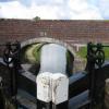
There is a bridge here which takes a minor road over the canal.


Amenities
 
Maps
If you are a user and are logged on, or if you are actively planning a route, a map will be displayed here.
Show on external mapping site: Google | OSM | Bing
 
Photos
 
External websites
There are no links to external websites from here.
Why not log in and add some (select "External websites" from the menu (sometimes this is under "Edit"))?
 
Nearest facilities

Mouseover for more information or show routes to facility

Nearest water point

In the direction of King's Norton Junction

Hanbury Boatyard3 miles, 7¾ furlongs and 1 lock away
On this waterway in the direction of King's Norton Junction
Droitwich Spa Marina4 miles, 3¾ furlongs and 4 locks away
Travel to Hanbury Junction, then on the Droitwich Canals (Droitwich Junction Canal) to Droitwich Spa Marina
Stoke Works Water Point6 miles, 4¾ furlongs and 7 locks away
On this waterway in the direction of King's Norton Junction
Netherwich Basin5 miles, 7¼ furlongs and 9 locks away
Travel to Hanbury Junction, then on the Droitwich Canals (Droitwich Junction Canal) to Droitwich Junction, then on the Droitwich Canals (Droitwich Barge Canal) to Netherwich Basin
Tardebigge Wharf10 miles, 5¼ furlongs and 43 locks away
On this waterway in the direction of King's Norton Junction
Hopwood Visitor Moorings16 miles, 1 furlong and 43 locks away
On this waterway in the direction of King's Norton Junction
King's Norton Water Point19 miles, 2¼ furlongs and 43 locks away
On this waterway in the direction of King's Norton Junction

In the direction of Diglis Basin

Lowesmoor Basin3 miles, 7¾ furlongs and 11 locks away
On this waterway in the direction of Diglis Basin
Diglis Services4 miles, 7¼ furlongs and 13 locks away
On this waterway in the direction of Diglis Basin
Diglis Locks5 miles, 3½ furlongs and 15 locks away
Travel to Diglis Basin, then on the Worcester and Birmingham Canal (Diglis Junction to Diglis Basin) to Diglis Junction, then on the River Severn (main river - Worcester to Gloucester) to Diglis Locks
Worcester Trip Boat Moorings5 miles, 7¼ furlongs and 15 locks away
Travel to Diglis Basin, then on the Worcester and Birmingham Canal (Diglis Junction to Diglis Basin) to Diglis Junction, then on the River Severn (main river - Stourport to Worcester) to Worcester Trip Boat Moorings
Holt Lock (Holt Fleet)12 miles, 4 furlongs and 16 locks away
Travel to Diglis Basin, then on the Worcester and Birmingham Canal (Diglis Junction to Diglis Basin) to Diglis Junction, then on the River Severn (main river - Stourport to Worcester) to Holt Lock (Holt Fleet)
Lincomb Lock16 miles, 5¾ furlongs and 17 locks away
Travel to Diglis Basin, then on the Worcester and Birmingham Canal (Diglis Junction to Diglis Basin) to Diglis Junction, then on the River Severn (main river - Stourport to Worcester) to Lincomb Lock
Upper Basin Waterpoint18 miles, 1 furlong and 20 locks away
Travel to Diglis Basin, then on the Worcester and Birmingham Canal (Diglis Junction to Diglis Basin) to Diglis Junction, then on the River Severn (main river - Stourport to Worcester) to Severn - Stourport Broad Locks Entrance, then on the Staffordshire and Worcestershire Canal (Stourport Basins: Broad Route) to Stourport Upper Basin, then on the Staffordshire and Worcestershire Canal (Stourport Basins: Narrow Route) to Upper Basin Waterpoint

Nearest rubbish disposal

In the direction of King's Norton Junction

Droitwich Spa Marina4 miles, 3¾ furlongs and 4 locks away
Travel to Hanbury Junction, then on the Droitwich Canals (Droitwich Junction Canal) to Droitwich Spa Marina
Stoke Bottom Lock No 237 miles, 2½ furlongs and 7 locks away
On this waterway in the direction of King's Norton Junction
Netherwich Basin5 miles, 7¼ furlongs and 9 locks away
Travel to Hanbury Junction, then on the Droitwich Canals (Droitwich Junction Canal) to Droitwich Junction, then on the Droitwich Canals (Droitwich Barge Canal) to Netherwich Basin
Tardebigge Wharf10 miles, 5¼ furlongs and 43 locks away
On this waterway in the direction of King's Norton Junction

In the direction of Diglis Basin

Lowesmoor Basin3 miles, 7¾ furlongs and 11 locks away
On this waterway in the direction of Diglis Basin
Diglis Basin5 miles and 13 locks away
On this waterway in the direction of Diglis Basin
Sabrina Footbridge6 miles, 1 furlong and 15 locks away
Travel to Diglis Basin, then on the Worcester and Birmingham Canal (Diglis Junction to Diglis Basin) to Diglis Junction, then on the River Severn (main river - Stourport to Worcester) to Sabrina Footbridge
Upper Basin Waterpoint18 miles, 1 furlong and 20 locks away
Travel to Diglis Basin, then on the Worcester and Birmingham Canal (Diglis Junction to Diglis Basin) to Diglis Junction, then on the River Severn (main river - Stourport to Worcester) to Severn - Stourport Broad Locks Entrance, then on the Staffordshire and Worcestershire Canal (Stourport Basins: Broad Route) to Stourport Upper Basin, then on the Staffordshire and Worcestershire Canal (Stourport Basins: Narrow Route) to Upper Basin Waterpoint

Nearest chemical toilet disposal

In the direction of King's Norton Junction

Droitwich Spa Marina4 miles, 3¾ furlongs and 4 locks away
Travel to Hanbury Junction, then on the Droitwich Canals (Droitwich Junction Canal) to Droitwich Spa Marina
Stoke Bottom Lock No 237 miles, 2½ furlongs and 7 locks away
On this waterway in the direction of King's Norton Junction
Tardebigge Wharf10 miles, 5¼ furlongs and 43 locks away
On this waterway in the direction of King's Norton Junction

In the direction of Diglis Basin

Lowesmoor Basin3 miles, 7¾ furlongs and 11 locks away
On this waterway in the direction of Diglis Basin
Diglis Services4 miles, 7¼ furlongs and 13 locks away
On this waterway in the direction of Diglis Basin
Stourport Marina17 miles, 1 furlong and 18 locks away
Travel to Diglis Basin, then on the Worcester and Birmingham Canal (Diglis Junction to Diglis Basin) to Diglis Junction, then on the River Severn (main river - Stourport to Worcester) to Stourport Marina
Upper Basin Waterpoint18 miles, 1 furlong and 20 locks away
Travel to Diglis Basin, then on the Worcester and Birmingham Canal (Diglis Junction to Diglis Basin) to Diglis Junction, then on the River Severn (main river - Stourport to Worcester) to Severn - Stourport Broad Locks Entrance, then on the Staffordshire and Worcestershire Canal (Stourport Basins: Broad Route) to Stourport Upper Basin, then on the Staffordshire and Worcestershire Canal (Stourport Basins: Narrow Route) to Upper Basin Waterpoint

Nearest place to turn

In the direction of King's Norton Junction

Tibberton Winding Hole7½ furlongs and 1 lock away
On this waterway in the direction of King's Norton Junction
Dunhampstead Winding Hole1 mile, 7 furlongs and 1 lock away
On this waterway in the direction of King's Norton Junction
Dunhampstead Boatyard2 miles, 1¼ furlongs and 1 lock away
On this waterway in the direction of King's Norton Junction
Hanbury Boatyard3 miles, 7¾ furlongs and 1 lock away
On this waterway in the direction of King's Norton Junction
Hanbury Junction4 miles, ½ furlongs and 1 lock away
On this waterway in the direction of King's Norton Junction
Hanbury Junction Winding Hole4 miles, 2 furlongs and 1 lock away
On this waterway in the direction of King's Norton Junction
Droitwich Spa Marina4 miles, 3¾ furlongs and 4 locks away
Travel to Hanbury Junction, then on the Droitwich Canals (Droitwich Junction Canal) to Droitwich Spa Marina
Astwood Winding Hole5 miles, 6¼ furlongs and 3 locks away
On this waterway in the direction of King's Norton Junction
Lock No 6 Winding Hole4 miles, 6¾ furlongs and 6 locks away
Travel to Hanbury Junction, then on the Droitwich Canals (Droitwich Junction Canal) to Lock No 6 Winding Hole
Droitwich Town Wharf5 miles, 5¼ furlongs and 9 locks away
Travel to Hanbury Junction, then on the Droitwich Canals (Droitwich Junction Canal) to Droitwich Junction, then on the Droitwich Canals (Droitwich Barge Canal) to Droitwich Town Wharf
Netherwich Basin5 miles, 7¼ furlongs and 9 locks away
Travel to Hanbury Junction, then on the Droitwich Canals (Droitwich Junction Canal) to Droitwich Junction, then on the Droitwich Canals (Droitwich Barge Canal) to Netherwich Basin
Winding Hole (east of Salwarpe Road Bridge)6 miles, ¾ furlongs and 9 locks away
Travel to Hanbury Junction, then on the Droitwich Canals (Droitwich Junction Canal) to Droitwich Junction, then on the Droitwich Canals (Droitwich Barge Canal) to Winding Hole (east of Salwarpe Road Bridge)
Stoke Wharf7 miles, 3 furlongs and 8 locks away
On this waterway in the direction of King's Norton Junction
Ladywood Top Lock Winding Hole8 miles, 5¼ furlongs and 9 locks away
Travel to Hanbury Junction, then on the Droitwich Canals (Droitwich Junction Canal) to Droitwich Junction, then on the Droitwich Canals (Droitwich Barge Canal) to Ladywood Top Lock Winding Hole

In the direction of Diglis Basin

Bilford Locks Winding Hole2 miles, 5¾ furlongs and 8 locks away
On this waterway in the direction of Diglis Basin
Lowesmoor Basin3 miles, 7¾ furlongs and 11 locks away
On this waterway in the direction of Diglis Basin
Diglis Junction5 miles, 1 furlong and 15 locks away
Travel to Diglis Basin, then on the Worcester and Birmingham Canal (Diglis Junction to Diglis Basin) to Diglis Junction
Diglis Locks Weir Exit5 miles, 4¼ furlongs and 16 locks away
Travel to Diglis Basin, then on the Worcester and Birmingham Canal (Diglis Junction to Diglis Basin) to Diglis Junction, then on the River Severn (main river - Worcester to Gloucester) to Diglis Locks Weir Exit
Severn - Teme Junction6 miles, 2¼ furlongs and 16 locks away
Travel to Diglis Basin, then on the Worcester and Birmingham Canal (Diglis Junction to Diglis Basin) to Diglis Junction, then on the River Severn (main river - Worcester to Gloucester) to Severn - Teme Junction
Bevere Lock Weir Exit8 miles, 7½ furlongs and 15 locks away
Travel to Diglis Basin, then on the Worcester and Birmingham Canal (Diglis Junction to Diglis Basin) to Diglis Junction, then on the River Severn (main river - Stourport to Worcester) to Bevere Lock Weir Exit

Nearest self-operated pump-out

In the direction of King's Norton Junction

Droitwich Spa Marina4 miles, 3¾ furlongs and 4 locks away
Travel to Hanbury Junction, then on the Droitwich Canals (Droitwich Junction Canal) to Droitwich Spa Marina

In the direction of Diglis Basin

Diglis Services4 miles, 7¼ furlongs and 13 locks away
On this waterway in the direction of Diglis Basin

Nearest boatyard pump-out

In the direction of King's Norton Junction

Dunhampstead Boatyard2 miles, 1¼ furlongs and 1 lock away
On this waterway in the direction of King's Norton Junction
Hanbury Boatyard3 miles, 7¾ furlongs and 1 lock away
On this waterway in the direction of King's Norton Junction

In the direction of Diglis Basin

Lowesmoor Basin3 miles, 7¾ furlongs and 11 locks away
On this waterway in the direction of Diglis Basin
Stourport Marina17 miles, 1 furlong and 18 locks away
Travel to Diglis Basin, then on the Worcester and Birmingham Canal (Diglis Junction to Diglis Basin) to Diglis Junction, then on the River Severn (main river - Stourport to Worcester) to Stourport Marina
Stourport Upper Basin18 miles, 1 furlong and 20 locks away
Travel to Diglis Basin, then on the Worcester and Birmingham Canal (Diglis Junction to Diglis Basin) to Diglis Junction, then on the River Severn (main river - Stourport to Worcester) to Severn - Stourport Broad Locks Entrance, then on the Staffordshire and Worcestershire Canal (Stourport Basins: Broad Route) to Stourport Upper Basin
Upper Staircase Lock Landing Pontoon18 miles, 1½ furlongs and 20 locks away
Travel to Diglis Basin, then on the Worcester and Birmingham Canal (Diglis Junction to Diglis Basin) to Diglis Junction, then on the River Severn (main river - Stourport to Worcester) to Severn - Stourport Broad Locks Entrance, then on the Staffordshire and Worcestershire Canal (Stourport Basins: Broad Route) to Stourport Upper Basin, then on the Staffordshire and Worcestershire Canal (Stourport Basins: Narrow Route) to Upper Staircase Lock Landing Pontoon
Direction of TV transmitter (From Wolfbane Cybernetic)
 
 
Geograph
 
Wikipedia

There is no page on Wikipedia called “Offerton Bridge”

Wikipedia pages that might relate to Offerton Bridge
[Offerton, Greater Manchester] Offerton is a suburb of Stockport, Greater Manchester, England. Historically in Cheshire, it includes Bosden Farm, Foggbrook and the Offerton Estate. [List of schools in Stockport] Stockport School, Heaviley Werneth School, Romiley Bridge College, Offerton Castle Hill High School, Offerton Heaton School, Heaton Moor Highfields Inclusion [Marple Bridge] circular route to Romiley and Bredbury (383 anticlockwise) and to Marple and Offerton (384 clockwise). There is also an hourly 394 service to Glossop in Derbyshire [Stockport] Hulme. Bus 314 runs between Stockport and Offerton, via Offerton Fold. Bus 384 runs between Stockport and Offerton, via Bredbury, Harrytown, Romiley and Marple [Little John] Grade 2 listed ex-farmhouse and barn built on it, called Nether House at Offerton. In Dublin, a local legend suggests that Little John visited the city in [Foggbrook] Foggbrook is an area of Offerton in Stockport, England. v t e [Metropolitan Borough of Stockport] (prior to 1974), the entire district is unparished (note that Offerton Park, called "Offerton Estate" until 2006, existed from 2002 to 2011): Bredbury and [Portwood] Chapel Heaton Mersey Heaton Moor Heaton Norris Marple Marple Bridge Mellor North Reddish Offerton Portwood Reddish Reddish Vale Romiley Shaw Heath South Reddish [SK postcode area] authority area(s) SK1 STOCKPORT Stockport Stockport SK2 STOCKPORT Stockport, Offerton Stockport SK3 STOCKPORT Stockport, Davenport, Edgeley, Adswood, Bridgehall [Sunderland] area was the long trench; a tactic of later warfare. In the village of Offerton roughly three miles inland from the area, skirmishes occurred. Parliament
 
Google

Results of Google Search

Cheap 24 Hour Gyms in Stockport from £19.99 | PureGym
Want to work out 24/7 at PureGym Stockport? Free Parking and our no contract gym memberships includes 50+ free classes. Join Today!
Lynx Taxis | Lynx Taxis the No 1 taxi service in Stockport
WELCOME To Lynx Taxis. NO EXTRA AFTER MIDNIGHT | LOW FARE POLICY. Equipped with the most advanced computerised system, allowing immediate despatch of your vehicle. With the state of the art GPS technology we are able to track every vehicle on our system at any one time, allowing the utmost efficiency in ...
Lawler & Co. Independant Estate Agents | Marple, Hazel Grove ...
Lawler & Co. Independent estate agents with prominent branches located in Marple, Hazel Grove & Poynton. Your local estate agent - Working harder for you.
Venue: The Big Barn Rally 3 | Whitebottom Farm Stockport | Thu ...
Venue information for The Big Barn Rally 3 at Whitebottom Farm, Stockport | Thu 24th May 2018: View information about this event's venue. Directions to The Big Barn Rally 3 at Whitebottom Farm, Stockport | Thu 24th May 2018: View Map and find nearby hotels and restaurants.
Stockport Hotels | Book Hotels In Stockport South | Premier Inn
Based near the town centre and with excellent transport links, Premier Inn Stockport South gets you closer to the action - whether you're here for a big celebration or business event. For culture, you're well placed to see the Tudor manor at Bramall Hall and the Edwardian mansion at Lyme Park. For sport, Old Trafford and ...
A Pootle over the Pike Tickets, Sat, Feb 24, 2018 at 10:00 AM ...
From here our route will take us to the Historic Park Bridge Heritage site once a bustling, noisy centre of industry a hundred years ago, now a quiet backwater between Ashton under Lyne and Oldham on the banks of the River Medlock. Park Bridge. We will then pick up The Oldham Way to Hartshead Pike,this section can be ...
BBC Weather - Stockport
Hourly weather for Stockport with a 5 to 10 day forecast, giving a look further ahead.
United Utilities - Low pressure?
What to do in the instance of having low pressure on your water supply and how to put a claim in for this.
Geological Survey of England and Wales, Vertical sections| BGS ...
No. 23. Barrow Hill Colliery, with part from the Graveyards Trial Pits, near Lower Gornal. No. 24. Corbyn's Hall Colliery, with Mr. Gibbons' Level Colliery. No. 25. Old Lion Colliery, South west of .... No. 39. Mr. Gilpin's Pit, between Church Bridge and Wyrley Bank, with another Pit at Highfields. No. 40. Near Bentley. No. 41.
364 - Stockport - Stockport – Stotts Tours – Bus Times
Stockport - Stockport. Show all stops. Stockport Bus Station (Stand N), 08:00, 09: 10, then hourly until, 14:10, 15:10, 16:20, 17:30, 18:40. Stockport St. Petersgate ( Stop LL), 08:01, 09:11, 14:11, 15:12, 16:22, 17:32, 18:41. Stockport Stopford House (Stop AB), 08:03, 09:13, 14:13, 15:14, 16:24, 17:34, 18:43. Stockport, nr Middle ...