CanalPlanAC

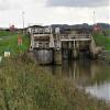
Market Weighton Junction Lock

 
East Riding of Yorkshire HU15 1WL, United Kingdom
 
Information about the place
Market Weighton Junction Lock is a minor waterways place on the Market Weighton Canal between Newport Road Bridge (Newport village) (3 miles and ¼ furlongs to the northwest) and Humber - Market Weighton Junction (Junction of the River Humber with the Market Weighton Canal) (¾ furlongs to the southeast).
 
 
The nearest place in the direction of Newport Road Bridge is Lantern Lane (Public footpath to Broomfleet); 5 furlongs away.

Mooring here is unrated.

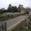
There is a bridge here which takes a minor road over the canal.

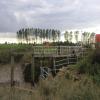
This is a lock, the rise of which is not known.

Newport Road Bridge3 miles, ¼ furlongs
Landing Lane2 miles, ¼ furlongs
Railway Bridge (Main Line to Hull)1 mile, 5¼ furlongs
Brickyard Bridge1 mile, 3¾ furlongs
Lantern Lane5 furlongs
Market Weighton Junction Lock
Humber - Market Weighton Junction¾ furlongs
 
 
Amenities
 
Maps
If you are a user and are logged on, or if you are actively planning a route, a map will be displayed here.
Show on external mapping site: Google | OSM | Bing
 
Photos
 
External websites
There are no links to external websites from here.
Why not log in and add some (select "External websites" from the menu (sometimes this is under "Edit"))?
 
Nearest facilities

Mouseover for more information or show routes to facility

Nearest water point

In the direction of Humber - Market Weighton Junction

Goole Marina10 miles, 3¼ furlongs and 2 locks away
Travel to Humber - Market Weighton Junction, then on the River Humber to Trent Falls, then on the River Ouse : Yorkshire (tidal section - Goole to Trent Falls) to Ouse - Aire and Calder Junction, then on the Aire and Calder Navigation (Main Line - Goole to Castleford) to Goole Marina
Dutch Riverside10 miles, 4¾ furlongs and 2 locks away
Travel to Humber - Market Weighton Junction, then on the River Humber to Trent Falls, then on the River Ouse : Yorkshire (tidal section - Goole to Trent Falls) to Ouse - Aire and Calder Junction, then on the Aire and Calder Navigation (Main Line - Goole to Castleford) to Dutch Riverside
Keadby Visitor Moorings10 miles, 6 furlongs and 2 locks away
Travel to Humber - Market Weighton Junction, then on the River Humber to Trent Falls, then on the River Trent (tidal section - Keadby to Trent Falls) to Keadby Junction, then on the Sheffield and South Yorkshire Navigation (Stainforth and Keadby Canal) to Keadby Visitor Moorings
Pollington Visitor Mooring18 miles, 6¾ furlongs and 2 locks away
Travel to Humber - Market Weighton Junction, then on the River Humber to Trent Falls, then on the River Ouse : Yorkshire (tidal section - Goole to Trent Falls) to Ouse - Aire and Calder Junction, then on the Aire and Calder Navigation (Main Line - Goole to Castleford) to Pollington Visitor Mooring
Pollington Manor Swing Bridge18 miles, 7¼ furlongs and 2 locks away
Travel to Humber - Market Weighton Junction, then on the River Humber to Trent Falls, then on the River Ouse : Yorkshire (tidal section - Goole to Trent Falls) to Ouse - Aire and Calder Junction, then on the Aire and Calder Navigation (Main Line - Goole to Castleford) to Pollington Manor Swing Bridge

No information

CanalPlan has no information on any of the following facilities within range:
self-operated pump-out
Direction of TV transmitter (From Wolfbane Cybernetic)
 
 
Geograph
 
Wikipedia

There is no page on Wikipedia called “Market Weighton Junction Lock”

Wikipedia pages that might relate to Market Weighton Junction Lock
[Market Weighton Canal] closest to Market Weighton was abandoned in 1900 and the right of navigation through Weighton lock was lost in 1971. However, as of 2002 the lock was passable [Pocklington Canal] branches from there, one to Weighton and the other to Pocklington. Wholesea is near to the site of Sod House Lock on the Market Weighton Canal. A second assessment [Hull and Selby Railway] 1848, along with a new main station, Hull Paragon; a connection to Market Weighton from Barlby near Selby was made in 1848 (closed 1954, see Selby to [York] East Yorkshire Motor Services routes to Hull, Beverley, Driffield, Market Weighton and Pocklington, and Harrogate Bus Company services to Knaresborough [List of closed railway stations in Britain: K-L] 1961 Little Stretton Halt Shrewsbury and Hereford Railway 1958 Little Weighton Hull and Barnsley Railway 1955 Littleham London and South Western Railway [List of electoral wards in England by constituency] Driffield and Rural, East Wolds and Coastal, Pocklington Provincial, Wolds Weighton. Great Grimsby: East Marsh, Freshney, Heneage, Park, Scartho, South, West [1977 Silver Jubilee and Birthday Honours] Midlands Region, British Gas Corporation. Donald Herbert Milne, Teacher, Market Weighton School, York. Ronald Harold Bertram Mitchem, Senior Executive Officer
 
Google

Results of Google Search

Market Weighton Canal - Wikipedia
The Market Weighton Canal ran 9.5 miles (15.3 km) from the Humber Estuary to its terminus ... The lower section of the canal, including Weighton Lock, (also called Humber lock), which provides ... Above the junction with the River Foulness, the channel is heavily silted and navigation is difficult in all but the smallest boats.
Category:Market Weighton Canal - Wikimedia Commons
Feb 1, 2019 ... Disused Lock on the Market Weighton Canal - geograph.org.uk ... Market Weighton Canal, Holme Canal junction - geograph.org.uk ...
Market Weighton Canal - Notes
The canal extends northwards from its junction with the Humber at Weighton Lock, near. Broomfleet, and terminates at Riverhead, south of the town of Market  ...
File:BSicon ueABZg+r.svg - Wikipedia
... Junction Canal · Iffley Lock · Irton Road railway station · Itchen Navigation · Lahn · Lambertseter Line · Lee Navigation · Mapledurham Lock · Market Weighton ...