CanalPlanAC

Dukinfield Railway Bridge

 
Wharf Street, Tameside SK16 4RA, United Kingdom
 
Information about the place
Dukinfield Railway Bridge is a minor waterways place on the Peak Forest Canal (Lower) between Dukinfield Junction (Junction of Ashton Canal with the Peak Forest Canal) (¾ furlongs to the northwest) and Marple Aqueduct (western end) (6 miles and 6½ furlongs to the south).
 
 
The nearest place in the direction of Dukinfield Junction is Portland Basin Arm (Access to Portland Basin Marina); ¼ furlongs away.
 
The nearest place in the direction of Marple Aqueduct (western end) is Dukinfield Lift Bridge No 1; 2 furlongs away.

Mooring here is unrated.

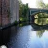
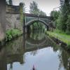
There is a bridge here which takes a railway over the canal.


Amenities

Amenities here

 United Norwest Co-operative Ltd

Amenities nearby at Dukinfield Lift Bridge No 1

 Cashpoint
 NatWest
 
Maps
If you are a user and are logged on, or if you are actively planning a route, a map will be displayed here.
Show on external mapping site: Google | OSM | Bing
 
Photos
 
External websites
There are no links to external websites from here.
Why not log in and add some (select "External websites" from the menu (sometimes this is under "Edit"))?
 
Nearest facilities

Mouseover for more information or show routes to facility

Nearest water point

In the direction of Marple Junction

Marple Services8 miles, ½ furlongs and 16 locks away
Travel to Marple Junction, then on the Macclesfield Canal to Marple Services
Braidbar Boats11 miles, 6¼ furlongs and 16 locks away
Travel to Marple Junction, then on the Macclesfield Canal to Braidbar Boats
Furness Vale Marina12 miles, 7½ furlongs and 16 locks away
Travel to Marple Junction, then on the Peak Forest Canal (Upper) to Furness Vale Marina
Whaley Bridge Services14 miles, 3¾ furlongs and 16 locks away
Travel to Marple Junction, then on the Peak Forest Canal (Upper) to Whaley Bridge Branch Junction, then on the Peak Forest Canal (Whaley Bridge Branch) to Whaley Bridge Services
Bugsworth Services14 miles, 4 furlongs and 16 locks away
Travel to Marple Junction, then on the Peak Forest Canal (Upper) to Bugsworth Services
Bollington Wharf16 miles, 4 furlongs and 16 locks away
Travel to Marple Junction, then on the Macclesfield Canal to Bollington Wharf
Swettenham Street Maintenance Yard19 miles, 3¾ furlongs and 16 locks away
Travel to Marple Junction, then on the Macclesfield Canal to Swettenham Street Maintenance Yard

In the direction of Dukinfield Junction

Fairfield Junction2 miles, 4¾ furlongs away
Travel to Dukinfield Junction, then on the Ashton Canal (Main Line) to Fairfield Junction
Grove Road Bridge No 965 miles, 1 furlong and 8 locks away
Travel to Dukinfield Junction, then on the Ashton Canal (Main Line) to Ashton-under-Lyne Junction, then on the Huddersfield Narrow Canal to Grove Road Bridge No 96
New Islington Marina6 miles, 7¼ furlongs and 20 locks away
Travel to Dukinfield Junction, then on the Ashton Canal (Main Line) to Ducie Street Junction, then on the Rochdale Canal to New Islington Marina Entrance, then on the Rochdale Canal (Main Line) to Cotton Field Wharf Marina, then on the Rochdale Canal (New Islington Marina Arm) to New Islington Marina
Wool Road Bridge No 7011 miles, 1 furlong and 23 locks away
Travel to Dukinfield Junction, then on the Ashton Canal (Main Line) to Ashton-under-Lyne Junction, then on the Huddersfield Narrow Canal to Wool Road Bridge No 70
Staffordshire, Kenworthy and other Arms7 miles, 5 furlongs and 27 locks away
Travel to Dukinfield Junction, then on the Ashton Canal (Main Line) to Ducie Street Junction, then on the Rochdale Canal to Castlefield Junction, then on the Bridgewater Canal (Main Line) to Staffordshire, Kenworthy and other Arms
Potato Wharf Arm & The New Basin7 miles, 5¾ furlongs and 27 locks away
Travel to Dukinfield Junction, then on the Ashton Canal (Main Line) to Ducie Street Junction, then on the Rochdale Canal to Castlefield Junction, then on the Bridgewater Canal (Main Line) to Potato Wharf Arm & The New Basin
Stretford Marina10 miles, 5 furlongs and 27 locks away
Travel to Dukinfield Junction, then on the Ashton Canal (Main Line) to Ducie Street Junction, then on the Rochdale Canal to Castlefield Junction, then on the Bridgewater Canal (Main Line) to Stretford Marina
Watch House Cruising Club11 miles, 5½ furlongs and 27 locks away
Travel to Dukinfield Junction, then on the Ashton Canal (Main Line) to Ducie Street Junction, then on the Rochdale Canal to Castlefield Junction, then on the Bridgewater Canal (Main Line) to Watch House Cruising Club
Worsley Visitor Moorings14 miles, 7¼ furlongs and 27 locks away
Travel to Dukinfield Junction, then on the Ashton Canal (Main Line) to Ducie Street Junction, then on the Rochdale Canal to Castlefield Junction, then on the Bridgewater Canal (Main Line) to Stretford - Waters Meeting, then on the Bridgewater Canal (Stretford and Leigh Branch) to Worsley Visitor Moorings
Bridgewater Marina16 miles, 3 furlongs and 27 locks away
Travel to Dukinfield Junction, then on the Ashton Canal (Main Line) to Ducie Street Junction, then on the Rochdale Canal to Castlefield Junction, then on the Bridgewater Canal (Main Line) to Stretford - Waters Meeting, then on the Bridgewater Canal (Stretford and Leigh Branch) to Bridgewater Marina
Standedge Tunnel (western entrance)13 miles, 1 furlong and 32 locks away
Travel to Dukinfield Junction, then on the Ashton Canal (Main Line) to Ashton-under-Lyne Junction, then on the Huddersfield Narrow Canal to Standedge Tunnel (western entrance)
Ye Olde Number 3 Transit Moorings18 miles, 4½ furlongs and 27 locks away
Travel to Dukinfield Junction, then on the Ashton Canal (Main Line) to Ducie Street Junction, then on the Rochdale Canal to Castlefield Junction, then on the Bridgewater Canal (Main Line) to Ye Olde Number 3 Transit Moorings
Standedge Tunnel (eastern entrance)16 miles, 2¾ furlongs and 32 locks away
Travel to Dukinfield Junction, then on the Ashton Canal (Main Line) to Ashton-under-Lyne Junction, then on the Huddersfield Narrow Canal to Standedge Tunnel (eastern entrance)

Nearest rubbish disposal

In the direction of Marple Junction

Marple Bottom Lock Bridge Winding Hole6 miles, 7½ furlongs away
On this waterway in the direction of Marple Junction
Marple Services8 miles, ½ furlongs and 16 locks away
Travel to Marple Junction, then on the Macclesfield Canal to Marple Services
Braidbar Boats11 miles, 6¼ furlongs and 16 locks away
Travel to Marple Junction, then on the Macclesfield Canal to Braidbar Boats
Whaley Bridge Services14 miles, 3¾ furlongs and 16 locks away
Travel to Marple Junction, then on the Peak Forest Canal (Upper) to Whaley Bridge Branch Junction, then on the Peak Forest Canal (Whaley Bridge Branch) to Whaley Bridge Services
Bugsworth Services14 miles, 4 furlongs and 16 locks away
Travel to Marple Junction, then on the Peak Forest Canal (Upper) to Bugsworth Services

In the direction of Dukinfield Junction

Wool Road Visitor Mooring11 miles, ¾ furlongs and 23 locks away
Travel to Dukinfield Junction, then on the Ashton Canal (Main Line) to Ashton-under-Lyne Junction, then on the Huddersfield Narrow Canal to Wool Road Visitor Mooring
Pickle Lock No 22E19 miles, 5¼ furlongs and 52 locks away
Travel to Dukinfield Junction, then on the Ashton Canal (Main Line) to Ashton-under-Lyne Junction, then on the Huddersfield Narrow Canal to Pickle Lock No 22E

Nearest chemical toilet disposal

In the direction of Marple Junction

Marple Services8 miles, ½ furlongs and 16 locks away
Travel to Marple Junction, then on the Macclesfield Canal to Marple Services
Furness Vale Marina12 miles, 7½ furlongs and 16 locks away
Travel to Marple Junction, then on the Peak Forest Canal (Upper) to Furness Vale Marina
Whaley Bridge Services14 miles, 3¾ furlongs and 16 locks away
Travel to Marple Junction, then on the Peak Forest Canal (Upper) to Whaley Bridge Branch Junction, then on the Peak Forest Canal (Whaley Bridge Branch) to Whaley Bridge Services
Bugsworth Services14 miles, 4 furlongs and 16 locks away
Travel to Marple Junction, then on the Peak Forest Canal (Upper) to Bugsworth Services
Bollington Wharf16 miles, 4 furlongs and 16 locks away
Travel to Marple Junction, then on the Macclesfield Canal to Bollington Wharf
Swettenham Wharf19 miles, 3½ furlongs and 16 locks away
Travel to Marple Junction, then on the Macclesfield Canal to Swettenham Wharf

In the direction of Dukinfield Junction

Fairfield Junction2 miles, 4¾ furlongs away
Travel to Dukinfield Junction, then on the Ashton Canal (Main Line) to Fairfield Junction
Grove Road Bridge No 965 miles, 1 furlong and 8 locks away
Travel to Dukinfield Junction, then on the Ashton Canal (Main Line) to Ashton-under-Lyne Junction, then on the Huddersfield Narrow Canal to Grove Road Bridge No 96
Wool Road Bridge No 7011 miles, 1 furlong and 23 locks away
Travel to Dukinfield Junction, then on the Ashton Canal (Main Line) to Ashton-under-Lyne Junction, then on the Huddersfield Narrow Canal to Wool Road Bridge No 70
Watch House Cruising Club11 miles, 5½ furlongs and 27 locks away
Travel to Dukinfield Junction, then on the Ashton Canal (Main Line) to Ducie Street Junction, then on the Rochdale Canal to Castlefield Junction, then on the Bridgewater Canal (Main Line) to Watch House Cruising Club
Pickle Lock No 22E19 miles, 5¼ furlongs and 52 locks away
Travel to Dukinfield Junction, then on the Ashton Canal (Main Line) to Ashton-under-Lyne Junction, then on the Huddersfield Narrow Canal to Pickle Lock No 22E
Waterside Lock No 21E19 miles, 6½ furlongs and 53 locks away
Travel to Dukinfield Junction, then on the Ashton Canal (Main Line) to Ashton-under-Lyne Junction, then on the Huddersfield Narrow Canal to Waterside Lock No 21E

Nearest place to turn

In the direction of Marple Junction

Dunkirk Farm Bridge Winding Hole1 mile, 4½ furlongs away
On this waterway in the direction of Marple Junction
Canal Street Winding Hole2 miles, 1½ furlongs away
On this waterway in the direction of Marple Junction
Unity Mills Winding Hole3 miles, 6 furlongs away
On this waterway in the direction of Marple Junction
Urwick Road Winding Hole5 miles, 5 furlongs away
On this waterway in the direction of Marple Junction
Marple Bottom Lock Bridge Winding Hole6 miles, 7½ furlongs away
On this waterway in the direction of Marple Junction
Winding Hole below Lock 137 miles, 6¾ furlongs and 12 locks away
On this waterway in the direction of Marple Junction
Marple Junction8 miles and 16 locks away
On this waterway in the direction of Marple Junction
Top Lock Marine Marina8 miles, ¾ furlongs and 16 locks away
Travel to Marple Junction, then on the Peak Forest Canal (Upper) to Top Lock Marine Marina

In the direction of Dukinfield Junction

Portland Basin Arm¼ furlongs away
On this waterway in the direction of Dukinfield Junction
Dukinfield Junction¾ furlongs away
On this waterway in the direction of Dukinfield Junction
Ashton-under-Lyne Junction4¾ furlongs away
Travel to Dukinfield Junction, then on the Ashton Canal (Main Line) to Ashton-under-Lyne Junction
Lumb Lane Bridge Winding Hole1 mile, 6¼ furlongs away
Travel to Dukinfield Junction, then on the Ashton Canal (Main Line) to Lumb Lane Bridge Winding Hole
Fairfield Junction2 miles, 4¾ furlongs away
Travel to Dukinfield Junction, then on the Ashton Canal (Main Line) to Fairfield Junction
Staley Wharf Winding Hole1 mile, 4½ furlongs and 3 locks away
Travel to Dukinfield Junction, then on the Ashton Canal (Main Line) to Ashton-under-Lyne Junction, then on the Huddersfield Narrow Canal to Staley Wharf Winding Hole
Knowle Street Winding Hole2 miles, 6½ furlongs and 7 locks away
Travel to Dukinfield Junction, then on the Ashton Canal (Main Line) to Ashton-under-Lyne Junction, then on the Huddersfield Narrow Canal to Knowle Street Winding Hole
Clayton Junction3 miles, 7 furlongs and 8 locks away
Travel to Dukinfield Junction, then on the Ashton Canal (Main Line) to Clayton Junction
Ashton New Road Winding Hole4 miles, 3¾ furlongs and 11 locks away
Travel to Dukinfield Junction, then on the Ashton Canal (Main Line) to Ashton New Road Winding Hole
Mossley Bottoms Winding Hole6 miles, 6½ furlongs and 12 locks away
Travel to Dukinfield Junction, then on the Ashton Canal (Main Line) to Ashton-under-Lyne Junction, then on the Huddersfield Narrow Canal to Mossley Bottoms Winding Hole
New Viaduct Winding Hole5 miles, 1 furlong and 15 locks away
Travel to Dukinfield Junction, then on the Ashton Canal (Main Line) to New Viaduct Winding Hole
Roughtown Court Winding Hole7 miles, 6¼ furlongs and 14 locks away
Travel to Dukinfield Junction, then on the Ashton Canal (Main Line) to Ashton-under-Lyne Junction, then on the Huddersfield Narrow Canal to Roughtown Court Winding Hole

Nearest self-operated pump-out

Nearest boatyard pump-out

In the direction of Marple Junction

Braidbar Boats11 miles, 6¼ furlongs and 16 locks away
Travel to Marple Junction, then on the Macclesfield Canal to Braidbar Boats
New Mills Marina12 miles, ¼ furlongs and 16 locks away
Travel to Marple Junction, then on the Peak Forest Canal (Upper) to New Mills Marina
Bollington Wharf16 miles, 4 furlongs and 16 locks away
Travel to Marple Junction, then on the Macclesfield Canal to Bollington Wharf
Kerridge Dry Dock16 miles, 7 furlongs and 16 locks away
Travel to Marple Junction, then on the Macclesfield Canal to Kerridge Dry Dock
Swettenham Wharf19 miles, 3½ furlongs and 16 locks away
Travel to Marple Junction, then on the Macclesfield Canal to Swettenham Wharf

In the direction of Dukinfield Junction

Portland Basin Arm¼ furlongs away
On this waterway in the direction of Dukinfield Junction
Stretford Marina10 miles, 5 furlongs and 27 locks away
Travel to Dukinfield Junction, then on the Ashton Canal (Main Line) to Ducie Street Junction, then on the Rochdale Canal to Castlefield Junction, then on the Bridgewater Canal (Main Line) to Stretford Marina
Bridgewater Marina16 miles, 3 furlongs and 27 locks away
Travel to Dukinfield Junction, then on the Ashton Canal (Main Line) to Ducie Street Junction, then on the Rochdale Canal to Castlefield Junction, then on the Bridgewater Canal (Main Line) to Stretford - Waters Meeting, then on the Bridgewater Canal (Stretford and Leigh Branch) to Bridgewater Marina
Direction of TV transmitter (From Wolfbane Cybernetic)
 
 
Geograph
 
Wikipedia

There is no page on Wikipedia called “Dukinfield Railway Bridge”

Wikipedia pages that might relate to Dukinfield Railway Bridge
[Dukinfield Central railway station] Dukinfield Central Railway Station served the town of Dukinfield from 1864 until 1959. It was situated on Wharf Street, near Station Street and adjacent [Dukinfield and Ashton railway station] Dukinfield and Ashton railway station served Dukinfield in Greater Manchester, England. The station was built at high level on a viaduct as it passed [Dukinfield Dog Lane railway station] trace left of the old station. "The Railways in Glossop". Glossop Heritage Trust. Retrieved 30 January 2021. "Dukinfield Chronology". Tameside Metropolitan [List of closed railway stations in Greater Manchester] Park Parade Audenshaw Droylsden Dukinfield & Ashton Dukinfield Central Godley East Hooley Hill Micklehurst Park Bridge Staley and Millbrook Altrincham [Sheffield, Ashton-under-Lyne and Manchester Railway] 1956; Dukinfield; opened 23 December 1845; resited to south west March 1863; renamed Dukinfield Central 1954; closed 4 May 1959; Guide Bridge (above) [Tameside] and spans the towns of Ashton-under-Lyne, Audenshaw, Denton, Droylsden, Dukinfield, Hyde, Mossley and Stalybridge plus Longdendale. Its western border is [Hazlehead Bridge railway station] Hazlehead Bridge railway station was a railway station on the Sheffield, Ashton-under-Lyne and Manchester Railway's Woodhead Line. It served villages [Listed buildings in Dukinfield] Dukinfield is a town in Tameside, Greater Manchester, England. The town and the surrounding area contains 20 listed buildings that are recorded in the [Oldham, Ashton and Guide Bridge Railway] Ashton and Guide Bridge Junction Railway was an early British railway company, which opened in 1861, connecting Oldham, Ashton and Guide Bridge. In 1847 the [Stockport–Stalybridge line] Stockport–Stalybridge line is a railway line in Greater Manchester, England, running from Stockport northeast to Stalybridge, via Guide Bridge. The line is today used
 
Google

Results of Google Search

Dukinfield Central railway station - Wikipedia
Dukinfield Central Railway Station served the town of Dukinfield from 1864 until 1959. It was situated on Wharf Street, near Station Street and adjacent to the Peak Forest Canal - the line from the station went over the canal on a cast-iron bridge, which is still there (2014).
How to find us - St Marks Dukinfield
You go under the railway bridge, take the next right into Wharf Street and then the first left into Railway Street. The church, hall, vicarage and car park appear near ...
Dukinfield and Ashton railway station - Wikipedia
The station was built at high level on a viaduct as it passed directly above Alma Bridge, King Street, Dukinfield. Access to the platforms was via an entrance in ...
Lower Peak Forest Canal, Dukinfield Wharf
Further along, the Manchester, Sheffield and Lincolnshire Railway (Stalybridge Branch) crosses the canal on an iron bridge. This bridge was built in 1845 and ...
Whaley Bridge to Dukinfield - 5 ways to travel via train, and line 219 ...
There are 5 ways to get from Whaley Bridge to Dukinfield by train, bus, taxi or car. Select an option below to see step-by-step directions and to compare ticket ...
Greystones last night of the Warm Wednesday project | British rail ...
Dukinfield views in Tameside by Cllr John Taylor: March 2012 British Rail, Salford, ... 08599 'Gorton' at Guide Bridge on Electric Locomotive, Diesel Locomotive, ...
Marple Bridge to Dukinfield - 5 ways to travel via train, taxi, car, and ...
There are 5 ways to get from Marple Bridge to Dukinfield by train, taxi, car or towncar. Select an option below to see step-by-step directions and to compare ticket ...
Tameside Trail
Railway station Greenfield 1 mile. Railway station Mossley 1.2 miles. This section of the path, offers a great variety of walking. Through historic Park Bridge, over ...
Dukinfield to Manchester City Centre, Blackfriars Bridge - 6 ways to ...
There are 6 ways to get from Dukinfield to Manchester City Centre, Blackfriars Bridge by train, tram, bus, taxi, car or towncar. Select an option below to see ...
Walks and Trails
Information about walks and trails in Tameside from Tameside's Countryside Service. ... Download the 'Park Bridge Heritage Trail'(2.06MB) A short circular walk to ... A four mile linear walk between Mossley and Stalybridge Railway Stations.