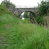
Bailey Bridge No 5
Address is taken from a point 331 yards away.

There is a bridge here which takes a track over the canal.
| Thurnham Bridge No 6 | 4¼ furlongs | |
| Thurnham Bridge Winding Hole | 4¼ furlongs | |
| Thurnham Mill Lock No 6 | 3 furlongs | |
| The Mill Inn | 3 furlongs | |
| Glasson Lock No 5 | 1¼ furlongs | |
| Bailey Bridge No 5 | ||
| Thurnham Church Bridge No 4 | 2 furlongs | |
| Glasson Lock No 4 | 2¼ furlongs | |
| Glasson Aqueduct No 1 | 4½ furlongs | |
| Bridge No 3 (Glasson Branch) | 6¼ furlongs | |
| Glasson Lock No 3 | 6½ furlongs | |
Why not log in and add some (select "External websites" from the menu (sometimes this is under "Edit"))?
Mouseover for more information or show routes to facility
Nearest water point
In the direction of Glasson Dock
In the direction of Lodge Hill Junction
Nearest rubbish disposal
In the direction of Lodge Hill Junction
Nearest chemical toilet disposal
In the direction of Lodge Hill Junction
Nearest place to turn
In the direction of Glasson Dock
In the direction of Lodge Hill Junction
No information
CanalPlan has no information on any of the following facilities within range:self-operated pump-out
boatyard pump-out
Wikipedia has a page about Bailey Bridge
A Bailey bridge is a type of portable, pre-fabricated, truss bridge. It was developed in 1940–1941 by the British for military use during the Second World War and saw extensive use by British, Canadian and US military engineering units. A Bailey bridge has the advantages of requiring no special tools or heavy equipment to assemble. The wood and steel bridge elements were small and light enough to be carried in trucks and lifted into place by hand, without the use of a crane. The bridges were strong enough to carry tanks. Bailey bridges continue to be used extensively in civil engineering construction projects and to provide temporary crossings for pedestrian and vehicle traffic. A Bailey bridge and its construction were prominently featured in the 1977 film A Bridge Too Far.


![Lock repairs, Lancaster Canal. Lock 5 on the Glasson Branch.A temporary dam has been slotted in in front of the lock gates, and the canal has been partially drained above and below the lock. (The yellow equipment is a pump.) The top lock gates have already been replaced. The new gates were built at the British Waterways workshop at Stanley Ferry (see [[1501196]] ). by Ian Taylor – 27 February 2011](https://s0.geograph.org.uk/geophotos/02/29/42/2294236_094f446f_120x120.jpg)
![Old lock gates, Lancaster Canal. Lock 5 on the Glasson Branch.The old bottom lock gates have been removed and temporarily placed alongside the lock. The paddles have been removed and placed in the left foreground. The balance beams have been sawn off, presumably to simplify handling. [[2279405]] shows these gates still in position 2 weeks earlier. by Ian Taylor – 27 February 2011](https://s1.geograph.org.uk/geophotos/02/29/42/2294237_9e0a758e_120x120.jpg)


![Lock repairs, Lancaster Canal. Lock 5 on the Glasson Branch.Scaffolding has been erected to carry out replacement of the lock gates. The temporary fencing beyond the lock indicates that the pound above the lock is going to be drained. (However, I'm not clear why a drained canal has to be fenced off, whilst a water-filled canal does not.)See [[1675779]] for a more normal view. by Ian Taylor – 13 February 2011](https://s1.geograph.org.uk/geophotos/02/27/94/2279405_61a1dbb3_120x120.jpg)


