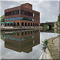
Station Street Bridge
is a minor waterways place
on the River Trent (Nottingham Canal) between
Meadow Lane Junction (Junction of Nottingham Canal with River Trent) (3 furlongs
and 1 lock
to the southeast) and
Carrington Street Bridge (Nottingham) (1½ furlongs
to the west).
The nearest place in the direction of Meadow Lane Junction is LMS Railway Bridge;
¼ furlongs
away.
The nearest place in the direction of Carrington Street Bridge is London Road Railway Bridge (dismantled);
a few yards
away.
There may be access to the towpath here.
Mooring here is unrated.
There is a bridge here which takes a minor road over the canal.
Meadow Lane New Bridge | 2¼ furlongs | |
Meadow Lane Bridge | 2¼ furlongs | |
Cattle Market Road Bridge | 1¼ furlongs | |
Queen's Road Bridge | ½ furlongs | |
LMS Railway Bridge | ¼ furlongs | |
Station Street Bridge | ||
London Road Railway Bridge (dismantled) | a few yards | |
Poplar Arms Corner | ¼ furlongs | |
London Road Bridge | ¼ furlongs | |
Boots Pipe Bridge | ¾ furlongs | |
Trent Street Bridge | 1¼ furlongs |
Amenities in Nottingham
Amenities at other places in Nottingham
at
at
at
at
at
at
at
at
at
at
at
at
at
at
at
at
at
at
at
at
at
at
at
at
at
at
at
at
at
at
at
at
at
at
at
at
at
at
at
at
at
at
at
at
at
at
at
at
at
at
at
at
at
at
at
at
at
at
at
at
at
at
at
at
at
at
There are no links to external websites from here.
Why not log in and add some (select "External websites" from the menu (sometimes this is under "Edit"))?
Mouseover for more information or show routes to facility
Nearest water point
In the direction of Lenton Chain
Beeston Lock No 5 — 5 miles, 4¼ furlongs and 1 lock away
Travel to Lenton Chain, then on the River Trent (Beeston Canal) to Beeston Lock No 5
Cranfleet Lock No 3 — 9 miles, 6¾ furlongs and 2 locks away
Travel to Lenton Chain, then on the River Trent (Beeston Canal) to Beeston Lock No 5, then on the River Trent (Western End) to Cranfleet Lock No 3
Former BW Trent Lock Waterway Office — 10 miles, 5¼ furlongs and 5 locks away
Travel to Lenton Chain, then on the River Trent (Beeston Canal) to Beeston Lock No 5, then on the River Trent (Western End) to Trent Junction, then on the Grand Union Canal (Erewash Canal) to Former BW Trent Lock Waterway Office
Sawley Locks No 2 — 11 miles, 3¼ furlongs and 4 locks away
Travel to Lenton Chain, then on the River Trent (Beeston Canal) to Beeston Lock No 5, then on the River Trent (Western End) to Sawley Locks No 2
Shardlow — 13 miles, 5 furlongs and 7 locks away
Travel to Lenton Chain, then on the River Trent (Beeston Canal) to Beeston Lock No 5, then on the River Trent (Western End) to Derwent Mouth, then on the Trent and Mersey Canal (Main Line - Derwent Mouth to Burton) to Shardlow
Weston Lock No 4 — 16 miles, 4¾ furlongs and 9 locks away
Travel to Lenton Chain, then on the River Trent (Beeston Canal) to Beeston Lock No 5, then on the River Trent (Western End) to Derwent Mouth, then on the Trent and Mersey Canal (Main Line - Derwent Mouth to Burton) to Weston Lock No 4
Bishop Meadow Lock No 54 — 18 miles, 5¼ furlongs and 9 locks away
Travel to Lenton Chain, then on the River Trent (Beeston Canal) to Beeston Lock No 5, then on the River Trent (Western End) to Trent Junction, then on the Grand Union Canal (Leicester Section - River Soar Navigation) to Bishop Meadow Lock No 54
Swarkestone Lock No 5 — 19 miles, 4 furlongs and 10 locks away
Travel to Lenton Chain, then on the River Trent (Beeston Canal) to Beeston Lock No 5, then on the River Trent (Western End) to Derwent Mouth, then on the Trent and Mersey Canal (Main Line - Derwent Mouth to Burton) to Swarkestone Lock No 5
Loughborough Basin — 19 miles, 6 furlongs and 11 locks away
Travel to Lenton Chain, then on the River Trent (Beeston Canal) to Beeston Lock No 5, then on the River Trent (Western End) to Trent Junction, then on the Grand Union Canal (Leicester Section - River Soar Navigation) to Loughborough Branch Junction, then on the Grand Union Canal (Leicester Section - Loughborough Branch) to Loughborough Basin
In the direction of Meadow Lane Junction
Holme Lock No 5 — 2 miles, 6¼ furlongs and 1 lock away
Travel to Meadow Lane Junction, then on the River Trent (non-tidal section) to Holme Lock No 5
Stoke Lock No 6 — 5 miles, 6¼ furlongs and 2 locks away
Travel to Meadow Lane Junction, then on the River Trent (non-tidal section) to Stoke Lock No 6
Gunthorpe Lock No 7 — 10 miles, 4¼ furlongs and 3 locks away
Travel to Meadow Lane Junction, then on the River Trent (non-tidal section) to Gunthorpe Lock No 7
Hazelford Lock No 8 — 15 miles, 2½ furlongs and 4 locks away
Travel to Meadow Lane Junction, then on the River Trent (non-tidal section) to Hazelford Lock No 8Nearest rubbish disposal
In the direction of Lenton Chain
Beeston Lock No 5 — 5 miles, 4¼ furlongs and 1 lock away
Travel to Lenton Chain, then on the River Trent (Beeston Canal) to Beeston Lock No 5
Cranfleet Lock No 3 — 9 miles, 6¾ furlongs and 2 locks away
Travel to Lenton Chain, then on the River Trent (Beeston Canal) to Beeston Lock No 5, then on the River Trent (Western End) to Cranfleet Lock No 3
Former BW Trent Lock Waterway Office — 10 miles, 5¼ furlongs and 5 locks away
Travel to Lenton Chain, then on the River Trent (Beeston Canal) to Beeston Lock No 5, then on the River Trent (Western End) to Trent Junction, then on the Grand Union Canal (Erewash Canal) to Former BW Trent Lock Waterway Office
Sawley Locks No 2 — 11 miles, 3¼ furlongs and 4 locks away
Travel to Lenton Chain, then on the River Trent (Beeston Canal) to Beeston Lock No 5, then on the River Trent (Western End) to Sawley Locks No 2
Swarkestone Lock No 5 — 19 miles, 4 furlongs and 10 locks away
Travel to Lenton Chain, then on the River Trent (Beeston Canal) to Beeston Lock No 5, then on the River Trent (Western End) to Derwent Mouth, then on the Trent and Mersey Canal (Main Line - Derwent Mouth to Burton) to Swarkestone Lock No 5
Loughborough Basin — 19 miles, 6 furlongs and 11 locks away
Travel to Lenton Chain, then on the River Trent (Beeston Canal) to Beeston Lock No 5, then on the River Trent (Western End) to Trent Junction, then on the Grand Union Canal (Leicester Section - River Soar Navigation) to Loughborough Branch Junction, then on the Grand Union Canal (Leicester Section - Loughborough Branch) to Loughborough Basin
In the direction of Meadow Lane Junction
Holme Lock No 5 — 2 miles, 6¼ furlongs and 1 lock away
Travel to Meadow Lane Junction, then on the River Trent (non-tidal section) to Holme Lock No 5
Stoke Lock No 6 — 5 miles, 6¼ furlongs and 2 locks away
Travel to Meadow Lane Junction, then on the River Trent (non-tidal section) to Stoke Lock No 6
Gunthorpe Lock No 7 — 10 miles, 4¼ furlongs and 3 locks away
Travel to Meadow Lane Junction, then on the River Trent (non-tidal section) to Gunthorpe Lock No 7
Hazelford Lock No 8 — 15 miles, 2½ furlongs and 4 locks away
Travel to Meadow Lane Junction, then on the River Trent (non-tidal section) to Hazelford Lock No 8Nearest chemical toilet disposal
In the direction of Lenton Chain
Beeston Lock No 5 — 5 miles, 4¼ furlongs and 1 lock away
Travel to Lenton Chain, then on the River Trent (Beeston Canal) to Beeston Lock No 5
Former BW Trent Lock Waterway Office — 10 miles, 5¼ furlongs and 5 locks away
Travel to Lenton Chain, then on the River Trent (Beeston Canal) to Beeston Lock No 5, then on the River Trent (Western End) to Trent Junction, then on the Grand Union Canal (Erewash Canal) to Former BW Trent Lock Waterway Office
Sawley Locks No 2 — 11 miles, 3¼ furlongs and 4 locks away
Travel to Lenton Chain, then on the River Trent (Beeston Canal) to Beeston Lock No 5, then on the River Trent (Western End) to Sawley Locks No 2
Sawley Cut Wharf — 11 miles, 4¾ furlongs and 5 locks away
Travel to Lenton Chain, then on the River Trent (Beeston Canal) to Beeston Lock No 5, then on the River Trent (Western End) to Sawley Cut Wharf
In the direction of Meadow Lane Junction
Meadow Lane Lock No 7 — 2¾ furlongs away
On this waterway in the direction of Meadow Lane Junction
Holme Lock No 5 — 2 miles, 6¼ furlongs and 1 lock away
Travel to Meadow Lane Junction, then on the River Trent (non-tidal section) to Holme Lock No 5
Stoke Lock No 6 — 5 miles, 6¼ furlongs and 2 locks away
Travel to Meadow Lane Junction, then on the River Trent (non-tidal section) to Stoke Lock No 6
Gunthorpe Lock No 7 — 10 miles, 4¼ furlongs and 3 locks away
Travel to Meadow Lane Junction, then on the River Trent (non-tidal section) to Gunthorpe Lock No 7Nearest place to turn
In the direction of Lenton Chain
Poplar Arms Corner — ¼ furlongs away
On this waterway in the direction of Lenton Chain
Canal Museum Wharf — 1¾ furlongs away
On this waterway in the direction of Lenton Chain
Redfield Road Bridge Winding Hole — 2 miles, 1¾ furlongs and 1 lock away
Travel to Lenton Chain, then on the River Trent (Beeston Canal) to Redfield Road Bridge Winding Hole
Rylands Bridge Winding Hole — 4 miles, 2 furlongs and 1 lock away
Travel to Lenton Chain, then on the River Trent (Beeston Canal) to Rylands Bridge Winding Hole
Cranfleet Lock Weir Exit — 9 miles, 6 furlongs and 2 locks away
Travel to Lenton Chain, then on the River Trent (Beeston Canal) to Beeston Lock No 5, then on the River Trent (Western End) to Cranfleet Lock Weir Exit
Soar Mouth — 10 miles, 5¾ furlongs and 4 locks away
Travel to Lenton Chain, then on the River Trent (Beeston Canal) to Beeston Lock No 5, then on the River Trent (Western End) to Trent Junction, then on the Grand Union Canal (Leicester Section - River Soar Navigation) to Soar Mouth
Redhill Lock Junction — 11 miles, ½ furlongs and 4 locks away
Travel to Lenton Chain, then on the River Trent (Beeston Canal) to Beeston Lock No 5, then on the River Trent (Western End) to Trent Junction, then on the Grand Union Canal (Leicester Section - River Soar Navigation) to Redhill Lock Junction
Sawley Lock No 2 Weir Exit — 11 miles, 2½ furlongs and 4 locks away
Travel to Lenton Chain, then on the River Trent (Beeston Canal) to Beeston Lock No 5, then on the River Trent (Western End) to Sawley Lock No 2 Weir Exit
Former BW Trent Lock Waterway Office — 10 miles, 5¼ furlongs and 5 locks away
Travel to Lenton Chain, then on the River Trent (Beeston Canal) to Beeston Lock No 5, then on the River Trent (Western End) to Trent Junction, then on the Grand Union Canal (Erewash Canal) to Former BW Trent Lock Waterway Office
Sheet Stores Basin — 11 miles, 2¼ furlongs and 5 locks away
Travel to Lenton Chain, then on the River Trent (Beeston Canal) to Beeston Lock No 5, then on the River Trent (Western End) to Trent Junction, then on the Grand Union Canal (Erewash Canal) to Sheet Stores Basin
Redhill Marine Ltd — 11 miles, 4¾ furlongs and 5 locks away
Travel to Lenton Chain, then on the River Trent (Beeston Canal) to Beeston Lock No 5, then on the River Trent (Western End) to Trent Junction, then on the Grand Union Canal (Leicester Section - River Soar Navigation) to Redhill Marine Ltd
Ratcliffe Lock Junction — 11 miles, 7¼ furlongs and 5 locks away
Travel to Lenton Chain, then on the River Trent (Beeston Canal) to Beeston Lock No 5, then on the River Trent (Western End) to Trent Junction, then on the Grand Union Canal (Leicester Section - River Soar Navigation) to Ratcliffe Lock Junction
Sawley Flood Lock Weir Entrance — 12 miles, ½ furlongs and 6 locks away
Travel to Lenton Chain, then on the River Trent (Beeston Canal) to Beeston Lock No 5, then on the River Trent (Western End) to Sawley Flood Lock Weir Entrance
Ratcliffe Weir — 12 miles, 2 furlongs and 6 locks away
Travel to Lenton Chain, then on the River Trent (Beeston Canal) to Beeston Lock No 5, then on the River Trent (Western End) to Trent Junction, then on the Grand Union Canal (Leicester Section - River Soar Navigation) to Ratcliffe Weir
Long Eaton Winding Hole — 12 miles, 4 furlongs and 6 locks away
Travel to Lenton Chain, then on the River Trent (Beeston Canal) to Beeston Lock No 5, then on the River Trent (Western End) to Trent Junction, then on the Grand Union Canal (Erewash Canal) to Long Eaton Winding Hole
Derwent Mouth — 12 miles, 4¼ furlongs and 6 locks away
Travel to Lenton Chain, then on the River Trent (Beeston Canal) to Beeston Lock No 5, then on the River Trent (Western End) to Derwent Mouth
In the direction of Meadow Lane Junction
Holme Lock Weir Entrance — 2 miles, 4¾ furlongs and 1 lock away
Travel to Meadow Lane Junction, then on the River Trent (non-tidal section) to Holme Lock Weir Entrance
Holme Lock Weir Exit — 2 miles, 7½ furlongs and 2 locks away
Travel to Meadow Lane Junction, then on the River Trent (non-tidal section) to Holme Lock Weir Exit
Hazelford Lock East Weir Entrance — 14 miles, 5 furlongs and 4 locks away
Travel to Meadow Lane Junction, then on the River Trent (non-tidal section) to Hazelford Lock East Weir Entrance
Hazelford Ferry — 14 miles, 5¾ furlongs and 4 locks away
Travel to Meadow Lane Junction, then on the River Trent (non-tidal section) to Hazelford FerryNo information
CanalPlan has no information on any of the following facilities within range:self-operated pump-out
boatyard pump-out
Direction of TV transmitter (From Wolfbane Cybernetic)
There is no page on Wikipedia called “Station Street Bridge”
Wikipedia pages that might relate to Station Street Bridge
[Cannon Street station]
Cannon Street station, also known as London Cannon Street, is a central London railway terminus and connected London Underground station in Travelcard
[Brooklyn Bridge–City Hall/Chambers Street station]
Brooklyn Bridge–City Hall/Chambers Street is a New York City Subway station complex in Lower Manhattan. The complex is served by trains of the IRT Lexington
[London Bridge station]
London Bridge is a central London railway terminus and connected London Underground station in Southwark, south-east London. It occupies a large area on
[Canal Street station (New York City Subway)]
Canal Street is a New York City Subway station complex. It is located in the Manhattan neighborhoods of Chinatown and SoHo, and is shared by the BMT Broadway
[Flinders Street railway station]
Flinders Street railway station is located on the corner of Flinders and Swanston streets in the central business district (CBD) of Melbourne, Victoria
[Bridge–Jay Streets station]
Bridge-Jay Street was a station on the demolished BMT Myrtle Avenue Line in Brooklyn, New York City. It had 2 tracks and 1 island platform. It was opened
[High Street station (IND Eighth Avenue Line)]
High Street, also labeled as High Street–Brooklyn Bridge, and also referred to as Brooklyn Bridge Plaza and Cranberry Street, is a station on the IND
[Bridge Street railway station]
Bridge Street railway station, now disused, was the original Glasgow terminus of the Glasgow and Paisley Joint Railway; jointly owned by the Glasgow,
[30th Street Station]
30th Street Station, officially William H. Gray III 30th Street Station, is an intermodal transit station in Philadelphia, Pennsylvania. It is the metropolitan
[Tower Bridge]
station is Tower Gateway. The nearest National Rail stations are at Fenchurch Street and London Bridge. In the late 19th century, increased commercial development
Results of Google Search
Station Street bridge to be renovated | Local News | daily-journal.comSep 4, 2002 ... The Station Street bridge over the Kankakee River east of Bird Park is the latest structure in the city scheduled for renovation. By spring 2005 ...
Station Street Bridge. Station Street Bridge. Primary Photographer(s): Nathan Holth and Rick McOmber. Bridge Documented: May 8, 2010.
Nov 7, 2019 ... A man says he was the victim of an attempted armed robbery on the Station Street Bridge in Kankakee. This happened Tuesday. The man say ...
Station Street Bridge-downstream profile. Structure carried both vehicular and trolleys when originally built. Photo by JD, 2-1012 per GS, 2012. License: ...
Nov 7, 2019 ... A man says he was the victim of an attempted armed robbery on the Station Street Bridge in Kankakee. This happened Tuesday. The man say ...
Oct 1, 2018 ... Over a thousand people came to the opening the the Station Street bridge which connects Carrum and Bonbeach. For the first time locals are ...
The Station Road Bridge, near Brecksville, Ohio, was built in 1882. It spans the Cuyahoga River between Cuyahoga County and Summit County, Ohio.
October 11, 2019 Update Road Updates -Station Street Bridge in Sturgeon is open -Washington Pike/Route 50 paving Friday & Saturday -Morganza closures...
Jun 8, 2020 ... Market Street or Veterans Bridge are recommended detours during this time. Station Street. Station Street will be closed Friday from 5 p.m. until ...
The Atlantic Station 17th Street Bridge is a critical component of a major redevelopment known as Atlantic Station, located on a former brownfield site in the ...