Lees Mill Bridge No 41
is a minor waterways place
on the Huddersfield Narrow Canal between
  Railway Lock No 42E (Marsden. Eastern summit lock) (3 miles and 1¼ furlongs
    and 22 locks
   to the west) and
  Titanic Mill (Linthwaite) (4 furlongs
    and 3 locks
   to the east).
  The nearest place in the direction of Railway Lock No 42E is Spot Lock No 20E;
  1¼ furlongs
   away.
   
  The nearest place in the direction of Titanic Mill is Holme Lock No 19E;
  ¾ furlongs
   away.
There may be access to the towpath here.
Mooring here is unrated. 
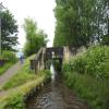
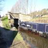
There is a bridge here which takes a minor road over the canal.
| Slaithwaite Visitor Moorings  | 3¼ furlongs | |
| Waterside Lock No 21E  | 3 furlongs | |
| Platt Lane Bridge No 42 | 2¾ furlongs | |
| Original Site of Lock No 21E | 2½ furlongs | |
| Spot Lock No 20E | 1¼ furlongs | |
| Lees Mill Bridge No 41 | ||
| Holme Lock No 19E | ¾ furlongs | |
| Can Lock No 18E | 1½ furlongs | |
| High Westwood Lock No 17E | 3¾ furlongs | |
| Low Westwood Bridge No 40 | 3¾ furlongs | |
| Titanic Mill | 4 furlongs | |
There are no links to external websites from here.
Why not log in and add some (select "External websites" from the menu (sometimes this is under "Edit"))?
Mouseover for more information or show routes to facility
Nearest water point
In the direction of Ashton-under-Lyne Junction
Waterside Lock No 21E — 3 furlongs  and 1 lock away
On this waterway in the direction of Ashton-under-Lyne Junction
Slaithwaite Winding Hole — 3½ furlongs  and 2 locks away
On this waterway in the direction of Ashton-under-Lyne Junction
Standedge Tunnel (eastern entrance) — 3 miles, 6½ furlongs  and 23 locks away
On this waterway in the direction of Ashton-under-Lyne Junction
Standedge Tunnel (western entrance) — 7 miles, ½ furlongs  and 23 locks away
On this waterway in the direction of Ashton-under-Lyne Junction
Wool Road Bridge No 70 — 9 miles, ¼ furlongs  and 32 locks away
On this waterway in the direction of Ashton-under-Lyne Junction
Grove Road Bridge No 96 — 15 miles, ½ furlongs  and 47 locks away
On this waterway in the direction of Ashton-under-Lyne Junction
In the direction of Aspley Basin (Huddersfield)
Aspley Basin (Huddersfield) — 4 miles, 2¾ furlongs  and 19 locks away
On this waterway in the direction of Aspley Basin (Huddersfield)
Shepley Bridge Sanitary Station — 10 miles, 7¼ furlongs  and 30 locks away
Travel  to Aspley Basin (Huddersfield), then on the Huddersfield Broad Canal to Cooper Bridge Junction, then on the Calder and Hebble Navigation (Main Line) to Shepley Bridge Sanitary Station
Brighouse Basin — 10 miles, 1 furlong  and 32 locks away
Travel  to Aspley Basin (Huddersfield), then on the Huddersfield Broad Canal to Cooper Bridge Junction, then on the Calder and Hebble Navigation (Main Line) to Brighouse Basin
Salterhebble Sanitary Station — 14 miles, 3 furlongs  and 41 locks away
Travel  to Aspley Basin (Huddersfield), then on the Huddersfield Broad Canal to Cooper Bridge Junction, then on the Calder and Hebble Navigation (Main Line) to Salterhebble Sanitary Station
Broad Cut Low Lock No 3 — 17 miles, 4¼ furlongs  and 38 locks away
Travel  to Aspley Basin (Huddersfield), then on the Huddersfield Broad Canal to Cooper Bridge Junction, then on the Calder and Hebble Navigation (Main Line) to Broad Cut Low Lock No 3
Salterhebble Junction — 14 miles, 3½ furlongs  and 42 locks away
Travel  to Aspley Basin (Huddersfield), then on the Huddersfield Broad Canal to Cooper Bridge Junction, then on the Calder and Hebble Navigation (Main Line) to Salterhebble Junction
Sowerby Bridge Basin — 16 miles, 5¼ furlongs  and 42 locks away
Travel  to Aspley Basin (Huddersfield), then on the Huddersfield Broad Canal to Cooper Bridge Junction, then on the Calder and Hebble Navigation (Main Line) to Salterhebble Junction, then on the Calder and Hebble Navigation (Main Line) to Sowerby Bridge BasinNearest rubbish disposal
In the direction of Ashton-under-Lyne Junction
Pickle Lock No 22E — 4¼ furlongs  and 2 locks away
On this waterway in the direction of Ashton-under-Lyne Junction
Wool Road Visitor Mooring — 9 miles, ½ furlongs  and 32 locks away
On this waterway in the direction of Ashton-under-Lyne Junction
In the direction of Aspley Basin (Huddersfield)
Aspley Basin (Huddersfield) — 4 miles, 2¾ furlongs  and 19 locks away
On this waterway in the direction of Aspley Basin (Huddersfield)
Shepley Bridge Sanitary Station — 10 miles, 7¼ furlongs  and 30 locks away
Travel  to Aspley Basin (Huddersfield), then on the Huddersfield Broad Canal to Cooper Bridge Junction, then on the Calder and Hebble Navigation (Main Line) to Shepley Bridge Sanitary Station
Brighouse Lower Basin Visitor Moorings — 10 miles, ¾ furlongs  and 31 locks away
Travel  to Aspley Basin (Huddersfield), then on the Huddersfield Broad Canal to Cooper Bridge Junction, then on the Calder and Hebble Navigation (Main Line) to Brighouse Lower Basin Visitor Moorings
Horbury Basin Residential Moorings & Sanitary Station — 15 miles, 3½ furlongs  and 37 locks away
Travel  to Aspley Basin (Huddersfield), then on the Huddersfield Broad Canal to Cooper Bridge Junction, then on the Calder and Hebble Navigation (Main Line) to Horbury Basin Residential Moorings & Sanitary Station
Salterhebble Sanitary Station — 14 miles, 3 furlongs  and 41 locks away
Travel  to Aspley Basin (Huddersfield), then on the Huddersfield Broad Canal to Cooper Bridge Junction, then on the Calder and Hebble Navigation (Main Line) to Salterhebble Sanitary Station
Sowerby Bridge Basin — 16 miles, 5¼ furlongs  and 42 locks away
Travel  to Aspley Basin (Huddersfield), then on the Huddersfield Broad Canal to Cooper Bridge Junction, then on the Calder and Hebble Navigation (Main Line) to Salterhebble Junction, then on the Calder and Hebble Navigation (Main Line) to Sowerby Bridge BasinNearest chemical toilet disposal
In the direction of Ashton-under-Lyne Junction
Waterside Lock No 21E — 3 furlongs  and 1 lock away
On this waterway in the direction of Ashton-under-Lyne Junction
Pickle Lock No 22E — 4¼ furlongs  and 2 locks away
On this waterway in the direction of Ashton-under-Lyne Junction
Wool Road Bridge No 70 — 9 miles, ¼ furlongs  and 32 locks away
On this waterway in the direction of Ashton-under-Lyne Junction
Grove Road Bridge No 96 — 15 miles, ½ furlongs  and 47 locks away
On this waterway in the direction of Ashton-under-Lyne Junction
In the direction of Aspley Basin (Huddersfield)
Aspley Basin (Huddersfield) — 4 miles, 2¾ furlongs  and 19 locks away
On this waterway in the direction of Aspley Basin (Huddersfield)
Shepley Bridge Sanitary Station — 10 miles, 7¼ furlongs  and 30 locks away
Travel  to Aspley Basin (Huddersfield), then on the Huddersfield Broad Canal to Cooper Bridge Junction, then on the Calder and Hebble Navigation (Main Line) to Shepley Bridge Sanitary Station
Brighouse Basin — 10 miles, 1 furlong  and 32 locks away
Travel  to Aspley Basin (Huddersfield), then on the Huddersfield Broad Canal to Cooper Bridge Junction, then on the Calder and Hebble Navigation (Main Line) to Brighouse Basin
Savile Town Wharf and Basin (Dewsbury) — 14 miles, 2¾ furlongs  and 34 locks away
Travel  to Aspley Basin (Huddersfield), then on the Huddersfield Broad Canal to Cooper Bridge Junction, then on the Calder and Hebble Navigation (Main Line) to Dewsbury Arm Junction, then on the Calder and Hebble Navigation (Dewsbury Old Cut) to Savile Town Wharf and Basin (Dewsbury)
Horbury Basin Residential Moorings & Sanitary Station — 15 miles, 3½ furlongs  and 37 locks away
Travel  to Aspley Basin (Huddersfield), then on the Huddersfield Broad Canal to Cooper Bridge Junction, then on the Calder and Hebble Navigation (Main Line) to Horbury Basin Residential Moorings & Sanitary Station
Salterhebble Sanitary Station — 14 miles, 3 furlongs  and 41 locks away
Travel  to Aspley Basin (Huddersfield), then on the Huddersfield Broad Canal to Cooper Bridge Junction, then on the Calder and Hebble Navigation (Main Line) to Salterhebble Sanitary Station
Sowerby Bridge Basin — 16 miles, 5¼ furlongs  and 42 locks away
Travel  to Aspley Basin (Huddersfield), then on the Huddersfield Broad Canal to Cooper Bridge Junction, then on the Calder and Hebble Navigation (Main Line) to Salterhebble Junction, then on the Calder and Hebble Navigation (Main Line) to Sowerby Bridge BasinNearest place to turn
In the direction of Ashton-under-Lyne Junction
Slaithwaite Winding Hole — 3½ furlongs  and 2 locks away
On this waterway in the direction of Ashton-under-Lyne Junction
Booth Lock Winding Hole — 2 miles, ½ furlongs  and 12 locks away
On this waterway in the direction of Ashton-under-Lyne Junction
Standedge Tunnel End Winding Hole — 3 miles, 5¾ furlongs  and 23 locks away
On this waterway in the direction of Ashton-under-Lyne Junction
Diggle Winding Hole — 7 miles, 3¼ furlongs  and 23 locks away
On this waterway in the direction of Ashton-under-Lyne Junction
Wool Road Winding Hole — 9 miles, 1 furlong  and 32 locks away
On this waterway in the direction of Ashton-under-Lyne Junction
Saddleworth Visitor Centre Winding Hole — 9 miles, 7 furlongs  and 34 locks away
On this waterway in the direction of Ashton-under-Lyne Junction
Manns Wharf Bridge Winding Hole — 11 miles, 1¾ furlongs  and 36 locks away
On this waterway in the direction of Ashton-under-Lyne Junction
In the direction of Aspley Basin (Huddersfield)
Linthwaite Winding Hole — 5 furlongs  and 3 locks away
On this waterway in the direction of Aspley Basin (Huddersfield)
Isis Lock Winding Hole — 2 miles, 1¼ furlongs  and 11 locks away
On this waterway in the direction of Aspley Basin (Huddersfield)
University Arm — 4 miles, 2 furlongs  and 19 locks away
On this waterway in the direction of Aspley Basin (Huddersfield)
Aspley Basin (Huddersfield) — 4 miles, 2¾ furlongs  and 19 locks away
On this waterway in the direction of Aspley Basin (Huddersfield)
Anchor Street Winding Hole — 4 miles, 7½ furlongs  and 19 locks away
Travel  to Aspley Basin (Huddersfield), then on the Huddersfield Broad Canal to Anchor Street Winding Hole
New Road Winding Hole — 5 miles, 3 furlongs  and 19 locks away
Travel  to Aspley Basin (Huddersfield), then on the Huddersfield Broad Canal to New Road Winding Hole
Deighton Road Bridge Winding Hole — 6 miles, 4¾ furlongs  and 24 locks away
Travel  to Aspley Basin (Huddersfield), then on the Huddersfield Broad Canal to Deighton Road Bridge Winding Hole
Cooper Bridge Junction — 7 miles, 6¾ furlongs  and 28 locks away
Travel  to Aspley Basin (Huddersfield), then on the Huddersfield Broad Canal to Cooper Bridge Junction
Battye Weir Entrance — 8 miles, 3¾ furlongs  and 29 locks away
Travel  to Aspley Basin (Huddersfield), then on the Huddersfield Broad Canal to Cooper Bridge Junction, then on the Calder and Hebble Navigation (Main Line) to Battye Weir Entrance
Shepley Bridge Marina — 10 miles, 7½ furlongs  and 30 locks away
Travel  to Aspley Basin (Huddersfield), then on the Huddersfield Broad Canal to Cooper Bridge Junction, then on the Calder and Hebble Navigation (Main Line) to Shepley Bridge Marina
Brighouse Basin — 10 miles, 1 furlong  and 32 locks away
Travel  to Aspley Basin (Huddersfield), then on the Huddersfield Broad Canal to Cooper Bridge Junction, then on the Calder and Hebble Navigation (Main Line) to Brighouse Basin
Ganny Winding Hole — 10 miles, 6½ furlongs  and 33 locks away
Travel  to Aspley Basin (Huddersfield), then on the Huddersfield Broad Canal to Cooper Bridge Junction, then on the Calder and Hebble Navigation (Main Line) to Ganny Winding Hole
Dewsbury Arm Junction — 13 miles, 2¾ furlongs  and 34 locks away
Travel  to Aspley Basin (Huddersfield), then on the Huddersfield Broad Canal to Cooper Bridge Junction, then on the Calder and Hebble Navigation (Main Line) to Dewsbury Arm JunctionNearest self-operated pump-out
In the direction of Ashton-under-Lyne Junction
Slaithwaite Winding Hole — 3½ furlongs  and 2 locks away
On this waterway in the direction of Ashton-under-Lyne Junction
Wool Road Bridge No 70 — 9 miles, ¼ furlongs  and 32 locks away
On this waterway in the direction of Ashton-under-Lyne JunctionNearest boatyard pump-out
In the direction of Aspley Basin (Huddersfield)
Aspley Basin (Huddersfield) — 4 miles, 2¾ furlongs  and 19 locks away
On this waterway in the direction of Aspley Basin (Huddersfield)
Shepley Bridge Marina — 10 miles, 7½ furlongs  and 30 locks away
Travel  to Aspley Basin (Huddersfield), then on the Huddersfield Broad Canal to Cooper Bridge Junction, then on the Calder and Hebble Navigation (Main Line) to Shepley Bridge Marina
Sowerby Bridge Basin — 16 miles, 5¼ furlongs  and 42 locks away
Travel  to Aspley Basin (Huddersfield), then on the Huddersfield Broad Canal to Cooper Bridge Junction, then on the Calder and Hebble Navigation (Main Line) to Salterhebble Junction, then on the Calder and Hebble Navigation (Main Line) to Sowerby Bridge BasinDirection of TV transmitter (From Wolfbane Cybernetic)
 
There is no page on Wikipedia called “Lees Mill Bridge”
Wikipedia pages that might relate to Lees Mill Bridge
[Hebden Bridge]
and access to major wool markets meant that Hebden Bridge was ideal for water-powered weaving mills and the town developed during the 19th and 20th centuries;
[James Lees-Milne]
Crompton & Co. Ltd, deriving a fortune mainly from a Lancashire cotton mill. Lees-Milne's parents were a "curiously contrasting couple" – his father "shy
[List of places in Derbyshire]
Cutthorpe Daisy Bank Dalbury Dalbury Lees Dale Dale Abbey Dale End Dale Moor Dalebank Dalebrook Danesmoor Darley Bridge Darley Dale Darley Hillside Denby
[Mill town]
A mill town, also known as factory town or mill village, is typically a settlement that developed around one or more mills or factories, usually cotton
[Derwent Valley Heritage Way]
Baslow Chatsworth Park: Chatsworth House Calton Lees Rowsley River Wye Caudwell's Mill Churchtown Darley Bridge Cawdor Quarry Matlock: Hall Leys Park, Bentley
[Piethorne Brook]
mill, apart from Haugh Mill, had a reservoir or millpond fed by the brook; Ogden Mill had a reservoir and millpond. Another mill, Lower Two Bridges Mill
[Sowerby Bridge]
director Sally Wainwright grew up in Sowerby Bridge. James Walton (1803–1883), inventor and industrialist Walter Lees (1875–1924), professional cricketer for
[Muckhart]
is visible downstream of the bridge, facing the bridge It is believed that Robert Burns would have passed by Muckhart Mill on 27 August 1787 while staying
[Fairbottom Branch Canal]
There was also a mill. Immediately north east of the terminus at Fenny Fields Bridge an industrial community was founded at Park Bridge and a tramway, which
[List of The Adventures of Robin Hood episodes]
episodes; it is unknown which other writers may have used this pseudonym. Robert Lees wrote several episodes, according to Lardner's papers, as John Dyson. It