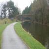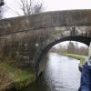
Caton Road Bridge No 105
Dolphinlee Bridge, Caton Road, Lancaster LA1 3PB, United Kingdom

Caton Road Bridge No 105
is a minor waterways place
on the Lancaster Canal (Main Line) between
Lodge Hill Junction (Junction with Lancaster Canal - Glasson Dock Branch) (7 miles and ¾ furlongs
to the south) and
Lune Aqueduct (northern end) (Over the River Lune, built by Rennie) (5¾ furlongs
to the northwest).
The nearest place in the direction of Lodge Hill Junction is Ridge Lane Bridge No 104;
5¾ furlongs
away.
The nearest place in the direction of Lune Aqueduct (northern end) is Caton Road Footbridge;
1¼ furlongs
away.
There may be access to the towpath here.
Mooring here is impossible (it may be physically impossible, forbidden, or allowed only for specific short-term purposes).
There is a bridge here which takes a track over the canal.
| Friarage Bridge No 100 | 1 mile, 2½ furlongs | |
| Nelson Street Bridge No 101 | 1 mile, 1¾ furlongs | |
| Moor Lane Bridge No 102 | 1 mile, 1 furlong | |
| Wolseley Street Footbridge No 103 | 7¼ furlongs | |
| Ridge Lane Bridge No 104 | 5¾ furlongs | |
| Caton Road Bridge No 105 | ||
| Caton Road Footbridge | 1¼ furlongs | |
| Bulk Road Aqueduct No 106 | 3¼ furlongs | |
| Lune Aqueduct (southern end) | 4¾ furlongs | |
| Lune Aqueduct (northern end) | 5¾ furlongs | |
| Halton Road Winding Hole | 6 furlongs | |
There are no links to external websites from here.
Why not log in and add some (select "External websites" from the menu (sometimes this is under "Edit"))?
Why not log in and add some (select "External websites" from the menu (sometimes this is under "Edit"))?
Mouseover for more information or show routes to facility
Nearest water point
In the direction of Preston Terminus
Lodge Hill Junction — 7 miles, ¾ furlongs away
On this waterway in the direction of Preston Terminus
Ratcliffe Bridge No 75 — 10 miles, 1½ furlongs away
On this waterway in the direction of Preston Terminus
Moss Lane Bridge No 63 — 14 miles, 2½ furlongs away
On this waterway in the direction of Preston Terminus
Brows Bridge No 8 — 9 miles, 4¾ furlongs and 6 locks away
Travel to Lodge Hill Junction, then on the Lancaster Canal (Glasson Branch) to Brows Bridge No 8
Glasson Visitor Moorings — 9 miles, 5¼ furlongs and 6 locks away
Travel to Lodge Hill Junction, then on the Lancaster Canal (Glasson Branch) to Glasson Visitor Moorings
Glasson Basin — 9 miles, 6¾ furlongs and 6 locks away
Travel to Lodge Hill Junction, then on the Lancaster Canal (Glasson Branch) to Glasson Basin
Bilsborrow Winding Hole — 19 miles, 3¼ furlongs away
On this waterway in the direction of Preston Terminus
In the direction of Tewitfield
Hest Bank Bridge No 118 — 3 miles, 2½ furlongs away
On this waterway in the direction of Tewitfield
Tewitfield — 11 miles away
On this waterway in the direction of TewitfieldNearest rubbish disposal
In the direction of Preston Terminus
Bilsborrow Winding Hole — 19 miles, 3¼ furlongs away
On this waterway in the direction of Preston Terminus
In the direction of Tewitfield
Hest Bank Bridge No 118 — 3 miles, 2½ furlongs away
On this waterway in the direction of Tewitfield
Tewitfield — 11 miles away
On this waterway in the direction of TewitfieldNearest chemical toilet disposal
In the direction of Preston Terminus
Bilsborrow Winding Hole — 19 miles, 3¼ furlongs away
On this waterway in the direction of Preston Terminus
In the direction of Tewitfield
Hest Bank Bridge No 118 — 3 miles, 2½ furlongs away
On this waterway in the direction of Tewitfield
Lundsfield Wharf — 6 miles, 5¾ furlongs away
On this waterway in the direction of Tewitfield
Tewitfield — 11 miles away
On this waterway in the direction of TewitfieldNearest place to turn
In the direction of Preston Terminus
Ashton Park Bridge Winding Hole — 5 miles, ¼ furlongs away
On this waterway in the direction of Preston Terminus
Galgate Basin Wharf — 6 miles, 6 furlongs away
On this waterway in the direction of Preston Terminus
Lodge Hill Junction — 7 miles, ¾ furlongs away
On this waterway in the direction of Preston Terminus
Carter's Wood Winding Hole — 7 miles, 3 furlongs and 1 lock away
Travel to Lodge Hill Junction, then on the Lancaster Canal (Glasson Branch) to Carter's Wood Winding Hole
Richmond Bridge Winding Hole — 8 miles, 5½ furlongs away
On this waterway in the direction of Preston Terminus
Ratcliffe Bridge Winding Hole — 10 miles, 2¼ furlongs away
On this waterway in the direction of Preston Terminus
Bells Bridge Winding Hole — 12 miles, 6 furlongs away
On this waterway in the direction of Preston Terminus
Cathouse Bridge Winding Hole — 14 miles, ½ furlongs away
On this waterway in the direction of Preston Terminus
Moss Lane Bridge Winding Hole (north) — 14 miles, 2¼ furlongs away
On this waterway in the direction of Preston Terminus
Moss Lane Bridge Winding Hole (south) — 14 miles, 2½ furlongs away
On this waterway in the direction of Preston Terminus
Kepple Lane Bridge Winding Hole — 14 miles, 4 furlongs away
On this waterway in the direction of Preston Terminus
Thurnham Bridge Winding Hole — 8 miles, 7½ furlongs and 6 locks away
Travel to Lodge Hill Junction, then on the Lancaster Canal (Glasson Branch) to Thurnham Bridge Winding Hole
In the direction of Tewitfield
Halton Road Winding Hole — 6 furlongs away
On this waterway in the direction of Tewitfield
Folly Bridge Winding Hole — 1 mile, 6¾ furlongs away
On this waterway in the direction of Tewitfield
Belmont Bridge Winding Hole — 2 miles, 2 furlongs away
On this waterway in the direction of Tewitfield
Hest Bank Winding Hole — 3 miles, 3¾ furlongs away
On this waterway in the direction of Tewitfield
Lundsfield Wharf — 6 miles, 5¾ furlongs away
On this waterway in the direction of Tewitfield
Capernwray Winding Hole — 9 miles, 1¼ furlongs away
On this waterway in the direction of Tewitfield
Lovers Creek — 9 miles, 5¼ furlongs away
On this waterway in the direction of Tewitfield
Tewitfield — 11 miles away
On this waterway in the direction of TewitfieldNo information
CanalPlan has no information on any of the following facilities within range:self-operated pump-out
boatyard pump-out
Direction of TV transmitter (From Wolfbane Cybernetic)
There is no page on Wikipedia called “Caton Road Bridge”
Wikipedia pages that might relate to Caton Road Bridge
[New York State Route 27]
Church Avenue. Eastbound NY 27 follows East 5th Street to Caton Avenue; westbound NY 27 leaves Caton Avenue at Coney Island Avenue, then follows Church Avenue
[Listed buildings in Caton-with-Littledale]
Caton-with-Littledale is a civil parish in Lancaster, Lancashire, England. It contains 53 listed buildings that are recorded in the National Heritage
[U.S. Route 1 Alternate (Baltimore, Maryland)]
in the late 1920s. Caton Avenue was paved as a concrete road from Washington Boulevard to Wilkens Avenue starting in 1930. Caton Avenue was widened and
[Maryland Route 25]
act to incorporate a company to make a turnpike road to lead from the cross roads near Richard Caton's limekiln, in Baltimore county, nearly in the direction
[U.S. Route 1 in Maryland]
Monroe Street to Caton Avenue just north of the city line. From Caton Avenue, US 1 followed Wilkens Avenue to Monroe Street. Caton Avenue and Wilkens
[New York State Route 225]
small hamlet of Caton. In the center of the community, NY 225 intersects CR 32 (Caton–Seeley Creek Road) and CR 120 (Tannery Creek Road). NY 225 turns
[A6 road (England)]
Greyhound Bridge and older Skerton Bridge. The A589 leaves for Morecambe and the A683 leaves for Caton and M6 junction 34. The road rejoins as Owen Road near
[Morecambe Bay]
Retrieved 25 April 2018. "No Boat Required – Exploring Tidal Islands", Peter Caton, 2011, Troubador Publishing, ISBN 978-1848767-010 https://www.arnsidesilverdaleaonb
[Agnewville, Virginia]
Road from Old Bridge Road to the old Horner Road (near the current Caton Hill Road). Agnewville flourished from 1890 to 1927. The land that became Agnewville
[Linden Boulevard]
City. It starts off at Flatbush Avenue in Brooklyn as a one-way street to Caton Avenue, where it becomes a two-way boulevard, and stretches through both
Results of Google Search
SD46SE CATON ROAD 1685-1/1/61 (East side (off)) Dolphinlee Bridge (No.105) II Accommodation bridge. c1797. Designed by John Rennie (engineer). For the ...
SD46SE CATON ROAD 1685-1/1/61 (East side (off)) Dolphinlee Bridge (No.105) II Accommodation bridge. c1797. Designed by John Rennie (engineer). For the ...
Mar 13, 1995 ... SD46SE CATON ROAD 1685-1/1/61 (East side (off)) Dolphinlee Bridge (No.105). II. Accommodation bridge. c1797. Designed by John Rennie
Sep 3, 2017 ... No. 103. Inner Harbor to Cromwell Bridge Park & Ride. BaltimoreLink Replacement(s): ... 5. Mondawmin to Cedonia. • No. 46. Paradise to Cedonia. • No. 105 ... Inherited the western portion (Frederick Road) of the former No.
There is no description for this series. ... Date ranges are not supported. ... RTE 24 to South of MD RTE 24; NE 104 Shop Drawings; NE 105 JFK-North of MD RTE ... Details, NE 367 Widening-North of Red Toad Road to B&O Railroad Bridge; NE ... I-895 to Bridge over I-895; 2156 SW City Line to Caton Avenue; 3374 Signing ...
Apr 15, 2020 ... (d) Violation of posted no parking rules prohibited. (1) Street ... (13) Weight and height restrictions on bridges, viaducts and other structures ... The term "marginal street" means any street, road, place, area or way ... as defined in §105 of the Vehicle and Traffic Law. ... Caton Avenue to Neptune Avenue.
View photos, property record valuation and tax data for 105 Bridge St, Joliet, IL 60435. Type: Exempt (full or partial).


![The Lancaster Canal towpath towards Lancaster. A nicely surfaced towpath with a half-mile stone in the foreground, 1½ miles north of Lancaster.A close-up view of the milestone can be seen on [[7313119]]. by Ian Elsworth – 15 April 2025](https://s1.geograph.org.uk/geophotos/08/02/12/8021205_25a26cc2_120x120.jpg)


