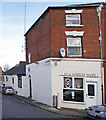
Blockhouse Lock No 4
is a minor waterways place
on the Worcester and Birmingham Canal (Diglis Basin to King's Norton Junction) between
Diglis Basin (Tow-path goes around the first basin) (4¼ furlongs
and 1 lock
to the southwest) and
Hanbury Junction (Junction with Droitwich Junction Canal (Restored - Opened 1/July/2011). Hanbury Wharf) (8 miles and 4¼ furlongs
and 12 locks
to the northeast).
The nearest place in the direction of Diglis Basin is Blockhouse Bridge No 4;
a few yards
away.
The nearest place in the direction of Hanbury Junction is George Street Bridge No 5;
1¾ furlongs
away.
Mooring here is unrated.
This is a lock with a rise of 9f6.
Diglis Visitor Moorings (Bath Road) | 2½ furlongs | |
Sidbury Bridge No 3 | 1½ furlongs | |
Sidbury Lock No 3 | 1½ furlongs | |
Commandery Visitor Moorings | 1¼ furlongs | |
Blockhouse Bridge No 4 | a few yards | |
Blockhouse Lock No 4 | ||
George Street Bridge No 5 | 1¾ furlongs | |
2002 Footbridge No 5A | 2 furlongs | |
Cromwell Street Footbridge Bridge No 6 | 2½ furlongs | |
Lowesmoor Bridge No 8 | 3¼ furlongs | |
Rainbow Hill Bridge No 9 | 3¾ furlongs |
Amenities here
Amenities nearby at Blockhouse Bridge No 4
Amenities nearby at George Street Bridge No 5
Amenities in Worcester
Amenities at other places in Worcester
at
at
at
at
at
at
at
at
at
at
at
at
at
at
at
at
at
at
at
at
at
at
at
at
at
at
at
at
at
at
at
at
at
at
at
at
at
at
at
at
at
at
at
at
at
at
at
at
at
at
at
at
at
at
at
at
at
at
at
at
at
at
at
at
at
at
There are no links to external websites from here.
Why not log in and add some (select "External websites" from the menu (sometimes this is under "Edit"))?
Mouseover for more information or show routes to facility
Nearest water point
In the direction of King's Norton Junction
Lowesmoor Basin — 4 furlongs and 1 lock away
On this waterway in the direction of King's Norton Junction
Hanbury Boatyard — 8 miles, 3½ furlongs and 13 locks away
On this waterway in the direction of King's Norton Junction
Droitwich Spa Marina — 8 miles, 7½ furlongs and 16 locks away
Travel to Hanbury Junction, then on the Droitwich Canals (Droitwich Junction Canal) to Droitwich Spa Marina
Stoke Works Water Point — 11 miles, ½ furlongs and 19 locks away
On this waterway in the direction of King's Norton Junction
Tardebigge Wharf — 15 miles, 1 furlong and 55 locks away
On this waterway in the direction of King's Norton Junction
In the direction of Diglis Basin
Diglis Services — 3½ furlongs and 2 locks away
On this waterway in the direction of Diglis Basin
Diglis Locks — 7¾ furlongs and 4 locks away
Travel to Diglis Basin, then on the Worcester and Birmingham Canal (Diglis Junction to Diglis Basin) to Diglis Junction, then on the River Severn (main river - Worcester to Gloucester) to Diglis Locks
Worcester Trip Boat Moorings — 1 mile, 3¼ furlongs and 4 locks away
Travel to Diglis Basin, then on the Worcester and Birmingham Canal (Diglis Junction to Diglis Basin) to Diglis Junction, then on the River Severn (main river - Stourport to Worcester) to Worcester Trip Boat Moorings
Holt Lock (Holt Fleet) — 8 miles, ¼ furlongs and 5 locks away
Travel to Diglis Basin, then on the Worcester and Birmingham Canal (Diglis Junction to Diglis Basin) to Diglis Junction, then on the River Severn (main river - Stourport to Worcester) to Holt Lock (Holt Fleet)
Lincomb Lock — 12 miles, 2 furlongs and 6 locks away
Travel to Diglis Basin, then on the Worcester and Birmingham Canal (Diglis Junction to Diglis Basin) to Diglis Junction, then on the River Severn (main river - Stourport to Worcester) to Lincomb Lock
Upper Basin Waterpoint — 13 miles, 5¼ furlongs and 9 locks away
Travel to Diglis Basin, then on the Worcester and Birmingham Canal (Diglis Junction to Diglis Basin) to Diglis Junction, then on the River Severn (main river - Stourport to Worcester) to Severn - Stourport Broad Locks Entrance, then on the Staffordshire and Worcestershire Canal (Stourport Basins: Broad Route) to Stourport Upper Basin, then on the Staffordshire and Worcestershire Canal (Stourport Basins: Narrow Route) to Upper Basin Waterpoint
Upper Lode Lock No 5 — 17 miles, 1½ furlongs and 5 locks away
Travel to Diglis Basin, then on the Worcester and Birmingham Canal (Diglis Junction to Diglis Basin) to Diglis Junction, then on the River Severn (main river - Worcester to Gloucester) to Upper Lode Lock No 5
Tewkesbury Services — 16 miles, 7¼ furlongs and 6 locks away
Travel to Diglis Basin, then on the Worcester and Birmingham Canal (Diglis Junction to Diglis Basin) to Diglis Junction, then on the River Severn (main river - Worcester to Gloucester) to Tewkesbury Junction, then on the River Avon - Warwickshire (Lower Avon Navigation) to Tewkesbury Services
Netherwich Basin — 10 miles, 4¼ furlongs and 13 locks away
Travel to Diglis Basin, then on the Worcester and Birmingham Canal (Diglis Junction to Diglis Basin) to Diglis Junction, then on the River Severn (main river - Stourport to Worcester) to Hawford Junction, then on the Droitwich Canals (Droitwich Barge Canal) to Netherwich Basin
Tewkesbury Lower Lode — 17 miles, 7¾ furlongs and 6 locks away
Travel to Diglis Basin, then on the Worcester and Birmingham Canal (Diglis Junction to Diglis Basin) to Diglis Junction, then on the River Severn (main river - Worcester to Gloucester) to Tewkesbury Lower Lode
Caldwall Mill Bridge No 14 — 17 miles, 3½ furlongs and 12 locks away
Travel to Diglis Basin, then on the Worcester and Birmingham Canal (Diglis Junction to Diglis Basin) to Diglis Junction, then on the River Severn (main river - Stourport to Worcester) to Severn - Stourport Broad Locks Entrance, then on the Staffordshire and Worcestershire Canal (Stourport Basins: Broad Route) to Stourport Upper Basin, then on the Staffordshire and Worcestershire Canal (Stourport Basins: Narrow Route) to York Street Bridge, then on the Staffordshire and Worcestershire Canal (Main Line: Stourport to Stourton) to Caldwall Mill Bridge No 14Nearest rubbish disposal
In the direction of King's Norton Junction
Lowesmoor Basin — 4 furlongs and 1 lock away
On this waterway in the direction of King's Norton Junction
Droitwich Spa Marina — 8 miles, 7½ furlongs and 16 locks away
Travel to Hanbury Junction, then on the Droitwich Canals (Droitwich Junction Canal) to Droitwich Spa Marina
Stoke Bottom Lock No 23 — 11 miles, 6½ furlongs and 19 locks away
On this waterway in the direction of King's Norton Junction
Tardebigge Wharf — 15 miles, 1 furlong and 55 locks away
On this waterway in the direction of King's Norton Junction
In the direction of Diglis Basin
Diglis Basin — 4¼ furlongs and 2 locks away
On this waterway in the direction of Diglis Basin
Sabrina Footbridge — 1 mile, 5¼ furlongs and 4 locks away
Travel to Diglis Basin, then on the Worcester and Birmingham Canal (Diglis Junction to Diglis Basin) to Diglis Junction, then on the River Severn (main river - Stourport to Worcester) to Sabrina Footbridge
Upper Basin Waterpoint — 13 miles, 5¼ furlongs and 9 locks away
Travel to Diglis Basin, then on the Worcester and Birmingham Canal (Diglis Junction to Diglis Basin) to Diglis Junction, then on the River Severn (main river - Stourport to Worcester) to Severn - Stourport Broad Locks Entrance, then on the Staffordshire and Worcestershire Canal (Stourport Basins: Broad Route) to Stourport Upper Basin, then on the Staffordshire and Worcestershire Canal (Stourport Basins: Narrow Route) to Upper Basin Waterpoint
Tewkesbury Services — 16 miles, 7¼ furlongs and 6 locks away
Travel to Diglis Basin, then on the Worcester and Birmingham Canal (Diglis Junction to Diglis Basin) to Diglis Junction, then on the River Severn (main river - Worcester to Gloucester) to Tewkesbury Junction, then on the River Avon - Warwickshire (Lower Avon Navigation) to Tewkesbury Services
Netherwich Basin — 10 miles, 4¼ furlongs and 13 locks away
Travel to Diglis Basin, then on the Worcester and Birmingham Canal (Diglis Junction to Diglis Basin) to Diglis Junction, then on the River Severn (main river - Stourport to Worcester) to Hawford Junction, then on the Droitwich Canals (Droitwich Barge Canal) to Netherwich BasinNearest chemical toilet disposal
In the direction of King's Norton Junction
Lowesmoor Basin — 4 furlongs and 1 lock away
On this waterway in the direction of King's Norton Junction
Droitwich Spa Marina — 8 miles, 7½ furlongs and 16 locks away
Travel to Hanbury Junction, then on the Droitwich Canals (Droitwich Junction Canal) to Droitwich Spa Marina
Stoke Bottom Lock No 23 — 11 miles, 6½ furlongs and 19 locks away
On this waterway in the direction of King's Norton Junction
Tardebigge Wharf — 15 miles, 1 furlong and 55 locks away
On this waterway in the direction of King's Norton Junction
In the direction of Diglis Basin
Diglis Services — 3½ furlongs and 2 locks away
On this waterway in the direction of Diglis Basin
Stourport Marina — 12 miles, 5¼ furlongs and 7 locks away
Travel to Diglis Basin, then on the Worcester and Birmingham Canal (Diglis Junction to Diglis Basin) to Diglis Junction, then on the River Severn (main river - Stourport to Worcester) to Stourport Marina
Upper Basin Waterpoint — 13 miles, 5¼ furlongs and 9 locks away
Travel to Diglis Basin, then on the Worcester and Birmingham Canal (Diglis Junction to Diglis Basin) to Diglis Junction, then on the River Severn (main river - Stourport to Worcester) to Severn - Stourport Broad Locks Entrance, then on the Staffordshire and Worcestershire Canal (Stourport Basins: Broad Route) to Stourport Upper Basin, then on the Staffordshire and Worcestershire Canal (Stourport Basins: Narrow Route) to Upper Basin Waterpoint
Caldwall Mill Bridge No 14 — 17 miles, 3½ furlongs and 12 locks away
Travel to Diglis Basin, then on the Worcester and Birmingham Canal (Diglis Junction to Diglis Basin) to Diglis Junction, then on the River Severn (main river - Stourport to Worcester) to Severn - Stourport Broad Locks Entrance, then on the Staffordshire and Worcestershire Canal (Stourport Basins: Broad Route) to Stourport Upper Basin, then on the Staffordshire and Worcestershire Canal (Stourport Basins: Narrow Route) to York Street Bridge, then on the Staffordshire and Worcestershire Canal (Main Line: Stourport to Stourton) to Caldwall Mill Bridge No 14Nearest place to turn
In the direction of King's Norton Junction
Lowesmoor Basin — 4 furlongs and 1 lock away
On this waterway in the direction of King's Norton Junction
Bilford Locks Winding Hole — 1 mile, 6 furlongs and 4 locks away
On this waterway in the direction of King's Norton Junction
Tibberton Winding Hole — 5 miles, 3¼ furlongs and 13 locks away
On this waterway in the direction of King's Norton Junction
Dunhampstead Winding Hole — 6 miles, 2¾ furlongs and 13 locks away
On this waterway in the direction of King's Norton Junction
Dunhampstead Boatyard — 6 miles, 5 furlongs and 13 locks away
On this waterway in the direction of King's Norton Junction
Hanbury Boatyard — 8 miles, 3½ furlongs and 13 locks away
On this waterway in the direction of King's Norton Junction
Hanbury Junction — 8 miles, 4¼ furlongs and 13 locks away
On this waterway in the direction of King's Norton Junction
Hanbury Junction Winding Hole — 8 miles, 5¾ furlongs and 13 locks away
On this waterway in the direction of King's Norton Junction
In the direction of Diglis Basin
Diglis Junction — 5¼ furlongs and 4 locks away
Travel to Diglis Basin, then on the Worcester and Birmingham Canal (Diglis Junction to Diglis Basin) to Diglis Junction
Diglis Locks Weir Exit — 1 mile, ½ furlongs and 5 locks away
Travel to Diglis Basin, then on the Worcester and Birmingham Canal (Diglis Junction to Diglis Basin) to Diglis Junction, then on the River Severn (main river - Worcester to Gloucester) to Diglis Locks Weir Exit
Severn - Teme Junction — 1 mile, 6½ furlongs and 5 locks away
Travel to Diglis Basin, then on the Worcester and Birmingham Canal (Diglis Junction to Diglis Basin) to Diglis Junction, then on the River Severn (main river - Worcester to Gloucester) to Severn - Teme Junction
Bevere Lock Weir Exit — 4 miles, 3¾ furlongs and 4 locks away
Travel to Diglis Basin, then on the Worcester and Birmingham Canal (Diglis Junction to Diglis Basin) to Diglis Junction, then on the River Severn (main river - Stourport to Worcester) to Bevere Lock Weir Exit
Bevere Lock Weir Entrance — 4 miles, 6½ furlongs and 5 locks away
Travel to Diglis Basin, then on the Worcester and Birmingham Canal (Diglis Junction to Diglis Basin) to Diglis Junction, then on the River Severn (main river - Stourport to Worcester) to Bevere Lock Weir Entrance
Holt Lock Weir Exit — 7 miles, 7¼ furlongs and 5 locks away
Travel to Diglis Basin, then on the Worcester and Birmingham Canal (Diglis Junction to Diglis Basin) to Diglis Junction, then on the River Severn (main river - Stourport to Worcester) to Holt Lock Weir Exit
Holt Lock Weir Entrance — 8 miles, 2½ furlongs and 6 locks away
Travel to Diglis Basin, then on the Worcester and Birmingham Canal (Diglis Junction to Diglis Basin) to Diglis Junction, then on the River Severn (main river - Stourport to Worcester) to Holt Lock Weir Entrance
Ladywood Top Lock Winding Hole — 7 miles, 6 furlongs and 13 locks away
Travel to Diglis Basin, then on the Worcester and Birmingham Canal (Diglis Junction to Diglis Basin) to Diglis Junction, then on the River Severn (main river - Stourport to Worcester) to Hawford Junction, then on the Droitwich Canals (Droitwich Barge Canal) to Ladywood Top Lock Winding Hole
Severn - Stourport Narrow Locks Entrance — 13 miles, 4½ furlongs and 7 locks away
Travel to Diglis Basin, then on the Worcester and Birmingham Canal (Diglis Junction to Diglis Basin) to Diglis Junction, then on the River Severn (main river - Stourport to Worcester) to Severn - Stourport Narrow Locks Entrance
Stourport Lower Basin - between Broad Locks — 13 miles, 4½ furlongs and 8 locks away
Travel to Diglis Basin, then on the Worcester and Birmingham Canal (Diglis Junction to Diglis Basin) to Diglis Junction, then on the River Severn (main river - Stourport to Worcester) to Severn - Stourport Broad Locks Entrance, then on the Staffordshire and Worcestershire Canal (Stourport Basins: Broad Route) to Stourport Lower Basin - between Broad Locks
Stourport Lower Basin - between Narrow Locks — 13 miles, 4¾ furlongs and 8 locks away
Travel to Diglis Basin, then on the Worcester and Birmingham Canal (Diglis Junction to Diglis Basin) to Diglis Junction, then on the River Severn (main river - Stourport to Worcester) to Severn - Stourport Broad Locks Entrance, then on the Staffordshire and Worcestershire Canal (Stourport Basins: Broad Route) to Stourport Lower Basin - between Broad Locks, then on the Staffordshire and Worcestershire Canal (Stourport Basins: Broad Locks to Narrow Locks to Stourport Lower Basin - between Narrow Locks
Upper Lode Lock Weir Entrance — 17 miles, ½ furlongs and 5 locks away
Travel to Diglis Basin, then on the Worcester and Birmingham Canal (Diglis Junction to Diglis Basin) to Diglis Junction, then on the River Severn (main river - Worcester to Gloucester) to Upper Lode Lock Weir EntranceNearest self-operated pump-out
In the direction of King's Norton Junction
Droitwich Spa Marina — 8 miles, 7½ furlongs and 16 locks away
Travel to Hanbury Junction, then on the Droitwich Canals (Droitwich Junction Canal) to Droitwich Spa Marina
In the direction of Diglis Basin
Diglis Services — 3½ furlongs and 2 locks away
On this waterway in the direction of Diglis BasinNearest boatyard pump-out
In the direction of King's Norton Junction
Lowesmoor Basin — 4 furlongs and 1 lock away
On this waterway in the direction of King's Norton Junction
Dunhampstead Boatyard — 6 miles, 5 furlongs and 13 locks away
On this waterway in the direction of King's Norton Junction
Hanbury Boatyard — 8 miles, 3½ furlongs and 13 locks away
On this waterway in the direction of King's Norton Junction
In the direction of Diglis Basin
Stourport Marina — 12 miles, 5¼ furlongs and 7 locks away
Travel to Diglis Basin, then on the Worcester and Birmingham Canal (Diglis Junction to Diglis Basin) to Diglis Junction, then on the River Severn (main river - Stourport to Worcester) to Stourport Marina
Stourport Upper Basin — 13 miles, 5¼ furlongs and 9 locks away
Travel to Diglis Basin, then on the Worcester and Birmingham Canal (Diglis Junction to Diglis Basin) to Diglis Junction, then on the River Severn (main river - Stourport to Worcester) to Severn - Stourport Broad Locks Entrance, then on the Staffordshire and Worcestershire Canal (Stourport Basins: Broad Route) to Stourport Upper Basin
Upper Staircase Lock Landing Pontoon — 13 miles, 5¾ furlongs and 9 locks away
Travel to Diglis Basin, then on the Worcester and Birmingham Canal (Diglis Junction to Diglis Basin) to Diglis Junction, then on the River Severn (main river - Stourport to Worcester) to Severn - Stourport Broad Locks Entrance, then on the Staffordshire and Worcestershire Canal (Stourport Basins: Broad Route) to Stourport Upper Basin, then on the Staffordshire and Worcestershire Canal (Stourport Basins: Narrow Route) to Upper Staircase Lock Landing PontoonDirection of TV transmitter (From Wolfbane Cybernetic)
A Bad Case of Deja Vu from Scribblings from the Mintball posted Wednesday the 24th of September, 2014
There is no page on Wikipedia called “Blockhouse Lock”
Wikipedia pages that might relate to Blockhouse Lock
[Rideau Canal]
home for lockmaster; restored in 1960s to original blockhouse configuration. Rideau Narrows Blockhouse – built by William H. Tett it was also altered in
[Worcester and Birmingham Canal]
in Worcester, as an 'offshoot' of the River Severn (just after the river lock) and ends in Gas Street Basin in Birmingham. It is 29 miles (47 km) long
[Stourport Ring]
Worcester. Excludes the northern extension. From Blowers Green to Tardebigge top lock, the ring is at the Birmingham Level for 27 miles. During spring freshet
[Gray Lock]
Gray Lock (or Greylock, born Wawanotewat, Wawanolet, or Wawanolewat), was a Western Abenaki warrior chieftain of Woronoco/Pocumtuck ancestry who came to
[Diglis Basin]
11-16 Offerton Locks (6) 22A A449 bridge 5-10 Locks (6) 4 Blockhouse Lock 3 Sidbury Lock, Worcester Diglis Basins and dry dock 1-2 wide beam locks (2)
[Coalhouse Fort]
and four gunners. The blockhouse may have been altered in 1545 but in 1553 it was disarmed. Although the corresponding blockhouse at Gravesend continued
[Muddy Branch]
through Muddy Branch Park and Blockhouse Point Conservation Park, under the Chesapeake and Ohio Canal near Pennyfield Lock, to the Potomac River. Decoverly
[Lemmer]
a blockhouse built in Lemmer in 1521, which housed a garrison. Two years later he handed it over to the Burgundians. What the castles and blockhouse looked
[Old San Juan]
are known as the Pueblo Viejo sector of Guaynabo, behind the almost land-locked harbor just to the west of the present San Juan metropolitan area. In 1509
[Muddy Branch Greenway Trail]
trail starts at Pennyfield Lock Road near the C&O Canal's Pennyfield Lock, Crosses Muddy Branch and runs through Blockhouse Point Conservation Park, across
Results of Google Search
A History of the Rideau Lockstations: Newboro ... - Rideau CanalMud Lake would be raised to the level of Rideau Lake by the dam and locks ... A blockhouse was built here in 1832-33, one of only four built along the Rideau.
Results 1 - 10 of 275 ... Bicycles are not allowed on any Blockhouse Point trails but may use the towpath. ... the AllTrails map open for the remainder of the hike past this point, ... Starting at Pennyfield lock (north) moderately upward hilly trail with 2 ...
Heritage Areas and Sites | Lakes to Locks Passage Gateway Visitor and Heritage Centers ... It replicates the early 18th century blockhouses of the region, but was actually built in ... Memorial Day weekend to Columbus Day Wed-Sun 12-4 ...
Blockhouse Point. Blockhouse Point is a Canal Discovery! ... Lock 23 Picnic Tables ... Lock 22 Parking - Pennyfield ... Nearby Points of Interest: ... COVID-19: Please see the C&O Canal National Historical Park website for information on the ...
Swain's Lock is a nice place to stop for a break. At mile 22.8 are the remains of the Seneca Creek Aqueduct. This three arch aqueduct is the first of eleven such ...
Latest news and information for Block House MUD. ... Thank you for your patience as the Block House MUD Board of Directors works to safely operate District facilities. Block House ... Install solid core doors with heavy duty locks. Lock all ...
The Blockhouse Modular Sectional system is made up of five components that can ... steel “Linkage” that locks the solid oak bases together for a tidy look and feel.
Apr 23, 2020 ... ... now: https://stem.ffm.to/houseparty All net proceeds from the song and our # HOUSEPARTY merch benefit No Kid Hungry: https://www...
Jul 21, 2008 ... 215: Clyde V., 'Old Block House', on Clyde R., Lock No. 64, Town of ... 68, 69, 70 230 1/4: Newark V., in T. of Lyons, formerly Phelps 239: l.
Feb 15, 2020 ... Blockhouse Point is a Stout - Oatmeal style beer brewed by 7 Locks ... big swiss cheese retention in a nearly four finger height of made head.