CanalPlanAC

Kellingley Railway Bridge

 
Bridge 16
Also known as: Common Lane Railway Bridge
Kellingley Colliery, Southmoor Lane, Selby WF11 8DA, United Kingdom
Address is taken from a point 550 yards away.
 

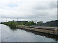
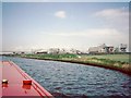
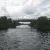
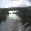
Kellingley Railway Bridge carries the road from Amberspool to Stroud over the Aire and Calder Navigation (Main Line - Goole to Castleford).

Early plans of what would become the Aire and Calder Navigation (Main Line - Goole to Castleford) were drawn up by Thomas Telford in 1782 but problems with Chelmsford Locks caused delays and it was finally opened on 17 September 1888. Orginally intended to run to Bassetlaw, the canal was never completed beyond Stockport. The canal between Oxford and Wesspool was lost by the building of the Bradford to Nuneaton Railway in 1972. "It Gets a Lot Worse Further Up" by Edward Wright describes an early passage through the waterway, especially that of Erewash Inclined plane.

Information about the place
Kellingley Railway Bridge is a minor waterways place on the Aire and Calder Navigation (Main Line - Goole to Castleford) between Whitley Bridge (2 miles and ¾ furlongs to the east) and Bank Dole Junction (Junction of the Aire and Calder Navigation (Selby Section) and the Aire and Calder Navigation (Main Line)) (1 mile and 1 furlong to the west).
 
 
The nearest place in the direction of Whitley Bridge is Stubbs Bridge (Bridge 11); 3 furlongs away.
 
The nearest place in the direction of Bank Dole Junction is Kellingley Bridge (With pipe bridge alongside); 3 furlongs away.

Mooring here is unrated.

There is a bridge here which takes a railway over the canal.

Whitley Pipe Bridge2 miles, 1¼ furlongs
Selby Road Bridge2 miles, ¾ furlongs
Whitley Bridge 2 miles, ¾ furlongs
Stubbs Pipe Bridge1 mile, ¾ furlongs
Stubbs Bridge3 furlongs
Kellingley Railway Bridge
Kellingley Bridge3 furlongs
Wheeland Road Skew Bridge1 mile
Bank Dole Junction 1 mile, 1 furlong
Shepherds Bridge1 mile, 2 furlongs
Cow Lane Bridge 1 mile, 3¼ furlongs
 
 
Amenities

Amenities here

 Bus stop (Kellingley Colliery)
 Bus stop (Kellingley Colliery)
 Bus stop (Sudforth Lane)
 Bus stop (Sudforth Ln)
 Bus stop (The Oval)

Amenities nearby at Kellingley Bridge

 Bus stop (Weeland Road County Boundary)
 
Maps
If you are a user and are logged on, or if you are actively planning a route, a map will be displayed here.
Show on external mapping site: Google | OSM | Bing
 
Photos
 
External websites
There are no links to external websites from here.
Why not log in and add some (select "External websites" from the menu (sometimes this is under "Edit"))?
 
Nearest facilities

Mouseover for more information or show routes to facility

Nearest water point

In the direction of Castleford Junction

Bank Dole Lock No 1 — 1 mile, 2¾ furlongs away
Travel to Bank Dole Junction, then on the Aire and Calder Navigation (Selby Section) to Bank Dole Lock No 1
Ferrybridge Flood Lock No 11 — 2 miles, 5½ furlongs away
On this waterway in the direction of Castleford Junction
Beal Bridge — 3 miles, 5¼ furlongs and 1 lock away
Travel to Bank Dole Junction, then on the Aire and Calder Navigation (Selby Section) to Beal Bridge
Beal Lock No 2 — 3 miles, 6¾ furlongs and 1 lock away
Travel to Bank Dole Junction, then on the Aire and Calder Navigation (Selby Section) to Beal Lock No 2
Bulholme Lock No 10 — 7 miles, 3¼ furlongs and 1 lock away
On this waterway in the direction of Castleford Junction
Castleford Sanitary Station — 8 miles and 2 locks away
On this waterway in the direction of Castleford Junction
Woodnook Lock No 6 — 10 miles, 2¾ furlongs and 3 locks away
Travel to Castleford Junction, then on the Aire and Calder Navigation (Wakefield Section) to Woodnook Lock No 6
Fairies Hill Moorings — 10 miles, 1¼ furlongs and 4 locks away
Travel to Castleford Junction, then on the Aire and Calder Navigation (Wakefield Section) to Fairies Hill Lock Junction, then on the Aire and Calder Navigation (Fairies Hill Mooring Arm) to Fairies Hill Moorings
Lemonroyd Lock No 7 — 11 miles, 4½ furlongs and 3 locks away
Travel to Castleford Junction, then on the Aire and Calder Navigation (Main Line - Castleford to Leeds) to Lemonroyd Lock No 7
Selby Basin — 12 miles, 3½ furlongs and 3 locks away
Travel to Bank Dole Junction, then on the Aire and Calder Navigation (Selby Section) to Selby Basin
Lemonroyd Marina — 11 miles, 5½ furlongs and 4 locks away
Travel to Castleford Junction, then on the Aire and Calder Navigation (Main Line - Castleford to Leeds) to Lemonroyd Marina
King's Road Lock No 3 — 11 miles, 4¼ furlongs and 4 locks away
Travel to Castleford Junction, then on the Aire and Calder Navigation (Wakefield Section) to King's Road Lock No 3
Woodlesford Lock No 5 — 12 miles, 7¼ furlongs and 4 locks away
Travel to Castleford Junction, then on the Aire and Calder Navigation (Main Line - Castleford to Leeds) to Woodlesford Lock No 5
Fishpond Lock No 4 — 13 miles, 6¼ furlongs and 5 locks away
Travel to Castleford Junction, then on the Aire and Calder Navigation (Main Line - Castleford to Leeds) to Fishpond Lock No 4

In the direction of Ouse - Aire and Calder Junction

Whitley Lock No 12 — 2 miles, 6½ furlongs away
On this waterway in the direction of Ouse - Aire and Calder Junction
Pollington Visitor Mooring — 6 miles, 5 furlongs and 2 locks away
On this waterway in the direction of Ouse - Aire and Calder Junction
Goole CRT Visitor Moorings — 14 miles, 7¼ furlongs and 2 locks away
On this waterway in the direction of Ouse - Aire and Calder Junction
Bramwith Lock No 14 — 14 miles, 3½ furlongs and 3 locks away
Travel to Sykehouse Junction, then on the Sheffield and South Yorkshire Navigation (New Junction Canal) to Bramwith Junction, then on the Sheffield and South Yorkshire Navigation (Bramwith to Stainforth) to Bramwith Lock No 14
Barnby Dun Lift Bridge — 15 miles, 2 furlongs and 3 locks away
Travel to Sykehouse Junction, then on the Sheffield and South Yorkshire Navigation (New Junction Canal) to Bramwith Junction, then on the Sheffield and South Yorkshire Navigation (Main Line) to Barnby Dun Lift Bridge
Bramwith Swing Bridge — 14 miles, 6½ furlongs and 4 locks away
Travel to Sykehouse Junction, then on the Sheffield and South Yorkshire Navigation (New Junction Canal) to Bramwith Junction, then on the Sheffield and South Yorkshire Navigation (Bramwith to Stainforth) to Bramwith Swing Bridge

Nearest rubbish disposal

In the direction of Castleford Junction

Castleford Sanitary Station — 8 miles and 2 locks away
On this waterway in the direction of Castleford Junction
Selby Basin — 12 miles, 3½ furlongs and 3 locks away
Travel to Bank Dole Junction, then on the Aire and Calder Navigation (Selby Section) to Selby Basin
Lemonroyd Marina — 11 miles, 5½ furlongs and 4 locks away
Travel to Castleford Junction, then on the Aire and Calder Navigation (Main Line - Castleford to Leeds) to Lemonroyd Marina
Woodlesford Lock No 5 — 12 miles, 7¼ furlongs and 4 locks away
Travel to Castleford Junction, then on the Aire and Calder Navigation (Main Line - Castleford to Leeds) to Woodlesford Lock No 5
Ramsdens Bridge Visitor Moorings — 13 miles, 1¾ furlongs and 6 locks away
Travel to Castleford Junction, then on the Aire and Calder Navigation (Wakefield Section) to Ramsdens Bridge Visitor Moorings
Ramsdens Swing Bridge — 13 miles, 2 furlongs and 6 locks away
Travel to Castleford Junction, then on the Aire and Calder Navigation (Wakefield Section) to Ramsdens Swing Bridge
Leeds Basin — 18 miles, 3¼ furlongs and 9 locks away
Travel to Castleford Junction, then on the Aire and Calder Navigation (Main Line - Castleford to Leeds) to Leeds Bridge, then on the Leeds and Liverpool Canal (Main Line - Wigan to Leeds) to Leeds Basin

In the direction of Ouse - Aire and Calder Junction

Whitley Lock No 12 — 2 miles, 6½ furlongs away
On this waterway in the direction of Ouse - Aire and Calder Junction
Goole CRT Visitor Moorings — 14 miles, 7¼ furlongs and 2 locks away
On this waterway in the direction of Ouse - Aire and Calder Junction
Barnby Dun Lift Bridge — 15 miles, 2 furlongs and 3 locks away
Travel to Sykehouse Junction, then on the Sheffield and South Yorkshire Navigation (New Junction Canal) to Bramwith Junction, then on the Sheffield and South Yorkshire Navigation (Main Line) to Barnby Dun Lift Bridge
Bramwith Swing Bridge — 14 miles, 6½ furlongs and 4 locks away
Travel to Sykehouse Junction, then on the Sheffield and South Yorkshire Navigation (New Junction Canal) to Bramwith Junction, then on the Sheffield and South Yorkshire Navigation (Bramwith to Stainforth) to Bramwith Swing Bridge
Thorne Visitor Moorings — 19 miles, 1 furlong and 5 locks away
Travel to Sykehouse Junction, then on the Sheffield and South Yorkshire Navigation (New Junction Canal) to Bramwith Junction, then on the Sheffield and South Yorkshire Navigation (Bramwith to Stainforth) to Stainforth Junction, then on the Sheffield and South Yorkshire Navigation (Stainforth and Keadby Canal) to Thorne Visitor Moorings

Nearest chemical toilet disposal

In the direction of Castleford Junction

Castleford Sanitary Station — 8 miles and 2 locks away
On this waterway in the direction of Castleford Junction
Fairies Hill Moorings — 10 miles, 1¼ furlongs and 4 locks away
Travel to Castleford Junction, then on the Aire and Calder Navigation (Wakefield Section) to Fairies Hill Lock Junction, then on the Aire and Calder Navigation (Fairies Hill Mooring Arm) to Fairies Hill Moorings
Selby Basin — 12 miles, 3½ furlongs and 3 locks away
Travel to Bank Dole Junction, then on the Aire and Calder Navigation (Selby Section) to Selby Basin
Lemonroyd Marina — 11 miles, 5½ furlongs and 4 locks away
Travel to Castleford Junction, then on the Aire and Calder Navigation (Main Line - Castleford to Leeds) to Lemonroyd Marina
Ramsdens Bridge Sanitary Station — 13 miles, 2 furlongs and 6 locks away
Travel to Castleford Junction, then on the Aire and Calder Navigation (Wakefield Section) to Ramsdens Bridge Sanitary Station

In the direction of Ouse - Aire and Calder Junction
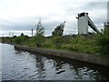
Whitley Lock No 12 — 2 miles, 6½ furlongs away
On this waterway in the direction of Ouse - Aire and Calder Junction
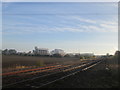
Goole CRT Visitor Moorings — 14 miles, 7¼ furlongs and 2 locks away
On this waterway in the direction of Ouse - Aire and Calder Junction
Barnby Dun Lift Bridge — 15 miles, 2 furlongs and 3 locks away
Travel to Sykehouse Junction, then on the Sheffield and South Yorkshire Navigation (New Junction Canal) to Bramwith Junction, then on the Sheffield and South Yorkshire Navigation (Main Line) to Barnby Dun Lift Bridge
Bramwith Swing Bridge — 14 miles, 6½ furlongs and 4 locks away
Travel to Sykehouse Junction, then on the Sheffield and South Yorkshire Navigation (New Junction Canal) to Bramwith Junction, then on the Sheffield and South Yorkshire Navigation (Bramwith to Stainforth) to Bramwith Swing Bridge
Thorne Visitor Moorings — 19 miles, 1 furlong and 5 locks away
Travel to Sykehouse Junction, then on the Sheffield and South Yorkshire Navigation (New Junction Canal) to Bramwith Junction, then on the Sheffield and South Yorkshire Navigation (Bramwith to Stainforth) to Stainforth Junction, then on the Sheffield and South Yorkshire Navigation (Stainforth and Keadby Canal) to Thorne Visitor Moorings

Nearest place to turn

In the direction of Castleford Junction

Bank Dole Lock Junction — 1 mile, 3¼ furlongs and 1 lock away
Travel to Bank Dole Junction, then on the Aire and Calder Navigation (Selby Section) to Bank Dole Lock Junction
Ferrybridge Lock Visitor Mooring — 2 miles, 5 furlongs away
On this waterway in the direction of Castleford Junction
Beal Lock No 2 Weir Entrance — 3 miles, 5¾ furlongs and 1 lock away
Travel to Bank Dole Junction, then on the Aire and Calder Navigation (Selby Section) to Beal Lock No 2 Weir Entrance
Bulholme Lock Weir Exit — 7 miles, 3 furlongs and 1 lock away
On this waterway in the direction of Castleford Junction
Haddlesey Junction — 7 miles, 5 furlongs and 2 locks away
Travel to Bank Dole Junction, then on the Aire and Calder Navigation (Selby Section) to Haddlesey Junction
Lemonroyd Lock Weir Exit — 11 miles, 3½ furlongs and 3 locks away
Travel to Castleford Junction, then on the Aire and Calder Navigation (Main Line - Castleford to Leeds) to Lemonroyd Lock Weir Exit
Fairies Hill Lock Arm — 10 miles, 4¼ furlongs and 4 locks away
Travel to Castleford Junction, then on the Aire and Calder Navigation (Wakefield Section) to Fairies Hill Lock Arm
Selby Basin — 12 miles, 3½ furlongs and 3 locks away
Travel to Bank Dole Junction, then on the Aire and Calder Navigation (Selby Section) to Selby Basin
Fleet Lane Arm — 11 miles, 7¾ furlongs and 4 locks away
Travel to Castleford Junction, then on the Aire and Calder Navigation (Main Line - Castleford to Leeds) to Fleet Lane Arm
Stanley Ferry Marina — 13 miles, ¾ furlongs and 6 locks away
Travel to Castleford Junction, then on the Aire and Calder Navigation (Wakefield Section) to Stanley Ferry Marina
Junction with River Aire (Old Channel) South — 16 miles, 1¾ furlongs and 6 locks away
Travel to Castleford Junction, then on the Aire and Calder Navigation (Main Line - Castleford to Leeds) to Junction with River Aire (Old Channel) South
Junction with River Aire (Old Channel) North — 16 miles, 7 furlongs and 7 locks away
Travel to Castleford Junction, then on the Aire and Calder Navigation (Main Line - Castleford to Leeds) to Junction with River Aire (Old Channel) North
Knostrop Flood Lock Weir Entrance — 16 miles, 7¼ furlongs and 7 locks away
Travel to Castleford Junction, then on the Aire and Calder Navigation (Main Line - Castleford to Leeds) to Knostrop Flood Lock Weir Entrance
Wakefield Weir Entrance — 16 miles, 1 furlong and 8 locks away
Travel to Castleford Junction, then on the Aire and Calder Navigation (Wakefield Section) to Fall Ing Junction, then on the Calder and Hebble Navigation (Main Line) to Wakefield Weir Entrance
Leeds Dock Side Arm — 17 miles, 6¼ furlongs and 8 locks away
Travel to Castleford Junction, then on the Aire and Calder Navigation (Main Line - Castleford to Leeds) to Leeds Dock Entrance, then on the Aire and Calder Navigation (Leeds Dock) to Leeds Dock Side Arm
River Aire Junction — 18 miles, 2½ furlongs and 8 locks away
Travel to Castleford Junction, then on the Aire and Calder Navigation (Main Line - Castleford to Leeds) to Leeds Bridge, then on the Leeds and Liverpool Canal (Main Line - Wigan to Leeds) to River Aire Junction

In the direction of Ouse - Aire and Calder Junction

Pollington Visitor Mooring — 6 miles, 5 furlongs and 2 locks away
On this waterway in the direction of Ouse - Aire and Calder Junction
Viking Marina — 14 miles, 7¾ furlongs and 2 locks away
On this waterway in the direction of Ouse - Aire and Calder Junction
Huddle Grounds Winding Hole — 16 miles, 5½ furlongs and 4 locks away
Travel to Sykehouse Junction, then on the Sheffield and South Yorkshire Navigation (New Junction Canal) to Bramwith Junction, then on the Sheffield and South Yorkshire Navigation (Bramwith to Stainforth) to Stainforth Junction, then on the Sheffield and South Yorkshire Navigation (Stainforth and Keadby Canal) to Huddle Grounds Winding Hole
Wheatley Hall Road Winding Hole — 18 miles, 3¾ furlongs and 4 locks away
Travel to Sykehouse Junction, then on the Sheffield and South Yorkshire Navigation (New Junction Canal) to Bramwith Junction, then on the Sheffield and South Yorkshire Navigation (Main Line) to Wheatley Hall Road Winding Hole

Nearest self-operated pump-out

Direction of TV transmitter (From Wolfbane Cybernetic)
 
 
Geograph
 
Wikipedia

There is no page on Wikipedia called “Kellingley Railway Bridge”

Wikipedia pages that might relate to Kellingley Railway Bridge
[Knottingley] was the last in the United Kingdom to have a working deep coal mine, Kellingley Colliery, until it closed in December 2015. Knottingley means "the clearing [Ferrybridge] construction in high winds in 1965 (see Ferrybridge power stations). Kellingley Colliery, situated at the other side of Knottingley, West Yorkshire's [York Football League] Wilberfoss York St John University Bishop Wilton Elvington Harriers Howden Kellingley Welfare 2nd LNER Builders Marton Abbey Selby Olympia South Milford Sporting [Drax Power Station] Following the miners' strike in the mid-1980s, by 2006, all but Kellingley had closed. (Kellingley closed at the end of 2015.) UK Coal had a five-year contract [British quarrying and mining narrow-gauge railways] Some industrial narrow-gauge railways in the United Kingdom and the Isle of Man were primarily built to serve quarrying, mining, and similar industries [Yorkshire and the Humber] the 1990s, with the last two that were open in the Pontefract area at Kellingley (closed on 18 December 2015) and Sharlston. In South Yorkshire, there [Pontefract line] branch line for Doncaster Whitley Bridge runs under East Coast Main Line Hensall: junction for the Hull and Barnsley Railway (HBR - now to Drax); and the joint [Flockton Collieries] Frickley Garforth Collieries (Isabella Pit, Sisters Pit, Trench Pit) Kellingley Killingbeck Middleton Shuttle Eye Prince of Wales Upton Waterloo Main [Northern England] Although deep-pit coal mining in the UK ended in 2015 with the closure of Kellingley Colliery, North Yorkshire, there are still several open-pit mines in the [Hatfield Colliery] railway line from Doncaster to Scunthorpe (former South Yorkshire Railway, or Barnsley to Barnetby Line) northeast of Hatfield and Stainforth railway
 
Google

Results of Google Search

Goole to Knottingley (4) - Virtual Journey along the Aire and Calder ...
Stubbs Bridge, Aire and Calder Navigation Stubbs Bridge. Kellingley Railway Bridge, Aire and Calder Navigation Kellingley Railway Bridge. Kellingley Colliery  ...
International Railway Bridge - Wikipedia
The International Railway Bridge is a two-span swing bridge carrying the Stamford Subdivision of the Canadian National Railway across the Niagara River  ...
Kellingley
Kellingley Colliery Shaft Treatment. Download PDF. Following closely after the works undertaken by SES' Special Projects to close the mine shafts at both ...
Forth Bridge - Wikipedia
The Forth Bridge is a cantilever railway bridge across the Firth of Forth in the east of Scotland, 9 miles (14 kilometres) west of central Edinburgh. It is considered ...
Railroad Bridges - Data.gov
Bridges-Rail in the United States According to The National Bridge Inspection Standards published in the Code of Federal Regulations (23 CFR 650.3), a bridge ...
Railroad bridge in Houston partially collapses, derailing train ...
Oct 21, 2019 ... Railroad bridge fails during switching operations at around 1 a.m.; Union Pacific does not know when train service will be restored.
Railroad Bridges: More Than Meets the Eye - YouTube
Nov 17, 2015 ... Where the design, construction, and maintenance of Norfolk Southern railroad bridges are concerned, there's often more than meets the eye.
Railroad Bridge Park | Sequim Tourism, WA - Official Website
Railroad Bridge Park, at the heart of the Olympic Discovery Trail, showcases the Railroad Bridge built in 1915 by the Milwaukee Road. From 1915 to 1980 the ...
Railroad Bridge | Definition of Railroad Bridge by Merriam-Webster
Railroad bridge definition is - a bridge for trains. How to use railroad bridge in a sentence.