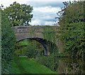
Park Head Bridge No 41
is a minor waterways place
on the Lancaster Canal (Main Line) between
Ribble Link - Lancaster Canal Junction (8 miles and ½ furlongs
to the south) and
Lodge Hill Junction (Junction with Lancaster Canal - Glasson Dock Branch) (14 miles and 4¼ furlongs
to the north).
The nearest place in the direction of Ribble Link - Lancaster Canal Junction is Hankinson Bridge No 40;
1½ furlongs
away.
The nearest place in the direction of Lodge Hill Junction is Park Head Winding Hole;
¾ furlongs
away.
There may be access to the towpath here.
Mooring here is unrated.
There is a bridge here which takes a minor road over the canal.
| Hollowforth Swing Bridge | 6¼ furlongs | |
| Hollowforth Winding Hole | 5½ furlongs | |
| Hollowforth Aqueduct No 38 | 4½ furlongs | |
| Hepgreave Bridge No 39 | 2¾ furlongs | |
| Hankinson Bridge No 40 | 1½ furlongs | |
| Park Head Bridge No 41 | ||
| Park Head Winding Hole | ¾ furlongs | |
| White Horse Bridge No 42 | 6¾ furlongs | |
| White Horse Winding Hole | 1 mile, 1 furlong | |
| Head Nook Bridge No 43 | 1 mile, 3¾ furlongs | |
| Roebuck Bridge No 44 | 1 mile, 7½ furlongs | |
Amenities nearby at Hankinson Bridge No 40
There are no links to external websites from here.
Why not log in and add some (select "External websites" from the menu (sometimes this is under "Edit"))?
Why not log in and add some (select "External websites" from the menu (sometimes this is under "Edit"))?
Mouseover for more information or show routes to facility
Nearest water point
In the direction of Preston Terminus
Swill Brook Basin — 2 miles, 2½ furlongs away
On this waterway in the direction of Preston Terminus
Blackleach Lane Marina — 2 miles, 5¾ furlongs away
On this waterway in the direction of Preston Terminus
Woodplumpton Road Bridge No 12 — 8 miles, 7¾ furlongs away
On this waterway in the direction of Preston Terminus
In the direction of Tewitfield
Bilsborrow Winding Hole — 2 miles, 2 furlongs away
On this waterway in the direction of Tewitfield
Moss Lane Bridge No 63 — 7 miles, 2¾ furlongs away
On this waterway in the direction of Tewitfield
Ratcliffe Bridge No 75 — 11 miles, 3½ furlongs away
On this waterway in the direction of Tewitfield
Lodge Hill Junction — 14 miles, 4¼ furlongs away
On this waterway in the direction of Tewitfield
Brows Bridge No 8 — 17 miles, ¼ furlongs and 6 locks away
Travel to Lodge Hill Junction, then on the Lancaster Canal (Glasson Branch) to Brows Bridge No 8
Glasson Visitor Moorings — 17 miles, ¾ furlongs and 6 locks away
Travel to Lodge Hill Junction, then on the Lancaster Canal (Glasson Branch) to Glasson Visitor Moorings
Glasson Basin — 17 miles, 2¼ furlongs and 6 locks away
Travel to Lodge Hill Junction, then on the Lancaster Canal (Glasson Branch) to Glasson BasinNearest rubbish disposal
In the direction of Preston Terminus
Woodplumpton Road Bridge No 12 — 8 miles, 7¾ furlongs away
On this waterway in the direction of Preston Terminus
In the direction of Tewitfield
Bilsborrow Winding Hole — 2 miles, 2 furlongs away
On this waterway in the direction of TewitfieldNearest chemical toilet disposal
In the direction of Preston Terminus
Woodplumpton Road Bridge No 12 — 8 miles, 7¾ furlongs away
On this waterway in the direction of Preston Terminus
In the direction of Tewitfield
Bilsborrow Winding Hole — 2 miles, 2 furlongs away
On this waterway in the direction of TewitfieldNearest place to turn
In the direction of Preston Terminus
Hollowforth Winding Hole — 5½ furlongs away
On this waterway in the direction of Preston Terminus
Moons Bridge Marina — 6¼ furlongs away
On this waterway in the direction of Preston Terminus
Swill Brook Basin — 2 miles, 2½ furlongs away
On this waterway in the direction of Preston Terminus
Salwick Hall Winding Hole — 5 miles, 2¼ furlongs away
On this waterway in the direction of Preston Terminus
Ward's House Winding Hole No 2 — 5 miles, 4¼ furlongs away
On this waterway in the direction of Preston Terminus
Ward's House Winding Hole No 1 — 5 miles, 6½ furlongs away
On this waterway in the direction of Preston Terminus
Tom Benson Way Bridge Winding Hole — 7 miles, 7 furlongs away
On this waterway in the direction of Preston Terminus
Ribble Link - Lancaster Canal Junction — 8 miles, ½ furlongs away
On this waterway in the direction of Preston Terminus
Bexhill Road Winding Hole — 8 miles, 3¾ furlongs away
On this waterway in the direction of Preston Terminus
In the direction of Tewitfield
Park Head Winding Hole — ¾ furlongs away
On this waterway in the direction of Tewitfield
White Horse Winding Hole — 1 mile, 1 furlong away
On this waterway in the direction of Tewitfield
Bilsborrow Winding Hole — 2 miles, 2 furlongs away
On this waterway in the direction of Tewitfield
Catterall Bridge Winding Hole — 5 miles, ¼ furlongs away
On this waterway in the direction of Tewitfield
Greenhalgh Castle Bridge Winding Hole — 6 miles, ¾ furlongs away
On this waterway in the direction of Tewitfield
Dimples Bridge Winding Hole — 6 miles, 2¾ furlongs away
On this waterway in the direction of Tewitfield
The Moorings Basin — 7 miles, ¾ furlongs away
On this waterway in the direction of Tewitfield
Kepple Lane Bridge Winding Hole — 7 miles, 1¼ furlongs away
On this waterway in the direction of Tewitfield
Moss Lane Bridge Winding Hole (south) — 7 miles, 2¾ furlongs away
On this waterway in the direction of Tewitfield
Moss Lane Bridge Winding Hole (north) — 7 miles, 2¾ furlongs away
On this waterway in the direction of Tewitfield
Cathouse Bridge Winding Hole — 7 miles, 4¾ furlongs away
On this waterway in the direction of TewitfieldNo information
CanalPlan has no information on any of the following facilities within range:self-operated pump-out
boatyard pump-out
Direction of TV transmitter (From Wolfbane Cybernetic)
There is no page on Wikipedia called “Park Head Bridge”
Wikipedia pages that might relate to Park Head Bridge
[Natural Bridge Park]
Natural Bridge Park near Natural Bridge, Alabama, is park in Winston County, Alabama, that has been open since 1954. The current owners are Jim and Barbara
[Caesars Head State Park]
Caesars Head State Park is a park in northern Greenville County, South Carolina, that borders Transylvania County, North Carolina, and is reached via
[Brooklyn Bridge Park]
Brooklyn Bridge Park is an 85-acre (34 ha) park on the Brooklyn side of the East River in New York City. Designed by landscape architecture firm Michael
[London Bridge]
0°05′16″W / 51.50806°N 0.08778°W / 51.50806; -0.08778 Several bridges named London Bridge have spanned the River Thames between the City of London and
[Operation London Bridge]
Operation London Bridge is the plan for what will happen in the United Kingdom after the death of Queen Elizabeth II. The plan was originally devised in
[Betsy Head Park]
Betsy Head Park is a 10.55-acre (4.27 ha) public park in Brownsville, Brooklyn, New York City, in two non-contiguous segments centered around Dumont Avenue
[Hilton Head Island, South Carolina]
pontoon bridge while the bridge was being repaired. The swing bridge was replaced by the current four-lane bridge in 1982. The beginning of Hilton Head as
[Hybrid Theory]
after Linkin Park struggled with "Runaway", and features a guitar riff and electronic percussion in the introduction transitioning into a bridge with distortion-heavy
[Basin Head Provincial Park]
Basin Head Provincial Park is a provincial park located in Basin Head, Prince Edward Island, Canada. It is best known by its nickname "Singing Sands"
[Devil's Bridge]
Devil's Bridge is a term applied to dozens of ancient bridges, found primarily in Europe. Most of these bridges are stone or masonry arch bridges and represent
Results of Google Search
South Cumberland State Park — Tennessee State ParksMar 24, 2020 ... The park is composed of approximately 30,845 acres in nine separate areas and boasts some of the best hiking and backcountry camping in ...
Nov 12, 2019 ... Before visiting, please check with individual parks regarding ... the spread of infectious diseases and practice Leave No Trace principles. ... Everett Covered Bridge: 2370 Everett Road, Peninsula 44264 (81° 35.08' W) (41° ...
Apr 17, 2020 ... Hillsborough County Veterans Memorial Park and Rear Admiral Leroy ... Head Start and Early Head Start centers are closed until at least Friday, May 1. ... Lutz, FL 33548; Morris Bridge Park Boat Ramp 13630 Morris Bridge Road ... No. Board of County Commissioners | Contact Us | County Locations | Jobs ...
Jun 25, 2019 ... Highway 169 traffic is head-to-head on the same side of the road ... There is no crossing between Highway 41 and County Highway 78 at the intersection. ... Construction crews poured concrete for the bridge deck of the new ...
U.S. Route 41 (US 41) in the U.S. state of Florida is a north–south United States Highway. ... An old narrow bridge across a dry creek can be found just north of this ... From this hill the road descends again as it runs between a trailer park on the ... After SR 24, US 27/41 curves back northwest but head straight northward ...
Oct 14, 2019 ... At present, there are no plans to change the at-grade intersections north of NY 199. ... Pines Bridge Road. 11.1, Exit 11. NY 134 ... 16.4, Exit 16. Franklin D Roosevelt State Park ... 41.4, Exit 41. CR 9 ... Bulls Head Road.
Location, University Park and Sweetwater, Florida, U.S.. Type, Bridge collapse. Deaths, 6. Non-fatal injuries, 8. [Full screen]. On March 15, 2018, a 175-foot-long (53 m), recently-constructed section of the FIU-Sweetwater UniversityCity pedestrian bridge collapsed onto the Tamiami Trail (U.S. Route 41), resulting ... The canal span, access ramps, and faux cable-stayed tower had not yet been ...
4178 Violations of offenses prohibiting stopping, standing or parking. ... or residential district, no person shall stop, park or leave standing any vehicle, ... illegally left standing upon any highway, bridge, causeway, or in any tunnel in such a ...
Hereafter no work of art shall become the property of the state by purchase, ... highway or other public place, park or ground belonging to or under control of the state. ... The construction of any building, bridge or its approaches, arch, gate, fence ... when requested to do so, by the governor, any legislative committee, head of ...
Note: Clipper Cards are not accepted on the Oracle Park service. Please note that ... Between Alameda or Oakland and San Francisco Ferry Building or Pier 41 .


