CanalPlanAC

Queen's Road Bridge

 
Nottingham NG2 3BE, United Kingdom
 
Information about the place
Queen's Road Bridge is a minor waterways place on the River Trent (Nottingham Canal) between Meadow Lane Junction (Junction of Nottingham Canal with River Trent) (2½ furlongs and 1 lock to the southeast) and Carrington Street Bridge (Nottingham) (2 furlongs to the west).
 
It is part of Nottingham.
 
The nearest place in the direction of Meadow Lane Junction is Cattle Market Road Bridge; ¾ furlongs away.
 
The nearest place in the direction of Carrington Street Bridge is LMS Railway Bridge; ¼ furlongs away.

There may be access to the towpath here.

Mooring here is unrated.

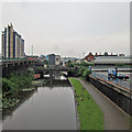
There is a bridge here which takes a minor road over the canal.


Amenities

Amenities here

 Speedy Hire

Amenities in Nottingham

 Aldi
 Aldi
 Alfreton Rd Supermarket
 Kwik Save
 Lidl
 Many Chinese Supermarket
 Tesco
 Tesco
 Budgens
 Caffe Nero
 Caffe Nero
 Caffe Nero
 Caffe Nero
 Costa Coffee
 Costa Coffee
 Patisserie-Valerie
 Starbucks
 Bella Italia
 Bella Italia
 Frankie & Bennys
 Hard Rock Cafe
 Loch Fyne
 Mange Caribbiene
 McDonalds
 McDonalds
 Nandos
 Pizza Hut
 Pizza Hut
 Pizza Hut
 Strada
 Bank
 Bell
 Bell Inn
 Bunkers Hill Inn
 Cape 23-27 Victoria Street &
 Dragon
 Elwes Arms
 Joseph Else
 Langtry's
 Lloyds No 1
 Lord Nelson
 Major Oak 24 -
 Nottingham
 Nottingham
 Nottingham
 Nottingham
 Old Dog & Partridge
 Pit & Pendulum
 Playhouse Cafe
 Roebuck Inn
 Ropewalk
 Rose & Crown
 Rose of England
 SEE ADDRESS
 SEE ADDRESS
 SEE ADDRESS
 SEE ADDRESS
 SEE ADDRESS
 Squares
 TGI Fridays
 Tap 'N' Tumbler
 Three Crowns
 Wetherspoons
 Wetherspoons
 Wetherspoons
 Yates's
 Poundland
 W H Smith
 Burger King
 Burger King
 Dominos Pizza
 Fish & Chips
 Fish & Chips
 Fish & Chips
 KFC
 Subway Sandwich Shop
 Subway Sandwich Shop
 Subway Sandwich Shop
 Subway Sandwich Shop
 Boots
 Boots
 Boots Chemist
 Boots Chemist
 Barclays
 Barclays
 Cashpoint
 Cashpoint
 Cashpoint
 Cashpoint
 Cashpoint
 Cashpoint
 Cashpoint
 Cashpoint
 Cashpoint
 Cashpoint
 Cashpoint
 Cashpoint
 Cashpoint
 Cashpoint
 Cashpoint
 Cashpoint
 Cashpoint
 Cashpoint
 Cashpoint
 Cashpoint
 Cashpoint
 Cashpoint
 Cashpoint
 Cashpoint
 Cashpoint
 Cashpoint
 Co-operative Bank
 Coventry
 HSBC
 Halifax
 Lloyds Bank
 Lloyds Bank
 NatWest
 NatWest
 NatWest
 NatWest
 Nationwide
 Nationwide
 RBS
 Santander
 Santander
 TSB
 Yorkshire Bank
 Texaco
 Total
 Freewheel - Nottingham
 Homebase
 Nottingham, Harlow Bros

Amenities at other places in Nottingham

 Hanson Chinese Supermarket at Carrington Street Bridge
 Sainsbury's at Abbey Railway Bridge
 Sainsbury's at Castle Bridge Road Bridge
 Sainsburys at Abbey Railway Bridge
 Sainsburys at Nottingham Castle Marina
 Sainsburys - Castle Bridge Road Castle Mariner - Nottingham NG7 1GX at Castle Bridge Road Bridge
 Lenton Tropical Foods at Abbey Railway Bridge
 Costa Coffee at Trent Street Bridge
 Starbucks at Carrington Street Bridge
 Starbucks at Trent Street Bridge
 La Tasca at Boots Pipe Bridge
 McDonalds at Carrington Street Bridge
 Pizza Hut at Nottingham Castle Marina
 Beefeater at Nottingham Castle Marina
 Canalhouse at Carrington Street Bridge
 Canalhouse at Canal Museum Arm
 Castle at Castle Lock No 6
 Company Inn at Wilford Street Footbridge
 Hungry Horse at Nottingham Castle Marina
 Johnson Arms at Lenton Chain
 Nottingham at Boots Pipe Bridge
 Royal Children at Castle Lock No 6
 Salutation at Castle Lock No 6
 Trent Bridge at Trent Bridge
 Trent Bridge Inn at Trent Bridge
 Ye Olde Trip at Castle Lock No 6
 B&M Bargains at Lady Bay Bridge
 W H Smith at Carrington Street Bridge
 Burger King at Lady Bay Bridge
 Dominos Pizza at Trent Bridge
 Fish & Chips at Castle Bridge Road Bridge
 Fish & Chips at Lady Bay Bridge No 2
 Fish & Chips at Meadow Lane New Bridge
 KFC at Lady Bay Bridge
 Subway Sandwich Shop at Castle Lock No 6
 Boots Chemist at Nottingham Tram Railway Bridge
 Cashpoint at Lady Bay Bridge
 Cashpoint at London Road Bridge
 Cashpoint at Meadow Lane Bridge
 Cashpoint at Trent Bridge
 Cashpoint at Carrington Street Bridge
 Cashpoint at Carrington Street Bridge
 Santander at Canal Museum Arm
 John A Stephens Ltd at Trent Bridge
 Murco at Lady Bay Bridge
 Nottingham Castle Marina at Nottingham Castle Marina
 Sainsburys Fuel at Castle Boulevard Footbridge
 Shell at London Road Bridge
 Sted Electrical at Boots Pipe Bridge
 Camping Supplies Shop at Castle Lock No 6
 Machine Mart at Poplar Arms Corner
 Plumbing Trade Supplies at Clayton's Bridge
 The Range at Lady Bay Bridge
 Nottingham Station at Carrington Street Bridge
 
Maps
If you are a user and are logged on, or if you are actively planning a route, a map will be displayed here.
Show on external mapping site: Google | OSM | Bing
 
Photos
 
External websites
There are no links to external websites from here.
Why not log in and add some (select "External websites" from the menu (sometimes this is under "Edit"))?
 
Nearest facilities

Mouseover for more information or show routes to facility

Nearest water point

In the direction of Lenton Chain

Beeston Lock No 55 miles, 4¾ furlongs and 1 lock away
Travel to Lenton Chain, then on the River Trent (Beeston Canal) to Beeston Lock No 5
Cranfleet Lock No 39 miles, 7¼ furlongs and 2 locks away
Travel to Lenton Chain, then on the River Trent (Beeston Canal) to Beeston Lock No 5, then on the River Trent (Western End) to Cranfleet Lock No 3
Former BW Trent Lock Waterway Office10 miles, 5¾ furlongs and 5 locks away
Travel to Lenton Chain, then on the River Trent (Beeston Canal) to Beeston Lock No 5, then on the River Trent (Western End) to Trent Junction, then on the Grand Union Canal (Erewash Canal) to Former BW Trent Lock Waterway Office
Sawley Locks No 211 miles, 3¾ furlongs and 4 locks away
Travel to Lenton Chain, then on the River Trent (Beeston Canal) to Beeston Lock No 5, then on the River Trent (Western End) to Sawley Locks No 2
Shardlow13 miles, 5½ furlongs and 7 locks away
Travel to Lenton Chain, then on the River Trent (Beeston Canal) to Beeston Lock No 5, then on the River Trent (Western End) to Derwent Mouth, then on the Trent and Mersey Canal (Main Line - Derwent Mouth to Burton) to Shardlow
Weston Lock No 416 miles, 5¼ furlongs and 9 locks away
Travel to Lenton Chain, then on the River Trent (Beeston Canal) to Beeston Lock No 5, then on the River Trent (Western End) to Derwent Mouth, then on the Trent and Mersey Canal (Main Line - Derwent Mouth to Burton) to Weston Lock No 4
Bishop Meadow Lock No 5418 miles, 5¾ furlongs and 9 locks away
Travel to Lenton Chain, then on the River Trent (Beeston Canal) to Beeston Lock No 5, then on the River Trent (Western End) to Trent Junction, then on the Grand Union Canal (Leicester Section - River Soar Navigation) to Bishop Meadow Lock No 54
Swarkestone Lock No 519 miles, 4½ furlongs and 10 locks away
Travel to Lenton Chain, then on the River Trent (Beeston Canal) to Beeston Lock No 5, then on the River Trent (Western End) to Derwent Mouth, then on the Trent and Mersey Canal (Main Line - Derwent Mouth to Burton) to Swarkestone Lock No 5
Loughborough Basin19 miles, 6½ furlongs and 11 locks away
Travel to Lenton Chain, then on the River Trent (Beeston Canal) to Beeston Lock No 5, then on the River Trent (Western End) to Trent Junction, then on the Grand Union Canal (Leicester Section - River Soar Navigation) to Loughborough Branch Junction, then on the Grand Union Canal (Leicester Section - Loughborough Branch) to Loughborough Basin

In the direction of Meadow Lane Junction

Holme Lock No 52 miles, 5¾ furlongs and 1 lock away
Travel to Meadow Lane Junction, then on the River Trent (non-tidal section) to Holme Lock No 5
Stoke Lock No 65 miles, 6 furlongs and 2 locks away
Travel to Meadow Lane Junction, then on the River Trent (non-tidal section) to Stoke Lock No 6
Gunthorpe Lock No 710 miles, 3¾ furlongs and 3 locks away
Travel to Meadow Lane Junction, then on the River Trent (non-tidal section) to Gunthorpe Lock No 7
Hazelford Lock No 815 miles, 2 furlongs and 4 locks away
Travel to Meadow Lane Junction, then on the River Trent (non-tidal section) to Hazelford Lock No 8

Nearest rubbish disposal

In the direction of Lenton Chain

Beeston Lock No 55 miles, 4¾ furlongs and 1 lock away
Travel to Lenton Chain, then on the River Trent (Beeston Canal) to Beeston Lock No 5
Cranfleet Lock No 39 miles, 7¼ furlongs and 2 locks away
Travel to Lenton Chain, then on the River Trent (Beeston Canal) to Beeston Lock No 5, then on the River Trent (Western End) to Cranfleet Lock No 3
Former BW Trent Lock Waterway Office10 miles, 5¾ furlongs and 5 locks away
Travel to Lenton Chain, then on the River Trent (Beeston Canal) to Beeston Lock No 5, then on the River Trent (Western End) to Trent Junction, then on the Grand Union Canal (Erewash Canal) to Former BW Trent Lock Waterway Office
Sawley Locks No 211 miles, 3¾ furlongs and 4 locks away
Travel to Lenton Chain, then on the River Trent (Beeston Canal) to Beeston Lock No 5, then on the River Trent (Western End) to Sawley Locks No 2
Swarkestone Lock No 519 miles, 4½ furlongs and 10 locks away
Travel to Lenton Chain, then on the River Trent (Beeston Canal) to Beeston Lock No 5, then on the River Trent (Western End) to Derwent Mouth, then on the Trent and Mersey Canal (Main Line - Derwent Mouth to Burton) to Swarkestone Lock No 5
Loughborough Basin19 miles, 6½ furlongs and 11 locks away
Travel to Lenton Chain, then on the River Trent (Beeston Canal) to Beeston Lock No 5, then on the River Trent (Western End) to Trent Junction, then on the Grand Union Canal (Leicester Section - River Soar Navigation) to Loughborough Branch Junction, then on the Grand Union Canal (Leicester Section - Loughborough Branch) to Loughborough Basin

In the direction of Meadow Lane Junction

Holme Lock No 52 miles, 5¾ furlongs and 1 lock away
Travel to Meadow Lane Junction, then on the River Trent (non-tidal section) to Holme Lock No 5
Stoke Lock No 65 miles, 6 furlongs and 2 locks away
Travel to Meadow Lane Junction, then on the River Trent (non-tidal section) to Stoke Lock No 6
Gunthorpe Lock No 710 miles, 3¾ furlongs and 3 locks away
Travel to Meadow Lane Junction, then on the River Trent (non-tidal section) to Gunthorpe Lock No 7
Hazelford Lock No 815 miles, 2 furlongs and 4 locks away
Travel to Meadow Lane Junction, then on the River Trent (non-tidal section) to Hazelford Lock No 8

Nearest chemical toilet disposal

In the direction of Lenton Chain

Beeston Lock No 55 miles, 4¾ furlongs and 1 lock away
Travel to Lenton Chain, then on the River Trent (Beeston Canal) to Beeston Lock No 5
Former BW Trent Lock Waterway Office10 miles, 5¾ furlongs and 5 locks away
Travel to Lenton Chain, then on the River Trent (Beeston Canal) to Beeston Lock No 5, then on the River Trent (Western End) to Trent Junction, then on the Grand Union Canal (Erewash Canal) to Former BW Trent Lock Waterway Office
Sawley Locks No 211 miles, 3¾ furlongs and 4 locks away
Travel to Lenton Chain, then on the River Trent (Beeston Canal) to Beeston Lock No 5, then on the River Trent (Western End) to Sawley Locks No 2
Sawley Cut Wharf11 miles, 5¼ furlongs and 5 locks away
Travel to Lenton Chain, then on the River Trent (Beeston Canal) to Beeston Lock No 5, then on the River Trent (Western End) to Sawley Cut Wharf

In the direction of Meadow Lane Junction

Meadow Lane Lock No 72¼ furlongs away
On this waterway in the direction of Meadow Lane Junction
Holme Lock No 52 miles, 5¾ furlongs and 1 lock away
Travel to Meadow Lane Junction, then on the River Trent (non-tidal section) to Holme Lock No 5
Stoke Lock No 65 miles, 6 furlongs and 2 locks away
Travel to Meadow Lane Junction, then on the River Trent (non-tidal section) to Stoke Lock No 6
Gunthorpe Lock No 710 miles, 3¾ furlongs and 3 locks away
Travel to Meadow Lane Junction, then on the River Trent (non-tidal section) to Gunthorpe Lock No 7

Nearest place to turn

In the direction of Lenton Chain

Poplar Arms Corner¾ furlongs away
On this waterway in the direction of Lenton Chain
Canal Museum Wharf2¼ furlongs away
On this waterway in the direction of Lenton Chain
Redfield Road Bridge Winding Hole2 miles, 2¼ furlongs and 1 lock away
Travel to Lenton Chain, then on the River Trent (Beeston Canal) to Redfield Road Bridge Winding Hole
Rylands Bridge Winding Hole4 miles, 2½ furlongs and 1 lock away
Travel to Lenton Chain, then on the River Trent (Beeston Canal) to Rylands Bridge Winding Hole
Cranfleet Lock Weir Exit9 miles, 6½ furlongs and 2 locks away
Travel to Lenton Chain, then on the River Trent (Beeston Canal) to Beeston Lock No 5, then on the River Trent (Western End) to Cranfleet Lock Weir Exit
Soar Mouth10 miles, 6¼ furlongs and 4 locks away
Travel to Lenton Chain, then on the River Trent (Beeston Canal) to Beeston Lock No 5, then on the River Trent (Western End) to Trent Junction, then on the Grand Union Canal (Leicester Section - River Soar Navigation) to Soar Mouth
Redhill Lock Junction11 miles, 1 furlong and 4 locks away
Travel to Lenton Chain, then on the River Trent (Beeston Canal) to Beeston Lock No 5, then on the River Trent (Western End) to Trent Junction, then on the Grand Union Canal (Leicester Section - River Soar Navigation) to Redhill Lock Junction
Sawley Lock No 2 Weir Exit11 miles, 3 furlongs and 4 locks away
Travel to Lenton Chain, then on the River Trent (Beeston Canal) to Beeston Lock No 5, then on the River Trent (Western End) to Sawley Lock No 2 Weir Exit
Former BW Trent Lock Waterway Office10 miles, 5¾ furlongs and 5 locks away
Travel to Lenton Chain, then on the River Trent (Beeston Canal) to Beeston Lock No 5, then on the River Trent (Western End) to Trent Junction, then on the Grand Union Canal (Erewash Canal) to Former BW Trent Lock Waterway Office
Sheet Stores Basin11 miles, 2¾ furlongs and 5 locks away
Travel to Lenton Chain, then on the River Trent (Beeston Canal) to Beeston Lock No 5, then on the River Trent (Western End) to Trent Junction, then on the Grand Union Canal (Erewash Canal) to Sheet Stores Basin
Redhill Marine Ltd11 miles, 5¼ furlongs and 5 locks away
Travel to Lenton Chain, then on the River Trent (Beeston Canal) to Beeston Lock No 5, then on the River Trent (Western End) to Trent Junction, then on the Grand Union Canal (Leicester Section - River Soar Navigation) to Redhill Marine Ltd
Ratcliffe Lock Junction11 miles, 7¾ furlongs and 5 locks away
Travel to Lenton Chain, then on the River Trent (Beeston Canal) to Beeston Lock No 5, then on the River Trent (Western End) to Trent Junction, then on the Grand Union Canal (Leicester Section - River Soar Navigation) to Ratcliffe Lock Junction
Sawley Flood Lock Weir Entrance12 miles, 1 furlong and 6 locks away
Travel to Lenton Chain, then on the River Trent (Beeston Canal) to Beeston Lock No 5, then on the River Trent (Western End) to Sawley Flood Lock Weir Entrance
Ratcliffe Weir12 miles, 2½ furlongs and 6 locks away
Travel to Lenton Chain, then on the River Trent (Beeston Canal) to Beeston Lock No 5, then on the River Trent (Western End) to Trent Junction, then on the Grand Union Canal (Leicester Section - River Soar Navigation) to Ratcliffe Weir
Long Eaton Winding Hole12 miles, 4½ furlongs and 6 locks away
Travel to Lenton Chain, then on the River Trent (Beeston Canal) to Beeston Lock No 5, then on the River Trent (Western End) to Trent Junction, then on the Grand Union Canal (Erewash Canal) to Long Eaton Winding Hole
Derwent Mouth12 miles, 4¾ furlongs and 6 locks away
Travel to Lenton Chain, then on the River Trent (Beeston Canal) to Beeston Lock No 5, then on the River Trent (Western End) to Derwent Mouth

In the direction of Meadow Lane Junction

Holme Lock Weir Entrance2 miles, 4¼ furlongs and 1 lock away
Travel to Meadow Lane Junction, then on the River Trent (non-tidal section) to Holme Lock Weir Entrance
Holme Lock Weir Exit2 miles, 7 furlongs and 2 locks away
Travel to Meadow Lane Junction, then on the River Trent (non-tidal section) to Holme Lock Weir Exit
Hazelford Lock East Weir Entrance14 miles, 4¾ furlongs and 4 locks away
Travel to Meadow Lane Junction, then on the River Trent (non-tidal section) to Hazelford Lock East Weir Entrance
Hazelford Ferry14 miles, 5¼ furlongs and 4 locks away
Travel to Meadow Lane Junction, then on the River Trent (non-tidal section) to Hazelford Ferry

No information

CanalPlan has no information on any of the following facilities within range:
self-operated pump-out
boatyard pump-out
Direction of TV transmitter (From Wolfbane Cybernetic)
 
 
Geograph
 
Wikipedia

Wikipedia has a page about Queen's Road Bridge

Queen may refer to:

Other Wikipedia pages that might relate to Queen's Road Bridge
[Queen] Queen, a piece in Carrom Queen (band), a British rock band Queen (Queen album), 1973 Queen (Kaya album), 2011 Queen (Nicki Minaj album), 2018 Queen, [Queen (band)] Queen are a British rock band formed in London in 1970. Their classic line-up was Freddie Mercury (lead vocals, piano), Brian May (guitar, vocals), Roger [Queen Elizabeth The Queen Mother] Elizabeth Angela Marguerite Bowes-Lyon (4 August 1900 – 30 March 2002) was Queen of the United Kingdom and the Dominions from 1936 to 1952 as the wife of [Queen Victoria] Victoria (Alexandrina Victoria; 24 May 1819 – 22 January 1901) was Queen of the United Kingdom of Great Britain and Ireland from 20 June 1837 until her [Queen (Queen album)] Queen is the debut studio album by the British rock band Queen. Released on 13 July 1973 by EMI Records in the UK and by Elektra Records in the US, it [Elizabeth I] 1603) was Queen of England and Ireland from 17 November 1558 until her death in 1603. Sometimes called the Virgin Queen, Gloriana or Good Queen Bess, Elizabeth [The Queen] fifteen other Commonwealth Realms, The Queen refers to: Elizabeth II (born 1926), Queen since 1952. The Queen may also refer to the queens of a number [Elizabeth II] Elizabeth II (Elizabeth Alexandra Mary; born 21 April 1926) is Queen of the United Kingdom and 15 other Commonwealth realms. Elizabeth was born in Mayfair [Mary, Queen of Scots] Mary, Queen of Scots (8 December 1542 – 8 February 1587), also known as Mary Stuart or Mary I of Scotland, reigned over Scotland from 14 December 1542 [Mary I of England] known as Mary Tudor, and as "Bloody Mary" by her Protestant opponents, was Queen of England from July 1553 until her death in 1558. She is best known for
 
Google

Results of Google Search

South Bridge Road - Wikipedia
South Bridge Road (Chinese: 桥南路) is a major road in Singapore, running south of the Singapore River in Chinatown. It starts at Elgin Bridge and ends at the ...
South Bridge Road | Infopedia
South Bridge Road is located in Outram, near the Singapore River in Singapore's central region. One of the thriving centres of the city in the heart of Chinatown, ...
10 South Bridge Road Places To Eat in Singapore
Check out the top South Bridge Road restaurants : The Dim Sum Place, Spagtacular, Beach Road Kitchen and more.
South Bridge Road (Singapore) - 2019 All You Need to Know Before ...
This 1.6km stretch of road runs from Elgin Bridge to Neil Road. It dates to pre ... We stayed for two nights in a hotel on South Bridge Road-what a top spot to stay.
Location View of 150 South Bridge Road, 058727
Streetdirectory.com Fook Hai Building is located in Chinatown Singapore. For Singapore Chinatown Hotels or Hotel Rooms, we recommend Furama hotel ...
De Vere Venues Orchard Hotel, Nottingham. Book with Hotelsclick ...
This 4-star hotel is within close proximity of Dusk till Dawn Poker and Casino and Queen's Medical Centre.Rooms Make yourself at home in one of the ...
South Bridge Road (Primary Road)
South Bridge Road is located in Chinatown, Nearest Chinatown MRT Station ( NE4/DT19) is 2 mins away. Discover maps, directions, photos, reviews and what is ...
130 Queen's Gate Hotel, London, UK - Booking.com
Featuring a range of luxurious accommodations south of Hyde Park, the ... Harrods, on Brompton Road, is less than a mile from Queen's Gate Apartments.
Location View of 50 South Bridge Road, 058682
Streetdirectory.com CMO Building is located in Boat Quay District, Singapore. Boat Quay comprises of a stretch of conserved shop houses and is the epitome of  ...
Restaurant licences - Restaurant licences (English) | DATA.GOV.HK
<DATA xmlns:xsi="http://www.w3.org/2001/XMLSchema-instance"> < DEPARTMENT>Food and Environmental Hygiene Department</DEPARTMENT>  ...