Ridge End Bridge No 21
Rawton Walls Bridge, Marpleridge SK6 7DZ, United Kingdom

Ridge End Bridge No 21
is a minor waterways place
on the Peak Forest Canal (Upper) between
Thornsett Road Bridge No 28 (New Mills) (2 miles and 7 furlongs
to the east) and
Marple Junction (Junction of Macclesfield and Peak Forest Canals) (1 mile and ½ furlongs
to the north).
The nearest place in the direction of Thornsett Road Bridge No 28 is Hollinwood Lane Narrows;
2 furlongs
away.
The nearest place in the direction of Marple Junction is Hill-Top Footbridge;
3 furlongs
away.
There may be access to the towpath here.
Mooring here is unrated.
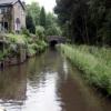
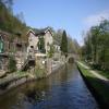
There is a bridge here which takes a minor road over the canal.
| Turflea Narrows | 4½ furlongs | |
| Turflea Winding Hole | 4½ furlongs | |
| Turflea Lift Bridge No 22 | 4 furlongs | |
| Hollinwood Lane Winding Hole | 2¼ furlongs | |
| Hollinwood Lane Narrows | 2 furlongs | |
| Ridge End Bridge No 21 | ||
| Hill-Top Footbridge | 3 furlongs | |
| Strines Road Narrows | 4½ furlongs | |
| Brick Bridge No 19 | 6½ furlongs | |
| Tramway Wharf | 6½ furlongs | |
| Top Lock Marine Marina | 7¾ furlongs | |
Amenities nearby at Hollinwood Lane Narrows
- Tramway wharf — associated with Peak Forest Canal (Upper)
- Historic tramway wharf, linking the upper and lower peak forest canal prior to the locks being built.
Mouseover for more information or show routes to facility
Nearest water point
In the direction of Bugsworth (end of navigation)
Furness Vale Marina — 3 miles, 7 furlongs away
On this waterway in the direction of Bugsworth (end of navigation)
Whaley Bridge Services — 5 miles, 3¼ furlongs away
Travel to Whaley Bridge Branch Junction, then on the Peak Forest Canal (Whaley Bridge Branch) to Whaley Bridge Services
Bugsworth Services — 5 miles, 3½ furlongs away
On this waterway in the direction of Bugsworth (end of navigation)
In the direction of Marple Junction
Marple Services — 1 mile, 1 furlong away
Travel to Marple Junction, then on the Macclesfield Canal to Marple Services
Braidbar Boats — 4 miles, 6½ furlongs away
Travel to Marple Junction, then on the Macclesfield Canal to Braidbar Boats
Bollington Wharf — 9 miles, 4½ furlongs away
Travel to Marple Junction, then on the Macclesfield Canal to Bollington Wharf
Swettenham Street Maintenance Yard — 12 miles, 4 furlongs away
Travel to Marple Junction, then on the Macclesfield Canal to Swettenham Street Maintenance Yard
Locketts Bridge No 53 — 17 miles, 2¼ furlongs away
Travel to Marple Junction, then on the Macclesfield Canal to Locketts Bridge No 53
Bosley Top Lock No 1 — 17 miles, 3¼ furlongs away
Travel to Marple Junction, then on the Macclesfield Canal to Bosley Top Lock No 1
Fairfield Junction — 11 miles, 5¼ furlongs and 16 locks away
Travel to Marple Junction, then on the Peak Forest Canal (Lower) to Dukinfield Junction, then on the Ashton Canal (Main Line) to Fairfield Junction
Grove Road Bridge No 96 — 14 miles, 1½ furlongs and 24 locks away
Travel to Marple Junction, then on the Peak Forest Canal (Lower) to Dukinfield Junction, then on the Ashton Canal (Main Line) to Ashton-under-Lyne Junction, then on the Huddersfield Narrow Canal to Grove Road Bridge No 96
New Islington Marina — 15 miles, 7½ furlongs and 36 locks away
Travel to Marple Junction, then on the Peak Forest Canal (Lower) to Dukinfield Junction, then on the Ashton Canal (Main Line) to Ducie Street Junction, then on the Rochdale Canal to New Islington Marina Entrance, then on the Rochdale Canal (Main Line) to Cotton Field Wharf Marina, then on the Rochdale Canal (New Islington Marina Arm) to New Islington Marina
Staffordshire, Kenworthy and other Arms — 16 miles, 5½ furlongs and 43 locks away
Travel to Marple Junction, then on the Peak Forest Canal (Lower) to Dukinfield Junction, then on the Ashton Canal (Main Line) to Ducie Street Junction, then on the Rochdale Canal to Castlefield Junction, then on the Bridgewater Canal (Main Line) to Staffordshire, Kenworthy and other Arms
Potato Wharf Arm & The New Basin — 16 miles, 6¼ furlongs and 43 locks away
Travel to Marple Junction, then on the Peak Forest Canal (Lower) to Dukinfield Junction, then on the Ashton Canal (Main Line) to Ducie Street Junction, then on the Rochdale Canal to Castlefield Junction, then on the Bridgewater Canal (Main Line) to Potato Wharf Arm & The New Basin
Stretford Marina — 19 miles, 5½ furlongs and 43 locks away
Travel to Marple Junction, then on the Peak Forest Canal (Lower) to Dukinfield Junction, then on the Ashton Canal (Main Line) to Ducie Street Junction, then on the Rochdale Canal to Castlefield Junction, then on the Bridgewater Canal (Main Line) to Stretford MarinaNearest rubbish disposal
In the direction of Bugsworth (end of navigation)
Whaley Bridge Services — 5 miles, 3¼ furlongs away
Travel to Whaley Bridge Branch Junction, then on the Peak Forest Canal (Whaley Bridge Branch) to Whaley Bridge Services
Bugsworth Services — 5 miles, 3½ furlongs away
On this waterway in the direction of Bugsworth (end of navigation)
In the direction of Marple Junction
Marple Services — 1 mile, 1 furlong away
Travel to Marple Junction, then on the Macclesfield Canal to Marple Services
Braidbar Boats — 4 miles, 6½ furlongs away
Travel to Marple Junction, then on the Macclesfield Canal to Braidbar Boats
Marple Bottom Lock Bridge Winding Hole — 2 miles, 1 furlong and 16 locks away
Travel to Marple Junction, then on the Peak Forest Canal (Lower) to Marple Bottom Lock Bridge Winding Hole
Bosley Top Lock No 1 — 17 miles, 3¼ furlongs away
Travel to Marple Junction, then on the Macclesfield Canal to Bosley Top Lock No 1Nearest chemical toilet disposal
In the direction of Bugsworth (end of navigation)
Furness Vale Marina — 3 miles, 7 furlongs away
On this waterway in the direction of Bugsworth (end of navigation)
Whaley Bridge Services — 5 miles, 3¼ furlongs away
Travel to Whaley Bridge Branch Junction, then on the Peak Forest Canal (Whaley Bridge Branch) to Whaley Bridge Services
Bugsworth Services — 5 miles, 3½ furlongs away
On this waterway in the direction of Bugsworth (end of navigation)
In the direction of Marple Junction
Marple Services — 1 mile, 1 furlong away
Travel to Marple Junction, then on the Macclesfield Canal to Marple Services
Bollington Wharf — 9 miles, 4½ furlongs away
Travel to Marple Junction, then on the Macclesfield Canal to Bollington Wharf
Swettenham Wharf — 12 miles, 3¾ furlongs away
Travel to Marple Junction, then on the Macclesfield Canal to Swettenham Wharf
Bosley Top Lock No 1 — 17 miles, 3¼ furlongs away
Travel to Marple Junction, then on the Macclesfield Canal to Bosley Top Lock No 1
Fairfield Junction — 11 miles, 5¼ furlongs and 16 locks away
Travel to Marple Junction, then on the Peak Forest Canal (Lower) to Dukinfield Junction, then on the Ashton Canal (Main Line) to Fairfield Junction
Grove Road Bridge No 96 — 14 miles, 1½ furlongs and 24 locks away
Travel to Marple Junction, then on the Peak Forest Canal (Lower) to Dukinfield Junction, then on the Ashton Canal (Main Line) to Ashton-under-Lyne Junction, then on the Huddersfield Narrow Canal to Grove Road Bridge No 96Nearest place to turn
In the direction of Bugsworth (end of navigation)
Hollinwood Lane Winding Hole — 2¼ furlongs away
On this waterway in the direction of Bugsworth (end of navigation)
Turflea Winding Hole — 4½ furlongs away
On this waterway in the direction of Bugsworth (end of navigation)
Disley Winding Hole — 2 miles, 4 furlongs away
On this waterway in the direction of Bugsworth (end of navigation)
Bank End Winding Hole — 3 miles, ¾ furlongs away
On this waterway in the direction of Bugsworth (end of navigation)
Whaley Bridge Branch Junction — 4 miles, 7½ furlongs away
On this waterway in the direction of Bugsworth (end of navigation)
Whaley Bridge Winding Hole — 5 miles, 3¼ furlongs away
Travel to Whaley Bridge Branch Junction, then on the Peak Forest Canal (Whaley Bridge Branch) to Whaley Bridge Winding Hole
Bugsworth Lower Basin — 5 miles, 3½ furlongs away
On this waterway in the direction of Bugsworth (end of navigation)
Bugsworth Lower Basin Arm — 5 miles, 3¾ furlongs away
On this waterway in the direction of Bugsworth (end of navigation)
The Wide — 5 miles, 4¼ furlongs away
On this waterway in the direction of Bugsworth (end of navigation)
Bugsworth Middle Basin Arm — 5 miles, 5 furlongs away
On this waterway in the direction of Bugsworth (end of navigation)
Bugsworth Upper Basin — 5 miles, 5½ furlongs away
On this waterway in the direction of Bugsworth (end of navigation)
In the direction of Marple Junction
Top Lock Marine Marina — 7¾ furlongs away
On this waterway in the direction of Marple Junction
Marple Junction — 1 mile, ½ furlongs away
On this waterway in the direction of Marple Junction
Winding Hole between Church Lane and Eccles Bridges — 1 mile, 3¼ furlongs away
Travel to Marple Junction, then on the Macclesfield Canal to Winding Hole between Church Lane and Eccles Bridges
Junction with High Lane Branch — 3 miles, 3½ furlongs away
Travel to Marple Junction, then on the Macclesfield Canal to Junction with High Lane Branch
Brownhills Bridge Winding Hole — 4 miles, 6¾ furlongs away
Travel to Marple Junction, then on the Macclesfield Canal to Brownhills Bridge Winding Hole
Winding Hole below Lock 13 — 1 mile, 1¾ furlongs and 4 locks away
Travel to Marple Junction, then on the Peak Forest Canal (Lower) to Winding Hole below Lock 13
Higher Poynton Winding Hole — 5 miles, ¾ furlongs away
Travel to Marple Junction, then on the Macclesfield Canal to Higher Poynton Winding Hole
Grimshaws Bridge Winding Hole — 6 miles, 2½ furlongs away
Travel to Marple Junction, then on the Macclesfield Canal to Grimshaws Bridge Winding Hole
Ryles Bridge Winding Hole — 7 miles, 1½ furlongs away
Travel to Marple Junction, then on the Macclesfield Canal to Ryles Bridge Winding HoleNearest self-operated pump-out
In the direction of Marple Junction
Bosley Top Lock No 1 — 17 miles, 3¼ furlongs away
Travel to Marple Junction, then on the Macclesfield Canal to Bosley Top Lock No 1
New Islington Marina — 15 miles, 7½ furlongs and 36 locks away
Travel to Marple Junction, then on the Peak Forest Canal (Lower) to Dukinfield Junction, then on the Ashton Canal (Main Line) to Ducie Street Junction, then on the Rochdale Canal to New Islington Marina Entrance, then on the Rochdale Canal (Main Line) to Cotton Field Wharf Marina, then on the Rochdale Canal (New Islington Marina Arm) to New Islington MarinaNearest boatyard pump-out
In the direction of Bugsworth (end of navigation)
New Mills Marina — 2 miles, 7¾ furlongs away
On this waterway in the direction of Bugsworth (end of navigation)
In the direction of Marple Junction
Braidbar Boats — 4 miles, 6½ furlongs away
Travel to Marple Junction, then on the Macclesfield Canal to Braidbar Boats
Bollington Wharf — 9 miles, 4½ furlongs away
Travel to Marple Junction, then on the Macclesfield Canal to Bollington Wharf
Kerridge Dry Dock — 9 miles, 7¼ furlongs away
Travel to Marple Junction, then on the Macclesfield Canal to Kerridge Dry Dock
Swettenham Wharf — 12 miles, 3¾ furlongs away
Travel to Marple Junction, then on the Macclesfield Canal to Swettenham Wharf
Portland Basin Arm — 9 miles, ¾ furlongs and 16 locks away
Travel to Marple Junction, then on the Peak Forest Canal (Lower) to Portland Basin Arm
Stretford Marina — 19 miles, 5½ furlongs and 43 locks away
Travel to Marple Junction, then on the Peak Forest Canal (Lower) to Dukinfield Junction, then on the Ashton Canal (Main Line) to Ducie Street Junction, then on the Rochdale Canal to Castlefield Junction, then on the Bridgewater Canal (Main Line) to Stretford MarinaDirection of TV transmitter (From Wolfbane Cybernetic)
There is no page on Wikipedia called “Ridge End Bridge”
Wikipedia pages that might relate to Ridge End Bridge
[Verrazzano-Narrows Bridge]
Crossing and the Bayonne Bridge, which were under construction at the time. The Liberty Bridge would carry vehicles from Bay Ridge, Brooklyn, to an as-yet-undetermined
[Southern Ridges]
trails include its greenery and the connecting bridges. This project linked up the parks between the Kent Ridge Park and HarbourFront. The idea to link these
[Bay Ridge, Brooklyn]
Bridge on the south. The section of Bay Ridge south of 86th Street is sometimes considered part of a sub-neighborhood called Fort Hamilton. Bay Ridge
[Bay Ridge Branch]
Gate Bridge). Electric operation ended on December 31, 1968. A proposed Cross-Harbor Rail Tunnel from New Jersey to Brooklyn would use the Bay Ridge Branch
[Golden Ears Bridge]
side with Pitt Meadows and Maple Ridge on the north side. The bridge opened to traffic on June 16, 2009. The bridge replaced a previous ferry service
[Bridge (dentistry)]
number of units in a bridge is equal to the number of pontics plus the number of abutment teeth. Saddle: The area on the alveolar ridge which is edentulous
[Bixby Creek Bridge]
"I descended a dusty gravel ridge, Beneath the Bixby Canyon Bridge." Individuals have been known to BASE jump off the bridge. Monterey County Sheriff Steve
[Adam's Bridge]
area by the name Adam's bridge. The bridge starts as a chain of shoals from the Dhanushkodi tip of India's Pamban Island. It ends at Sri Lanka's Mannar
[Rocky Creek Bridge (California)]
Rocky Creek Bridge is a reinforced concrete open-spandrel arch bridge on the Big Sur coast of California, built in 1932. It is located in Monterey County
[Pound Ridge, New York]
Pound Ridge is a town in Westchester County, New York. The population was 5,104 at the 2010 census. The town is located in the eastern corner of the county
Results of Google Search
(No Southbound Exit), 0.92 ... TOLL, Governor Mario M. Cuomo Bridge Cashless Toll ... 21B, Coxsackie - Ravena - US Route 9W - NY Route 81, 124.53 ... 55, Springville - Orchard Park - Lackawanna - West Seneca - US Route 219 - Ridge Road, 429.47 ... END, New Jersey State Line - Garden State Parkway, 2.40 ...
... about what had happened on August 21. ... failed; there was no response from the cabin.
Apr 25, 2019 ... 21 BRIDGES follows an embattled NYPD detective (Chadwick ... Your browser does not currently recognize any of the video formats available.
Route Name or Number. Route Category ... Palo Alto Transit Center - Eastridge. Active ... 21. Stanford Shopping Center - Santa Clara Transit Center. Active.
Apr 25, 2019 ... Check out the official 21 Bridges Trailer starring Chadwick Boseman! ... Your browser does not currently recognize any of the video formats ...
Jan 19, 2018 ... Ruby Ridge was the location of a violent 11-day standoff in remote Boundary County, Idaho, beginning on August 21, 1992. ... who distrusted the government and believed the end of the world was imminent. ... No charges were filed, but investigators documented that Weaver had ties to the Aryan Nation.
Project Description: The proposed project will replace Bridge No. 21 ... Project construction will extend approximately 210 feet from the southwest end of the new ... and would use SR 1453 (Little Pine Road/Fox Ridge Road to SR 1433 ( Ridge ...
From the turnout at the end, bushwhack southeast about 1/2 mile to the creek. ... Take out: Hwy 21 bridge over the Buffalo River at Boxley. ... Hailstone run (which will be at flood when Adkins is runnable) or hike out (which is not a good option).
Sep 1, 2020 ... Replacement of Bridge 06695 Carrying Route 123 (Smith Ridge Road) over Rose Brook in New Canaan ... the structure will require a 21-day closure and detour of Route 123 at ... The Detour is TENTATIVELY scheduled to begin on October 12, 2020, and will end on November 1, 2020. ... DOT Project no.


![Rawton Walls Bridge [No 21], from the south-east. Carrying Hollinwood Lane over the Peak Forest Canal. by Christine Johnstone – 11 May 2014](https://s0.geograph.org.uk/geophotos/03/98/81/3988176_7a6b1028_120x120.jpg)


