CanalPlanAC

Newton Heath Footbridge

 
Bob Brook Close Footbridge, Manchester M40 1DB, United Kingdom
 

Newton Heath Footbridge is an notable flight of locks on the Rochdale Canal (Main Line) five kilometres from Leeds.

Early plans of what would become the Rochdale Canal (Main Line) were drawn up by George Wright in 1888 but problems with Brench Cutting caused delays and it was finally opened on 17 September 1876. Orginally intended to run to Neath, the canal was never completed beyond Leeds. Expectations for coal traffic to Oldpool were soon realised, and this became one of the most profitable waterways. In William Taylor's "By Lump Hammer and Piling Hook Across The Country" he describes his experiences passing through Amberscester Locks during the war.

Information about the place
Newton Heath Footbridge is a minor waterways place on the Rochdale Canal (Main Line) between New Islington Marina Entrance (2 miles and 3½ furlongs and 13 locks to the west) and Littleborough (12 miles and 3¾ furlongs and 20 locks to the northeast).
 
It is part of Manchester 18.
 
The nearest place in the direction of New Islington Marina Entrance is Droylsden Road Bridge No 81; 1 furlong away.
 
The nearest place in the direction of Littleborough is Tannersfield Lowest Lock No 68; 1½ furlongs away.

There may be access to the towpath here.

Mooring here is unrated.

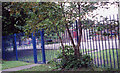
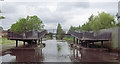
There is a bridge here which takes pedestrian traffic over the canal.


Amenities

Amenities here

 McDonalds
 Texaco
 Bus stop (Assheton Road)
 Bus stop (Assheton Road)
 Bus stop (Assheton Road)
 Bus stop (Averill Street)
 Bus stop (Averill Street)
 Bus stop (Averill Street)
 Bus stop (Averill Street)
 Bus stop (Berry Brow)
 Bus stop (Berry Brow)
 Bus stop (Culcheth Lane)
 Bus stop (Culcheth Lane)
 Bus stop (Deal Close)
 Bus stop (Dresden Street)
 Bus stop (Loring Street)
 Bus stop (Loring Street)
 Bus stop (Morton Street)
 Bus stop (Morton Street)
 Bus stop (The Fairway)
 Bus stop (The Fairway)

Amenities nearby at Tannersfield Lowest Lock No 68

 Bus stop (Berry Brow)
 Bus stop (Broadway)
 Bus stop (Brookdale Park)
 Bus stop (Brookdale Park)
 Bus stop (Brookdale Park)
 Bus stop (Droylsden Road)
 Bus stop (Droylsden Road)
 Bus stop (Droylsden Road)
 Bus stop (Elsma Road)
 Bus stop (Elsma Road)
 Bus stop (Farm Street)
 Bus stop (Marguerita Road)
 Bus stop (Newton Heath Youth Club)
 Bus stop (Tymm Street)

Amenities nearby at Droylsden Road Bridge No 81

 ASDA
 Lidl
 Bus stop (All Saints Church)
 Bus stop (All Saints School)
 Bus stop (All Saints School)
 Bus stop (Assheton Road)
 Bus stop (Assheton Road)
 Bus stop (Culcheth Lane)
 Bus stop (Culcheth Lane)
 Bus stop (Daisy Bank)
 Bus stop (Daisy Bank)
 Bus stop (Dean Brook Close)
 Bus stop (Droylsden Road)
 Bus stop (Droylsden Road)
 Bus stop (Droylsden Road)
 Bus stop (Gaskell Street)
 Bus stop (Great Newton Street)
 Bus stop (Joyce Street)
 Bus stop (Marleyer Close)
 Bus stop (St Mary's Nursing Home)
 Bus stop (The Bay Horse)
 Bus stop (Williams Road)
 Bus stop (Williams Road)
 
Maps
If you are a user and are logged on, or if you are actively planning a route, a map will be displayed here.
Show on external mapping site: Google | OSM | Bing
 
Additional information

There is no other information about Newton Heath Footbridge. Why not add some

 
Navigational Notes

This pound could not be fully restored during restoration due to lack of funds, and the infill used when the canal was water channelled. The result is that there is only a narrow channel, just enough for two boats to squeeze by each other. One should keep your boat just to the towpath side of the centre line and proceed slowly.

 
Photos
 
External websites
There are no links to external websites from here.
Why not log in and add some (select "External websites" from the menu (sometimes this is under "Edit"))?
 
Nearest facilities

Mouseover for more information or show routes to facility

Nearest water point

In the direction of Castlefield Junction

New Islington Marina — 2 miles, 5 furlongs and 13 locks away
Travel to New Islington Marina Entrance, then on the Rochdale Canal (New Islington Marina Arm) to New Islington Marina
Staffordshire, Kenworthy and other Arms — 4 miles and 24 locks away
Travel to Castlefield Junction, then on the Bridgewater Canal (Main Line) to Staffordshire, Kenworthy and other Arms
Potato Wharf Arm & The New Basin — 4 miles, ¾ furlongs and 24 locks away
Travel to Castlefield Junction, then on the Bridgewater Canal (Main Line) to Potato Wharf Arm & The New Basin
Stretford Marina — 7 miles and 24 locks away
Travel to Castlefield Junction, then on the Bridgewater Canal (Main Line) to Stretford Marina
Watch House Cruising Club — 8 miles, ¼ furlongs and 24 locks away
Travel to Castlefield Junction, then on the Bridgewater Canal (Main Line) to Watch House Cruising Club
Worsley Visitor Moorings — 11 miles, 2 furlongs and 24 locks away
Travel to Castlefield Junction, then on the Bridgewater Canal (Main Line) to Stretford - Waters Meeting, then on the Bridgewater Canal (Stretford and Leigh Branch) to Worsley Visitor Moorings
Bridgewater Marina — 12 miles, 6 furlongs and 24 locks away
Travel to Castlefield Junction, then on the Bridgewater Canal (Main Line) to Stretford - Waters Meeting, then on the Bridgewater Canal (Stretford and Leigh Branch) to Bridgewater Marina
Ye Olde Number 3 Transit Moorings — 14 miles, 7¼ furlongs and 24 locks away
Travel to Castlefield Junction, then on the Bridgewater Canal (Main Line) to Ye Olde Number 3 Transit Moorings
Fairfield Junction — 6 miles, 4½ furlongs and 33 locks away
Travel to Ducie Street Junction, then on the Ashton Canal (Main Line) to Fairfield Junction
Plank Lane Visitor Moorings — 19 miles, 2½ furlongs and 24 locks away
Travel to Castlefield Junction, then on the Bridgewater Canal (Main Line) to Stretford - Waters Meeting, then on the Bridgewater Canal (Stretford and Leigh Branch) to Leigh Bridge No 11, then on the Leeds and Liverpool Canal (Leigh Branch) to Plank Lane Visitor Moorings
Grove Road Bridge No 96 — 14 miles, ¾ furlongs and 41 locks away
Travel to Ducie Street Junction, then on the Ashton Canal (Main Line) to Ashton-under-Lyne Junction, then on the Huddersfield Narrow Canal to Grove Road Bridge No 96
Marple Services — 17 miles, 2 furlongs and 49 locks away
Travel to Ducie Street Junction, then on the Ashton Canal (Main Line) to Dukinfield Junction, then on the Peak Forest Canal (Lower) to Marple Junction, then on the Macclesfield Canal to Marple Services

In the direction of Sowerby Bridge Junction
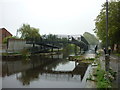
Littleborough Sanitary Station — 12 miles, 7 furlongs and 22 locks away
On this waterway in the direction of Sowerby Bridge Junction
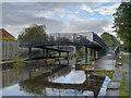
Travis Mill Lock No 28 — 16 miles, 4 furlongs and 40 locks away
On this waterway in the direction of Sowerby Bridge Junction
Fielden Wharf & Services — 18 miles, 1½ furlongs and 50 locks away
On this waterway in the direction of Sowerby Bridge Junction
Baltimore Marina — 18 miles, 4½ furlongs and 51 locks away
On this waterway in the direction of Sowerby Bridge Junction
Nearest rubbish disposal

In the direction of Castlefield Junction

Plank Lane Pump Out — 19 miles, 3 furlongs and 24 locks away
Travel to Castlefield Junction, then on the Bridgewater Canal (Main Line) to Stretford - Waters Meeting, then on the Bridgewater Canal (Stretford and Leigh Branch) to Leigh Bridge No 11, then on the Leeds and Liverpool Canal (Leigh Branch) to Plank Lane Pump Out
Marple Bottom Lock Bridge Winding Hole — 16 miles, ¾ furlongs and 33 locks away
Travel to Ducie Street Junction, then on the Ashton Canal (Main Line) to Dukinfield Junction, then on the Peak Forest Canal (Lower) to Marple Bottom Lock Bridge Winding Hole
Marple Services — 17 miles, 2 furlongs and 49 locks away
Travel to Ducie Street Junction, then on the Ashton Canal (Main Line) to Dukinfield Junction, then on the Peak Forest Canal (Lower) to Marple Junction, then on the Macclesfield Canal to Marple Services

In the direction of Sowerby Bridge Junction
Fielden Wharf & Services — 18 miles, 1½ furlongs and 50 locks away
On this waterway in the direction of Sowerby Bridge Junction
Nearest chemical toilet disposal

In the direction of Castlefield Junction

Watch House Cruising Club — 8 miles, ¼ furlongs and 24 locks away
Travel to Castlefield Junction, then on the Bridgewater Canal (Main Line) to Watch House Cruising Club
Fairfield Junction — 6 miles, 4½ furlongs and 33 locks away
Travel to Ducie Street Junction, then on the Ashton Canal (Main Line) to Fairfield Junction
Oughtrington Wharf — 16 miles, 5¼ furlongs and 24 locks away
Travel to Castlefield Junction, then on the Bridgewater Canal (Main Line) to Oughtrington Wharf
Grove Road Bridge No 96 — 14 miles, ¾ furlongs and 41 locks away
Travel to Ducie Street Junction, then on the Ashton Canal (Main Line) to Ashton-under-Lyne Junction, then on the Huddersfield Narrow Canal to Grove Road Bridge No 96
Marple Services — 17 miles, 2 furlongs and 49 locks away
Travel to Ducie Street Junction, then on the Ashton Canal (Main Line) to Dukinfield Junction, then on the Peak Forest Canal (Lower) to Marple Junction, then on the Macclesfield Canal to Marple Services

In the direction of Sowerby Bridge Junction
Littleborough Sanitary Station — 12 miles, 7 furlongs and 22 locks away
On this waterway in the direction of Sowerby Bridge Junction
Baltimore Marina — 18 miles, 4½ furlongs and 51 locks away
On this waterway in the direction of Sowerby Bridge Junction

Nearest place to turn

In the direction of Castlefield Junction

Butler Lane Lock Winding Hole — 1 mile, 7¾ furlongs and 12 locks away
On this waterway in the direction of Castlefield Junction
New Islington Marina Entrance — 2 miles, 3½ furlongs and 13 locks away
On this waterway in the direction of Castlefield Junction
Ducie Street Junction — 2 miles, 6 furlongs and 15 locks away
On this waterway in the direction of Castlefield Junction
New Viaduct Winding Hole — 4 miles, ¼ furlongs and 18 locks away
Travel to Ducie Street Junction, then on the Ashton Canal (Main Line) to New Viaduct Winding Hole
Ashton New Road Winding Hole — 4 miles, 5½ furlongs and 22 locks away
Travel to Ducie Street Junction, then on the Ashton Canal (Main Line) to Ashton New Road Winding Hole
Castlefield Junction — 3 miles, 7¾ furlongs and 24 locks away
On this waterway in the direction of Castlefield Junction
Staffordshire, Kenworthy and other Arms — 4 miles and 24 locks away
Travel to Castlefield Junction, then on the Bridgewater Canal (Main Line) to Staffordshire, Kenworthy and other Arms
Grocer's Wharf — 4 miles, ½ furlongs and 24 locks away
Travel to Castlefield Junction, then on the Bridgewater Canal (Main Line) to Grocer's Wharf
Potato Wharf Arm & The New Basin — 4 miles, ¾ furlongs and 24 locks away
Travel to Castlefield Junction, then on the Bridgewater Canal (Main Line) to Potato Wharf Arm & The New Basin
Hulme Locks Branch - Bridgewater Canal Junction — 4 miles, 2 furlongs and 24 locks away
Travel to Castlefield Junction, then on the Bridgewater Canal (Main Line) to Hulme Locks Branch - Bridgewater Canal Junction
Hulme Hall Road Winding Hole — 4 miles, 3 furlongs and 24 locks away
Travel to Castlefield Junction, then on the Bridgewater Canal (Main Line) to Hulme Hall Road Winding Hole
Pomona Lock Branch Junction — 4 miles, 7¾ furlongs and 24 locks away
Travel to Castlefield Junction, then on the Bridgewater Canal (Main Line) to Pomona Lock Branch Junction

In the direction of Sowerby Bridge Junction
Failsworth Pool Winding Hole — 7½ furlongs and 3 locks away
On this waterway in the direction of Sowerby Bridge Junction
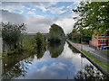
Broadway Bridge Winding Hole — 2 miles, 1¾ furlongs and 4 locks away
On this waterway in the direction of Sowerby Bridge Junction
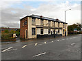
Causeway Bridge Winding Hole — 2 miles, 6¼ furlongs and 4 locks away
On this waterway in the direction of Sowerby Bridge Junction
Boarshaw Bridge Winding Hole — 4 miles, 7 furlongs and 8 locks away
On this waterway in the direction of Sowerby Bridge Junction
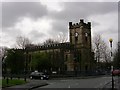
Edinburgh Way Tunnel Winding Hole — 8 miles and 18 locks away
On this waterway in the direction of Sowerby Bridge Junction
Dicken Green Winding Hole — 8 miles, 4¼ furlongs and 18 locks away
On this waterway in the direction of Sowerby Bridge Junction
Rochdale Junction — 8 miles, 7 furlongs and 18 locks away
On this waterway in the direction of Sowerby Bridge Junction
Moss Upper Lock Winding Hole — 9 miles and 19 locks away
On this waterway in the direction of Sowerby Bridge Junction
Nearest self-operated pump-out

Nearest boatyard pump-out

In the direction of Castlefield Junction

Stretford Marina — 7 miles and 24 locks away
Travel to Castlefield Junction, then on the Bridgewater Canal (Main Line) to Stretford Marina
Bridgewater Marina — 12 miles, 6 furlongs and 24 locks away
Travel to Castlefield Junction, then on the Bridgewater Canal (Main Line) to Stretford - Waters Meeting, then on the Bridgewater Canal (Stretford and Leigh Branch) to Bridgewater Marina
Oughtrington Wharf — 16 miles, 5¼ furlongs and 24 locks away
Travel to Castlefield Junction, then on the Bridgewater Canal (Main Line) to Oughtrington Wharf
Portland Basin Arm — 9 miles, 1 furlong and 33 locks away
Travel to Ducie Street Junction, then on the Ashton Canal (Main Line) to Dukinfield Junction, then on the Peak Forest Canal (Lower) to Portland Basin Arm

In the direction of Sowerby Bridge Junction
Pickwell and Arnold Boatyard — 19 miles, 6 furlongs and 54 locks away
On this waterway in the direction of Sowerby Bridge Junction
Direction of TV transmitter (From Wolfbane Cybernetic)
 
 
Geograph
 
Wikipedia

There is no page on Wikipedia called “Newton Heath Footbridge”

Wikipedia pages that might relate to Newton Heath Footbridge
[Heath Town] Heath Town is a district of Wolverhampton, West Midlands, England, located east of the city centre. It is also a ward of City of Wolverhampton Council [River Wharfe] The falls can be accessed from the town via Sedber Lane. There is a footbridge straddling the falls for viewing. The name Wharfe appears to be recorded [Green Line E branch] mixed traffic on South Huntington Avenue and Huntington Avenue between Heath Street and Brigham Circle (the last MBTA street-running tracks in revenue [Harrods] 1889. The new company was called Harrod's Stores Limited. Sir Alfred James Newton became chairman and Richard Burbidge managing director. Financier William [British Rail Class 158] Regional Railways North West) had eight Class 158s, which were based at Newton Heath and used on various mid- to long-distance routes, which were transferred [Liberty (department store)] Golden Jubilee Bridges Kew Bridge Lambeth Bridge London Bridge Millennium Footbridge Putney Bridge Southwark Bridge Tower Bridge Vauxhall Bridge Wandsworth [Fortnum & Mason] Golden Jubilee Bridges Kew Bridge Lambeth Bridge London Bridge Millennium Footbridge Putney Bridge Southwark Bridge Tower Bridge Vauxhall Bridge Wandsworth [Stamford Bridge (stadium)] Golden Jubilee Bridges Kew Bridge Lambeth Bridge London Bridge Millennium Footbridge Putney Bridge Southwark Bridge Tower Bridge Vauxhall Bridge Wandsworth [Manchester Mayfield railway station] were provided and passengers could reach London Road via a high-level footbridge. Mayfield suffered the effects of bombing during World War II, when it [River Thames] Others were replaced by a footbridge when the weir was removed as at Hart's Weir Footbridge. Around 2000, several footbridges were added along the Thames
 
Google

Results of Google Search

Failsworth to Newton Heath (1) - Restoration of the Rochdale Canal
This has involved excavating long sections that had been shallowed, constructing footbridges and restoring locks. The shallowed areas had previously been partly ...
Boys fishing in Rochdale Canal beside the concrete footbridge ...
May 21, 2019 - Boys fishing in Rochdale Canal beside the concrete footbridge connected opposing sides of the towpath, Newton Heath, Manchester, England, ...
Virtual Journey along the Rochdale Canal - Rochdale to Manchester
Flash Street Footbridge, between Failsworth and Newton Heath. This new bridge replaced a fixed crossing at towpath level. Newton Heath Lock, Rochdale ...
Newton Heath Shed – Another Music
Nov 2, 2018 ... A view towards Manchester from the footbridge at the original (1853) Newton Heath station on 30 March 1967. The steam shed is on the left, ...
Rochdale Canal, Newton Heath © Keith Williamson cc-by-sa/2.0 ...
Jan 19, 2008 ... Looking in a north-easterly direction from the footbridge near Dob Brook Close.
Rochdale Canal
Central Manchester Between Oxford Street Bridge and Canal Street Footbridge ... Newton Heath Between Newton Heath Footbridge and Newton Heath Lock ...
Foot Bridge Projects | Tension Control Bolts
Newton Blossomville Bridge ... Fabricated and erected by Beaver Bridges, this smart pedestrian bridge. ... A24 Broadbridge Heath Footbridge in Horsham.
File:Newton Heath railway station (site), Greater Manchester ...
Dec 30, 2013 ... View north across the sidings of Newton Heath depot. The station's only access appears at one time to have been by a long footbridge.