CanalPlanAC

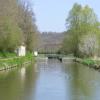
Ecluse 49 Garenne

 
295 Sur la Garenne, 58500 Surgy, France
 
Information about the place
Ecluse 49 Garenne is a minor waterways place on the Canal du Nivernais (Main Line) between Clamecy (3.10 kilometres and 3 locks to the south) and Nivernais - Vermenton Jonction (Junction of the Canal du Nivernais with the Vermenton Branch) (36.38 kilometres and 22 locks to the northeast).
 
 
The nearest place in the direction of Clamecy is Kilometre Post - La Loire 117Km; 0.18 kilometres away.
 
The nearest place in the direction of Nivernais - Vermenton Jonction is Pont de Ecluse Garenne (This is a changeline bridge ); 0.61 kilometres away.

Mooring here is unrated.

This is a lock with a rise of 1.21 metres.


Amenities
 
Maps
If you are a user and are logged on, or if you are actively planning a route, a map will be displayed here.
Show on external mapping site: Google | OSM | Bing
 
Photos
 
External websites
 VisuRiS — associated with Waterways of Mainland Europe
The official inland waterway resource for Belgium with actual traffic and planned operations on the waterways. Also has voyage planning and notices to mariners
 
Nearest facilities

Mouseover for more information or show routes to facility

Nearest water point

In the direction of Auxerre

Basin de Chatel Censoir15.19 km and 8 locks away
On this waterway in the direction of Auxerre
Mailly-la-Ville Halte Nautique28.12 km and 16 locks away
On this waterway in the direction of Auxerre

In the direction of Canal du Nivernais - Loire Junction

Tannay-Port Basin21.14 km and 15 locks away
On this waterway in the direction of Canal du Nivernais - Loire Junction

Nearest rubbish disposal

In the direction of Auxerre

Mailly-la-Ville Halte Nautique28.12 km and 16 locks away
On this waterway in the direction of Auxerre

In the direction of Canal du Nivernais - Loire Junction

Tannay-Port Basin21.14 km and 15 locks away
On this waterway in the direction of Canal du Nivernais - Loire Junction

No information

CanalPlan has no information on any of the following facilities within range:
chemical toilet disposal
place to turn
self-operated pump-out
boatyard pump-out
 
 
Geograph
 
Wikipedia

There is no page on Wikipedia called “Ecluse 49 Garenne”

Wikipedia pages that might relate to Ecluse 49 Garenne
[List of crossings of the Seine] Courcelles-sur-Seine (D 316), Courcelles-sur-Seine – Aubevoye Passerelle du barrage-écluse de Port-Mort, Port-Mort – Gaillon Vieux pont de Vernon (Old Bridge of Vernon [List of paintings by Camille Pissarro] 488 The Rabbit Warren, Côte Saint-Denis at Pontoise, Effect of Snow (La Garenne, Côte Saint-Denis à Pontoise, effet de neige) 1879 59.2 x 72.3 Art Institute [Cagny, Somme] outskirts of Amiens, about 3 miles (5 km) from the centre The site of Cagny-La-Garenne 2 has evidence of humans Homo heidelbergensis from an inter-Ice-age environment
 
Google

Results of Google Search

File:ECLUSE ND de LA GARENNE 0804 10.jpg - Wikimedia ...
Mar 30, 2017 ... Français : Installations de l'écluse dite Notre-Dame de la Garenne, ... Camera location, 49° 11′ 04.2″ N, 1° 08′ 28.32″ E Kartographer ...
Écluse Notre-Dame-de-la-Garenne — Wikipédia
L'écluse Notre-Dame-de-la-Garenne ou barrage de Port-Mort est un système combinant ... Localisation. Saint-Pierre-la-Garenne, Eure · Flag of France.svg France. Coordonnées. 49° 10′ 02″ N, 1° 23′ 14″ E. Cours d'eau. Seine ...
Liste des écluses de la Seine — Wikipédia
Cette liste recense les écluses de la Seine, de l'aval vers l'amont, entre son embouchure dans ... Écluse Notre-Dame-de-la-Garenne, 49° 10′ 02″ nord, 1° 23′ 14″ est, 161,265, 40,495, ECLUSE ND de LA GARENNE 0804 04.jpg.
Fitxategi:ECLUSE ND de LA GARENNE 0804 30.jpg - Wikipedia ...
Français : Installations de l'écluse dite Notre-Dame de la Garenne, hameau de la ... Kameraren kokapena, 49° 09′ 54,36″ N, 1° 23′ 13,92″ E · Kartographer ...
Ecluse Notre Dame de la Garenne - GAILLON (27) - Baudin ...
Ecluse Notre Dame de la Garenne – GAILLON (27). Equipements portuaires/ fluviaux. Ecluse Notre Dame de la Garenne – GAILLON (27). Groupe · Qui sommes ...
Fichier:ECLUSE ND de LA GARENNE 0804 30.jpg — Wikipédia
Français : Installations de l'écluse dite Notre-Dame de la Garenne, hameau de la ... de vue, 49° 09′ 54,36″ N, 1° 23′ 13,92″ E · Kartographer map based on ...
Ligne bus B - Cannes-Écluse - Varennes-sur-Seine - Transdev Île ...
Cannes-Écluse - La Grande Plaine. Varennes-sur-Seine - Maison Rouge ... Cannes-Écluse - La Grande Plaine ... Varennes-sur-Seine - Grande Garenne.
Súbor:ECLUSE ND de LA GARENNE 0804 30.jpg – Wikipédia
Pozícia kamery, 49° 09′ 54,36″ S, 1° 23′ 13,92″ V · Kartographer map based on ... Použitie ECLUSE ND de LA GARENNE 0804 30.jpg na ca.wikipedia. org.
Carte de France des écluses fluviales
Les écluses par Googlemaps et Vnf avec vision satellite, laissez vous guider sur le réseau fluvial français.