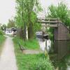
Lock Lane Footbridge
Erewash Moorings, Lock Lane, Sawley NG10 2FY, United Kingdom
Address is taken from a point 292 yards away.

Lock Lane Footbridge
is a minor waterways place
on the Grand Union Canal (Erewash Canal) between
Sheet Stores Basin (3 furlongs
to the northwest) and
Trent Junction (Junction of River Trent, Grand Union Leicester Section and Erewash Canals) (3 furlongs
and 1 lock
to the southeast).
The nearest place in the direction of Sheet Stores Basin is Flood Lock by Railway Bridge;
2¼ furlongs
away.
The nearest place in the direction of Trent Junction is Former BW Trent Lock Waterway Office;
2 furlongs
away.
There may be access to the towpath here.
Mooring here is unrated.
There is a bridge here which takes pedestrian traffic over the canal.
Fields Farm Road Bridge | 3¼ furlongs | |
Sheet Stores Basin | 3 furlongs | |
Sheet Stores Junction Railway Bridge | 2¾ furlongs | |
Sheet Stores Junction Railway Bridge - Freight Line | 2¼ furlongs | |
Flood Lock by Railway Bridge | 2¼ furlongs | |
Lock Lane Footbridge | ||
Former BW Trent Lock Waterway Office | 2 furlongs | |
Trent Lock No 60 | 2½ furlongs | |
Trent Lock Footbridge | 2½ furlongs | |
Trent Junction Footbridge | 2¾ furlongs | |
Trent Junction | 3 furlongs |
Amenities nearby at Former BW Trent Lock Waterway Office
- Grand Union Canal Walk — associated with Grand Union Canal
- An illustrated walk along the Grand Union Canal from London to Birmingham
Mouseover for more information or show routes to facility
Nearest water point
In the direction of Trent Junction
Former BW Trent Lock Waterway Office — 2 furlongs away
On this waterway in the direction of Trent Junction
Sawley Locks No 2 — 1 mile, 2 furlongs and 1 lock away
Travel to Trent Junction, then on the River Trent (Western End) to Sawley Locks No 2
Cranfleet Lock No 3 — 1 mile, ½ furlongs and 2 locks away
Travel to Trent Junction, then on the River Trent (Western End) to Cranfleet Lock No 3
Shardlow — 3 miles, 3¾ furlongs and 4 locks away
Travel to Trent Junction, then on the River Trent (Western End) to Derwent Mouth, then on the Trent and Mersey Canal (Main Line - Derwent Mouth to Burton) to Shardlow
Beeston Lock No 5 — 5 miles, 3 furlongs and 3 locks away
Travel to Trent Junction, then on the River Trent (Western End) to Beeston Lock No 5
Weston Lock No 4 — 6 miles, 3½ furlongs and 6 locks away
Travel to Trent Junction, then on the River Trent (Western End) to Derwent Mouth, then on the Trent and Mersey Canal (Main Line - Derwent Mouth to Burton) to Weston Lock No 4
Bishop Meadow Lock No 54 — 8 miles, 4¼ furlongs and 6 locks away
Travel to Trent Junction, then on the Grand Union Canal (Leicester Section - River Soar Navigation) to Bishop Meadow Lock No 54
Swarkestone Lock No 5 — 9 miles, 2¾ furlongs and 7 locks away
Travel to Trent Junction, then on the River Trent (Western End) to Derwent Mouth, then on the Trent and Mersey Canal (Main Line - Derwent Mouth to Burton) to Swarkestone Lock No 5
Loughborough Basin — 9 miles, 4¾ furlongs and 8 locks away
Travel to Trent Junction, then on the Grand Union Canal (Leicester Section - River Soar Navigation) to Loughborough Branch Junction, then on the Grand Union Canal (Leicester Section - Loughborough Branch) to Loughborough Basin
Holme Lock No 5 — 13 miles, 5½ furlongs and 6 locks away
Travel to Trent Junction, then on the River Trent (Western End) to Beeston Lock No 5, then on the River Trent (Beeston Canal) to Lenton Chain, then on the River Trent (Nottingham Canal) to Meadow Lane Junction, then on the River Trent (non-tidal section) to Holme Lock No 5
Barrow Boating — 13 miles, 4¼ furlongs and 10 locks away
Travel to Trent Junction, then on the Grand Union Canal (Leicester Section - River Soar Navigation) to Barrow Boating
Willington Services — 14 miles, 5¼ furlongs and 9 locks away
Travel to Trent Junction, then on the River Trent (Western End) to Derwent Mouth, then on the Trent and Mersey Canal (Main Line - Derwent Mouth to Burton) to Willington Services
Stoke Lock No 6 — 16 miles, 5¾ furlongs and 7 locks away
Travel to Trent Junction, then on the River Trent (Western End) to Beeston Lock No 5, then on the River Trent (Beeston Canal) to Lenton Chain, then on the River Trent (Nottingham Canal) to Meadow Lane Junction, then on the River Trent (non-tidal section) to Stoke Lock No 6
Horninglow Basin — 18 miles, 7 furlongs and 9 locks away
Travel to Trent Junction, then on the River Trent (Western End) to Derwent Mouth, then on the Trent and Mersey Canal (Main Line - Derwent Mouth to Burton) to Horninglow Basin
Hope and Anchor Bridge No 19 — 19 miles, 1¼ furlongs and 14 locks away
Travel to Trent Junction, then on the Grand Union Canal (Leicester Section - River Soar Navigation) to Hope and Anchor Bridge No 19
In the direction of Derby Road Bridge
Langley Junction — 11 miles, 2 furlongs and 14 locks away
Travel to Derby Road Bridge, then on the Cromford Canal (broad gauge, navigable) to Langley JunctionNearest rubbish disposal
In the direction of Trent Junction
Former BW Trent Lock Waterway Office — 2 furlongs away
On this waterway in the direction of Trent Junction
Sawley Locks No 2 — 1 mile, 2 furlongs and 1 lock away
Travel to Trent Junction, then on the River Trent (Western End) to Sawley Locks No 2
Cranfleet Lock No 3 — 1 mile, ½ furlongs and 2 locks away
Travel to Trent Junction, then on the River Trent (Western End) to Cranfleet Lock No 3
Beeston Lock No 5 — 5 miles, 3 furlongs and 3 locks away
Travel to Trent Junction, then on the River Trent (Western End) to Beeston Lock No 5
Swarkestone Lock No 5 — 9 miles, 2¾ furlongs and 7 locks away
Travel to Trent Junction, then on the River Trent (Western End) to Derwent Mouth, then on the Trent and Mersey Canal (Main Line - Derwent Mouth to Burton) to Swarkestone Lock No 5
Loughborough Basin — 9 miles, 4¾ furlongs and 8 locks away
Travel to Trent Junction, then on the Grand Union Canal (Leicester Section - River Soar Navigation) to Loughborough Branch Junction, then on the Grand Union Canal (Leicester Section - Loughborough Branch) to Loughborough Basin
Holme Lock No 5 — 13 miles, 5½ furlongs and 6 locks away
Travel to Trent Junction, then on the River Trent (Western End) to Beeston Lock No 5, then on the River Trent (Beeston Canal) to Lenton Chain, then on the River Trent (Nottingham Canal) to Meadow Lane Junction, then on the River Trent (non-tidal section) to Holme Lock No 5
Barrow Boating — 13 miles, 4¼ furlongs and 10 locks away
Travel to Trent Junction, then on the Grand Union Canal (Leicester Section - River Soar Navigation) to Barrow Boating
Willington Services — 14 miles, 5¼ furlongs and 9 locks away
Travel to Trent Junction, then on the River Trent (Western End) to Derwent Mouth, then on the Trent and Mersey Canal (Main Line - Derwent Mouth to Burton) to Willington Services
Stoke Lock No 6 — 16 miles, 5¾ furlongs and 7 locks away
Travel to Trent Junction, then on the River Trent (Western End) to Beeston Lock No 5, then on the River Trent (Beeston Canal) to Lenton Chain, then on the River Trent (Nottingham Canal) to Meadow Lane Junction, then on the River Trent (non-tidal section) to Stoke Lock No 6
Broome Island — 14 miles, 2½ furlongs and 10 locks away
Travel to Trent Junction, then on the Grand Union Canal (Leicester Section - River Soar Navigation) to Broome IslandNearest chemical toilet disposal
In the direction of Trent Junction
Former BW Trent Lock Waterway Office — 2 furlongs away
On this waterway in the direction of Trent Junction
Sawley Locks No 2 — 1 mile, 2 furlongs and 1 lock away
Travel to Trent Junction, then on the River Trent (Western End) to Sawley Locks No 2
Sawley Cut Wharf — 1 mile, 3¾ furlongs and 2 locks away
Travel to Trent Junction, then on the River Trent (Western End) to Sawley Cut Wharf
Beeston Lock No 5 — 5 miles, 3 furlongs and 3 locks away
Travel to Trent Junction, then on the River Trent (Western End) to Beeston Lock No 5
Meadow Lane Lock No 7 — 11 miles, 2 furlongs and 5 locks away
Travel to Trent Junction, then on the River Trent (Western End) to Beeston Lock No 5, then on the River Trent (Beeston Canal) to Lenton Chain, then on the River Trent (Nottingham Canal) to Meadow Lane Lock No 7
Holme Lock No 5 — 13 miles, 5½ furlongs and 6 locks away
Travel to Trent Junction, then on the River Trent (Western End) to Beeston Lock No 5, then on the River Trent (Beeston Canal) to Lenton Chain, then on the River Trent (Nottingham Canal) to Meadow Lane Junction, then on the River Trent (non-tidal section) to Holme Lock No 5
Barrow Boating — 13 miles, 4¼ furlongs and 10 locks away
Travel to Trent Junction, then on the Grand Union Canal (Leicester Section - River Soar Navigation) to Barrow Boating
Willington Services — 14 miles, 5¼ furlongs and 9 locks away
Travel to Trent Junction, then on the River Trent (Western End) to Derwent Mouth, then on the Trent and Mersey Canal (Main Line - Derwent Mouth to Burton) to Willington Services
Stoke Lock No 6 — 16 miles, 5¾ furlongs and 7 locks away
Travel to Trent Junction, then on the River Trent (Western End) to Beeston Lock No 5, then on the River Trent (Beeston Canal) to Lenton Chain, then on the River Trent (Nottingham Canal) to Meadow Lane Junction, then on the River Trent (non-tidal section) to Stoke Lock No 6
Sileby Mill Mooring Basin — 16 miles, ½ furlongs and 11 locks away
Travel to Trent Junction, then on the Grand Union Canal (Leicester Section - River Soar Navigation) to Sileby Mill Mooring Basin
Horninglow Basin — 18 miles, 7 furlongs and 9 locks away
Travel to Trent Junction, then on the River Trent (Western End) to Derwent Mouth, then on the Trent and Mersey Canal (Main Line - Derwent Mouth to Burton) to Horninglow Basin
In the direction of Derby Road Bridge
Langley Junction — 11 miles, 2 furlongs and 14 locks away
Travel to Derby Road Bridge, then on the Cromford Canal (broad gauge, navigable) to Langley JunctionNearest place to turn
In the direction of Trent Junction
Former BW Trent Lock Waterway Office — 2 furlongs away
On this waterway in the direction of Trent Junction
Soar Mouth — 4½ furlongs and 1 lock away
Travel to Trent Junction, then on the Grand Union Canal (Leicester Section - River Soar Navigation) to Soar Mouth
Redhill Lock Junction — 7¼ furlongs and 1 lock away
Travel to Trent Junction, then on the Grand Union Canal (Leicester Section - River Soar Navigation) to Redhill Lock Junction
Sawley Lock No 2 Weir Exit — 1 mile, 1½ furlongs and 1 lock away
Travel to Trent Junction, then on the River Trent (Western End) to Sawley Lock No 2 Weir Exit
Redhill Marine Ltd — 1 mile, 3½ furlongs and 2 locks away
Travel to Trent Junction, then on the Grand Union Canal (Leicester Section - River Soar Navigation) to Redhill Marine Ltd
Ratcliffe Lock Junction — 1 mile, 6 furlongs and 2 locks away
Travel to Trent Junction, then on the Grand Union Canal (Leicester Section - River Soar Navigation) to Ratcliffe Lock Junction
Cranfleet Lock Weir Exit — 1 mile, 1¼ furlongs and 3 locks away
Travel to Trent Junction, then on the River Trent (Western End) to Cranfleet Lock Weir Exit
Sawley Flood Lock Weir Entrance — 1 mile, 7¼ furlongs and 3 locks away
Travel to Trent Junction, then on the River Trent (Western End) to Sawley Flood Lock Weir Entrance
Ratcliffe Weir — 2 miles, ¾ furlongs and 3 locks away
Travel to Trent Junction, then on the Grand Union Canal (Leicester Section - River Soar Navigation) to Ratcliffe Weir
Derwent Mouth — 2 miles, 3 furlongs and 3 locks away
Travel to Trent Junction, then on the River Trent (Western End) to Derwent Mouth
Station Road Arm — 3 miles, 2 furlongs and 4 locks away
Travel to Trent Junction, then on the Grand Union Canal (Leicester Section - River Soar Navigation) to Station Road Arm
Shardlow — 3 miles, 3¾ furlongs and 4 locks away
Travel to Trent Junction, then on the River Trent (Western End) to Derwent Mouth, then on the Trent and Mersey Canal (Main Line - Derwent Mouth to Burton) to Shardlow
Winding Hole below Shardlow Lock — 3 miles, 5 furlongs and 4 locks away
Travel to Trent Junction, then on the River Trent (Western End) to Derwent Mouth, then on the Trent and Mersey Canal (Main Line - Derwent Mouth to Burton) to Winding Hole below Shardlow Lock
London Road Marina (northern entrance) — 4 miles, 2 furlongs and 5 locks away
Travel to Trent Junction, then on the Grand Union Canal (Leicester Section - River Soar Navigation) to London Road Marina (northern entrance)
London Road Marina (southern entrance) — 4 miles, 3¼ furlongs and 5 locks away
Travel to Trent Junction, then on the Grand Union Canal (Leicester Section - River Soar Navigation) to London Road Marina (southern entrance)
Rylands Bridge Winding Hole — 6 miles, 5¼ furlongs and 4 locks away
Travel to Trent Junction, then on the River Trent (Western End) to Beeston Lock No 5, then on the River Trent (Beeston Canal) to Rylands Bridge Winding Hole
In the direction of Derby Road Bridge
Sheet Stores Basin — 3 furlongs away
On this waterway in the direction of Derby Road Bridge
Long Eaton Winding Hole — 1 mile, 4¾ furlongs and 1 lock away
On this waterway in the direction of Derby Road Bridge
Sandiacre Junction — 2 miles, 7½ furlongs and 3 locks away
On this waterway in the direction of Derby Road Bridge
Winding Hole above Stanton Lock — 5 miles, 1 furlong and 5 locks away
On this waterway in the direction of Derby Road BridgeNearest self-operated pump-out
In the direction of Trent Junction
Mercia Marina — 14 miles, ¼ furlongs and 9 locks away
Travel to Trent Junction, then on the River Trent (Western End) to Derwent Mouth, then on the Trent and Mersey Canal (Main Line - Derwent Mouth to Burton) to Mercia MarinaNearest boatyard pump-out
In the direction of Trent Junction
Mercia Marina — 14 miles, ¼ furlongs and 9 locks away
Travel to Trent Junction, then on the River Trent (Western End) to Derwent Mouth, then on the Trent and Mersey Canal (Main Line - Derwent Mouth to Burton) to Mercia Marina
Sileby Mill Mooring Basin — 16 miles, ½ furlongs and 11 locks away
Travel to Trent Junction, then on the Grand Union Canal (Leicester Section - River Soar Navigation) to Sileby Mill Mooring Basin
Shobnall Marina — 19 miles, 5½ furlongs and 10 locks away
Travel to Trent Junction, then on the River Trent (Western End) to Derwent Mouth, then on the Trent and Mersey Canal (Main Line - Derwent Mouth to Burton) to Horninglow Basin, then on the Trent and Mersey Canal (Main Line - Burton to Fradley) to Shobnall Marina
In the direction of Derby Road Bridge
Langley Junction — 11 miles, 2 furlongs and 14 locks away
Travel to Derby Road Bridge, then on the Cromford Canal (broad gauge, navigable) to Langley JunctionDirection of TV transmitter (From Wolfbane Cybernetic)
There is no page on Wikipedia called “Lock Lane Footbridge”
Wikipedia pages that might relate to Lock Lane Footbridge
[Salmon Lane Lock]
Salmon Lane Lock is a lock on the Regent's Canal, in Limehouse in the London Borough of Tower Hamlets. A new footbridge at the lock was completed in February
[Grafton Lock]
replaced by Eaton Footbridge in 1936. The Thames Conservancy removed the weir in 1869. The first suggestion for a permanent pound lock was made in 1892
[List of bridges in Cambridge]
pedestrian and cycle bridge that links Cutter Ferry Lane with Midsummer Common. The original footbridge was closed in 2003 after over 75 years of service
[River Don, Yorkshire]
contrast. This footbridge over the River Don is the only crossing in the 4 km between Station Lane Bridge in Oughtibridge and Leppings Lane, Hillsborough
[River Don Navigation]
navigation before Doncaster Town Lock. Cheswold Hauling Bridge, also known as Cheswold High Bridge, is a footbridge on the navigation towpath, which crosses
[Tees Barrage]
change. The Tees Barrage comprises a river barrage, road bridge, footbridge, barge lock, fish pass and white water course. The waters above the barrage
[Lea Valley Walk]
and Tottenham Marshes. Under a small footbridge known locally as Chalk Bridge. Walking towards Stonebridge Lock with Lockwood Reservoir to the east. Crossing
[List of crossings of the River Thames]
Benson Lock. Others were replaced by a footbridge when the weir was removed, as at Hart's Weir Footbridge. Around the year 2000, several footbridges were
[Leeds and Liverpool Canal]
Redcote Lane / Redcote Lane footbridge Wyther Lane aka Amen Corner Broad Lane, leading to Bramley Kirkstall Brewery Bridge 221A, B6157 Bridge Road Lock 7
[Chesterton Road, Cambridge]
Green, named after Jesus College to the south of the Green. Jesus Lock and a footbridge on the Cam link Chesterton Road with Jesus Green for pedestrians
Results of Google Search
THE 10 CLOSEST Hotels to Jesus Lock Footbridge, Cambridge ...3,293 reviews. Thompson's Lane, Cambridge CB5 8AQ, England. 0.1 miles from Jesus Lock Footbridge. #2 Best Value of 5,243 places to stay in Cambridge.
Little Valley. Griggstown. Lock. Blackwells. Mills Causeway. Millstone. River ... Lane. Footbridge. Landing. Lane. Bridge. Demott Lane. W eston. Canal Road.
The access road also marks the eastern border of the athletic fields of Rutgers Prep, a private school (pre-K-12). Note: The footbridge was washed out on Sunday, ...
Weston. Canal Road. Frenchtown. Demott. Lane. Footbridge Landing. Lane. Bridge ... Lock. River Road. Canal Road. Griggstown. Six Mile Run Reservoir Site .
May 5, 2006 ... Stay in the right lane, because the turnoff to the 5 Mile Lock is ... miles (1.6 miles after the I-287 ramp) you will pass a large arched footbridge.
Lock 6, 5.4, About 15 parking spaces along Clara Barton Parkway. ... Walhonding Road footbridge, 6.4, Parking lot with 20 spaces on MacArthur Boulevard.
301 Lock Lane, Richmond, VA 23226, 6212 square foot, 8 bedrooms, 6 full & 2 partial bathrooms, asking price of $2295000, MLS ID 2008699.
Zillow has 30 photos of this $380000 3 beds, 3 baths, 2533 sqft single family home located at 104 Lock Ln, Alum Creek, WV 25003 built in 2002. MLS # 235406.
Temple Footbridge is a pedestrian only bridge near Hurley, Berkshire across the River Thames in England. It connects the Buckinghamshire and Berkshire banks. It crosses the Thames just above Temple Lock. ... Path had been required to take a detour away from the river bank along a road through Bisham and Marlow.
Footbridge across the Potomac River at Harpers Ferry closed. Alert 1 , Severity , closure ... Swains Lock hiker biker campsite remains closed. Please bring your own ... Open, Great Falls entrance road on MacArthur Boulevard. Open, Parking lot.