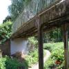
Thurcaston Footbridge
is a minor waterways place
on the Grand Union Canal (Leicester Section - River Soar Navigation) between
Soar Lane Bridge No 3 (2 miles and 1¾ furlongs
and 3 locks
to the southwest) and
Thurmaston Lock No 46 (Thurmaston on east bank) (2 miles and 3 furlongs
and 1 lock
to the northeast).
The nearest place in the direction of Soar Lane Bridge No 3 is Holden Street Bridge No 11;
3½ furlongs
away.
The nearest place in the direction of Thurmaston Lock No 46 is Thurcaston Old Bridge No 12;
a few yards
away.
There may be access to the towpath here.
Mooring here is unrated.
There is a bridge here which takes pedestrian traffic over the canal.
| Abbey Park Road Bridge No 9 | 1 mile, 1½ furlongs | |
| Wolsey Chimneys | 6 furlongs | |
| Swan's Nest Bridge No 10 | 4¾ furlongs | |
| Belgrave Lock No 44 | 4½ furlongs | |
| Holden Street Bridge No 11 | 3½ furlongs | |
| Thurcaston Footbridge | ||
| Thurcaston Old Bridge No 12 | a few yards | |
| Entrance to Riverside Lakes | ¾ furlongs | |
| New Bridge No 13 | 1½ furlongs | |
| Watermead Way Bridge No 14 (A563) | 6 furlongs | |
| Birstall Lock Winding Hole | 1 mile, 2¼ furlongs | |
- Grand Union Canal Walk — associated with Grand Union Canal
- An illustrated walk along the Grand Union Canal from London to Birmingham
Mouseover for more information or show routes to facility
Nearest water point
In the direction of Trent Junction
Hope and Anchor Bridge No 19 — 3 miles, 4¾ furlongs and 2 locks away
On this waterway in the direction of Trent Junction
Barrow Boating — 9 miles, 1¾ furlongs and 6 locks away
On this waterway in the direction of Trent Junction
Loughborough Basin — 13 miles, 3¼ furlongs and 8 locks away
Travel to Loughborough Branch Junction, then on the Grand Union Canal (Leicester Section - Loughborough Branch) to Loughborough Basin
Bishop Meadow Lock No 54 — 14 miles, 2 furlongs and 9 locks away
On this waterway in the direction of Trent Junction
In the direction of River Soar Junction
Friars Mill Visitor Moorings — 2 miles, 3 furlongs and 3 locks away
On this waterway in the direction of River Soar Junction
Kilby Bridge No 87 — 10 miles, 6¾ furlongs and 15 locks away
Travel to River Soar Junction, then on the Grand Union Canal (Leicester Section - Leicestershire and Northamptonshire Union Canal) to Kilby Bridge No 87Nearest rubbish disposal
In the direction of Trent Junction
Broome Island — 8 miles, 3½ furlongs and 6 locks away
On this waterway in the direction of Trent Junction
Barrow Boating — 9 miles, 1¾ furlongs and 6 locks away
On this waterway in the direction of Trent Junction
Loughborough Basin — 13 miles, 3¼ furlongs and 8 locks away
Travel to Loughborough Branch Junction, then on the Grand Union Canal (Leicester Section - Loughborough Branch) to Loughborough Basin
In the direction of River Soar Junction
Kilby Bridge No 87 — 10 miles, 6¾ furlongs and 15 locks away
Travel to River Soar Junction, then on the Grand Union Canal (Leicester Section - Leicestershire and Northamptonshire Union Canal) to Kilby Bridge No 87Nearest chemical toilet disposal
In the direction of Trent Junction
Sileby Mill Mooring Basin — 6 miles, 5½ furlongs and 5 locks away
On this waterway in the direction of Trent Junction
Barrow Boating — 9 miles, 1¾ furlongs and 6 locks away
On this waterway in the direction of Trent Junction
In the direction of River Soar Junction
Kilby Bridge No 87 — 10 miles, 6¾ furlongs and 15 locks away
Travel to River Soar Junction, then on the Grand Union Canal (Leicester Section - Leicestershire and Northamptonshire Union Canal) to Kilby Bridge No 87Nearest place to turn
In the direction of Trent Junction
Entrance to Riverside Lakes — ¾ furlongs away
On this waterway in the direction of Trent Junction
Birstall Lock Winding Hole — 1 mile, 2¼ furlongs away
On this waterway in the direction of Trent Junction
White Horse Lane Junction — 1 mile, 3½ furlongs and 1 lock away
On this waterway in the direction of Trent Junction
Leicester Marina Entrance — 2 miles, 1½ furlongs and 1 lock away
On this waterway in the direction of Trent Junction
Thurmaston Lock Arm — 2 miles, 2¾ furlongs and 1 lock away
On this waterway in the direction of Trent Junction
MGM Boats Winding Hole — 2 miles, 3½ furlongs and 2 locks away
On this waterway in the direction of Trent Junction
MGM Boats, Thurmaston — 2 miles, 4¼ furlongs and 2 locks away
On this waterway in the direction of Trent Junction
Old Junction Boatyard (Syston) — 4 miles, ¾ furlongs and 2 locks away
On this waterway in the direction of Trent Junction
River Wreake Junction — 4 miles, 1 furlong and 2 locks away
On this waterway in the direction of Trent Junction
Wreake Outlet by Junction Lock No 47 — 4 miles, 5¾ furlongs and 3 locks away
On this waterway in the direction of Trent Junction
Wreake Mouth — 5 miles, 1 furlong and 3 locks away
On this waterway in the direction of Trent Junction
Cossington Mill Stream Junction — 5 miles, 2½ furlongs and 4 locks away
On this waterway in the direction of Trent Junction
Loughborough Road Winding Hole — 5 miles, 3¼ furlongs and 4 locks away
On this waterway in the direction of Trent Junction
Sileby Mill — 6 miles, 5 furlongs and 5 locks away
On this waterway in the direction of Trent Junction
Sileby Mill Mooring Basin — 6 miles, 5½ furlongs and 5 locks away
On this waterway in the direction of Trent Junction
Mountsorrel Lock Junction — 7 miles, 4¼ furlongs and 5 locks away
On this waterway in the direction of Trent Junction
Soar Outlet by Mountsorrel Lock — 7 miles, 5 furlongs and 6 locks away
On this waterway in the direction of Trent Junction
Meadow Farm Junction — 8 miles, 4¼ furlongs and 6 locks away
On this waterway in the direction of Trent Junction
In the direction of River Soar Junction
Belgrave Circle Arm (disused) — 1 mile, 1¾ furlongs and 1 lock away
On this waterway in the direction of River Soar Junction
Memory Lane Wharf — 1 mile, 2½ furlongs and 2 locks away
On this waterway in the direction of River Soar JunctionNearest self-operated pump-out
In the direction of River Soar Junction
Kilby Bridge No 87 — 10 miles, 6¾ furlongs and 15 locks away
Travel to River Soar Junction, then on the Grand Union Canal (Leicester Section - Leicestershire and Northamptonshire Union Canal) to Kilby Bridge No 87Nearest boatyard pump-out
In the direction of Trent Junction
Sileby Mill Mooring Basin — 6 miles, 5½ furlongs and 5 locks away
On this waterway in the direction of Trent JunctionDirection of TV transmitter (From Wolfbane Cybernetic)
There is no page on Wikipedia called “Thurcaston Footbridge”
Wikipedia pages that might relate to Thurcaston Footbridge
[Packhorse bridge]
for England. Retrieved 5 April 2020. Historic England. "Sandham Bridge, Thurcaston and Cropston (Grade II) (1361097)". National Heritage List for England
[List of crossings of the River Soar]
Notes & refs 1 Footbridge Sharnford 52°31′27″N 1°16′55″W / 52.52412°N 1.28196°W / 52.52412; -1.28196 (Footbridge) Footpath Footbridge downstream of
[Belgrave and Birstall railway station]
Distributor road, although a footbridge running close to the alignment of the former trackbed carries pedestrians to Thurcaston road, over which the line
[Scheduled monuments in Leicester]
Beaumont Leys Medieval Earthworks (Castle Hill): Description of the Monument Thurcaston Road, Belgrave Bridge: Description of the Monument Battersbee Road: Birds
Results of Google Search
Feb 23, 2015 ... English: Belgrave Bridge carrying Thurcaston Road over the River Soar at Belgrave, Leicester ... Beside it is a 20th-century concrete footbridge.
Jan 2, 2008 ... SK5907 :: Thurcaston roadbridge and footbridge over the river Soar, near to Birstall, Leicestershire, Great Britain by Jim Thornton.
SK550100. Thurcaston & Cropston NDP Environmental Report 2015-2031 ... Square 2: Footbridge over outflow stream, looking north to Bradgate Road (J61)Â ...
Feb 2, 2012 ... ... by something being thrown from the footbridge. A third case of a cracked windscreen on a car on the A46 in Thurcaston was also reported.
Saint Alkmund's Way Footbridge is a replacement cycle and footbridge in Derby, England over the A601 (St Alkmund's Way). The 2007 design includes ...
Sep 28, 2015 ... Holden Street Footbridge is over 30 years old. ... A well-lit diversion route will be signposted via: Riverside Way, Thurcaston Rd Footbridge/Â ...
This scheme involved the design and construction of a five-metre-wide pedestrian and cycle bridge across the Grand Union Canal in Leicester. The bridge leads ...


![Footpath beside River Soar in Leicester Riverside Park. There is a waymarker [[5986957]] on the left hand side of the path by Roger Templeman – 09 May 2018](https://s0.geograph.org.uk/geophotos/05/98/69/5986968_5ffc0ba2_120x120.jpg)


