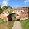
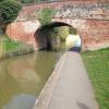
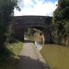
Astwood Cemetery Bridge No 14
School Playing Fields, Gillam Street, Worcester WR3 8JT, United Kingdom
Address is taken from a point 330 yards away.

Astwood Cemetery Bridge No 14
is a minor waterways place
on the Worcester and Birmingham Canal (Diglis Basin to King's Norton Junction) between
Diglis Basin (Tow-path goes around the first basin) (2 miles and ¾ furlongs
and 4 locks
to the south) and
Hanbury Junction (Junction with Droitwich Junction Canal (Restored - Opened 1/July/2011). Hanbury Wharf) (6 miles and 7¾ furlongs
and 10 locks
to the northeast).
The nearest place in the direction of Diglis Basin is Gregory's Mill Top Lock No 6;
1½ furlongs
away.
The nearest place in the direction of Hanbury Junction is Bilford Bottom Lock No 7;
1 furlong
away.
There may be access to the towpath here.
Mooring here is unrated.
There is a bridge here which takes pedestrian traffic over the canal.
Tavern Hill Bridge No 12 | 3¾ furlongs | |
Lowesmoor Visitor Moorings | 3¼ furlongs | |
Gregory's Mill Bridge No 13 | 2½ furlongs | |
Gregory's Mill Bottom Lock No 5 | 2¼ furlongs | |
Gregory's Mill Top Lock No 6 | 1½ furlongs | |
Astwood Cemetery Bridge No 14 | ||
Bilford Bottom Lock No 7 | 1 furlong | |
Bilford Locks Winding Hole | 1¼ furlongs | |
Bilford Bridge No 15 | 1½ furlongs | |
Bilford Top Lock No 8 | 1¾ furlongs | |
Ivy Bridge No 16 | 3¾ furlongs |
There are no links to external websites from here.
Why not log in and add some (select "External websites" from the menu (sometimes this is under "Edit"))?
Mouseover for more information or show routes to facility
Nearest water point
In the direction of King's Norton Junction
Hanbury Boatyard — 6 miles, 6¾ furlongs and 10 locks away
On this waterway in the direction of King's Norton Junction
Droitwich Spa Marina — 7 miles, 3 furlongs and 13 locks away
Travel to Hanbury Junction, then on the Droitwich Canals (Droitwich Junction Canal) to Droitwich Spa Marina
Stoke Works Water Point — 9 miles, 4 furlongs and 16 locks away
On this waterway in the direction of King's Norton Junction
Netherwich Basin — 8 miles, 6½ furlongs and 18 locks away
Travel to Hanbury Junction, then on the Droitwich Canals (Droitwich Junction Canal) to Droitwich Junction, then on the Droitwich Canals (Droitwich Barge Canal) to Netherwich Basin
Tardebigge Wharf — 13 miles, 4½ furlongs and 52 locks away
On this waterway in the direction of King's Norton Junction
Hopwood Visitor Moorings — 19 miles and 52 locks away
On this waterway in the direction of King's Norton Junction
In the direction of Diglis Basin
Lowesmoor Basin — 1 mile, ½ furlongs and 2 locks away
On this waterway in the direction of Diglis Basin
Diglis Services — 2 miles, ¼ furlongs and 4 locks away
On this waterway in the direction of Diglis Basin
Diglis Locks — 2 miles, 4¼ furlongs and 6 locks away
Travel to Diglis Basin, then on the Worcester and Birmingham Canal (Diglis Junction to Diglis Basin) to Diglis Junction, then on the River Severn (main river - Worcester to Gloucester) to Diglis Locks
Worcester Trip Boat Moorings — 3 miles and 6 locks away
Travel to Diglis Basin, then on the Worcester and Birmingham Canal (Diglis Junction to Diglis Basin) to Diglis Junction, then on the River Severn (main river - Stourport to Worcester) to Worcester Trip Boat Moorings
Holt Lock (Holt Fleet) — 9 miles, 4¾ furlongs and 7 locks away
Travel to Diglis Basin, then on the Worcester and Birmingham Canal (Diglis Junction to Diglis Basin) to Diglis Junction, then on the River Severn (main river - Stourport to Worcester) to Holt Lock (Holt Fleet)
Lincomb Lock — 13 miles, 6½ furlongs and 8 locks away
Travel to Diglis Basin, then on the Worcester and Birmingham Canal (Diglis Junction to Diglis Basin) to Diglis Junction, then on the River Severn (main river - Stourport to Worcester) to Lincomb Lock
Upper Basin Waterpoint — 15 miles, 1¾ furlongs and 11 locks away
Travel to Diglis Basin, then on the Worcester and Birmingham Canal (Diglis Junction to Diglis Basin) to Diglis Junction, then on the River Severn (main river - Stourport to Worcester) to Severn - Stourport Broad Locks Entrance, then on the Staffordshire and Worcestershire Canal (Stourport Basins: Broad Route) to Stourport Upper Basin, then on the Staffordshire and Worcestershire Canal (Stourport Basins: Narrow Route) to Upper Basin Waterpoint
Upper Lode Lock No 5 — 18 miles, 6 furlongs and 7 locks away
Travel to Diglis Basin, then on the Worcester and Birmingham Canal (Diglis Junction to Diglis Basin) to Diglis Junction, then on the River Severn (main river - Worcester to Gloucester) to Upper Lode Lock No 5
Tewkesbury Services — 18 miles, 3¾ furlongs and 8 locks away
Travel to Diglis Basin, then on the Worcester and Birmingham Canal (Diglis Junction to Diglis Basin) to Diglis Junction, then on the River Severn (main river - Worcester to Gloucester) to Tewkesbury Junction, then on the River Avon - Warwickshire (Lower Avon Navigation) to Tewkesbury Services
Tewkesbury Lower Lode — 19 miles, 4¼ furlongs and 8 locks away
Travel to Diglis Basin, then on the Worcester and Birmingham Canal (Diglis Junction to Diglis Basin) to Diglis Junction, then on the River Severn (main river - Worcester to Gloucester) to Tewkesbury Lower Lode
Caldwall Mill Bridge No 14 — 19 miles, ¼ furlongs and 14 locks away
Travel to Diglis Basin, then on the Worcester and Birmingham Canal (Diglis Junction to Diglis Basin) to Diglis Junction, then on the River Severn (main river - Stourport to Worcester) to Severn - Stourport Broad Locks Entrance, then on the Staffordshire and Worcestershire Canal (Stourport Basins: Broad Route) to Stourport Upper Basin, then on the Staffordshire and Worcestershire Canal (Stourport Basins: Narrow Route) to York Street Bridge, then on the Staffordshire and Worcestershire Canal (Main Line: Stourport to Stourton) to Caldwall Mill Bridge No 14Nearest rubbish disposal
In the direction of King's Norton Junction
Droitwich Spa Marina — 7 miles, 3 furlongs and 13 locks away
Travel to Hanbury Junction, then on the Droitwich Canals (Droitwich Junction Canal) to Droitwich Spa Marina
Stoke Bottom Lock No 23 — 10 miles, 1¾ furlongs and 16 locks away
On this waterway in the direction of King's Norton Junction
Netherwich Basin — 8 miles, 6½ furlongs and 18 locks away
Travel to Hanbury Junction, then on the Droitwich Canals (Droitwich Junction Canal) to Droitwich Junction, then on the Droitwich Canals (Droitwich Barge Canal) to Netherwich Basin
Tardebigge Wharf — 13 miles, 4½ furlongs and 52 locks away
On this waterway in the direction of King's Norton Junction
In the direction of Diglis Basin
Lowesmoor Basin — 1 mile, ½ furlongs and 2 locks away
On this waterway in the direction of Diglis Basin
Diglis Basin — 2 miles, ¾ furlongs and 4 locks away
On this waterway in the direction of Diglis Basin
Sabrina Footbridge — 3 miles, 1¾ furlongs and 6 locks away
Travel to Diglis Basin, then on the Worcester and Birmingham Canal (Diglis Junction to Diglis Basin) to Diglis Junction, then on the River Severn (main river - Stourport to Worcester) to Sabrina Footbridge
Upper Basin Waterpoint — 15 miles, 1¾ furlongs and 11 locks away
Travel to Diglis Basin, then on the Worcester and Birmingham Canal (Diglis Junction to Diglis Basin) to Diglis Junction, then on the River Severn (main river - Stourport to Worcester) to Severn - Stourport Broad Locks Entrance, then on the Staffordshire and Worcestershire Canal (Stourport Basins: Broad Route) to Stourport Upper Basin, then on the Staffordshire and Worcestershire Canal (Stourport Basins: Narrow Route) to Upper Basin Waterpoint
Tewkesbury Services — 18 miles, 3¾ furlongs and 8 locks away
Travel to Diglis Basin, then on the Worcester and Birmingham Canal (Diglis Junction to Diglis Basin) to Diglis Junction, then on the River Severn (main river - Worcester to Gloucester) to Tewkesbury Junction, then on the River Avon - Warwickshire (Lower Avon Navigation) to Tewkesbury ServicesNearest chemical toilet disposal
In the direction of King's Norton Junction
Droitwich Spa Marina — 7 miles, 3 furlongs and 13 locks away
Travel to Hanbury Junction, then on the Droitwich Canals (Droitwich Junction Canal) to Droitwich Spa Marina
Stoke Bottom Lock No 23 — 10 miles, 1¾ furlongs and 16 locks away
On this waterway in the direction of King's Norton Junction
Tardebigge Wharf — 13 miles, 4½ furlongs and 52 locks away
On this waterway in the direction of King's Norton Junction
In the direction of Diglis Basin
Lowesmoor Basin — 1 mile, ½ furlongs and 2 locks away
On this waterway in the direction of Diglis Basin
Diglis Services — 2 miles, ¼ furlongs and 4 locks away
On this waterway in the direction of Diglis Basin
Stourport Marina — 14 miles, 1¾ furlongs and 9 locks away
Travel to Diglis Basin, then on the Worcester and Birmingham Canal (Diglis Junction to Diglis Basin) to Diglis Junction, then on the River Severn (main river - Stourport to Worcester) to Stourport Marina
Upper Basin Waterpoint — 15 miles, 1¾ furlongs and 11 locks away
Travel to Diglis Basin, then on the Worcester and Birmingham Canal (Diglis Junction to Diglis Basin) to Diglis Junction, then on the River Severn (main river - Stourport to Worcester) to Severn - Stourport Broad Locks Entrance, then on the Staffordshire and Worcestershire Canal (Stourport Basins: Broad Route) to Stourport Upper Basin, then on the Staffordshire and Worcestershire Canal (Stourport Basins: Narrow Route) to Upper Basin Waterpoint
Caldwall Mill Bridge No 14 — 19 miles, ¼ furlongs and 14 locks away
Travel to Diglis Basin, then on the Worcester and Birmingham Canal (Diglis Junction to Diglis Basin) to Diglis Junction, then on the River Severn (main river - Stourport to Worcester) to Severn - Stourport Broad Locks Entrance, then on the Staffordshire and Worcestershire Canal (Stourport Basins: Broad Route) to Stourport Upper Basin, then on the Staffordshire and Worcestershire Canal (Stourport Basins: Narrow Route) to York Street Bridge, then on the Staffordshire and Worcestershire Canal (Main Line: Stourport to Stourton) to Caldwall Mill Bridge No 14Nearest place to turn
In the direction of King's Norton Junction
Bilford Locks Winding Hole — 1¼ furlongs and 1 lock away
On this waterway in the direction of King's Norton Junction
Tibberton Winding Hole — 3 miles, 6¾ furlongs and 10 locks away
On this waterway in the direction of King's Norton Junction
Dunhampstead Winding Hole — 4 miles, 6¼ furlongs and 10 locks away
On this waterway in the direction of King's Norton Junction
Dunhampstead Boatyard — 5 miles, ½ furlongs and 10 locks away
On this waterway in the direction of King's Norton Junction
Hanbury Boatyard — 6 miles, 6¾ furlongs and 10 locks away
On this waterway in the direction of King's Norton Junction
Hanbury Junction — 6 miles, 7¾ furlongs and 10 locks away
On this waterway in the direction of King's Norton Junction
Hanbury Junction Winding Hole — 7 miles, 1 furlong and 10 locks away
On this waterway in the direction of King's Norton Junction
Droitwich Spa Marina — 7 miles, 3 furlongs and 13 locks away
Travel to Hanbury Junction, then on the Droitwich Canals (Droitwich Junction Canal) to Droitwich Spa Marina
Astwood Winding Hole — 8 miles, 5¼ furlongs and 12 locks away
On this waterway in the direction of King's Norton Junction
Lock No 6 Winding Hole — 7 miles, 6 furlongs and 15 locks away
Travel to Hanbury Junction, then on the Droitwich Canals (Droitwich Junction Canal) to Lock No 6 Winding Hole
In the direction of Diglis Basin
Lowesmoor Basin — 1 mile, ½ furlongs and 2 locks away
On this waterway in the direction of Diglis Basin
Diglis Junction — 2 miles, 2 furlongs and 6 locks away
Travel to Diglis Basin, then on the Worcester and Birmingham Canal (Diglis Junction to Diglis Basin) to Diglis Junction
Diglis Locks Weir Exit — 2 miles, 5 furlongs and 7 locks away
Travel to Diglis Basin, then on the Worcester and Birmingham Canal (Diglis Junction to Diglis Basin) to Diglis Junction, then on the River Severn (main river - Worcester to Gloucester) to Diglis Locks Weir Exit
Severn - Teme Junction — 3 miles, 3 furlongs and 7 locks away
Travel to Diglis Basin, then on the Worcester and Birmingham Canal (Diglis Junction to Diglis Basin) to Diglis Junction, then on the River Severn (main river - Worcester to Gloucester) to Severn - Teme Junction
Bevere Lock Weir Exit — 6 miles, ¼ furlongs and 6 locks away
Travel to Diglis Basin, then on the Worcester and Birmingham Canal (Diglis Junction to Diglis Basin) to Diglis Junction, then on the River Severn (main river - Stourport to Worcester) to Bevere Lock Weir Exit
Bevere Lock Weir Entrance — 6 miles, 3 furlongs and 7 locks away
Travel to Diglis Basin, then on the Worcester and Birmingham Canal (Diglis Junction to Diglis Basin) to Diglis Junction, then on the River Severn (main river - Stourport to Worcester) to Bevere Lock Weir Entrance
Holt Lock Weir Exit — 9 miles, 3¾ furlongs and 7 locks away
Travel to Diglis Basin, then on the Worcester and Birmingham Canal (Diglis Junction to Diglis Basin) to Diglis Junction, then on the River Severn (main river - Stourport to Worcester) to Holt Lock Weir Exit
Holt Lock Weir Entrance — 9 miles, 7 furlongs and 8 locks away
Travel to Diglis Basin, then on the Worcester and Birmingham Canal (Diglis Junction to Diglis Basin) to Diglis Junction, then on the River Severn (main river - Stourport to Worcester) to Holt Lock Weir Entrance
Ladywood Top Lock Winding Hole — 9 miles, 2¾ furlongs and 15 locks away
Travel to Diglis Basin, then on the Worcester and Birmingham Canal (Diglis Junction to Diglis Basin) to Diglis Junction, then on the River Severn (main river - Stourport to Worcester) to Hawford Junction, then on the Droitwich Canals (Droitwich Barge Canal) to Ladywood Top Lock Winding Hole
Severn - Stourport Narrow Locks Entrance — 15 miles, 1 furlong and 9 locks away
Travel to Diglis Basin, then on the Worcester and Birmingham Canal (Diglis Junction to Diglis Basin) to Diglis Junction, then on the River Severn (main river - Stourport to Worcester) to Severn - Stourport Narrow Locks EntranceNearest self-operated pump-out
In the direction of King's Norton Junction
Droitwich Spa Marina — 7 miles, 3 furlongs and 13 locks away
Travel to Hanbury Junction, then on the Droitwich Canals (Droitwich Junction Canal) to Droitwich Spa Marina
In the direction of Diglis Basin
Diglis Services — 2 miles, ¼ furlongs and 4 locks away
On this waterway in the direction of Diglis BasinNearest boatyard pump-out
In the direction of King's Norton Junction
Dunhampstead Boatyard — 5 miles, ½ furlongs and 10 locks away
On this waterway in the direction of King's Norton Junction
Hanbury Boatyard — 6 miles, 6¾ furlongs and 10 locks away
On this waterway in the direction of King's Norton Junction
In the direction of Diglis Basin
Lowesmoor Basin — 1 mile, ½ furlongs and 2 locks away
On this waterway in the direction of Diglis Basin
Stourport Marina — 14 miles, 1¾ furlongs and 9 locks away
Travel to Diglis Basin, then on the Worcester and Birmingham Canal (Diglis Junction to Diglis Basin) to Diglis Junction, then on the River Severn (main river - Stourport to Worcester) to Stourport Marina
Stourport Upper Basin — 15 miles, 1¾ furlongs and 11 locks away
Travel to Diglis Basin, then on the Worcester and Birmingham Canal (Diglis Junction to Diglis Basin) to Diglis Junction, then on the River Severn (main river - Stourport to Worcester) to Severn - Stourport Broad Locks Entrance, then on the Staffordshire and Worcestershire Canal (Stourport Basins: Broad Route) to Stourport Upper Basin
Upper Staircase Lock Landing Pontoon — 15 miles, 2½ furlongs and 11 locks away
Travel to Diglis Basin, then on the Worcester and Birmingham Canal (Diglis Junction to Diglis Basin) to Diglis Junction, then on the River Severn (main river - Stourport to Worcester) to Severn - Stourport Broad Locks Entrance, then on the Staffordshire and Worcestershire Canal (Stourport Basins: Broad Route) to Stourport Upper Basin, then on the Staffordshire and Worcestershire Canal (Stourport Basins: Narrow Route) to Upper Staircase Lock Landing PontoonDirection of TV transmitter (From Wolfbane Cybernetic)
There is no page on Wikipedia called “Astwood Cemetery Bridge”
Wikipedia pages that might relate to Astwood Cemetery Bridge
[South Kensington]
family-owned hand built sportscar company operates a main dealership out of Astwood Mews in South Kensington. Christie's auction house had a second London
[Worcester Electric Traction Company]
Two further cars were purchased in 1921. Routes ran to Barbourne, Astwood Cemetery (via Rainbow Hill), Shrub Hill railway station, London Road, Bath Road
[Icknield Street]
county, and a little west of Birmingham crosses the [River] Tame at Woodford Bridge into Staffordshire; runs through Sutton Park and by Shenston, cuts the WAETLINGA-STRAETE
[1996 New Year Honours]
Laura Louise Anderson. For services to the community. Mamie Enola Linda Astwood. For services to the community in the field of education. Edna Gertrude
[1993 New Year Honours]
and Excise. Diplomatic Service and Overseas List Cynthia Anita Louise Astwood, Establishment Secretary, Turks and Caicos Islands. Dr. John George Bailey
Results of Google Search
Apr 10, 2010 ... This is known as Astwood Cemetery Bridge. Maintenance work on the canal and towpaths was in progress. A large section has had attention.
Birth, 14 Dec 1910 ... Astwood Cemetery ... Service No: 47599 ... Indian Medical Service, and of Mildred Macleod McKendrick, of Carr Bridge, lnverness-shire.
Conservation. Area No. Description. Angel Place. No. 14 (former Five Ways Hotel ). 1 ... Astwood Road. No. ..... Bridge 14, Astwood Cemetery Bridge 12.
(1 disused railway); The Mailbox (Birmingham); Salvage Turn Bridge (New Bridge ... No TowPath; Wast Hill Tunnel South Portal; Lea End Lane Bridge ( Bridge 69) ... Ivy Bridge (16); Bilford Lock 8; Bilford Lock 7; Astwood Cemetery Bridge (14)Â ...
We reach Coffin Bridge (No.34), and know that there are three more bridges before we reach .... up the boat, and make our way back to the footpath near Astwood Cemetery Bridge No. 14, where we ask some people which way we should go.
Mar 11, 2010 ... Bilford Bridge No 15. 14.7 - 51. Bilford Locks Winding Hole. 14.7 - 52. Bilford Bottom Lock No 7. 14.9 - 52. Astwood Cemetery Bridge No 14.
Astwood Road, DV 04, Paget. Astwood Walk ... Band Room Lane, HM 14, Pembroke. Barkers Hill .... Bridge Street, GE 05, Town of St. George. Bridge View .... Cemetery Road, HM 07, Pembroke. Century ...... No Name Lane, MA 04, Sandys.