CanalPlanAC

Whittlefield Bridge No 129

 
Pendle Way, Burnley BB12 0LY, United Kingdom
 
Information about the place
Whittlefield Bridge No 129 is a minor waterways place on the Leeds and Liverpool Canal (Main Line - Wigan to Leeds) between Feniscowles Bridge No 93B (18 miles and 5½ furlongs and 6 locks to the west) and Salterforth Bridge No 151 (Salterforth village 200 yards northeast) (11 miles and 6¼ furlongs and 7 locks to the northeast).
 
 
The nearest place in the direction of Feniscowles Bridge No 93B is Gannow Tunnel No 128 (northern entrance); 2½ furlongs away.
 
The nearest place in the direction of Salterforth Bridge No 151 is Whittlefield Bridge Aqueduct No 31A (northern end) (Over M65); ¼ furlongs away.

There may be access to the towpath here.

Mooring here is good (a nice place to moor), mooring pins are needed. Nice location with mooring rings. Easy access to Rose Grove and the Gannow Wharf pub is jolly friendly. .

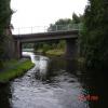
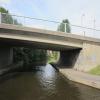
There is a bridge here which takes a minor road over the canal.


Amenities

Amenities nearby at Gannow Tunnel No 128 (northern entrance)

 Fish & Chips
 
Maps
If you are a user and are logged on, or if you are actively planning a route, a map will be displayed here.
Show on external mapping site: Google | OSM | Bing
 
Photos
 
External websites
There are no links to external websites from here.
Why not log in and add some (select "External websites" from the menu (sometimes this is under "Edit"))?
 
Nearest facilities

Mouseover for more information or show routes to facility

Nearest water point

In the direction of Leeds Bridge

Reedley Marina4 miles, ½ furlongs away
On this waterway in the direction of Leeds Bridge
Barrowford Top Lock No 458 miles, 1½ furlongs and 6 locks away
On this waterway in the direction of Leeds Bridge
Foulridge Wharf10 miles, ¾ furlongs and 7 locks away
On this waterway in the direction of Leeds Bridge
Salterforth Bridge No 15111 miles, 6¼ furlongs and 7 locks away
On this waterway in the direction of Leeds Bridge
Lower Park Marina12 miles, 3½ furlongs and 7 locks away
On this waterway in the direction of Leeds Bridge
Greenberfield Services14 miles and 7 locks away
On this waterway in the direction of Leeds Bridge
East Marton Visitor Moorings16 miles, 7¼ furlongs and 10 locks away
On this waterway in the direction of Leeds Bridge
Priest Holme Water Point19 miles, 5 furlongs and 16 locks away
On this waterway in the direction of Leeds Bridge

In the direction of Wigan Junction

Rose Grove Services1 mile, 2½ furlongs away
On this waterway in the direction of Wigan Junction
Blackburn Lock Sanitary Station16 miles, ¾ furlongs and 4 locks away
On this waterway in the direction of Wigan Junction

Nearest rubbish disposal

In the direction of Leeds Bridge

Barrowford Lock No 478 miles, ½ furlongs and 4 locks away
On this waterway in the direction of Leeds Bridge
Foulridge Wharf10 miles, ¾ furlongs and 7 locks away
On this waterway in the direction of Leeds Bridge
Salterforth Bridge No 15111 miles, 6¼ furlongs and 7 locks away
On this waterway in the direction of Leeds Bridge
Lower Park Marina12 miles, 3½ furlongs and 7 locks away
On this waterway in the direction of Leeds Bridge
Greenberfield Services14 miles and 7 locks away
On this waterway in the direction of Leeds Bridge

In the direction of Wigan Junction

Rose Grove Services1 mile, 2½ furlongs away
On this waterway in the direction of Wigan Junction
Blackburn Lock Sanitary Station16 miles, ¾ furlongs and 4 locks away
On this waterway in the direction of Wigan Junction

Nearest chemical toilet disposal

In the direction of Leeds Bridge

Barrowford Top Lock No 458 miles, 1½ furlongs and 6 locks away
On this waterway in the direction of Leeds Bridge
Foulridge Wharf10 miles, ¾ furlongs and 7 locks away
On this waterway in the direction of Leeds Bridge
Salterforth Bridge No 15111 miles, 6¼ furlongs and 7 locks away
On this waterway in the direction of Leeds Bridge
Lower Park Marina12 miles, 3½ furlongs and 7 locks away
On this waterway in the direction of Leeds Bridge
Greenberfield Services14 miles and 7 locks away
On this waterway in the direction of Leeds Bridge

In the direction of Wigan Junction

Rose Grove Services1 mile, 2½ furlongs away
On this waterway in the direction of Wigan Junction
Blackburn Lock Sanitary Station16 miles, ¾ furlongs and 4 locks away
On this waterway in the direction of Wigan Junction

Nearest place to turn

In the direction of Leeds Bridge

Nelson Square Winding Hole6½ furlongs away
On this waterway in the direction of Leeds Bridge
Sandholme Aqueduct Winding Hole2 miles, 1¾ furlongs away
On this waterway in the direction of Leeds Bridge
Winding Hole North of Burnley Embankment2 miles, 3¼ furlongs away
On this waterway in the direction of Leeds Bridge
Burley Lane Winding Hole3 miles, 3¾ furlongs away
On this waterway in the direction of Leeds Bridge
Hawks House Winding Hole4 miles, 5 furlongs away
On this waterway in the direction of Leeds Bridge
Hodge Bank Winding Hole6 miles, 6¾ furlongs away
On this waterway in the direction of Leeds Bridge
Wanless Bridge Winding Hole8 miles, 5¾ furlongs and 7 locks away
On this waterway in the direction of Leeds Bridge
Foulridge Wharf Winding Hole10 miles, 1¼ furlongs and 7 locks away
On this waterway in the direction of Leeds Bridge
Long Ing Bridge Winding Hole12 miles, 7¼ furlongs and 7 locks away
On this waterway in the direction of Leeds Bridge

In the direction of Wigan Junction

Old Rose Grove Winding Hole1 mile, 4¾ furlongs away
On this waterway in the direction of Wigan Junction
Hapton Winding Hole3 miles, 3 furlongs away
On this waterway in the direction of Wigan Junction
Shuttleworth Winding Hole4 miles, 2 furlongs away
On this waterway in the direction of Wigan Junction
Clough Bank Winding Hole5 miles, ¼ furlongs away
On this waterway in the direction of Wigan Junction
Whalley Road Bridge Winding Hole6 miles, 6½ furlongs away
On this waterway in the direction of Wigan Junction
Church Kirk Bridge Winding Hole8 miles, 3 furlongs away
On this waterway in the direction of Wigan Junction
Railway Bridge No 110B Winding Hole9 miles, ½ furlongs away
On this waterway in the direction of Wigan Junction
Dunkenhalgh Aqueduct Winding Hole10 miles, ¾ furlongs away
On this waterway in the direction of Wigan Junction
Rishton Winding Hole10 miles, 2¼ furlongs away
On this waterway in the direction of Wigan Junction
Trident Way Winding Hole12 miles, 6¼ furlongs away
On this waterway in the direction of Wigan Junction
Eanam Bridge Winding Hole14 miles, 7¼ furlongs away
On this waterway in the direction of Wigan Junction

Nearest self-operated pump-out

In the direction of Wigan Junction

Rose Grove Services1 mile, 2½ furlongs away
On this waterway in the direction of Wigan Junction

Nearest boatyard pump-out

In the direction of Leeds Bridge

Reedley Marina4 miles, ½ furlongs away
On this waterway in the direction of Leeds Bridge
Lower Park Marina12 miles, 3½ furlongs and 7 locks away
On this waterway in the direction of Leeds Bridge
Direction of TV transmitter (From Wolfbane Cybernetic)
 
 
Geograph
 
Wikipedia

There is no page on Wikipedia called “Whittlefield Bridge”

Wikipedia pages that might relate to Whittlefield Bridge
[Burnley] Ightenhill, Whittlefield, Rose Grove and Lowerhouse to the north. The 1980s and 1990s saw massive expansion of Ightenhill and Whittlefield. Developers [Ightenhill] parishes of Higham with West Close Booth, and Reedley Hallows. It is in the Whittlefield with Ightenhill ward of Burnley borough. The name is historically recorded [List of electoral wards in Lancashire] Lanehead (3) Lower-house (3) Queensgate (3) Rosehill (3) Trinity (3) Whittlefield with Ightenhill () Wards from 2 May 2002 to present: Bank Hall (3) Briercliffe [Burnley Barracks railway station] density Victorian terraced residential areas of Trinity, Westgate and Whittlefield during the 1960s and 70s, together with the construction of the M65 motorway [Burnley Embankment] from the digging of the nearby 559-yard (511 m) Gannow Tunnel and the Whittlefield cutting. The earthwork is 1,256 yards (0.714 mi; 1.148 km) long, it is [Burnley Coalfield] Habergham closed and larger collieries were sunk at Bank House Colliery, Whittlefield Colliery and the old Fulledge Colliery was redeveloped and linked by [List of schools in Lancashire] School, Burnley Wellfield Methodist and Anglican Church School, Burnley Whittlefield Primary School, Burnley Worsthorne Primary School, Worsthorne Abbey Village [List of electoral wards in England by constituency] Queensgate, Rosegrove with Lowerhouse, Rosehill with Burnley Wood, Trinity, Whittlefield with Ightenhill. Chorley: Adlington and Anderton, Astley and Buckshaw [Civil parishes in Lancashire] Rosegrove with Lowerhouse (part); Rosehill with Burnley Wood; Trinity; and Whittlefield with Ightenhill (part) wards. Retrieved 4 February 2010 A Vision of Britain [Places of worship in Burnley] retrieved 5 September 2012 "Whittlefield, High St, Wesleyan Methodist, Burnley", Burnley, GENUKI, retrieved 5 September 2012 "Whittlefield", Burnley, LFH&HS Pendle
 
Google

Results of Google Search

General Club Documents
Please note that due to Covid-19, the Bridge Club is closed until further notice ... later suggestions in green · 2017 Laws of Duplicate Bridge – no highlights ...
Listed buildings in Carnforth - Wikipedia
Carnforth is a civil parish in Lancaster, Lancashire, England. It contains 20 listed buildings that ... The Lancaster Canal passes through the parish, and two bridges crossing it are listed. ... retrieved 17 April 2015; Historic England, "Hodgson's Bridge (No 129), Carnforth (1071923)", National Heritage List for England, retrieved ...