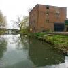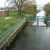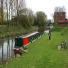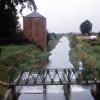
Bishopbridge Weir
is a place on the waterways
at the end of the River Ancholme (unnavigable section); past
Owersby Landing (1 mile and 4 furlongs
to the northwest).
The nearest place in the direction of Owersby Landing is Winding Hole below Bishopbridge;
2¼ furlongs
away.
Mooring here is unrated.
| Harlam Hill Lock No 1 | 2 miles, 2½ furlongs | |
| Harlam Hill Lock Weir Entrance | 2 miles, 1¾ furlongs | |
| Atterby Landing | 2 miles | |
| Owersby Landing | 1 mile, 4 furlongs | |
| Winding Hole below Bishopbridge | 2¼ furlongs | |
| Bishopbridge Weir | ||
There are no links to external websites from here.
Why not log in and add some (select "External websites" from the menu (sometimes this is under "Edit"))?
Why not log in and add some (select "External websites" from the menu (sometimes this is under "Edit"))?
Mouseover for more information or show routes to facility
Nearest place to turn
In the direction of Harlam Hill Lock No 1
Winding Hole below Bishopbridge — 2¼ furlongs away
On this waterway in the direction of Harlam Hill Lock No 1
Old River Ancholme Southern Junction — 9 miles, 4 furlongs and 1 lock away
Travel to Harlam Hill Lock No 1, then on the River Ancholme (Main River) to Old River Ancholme Southern Junction
Old River Ancholme Northern Junction — 10 miles, 6¼ furlongs and 1 lock away
Travel to Harlam Hill Lock No 1, then on the River Ancholme (Main River) to Old River Ancholme Northern JunctionNo information
CanalPlan has no information on any of the following facilities within range:water point
rubbish disposal
chemical toilet disposal
self-operated pump-out
boatyard pump-out
Direction of TV transmitter (From Wolfbane Cybernetic)
There is no page on Wikipedia called “Bishopbridge Weir”
Wikipedia pages that might relate to Bishopbridge Weir
[Osgodby, Lincolnshire]
Kingerby, Kirkby cum Osgodby, Osgodby itself, Usselby and the hamlet of Bishopbridge. To the north is North Owersby. Nearby to the west is the north-south
[River Ancholme]
east and then north to Bishopbridge (west of Market Rasen) (TF 03163 91070), where it is joined by the Rase. North of Bishopbridge it flows through the
[Horkstow Bridge]
and is a Grade II* listed building. The River Ancholme rises south of Bishopbridge in Lincolnshire, flows northwards through the town of Brigg and the Ancholme
[List of bridges and viaducts in Lincolnshire]
drainage channel. Bishopbridge Weir Footbridge River Ancholme Bishopbridge Iron Truss No public Access. Part of the weir infrastructure. Point at which
Results of Google Search
File:Bishop Bridge Weir - geograph.org.uk - 783642.jpg. Language ... English: Bishop Bridge Weir This weir is the limit of navigation of the Ancholme. Date, 29 ...
Apr 30, 2008 ... This weir is the limit of navigation of the Ancholme. ... taken 12 years ago, near to Bishopbridge, Lincolnshire, Great Britain. This is 1 of 2 ...
Jun 4, 2020 ... File:Bishop Bridge Weir - geograph.org.uk - 783642.jpg ... English: Bishop Bridge Weir This weir is the limit of navigation of the Ancholme.
Oct 26, 2011 ... Bishop Bridge Weir - geograph.org.uk - 783642.jpg 640 × 478; 135 KB ... Bishopbridge - geograph.org.uk - 138887.jpg 640 × 480; 158 KB.
Crump profile weir (crest length 3.658m). Removed from peak flows dataset in September 2020 (WINFAP Files v9). Missing daily flow for June 2019 event as ...
The River Ancholme rises south of Bishopbridge in Lincolnshire, flows northwards through the town of Brigg and the Ancholme Level, an area of fenland , and ...
GAINSBOROUGH DN21 4RU, 01652 678364, Map, X, X, X, Huge selection of ciders. Bishopbridge Weir, The Old Bell Inn Bishopbridge MARKET DRAYTON
Hello, My name is Catherine and I am an experienced Counsellor using a Cognitive Behavioural Therapy approach. I have been working with clients in my ...


![The Sign of The Bell. The rather weathered sign of the Bell [[783620]] at Bishop Bridge. by David Wright – 29 April 2008](https://s3.geograph.org.uk/photos/78/36/783623_af115db9_120x120.jpg)


