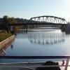
South Bridge Street Bridge E-23
is a minor waterways place
on the New York State Canal System (Erie Canal) between
Second Street Bridge (49.51 miles
and 11 locks
to the east) and
Erie - Oswego Junction (Junction of the Erie Canal with the Oswego Canal at Three Rivers) (114.82 miles
and 11 locks
to the west).
The nearest place in the direction of Second Street Bridge is Tribes Hill Lock E12;
5.20 miles
away.
The nearest place in the direction of Erie - Oswego Junction is Randall Lock E13;
4.79 miles
away.
There may be access to the towpath here.
Mooring here is unrated.
There is a bridge here which takes a road over the canal.
CSXT Railway Bridge E-17 | 18.84 miles | |
Cranesville Lock E10 | 14.11 miles | |
Church Street Bridge E-19A | 10.93 miles | |
Amsterdam Lock E11 | 9.69 miles | |
Tribes Hill Lock E12 | 5.20 miles | |
South Bridge Street Bridge E-23 | ||
Randall Lock E13 | 4.79 miles | |
Church Street Bridge E-24 | 12.52 miles | |
Canajoharie Lock E14 | 12.87 miles | |
River Street Bridge E-25 | 15.88 miles | |
Fort Plain Lock E15 | 16.32 miles |
There are no links to external websites from here.
Why not log in and add some (select "External websites" from the menu (sometimes this is under "Edit"))?
Mouseover for more information or show routes to facility
No information
CanalPlan has no information on any of the following facilities within range:water point
rubbish disposal
chemical toilet disposal
place to turn
self-operated pump-out
boatyard pump-out
There is no page on Wikipedia called “South Bridge Street Bridge E-23”
Wikipedia pages that might relate to South Bridge Street Bridge E-23
[Brooklyn Bridge]
Row to the west, Chambers/Centre Streets to the north, and Pearl Street to the south. However, the exit from the bridge to northbound Park Row was closed
[London Bridge]
Stane Street and Watling Street (now the A2). Around AD 50, the temporary bridge over the Thames was replaced by a permanent timber piled bridge, maintained
[Queensboro Bridge]
Island. The bridge is also known as the 59th Street Bridge because its Manhattan end is located between 59th and 60th streets. The Queensboro Bridge carries
[Sydney Harbour Bridge]
Under the direction of John Bradfield of the New South Wales Department of Public Works, the bridge was designed and built by British firm Dorman Long
[Tower Bridge]
Tower Bridge is a combined bascule and suspension bridge in London, built between 1886 and 1894. The bridge crosses the River Thames close to the Tower
[Williamsburg Bridge]
Williamsburg Bridge is a suspension bridge in New York City across the East River connecting the Lower East Side of Manhattan at Delancey Street with the
[Sunshine Skyway Bridge]
bridge, resulting in the sinking of the cutter and the loss of 23 crew members. In May 1980, the freighter MV Summit Venture collided with a bridge support
[Bridge to nowhere]
abandoned railway line. The bridge is completed, but the streets connecting the bridge are not completed. Further, the term "bridge to nowhere" may be used
[Golden Gate Bridge]
The Golden Gate Bridge is a suspension bridge spanning the Golden Gate, the one-mile-wide (1.6 km) strait connecting San Francisco Bay and the Pacific
[George Washington Bridge]
The George Washington Bridge is a double-decked suspension bridge spanning the Hudson River, connecting the New York City borough of Manhattan with the
Results of Google Search
Bridge Heights - New York State Canals48.52, Bridge E-23, S Bridge St, SR 30A, 278.00, 23.20, 281.20, 20.00, E13 lower ... 71.45, Bridge E-27, River Rd, CR 65, 322.50, 23.16, 325.50, 20.16, E16Â ...
Nov 18, 2018 ... FDR Drive, originally named East River Drive, is a freeway running along the eastern edge of ... East 23rd Street ... East East 61st Street Queensboro Bridge, Exit 12. NY 25 East ... Harlem River Drive north, FDR Drive south.
It crossed the Maumee River via the Fassett Street Bridge, then followed South, Sumner, Logan, Summit, and Huron streets to rejoin its original routing. The ...
Jul 23, 2012 ... July 23, 2012. EX: actual clearance is ... E. of Sheffield Rd. CTA. X0089. NP ... 12/ 04/2009. Busway Under Pedestrian Bridge 600 S. 200 E.
Apr 10, 2020 ... Replacing an existing bridge on Fairview Ave N. ... Ave S Bridge Seismic Retrofit Project · Thornton Creek Bridge Study ... Fairview Ave N bridge closed on Monday, September 23 ... Temporary street parking will be provided on the east and west sides of Fairview Ave N between Yale Ave N and Aloha St.
Avenue C. Avenue D. 1 Avenue. 2 Avenue. 3 Avenue. 4 Avenue up to 200 up to 400 up to 600 ... SOUTH. NORTH. Approximate North / South walking distance. East / West distances slightly ... Station. 34 St. Penn Station. 33 St. 28 St. 23 St. 23 St. 23 St. 23 St. 18 St. 28 St. 28 St. 57 St ... BRIDGE BUS STATION. RIVERBANK.
Jun 7, 2019 ... Schedule. The 23rd Avenue Corridor Improvement project includes three phases: Phase 1. S Jackson St to E John St: June 2015 – spring 2017 ...
5 days ago ... Update on the upcoming weekend's roadwork and street closures from New ... for replacement of West 31st Street Bridge over Amtrak, beginning Friday, August 23 , ... occur on the south side of 31st Street throughout the duration of this project. ... East 51st Street between Lexington Avenue and Park Avenue.
March 23 - TBD: The West Seattle High-Rise Bridge is closed until further notice. April 6 - May 4: S King St. closed westbound from 1st Ave S to Alaskan Way S for a water ... Station will be located east of 1st Ave NE, spanning NE 103rd Street.
WIS 82 bridge over Wisconsin River (Point Bluff Bridge), between Mauston ... US 12/18 (Madison Beltline) - South Towne Drive/W Broadway bridge over US ... US 61 (Cherry Street to City Limits Road), Lancaster - Grant County ... US 18/151 to East County Line, Dodgeville to Mt. Horeb - Iowa County; US 151 (WIS 23 to USÂ ...