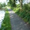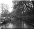
Furness Vale Aqueduct
Goytside Meadows Local Nature Reserve, Buxton Road, High Peak SK23 7PY, United Kingdom
Address is taken from a point 360 yards away.
Address is taken from a point 360 yards away.

Furness Vale Aqueduct
is a minor waterways place
on the Peak Forest Canal (Upper) between
Whaley Bridge Branch Junction (Junction with Whaley Bridge Branch) (1 mile and 4¼ furlongs
to the southeast) and
Thornsett Road Bridge No 28 (New Mills) (4¼ furlongs
to the northwest).
The nearest place in the direction of Whaley Bridge Branch Junction is Carr Swing Bridge No 30;
1¾ furlongs
away.
The nearest place in the direction of Thornsett Road Bridge No 28 is Bank End Bridge No 29;
1¼ furlongs
away.
Mooring here is unrated.
There is a small aqueduct or underbridge here.
| Footbridge No 32 | 7½ furlongs | |
| Furness Bridge No 31 | 5 furlongs | |
| Furness Brook Aqueduct | 4¾ furlongs | |
| Furness Vale Marina | 3¾ furlongs | |
| Carr Swing Bridge No 30 | 1¾ furlongs | |
| Furness Vale Aqueduct | ||
| Bank End Bridge No 29 | 1¼ furlongs | |
| Bank End Winding Hole | 2½ furlongs | |
| New Mills Marina | 3½ furlongs | |
| Thornsett Road Bridge No 28 | 4¼ furlongs | |
| Disley Winding Hole | 7½ furlongs | |
- Tramway wharf — associated with Peak Forest Canal (Upper)
- Historic tramway wharf, linking the upper and lower peak forest canal prior to the locks being built.
Mouseover for more information or show routes to facility
Nearest water point
In the direction of Bugsworth (end of navigation)
Furness Vale Marina — 3¾ furlongs away
On this waterway in the direction of Bugsworth (end of navigation)
Whaley Bridge Services — 2 miles away
Travel to Whaley Bridge Branch Junction, then on the Peak Forest Canal (Whaley Bridge Branch) to Whaley Bridge Services
Bugsworth Services — 2 miles, ¼ furlongs away
On this waterway in the direction of Bugsworth (end of navigation)
In the direction of Marple Junction
Marple Services — 4 miles, 4¼ furlongs away
Travel to Marple Junction, then on the Macclesfield Canal to Marple Services
Braidbar Boats — 8 miles, 2 furlongs away
Travel to Marple Junction, then on the Macclesfield Canal to Braidbar Boats
Bollington Wharf — 12 miles, 7¾ furlongs away
Travel to Marple Junction, then on the Macclesfield Canal to Bollington Wharf
Swettenham Street Maintenance Yard — 15 miles, 7½ furlongs away
Travel to Marple Junction, then on the Macclesfield Canal to Swettenham Street Maintenance Yard
Fairfield Junction — 15 miles, ½ furlongs and 16 locks away
Travel to Marple Junction, then on the Peak Forest Canal (Lower) to Dukinfield Junction, then on the Ashton Canal (Main Line) to Fairfield Junction
Grove Road Bridge No 96 — 17 miles, 4¾ furlongs and 24 locks away
Travel to Marple Junction, then on the Peak Forest Canal (Lower) to Dukinfield Junction, then on the Ashton Canal (Main Line) to Ashton-under-Lyne Junction, then on the Huddersfield Narrow Canal to Grove Road Bridge No 96
New Islington Marina — 19 miles, 3 furlongs and 36 locks away
Travel to Marple Junction, then on the Peak Forest Canal (Lower) to Dukinfield Junction, then on the Ashton Canal (Main Line) to Ducie Street Junction, then on the Rochdale Canal to New Islington Marina Entrance, then on the Rochdale Canal (Main Line) to Cotton Field Wharf Marina, then on the Rochdale Canal (New Islington Marina Arm) to New Islington MarinaNearest rubbish disposal
In the direction of Bugsworth (end of navigation)
Whaley Bridge Services — 2 miles away
Travel to Whaley Bridge Branch Junction, then on the Peak Forest Canal (Whaley Bridge Branch) to Whaley Bridge Services
Bugsworth Services — 2 miles, ¼ furlongs away
On this waterway in the direction of Bugsworth (end of navigation)
In the direction of Marple Junction
Marple Services — 4 miles, 4¼ furlongs away
Travel to Marple Junction, then on the Macclesfield Canal to Marple Services
Braidbar Boats — 8 miles, 2 furlongs away
Travel to Marple Junction, then on the Macclesfield Canal to Braidbar Boats
Marple Bottom Lock Bridge Winding Hole — 5 miles, 4½ furlongs and 16 locks away
Travel to Marple Junction, then on the Peak Forest Canal (Lower) to Marple Bottom Lock Bridge Winding HoleNearest chemical toilet disposal
In the direction of Bugsworth (end of navigation)
Furness Vale Marina — 3¾ furlongs away
On this waterway in the direction of Bugsworth (end of navigation)
Whaley Bridge Services — 2 miles away
Travel to Whaley Bridge Branch Junction, then on the Peak Forest Canal (Whaley Bridge Branch) to Whaley Bridge Services
Bugsworth Services — 2 miles, ¼ furlongs away
On this waterway in the direction of Bugsworth (end of navigation)
In the direction of Marple Junction
Marple Services — 4 miles, 4¼ furlongs away
Travel to Marple Junction, then on the Macclesfield Canal to Marple Services
Bollington Wharf — 12 miles, 7¾ furlongs away
Travel to Marple Junction, then on the Macclesfield Canal to Bollington Wharf
Swettenham Wharf — 15 miles, 7¼ furlongs away
Travel to Marple Junction, then on the Macclesfield Canal to Swettenham Wharf
Fairfield Junction — 15 miles, ½ furlongs and 16 locks away
Travel to Marple Junction, then on the Peak Forest Canal (Lower) to Dukinfield Junction, then on the Ashton Canal (Main Line) to Fairfield Junction
Grove Road Bridge No 96 — 17 miles, 4¾ furlongs and 24 locks away
Travel to Marple Junction, then on the Peak Forest Canal (Lower) to Dukinfield Junction, then on the Ashton Canal (Main Line) to Ashton-under-Lyne Junction, then on the Huddersfield Narrow Canal to Grove Road Bridge No 96Nearest place to turn
In the direction of Bugsworth (end of navigation)
Whaley Bridge Branch Junction — 1 mile, 4¼ furlongs away
On this waterway in the direction of Bugsworth (end of navigation)
Whaley Bridge Winding Hole — 2 miles away
Travel to Whaley Bridge Branch Junction, then on the Peak Forest Canal (Whaley Bridge Branch) to Whaley Bridge Winding Hole
Bugsworth Lower Basin — 2 miles, ¼ furlongs away
On this waterway in the direction of Bugsworth (end of navigation)
Bugsworth Lower Basin Arm — 2 miles, ½ furlongs away
On this waterway in the direction of Bugsworth (end of navigation)
The Wide — 2 miles, ¾ furlongs away
On this waterway in the direction of Bugsworth (end of navigation)
Bugsworth Middle Basin Arm — 2 miles, 1¾ furlongs away
On this waterway in the direction of Bugsworth (end of navigation)
Bugsworth Upper Basin — 2 miles, 2¼ furlongs away
On this waterway in the direction of Bugsworth (end of navigation)
In the direction of Marple Junction
Bank End Winding Hole — 2½ furlongs away
On this waterway in the direction of Marple Junction
Disley Winding Hole — 7½ furlongs away
On this waterway in the direction of Marple Junction
Turflea Winding Hole — 2 miles, 7 furlongs away
On this waterway in the direction of Marple Junction
Hollinwood Lane Winding Hole — 3 miles, 1 furlong away
On this waterway in the direction of Marple Junction
Top Lock Marine Marina — 4 miles, 3 furlongs away
On this waterway in the direction of Marple Junction
Marple Junction — 4 miles, 3¾ furlongs away
On this waterway in the direction of Marple Junction
Winding Hole between Church Lane and Eccles Bridges — 4 miles, 6½ furlongs away
Travel to Marple Junction, then on the Macclesfield Canal to Winding Hole between Church Lane and Eccles Bridges
Junction with High Lane Branch — 6 miles, 7 furlongs away
Travel to Marple Junction, then on the Macclesfield Canal to Junction with High Lane Branch
Brownhills Bridge Winding Hole — 8 miles, 2 furlongs away
Travel to Marple Junction, then on the Macclesfield Canal to Brownhills Bridge Winding Hole
Winding Hole below Lock 13 — 4 miles, 5¼ furlongs and 4 locks away
Travel to Marple Junction, then on the Peak Forest Canal (Lower) to Winding Hole below Lock 13
Higher Poynton Winding Hole — 8 miles, 4 furlongs away
Travel to Marple Junction, then on the Macclesfield Canal to Higher Poynton Winding Hole
Grimshaws Bridge Winding Hole — 9 miles, 5¾ furlongs away
Travel to Marple Junction, then on the Macclesfield Canal to Grimshaws Bridge Winding Hole
Ryles Bridge Winding Hole — 10 miles, 4¾ furlongs away
Travel to Marple Junction, then on the Macclesfield Canal to Ryles Bridge Winding HoleNearest self-operated pump-out
In the direction of Marple Junction
New Islington Marina — 19 miles, 3 furlongs and 36 locks away
Travel to Marple Junction, then on the Peak Forest Canal (Lower) to Dukinfield Junction, then on the Ashton Canal (Main Line) to Ducie Street Junction, then on the Rochdale Canal to New Islington Marina Entrance, then on the Rochdale Canal (Main Line) to Cotton Field Wharf Marina, then on the Rochdale Canal (New Islington Marina Arm) to New Islington MarinaNearest boatyard pump-out
In the direction of Marple Junction
New Mills Marina — 3½ furlongs away
On this waterway in the direction of Marple Junction
Braidbar Boats — 8 miles, 2 furlongs away
Travel to Marple Junction, then on the Macclesfield Canal to Braidbar Boats
Bollington Wharf — 12 miles, 7¾ furlongs away
Travel to Marple Junction, then on the Macclesfield Canal to Bollington Wharf
Kerridge Dry Dock — 13 miles, 2½ furlongs away
Travel to Marple Junction, then on the Macclesfield Canal to Kerridge Dry Dock
Swettenham Wharf — 15 miles, 7¼ furlongs away
Travel to Marple Junction, then on the Macclesfield Canal to Swettenham Wharf
Portland Basin Arm — 12 miles, 4¼ furlongs and 16 locks away
Travel to Marple Junction, then on the Peak Forest Canal (Lower) to Portland Basin ArmDirection of TV transmitter (From Wolfbane Cybernetic)
There is no page on Wikipedia called “Furness Vale Aqueduct”
Wikipedia pages that might relate to Furness Vale Aqueduct
[Peak Forest Canal]
with extensive views of Furness Vale, and the Peak District beyond from Marple through Strines, Disley, New Mills, Furness Vale and Bridgemont. It terminates
[Marple Aqueduct]
placed with William Broadhead, Bethel Furness and William Anderson in 1795. Furness died later in 1795, so the aqueduct was completed by the remaining partners
[Canals in Cheshire]
end of the Tame Aqueduct at Dukinfield through Newton, Hyde, Woodley, Bredbury, Romiley, Marple, Strines, Disley, New Mills, Furness Vale, and Bridgemont
[River Goyt]
Bamford Birch Vale Brough and Shatton Buxworth Castleton Charlesworth Chinley Chisworth Crowden Derwent Dove Holes Edale Furness Vale Gamesley Hague
[Listed building]
Somerset Norwich Castle, Norwich Palace of Westminster, London Pontcysyllte Aqueduct, North Wales Portchester Castle, Hampshire Quarr Abbey, Isle of Wight Tower
[Roman Empire]
through the aqueduct, it was collected in tanks and fed through pipes to public fountains, baths, toilets, or industrial sites. The main aqueducts in the city
[Gold]
One of their largest mines was at Las Medulas in León, where seven long aqueducts enabled them to sluice most of a large alluvial deposit. The mines at
[West Coast Main Line]
trains or through coaches from London, such as: Windermere; Barrow-in-Furness, Whitehaven and Workington; Huddersfield, Bradford Interchange, Leeds and
[Iron]
Industrial Revolution. Following this, iron was used in rails, boats, ships, aqueducts, and buildings, as well as in iron cylinders in steam engines. Railways
[Mining]
the use of large volumes of water brought to the minehead by numerous aqueducts. The water was used for a variety of purposes, including removing overburden
Results of Google Search
The Peak Forest Canal is a narrow (7-foot (2.13 m) gauge) locked artificial waterway in ... The canal is perched halfway up the valley-side with extensive views of Furness Vale, and the Peak District beyond from ... These would have replaced the stone construction of Marple Aqueduct by a somewhat flimsy cast iron trough.
There are five noteworthy smaller aqueducts on the Peak Forest Canal, three on the lower level and two ... Furness Aqueduct, Furness Vale, 11 February 1978.
Apr 27, 2020 ... English: Furness Vale is a village in the High Peak district of Derbyshire, England ... Aqueduct, Furness Vale.jpg 4,000 × 3,000; 5.08 MB.
Furness Basin, Diglee Drift Mine & Furness Clough Colliery. Furness Basin is situated on the offside of the canal in Furness Vale adjacent to Furness Aqueduct .
Jun 19, 2018 ... In the foreground is the stone parapet of the Furness Vale Aqueduct. This carries the canal across Furness Brook and also over an abandoned ...
Nov 1, 2017 ... Martin Ludgate. Crossing the 100ft high Marple Aqueduct. Archant ... Carr Swingbridge near Furness Vale. There's a sharp contrast between ...
Dec 25, 2018 ... Furness Vale in Derbyshire takes pride in it's three "Australian" bungalows. ... Just before the road bridge, the canal crosses a small aqueduct.
Explore Furness Vale in Derbyshire with pictures, local history and ... these include a flight of 16 locks and a three arched aqueduct which takes the Peak Forest ...
25. Swing Bridge. New Mills Marina. 30. Swing Bridge. Furness Vale Marina and Dry Dock. Furness Vale Aqueduct. Whaley Bridge Branch. Bugsworth Basin ...


![Bankend Bridge [No 29], Peak Forest Canal. From the north-west. by Christine Johnstone – 10 May 2014](https://s1.geograph.org.uk/geophotos/03/98/74/3987485_7abb5181_120x120.jpg)


