Winsford Marina 


Address is taken from a point 460 yards away.
Winsford Marina is on the River Weaver (Main Line).
Early plans for the River Weaver (Main Line) between Amberspool and Barcester were proposed by John Longbotham but languished until Thomas Dadford was appointed as secretary to the board in 1782. From a junction with The Leeds and Liverpool Canal at Taunford the canal ran for 23 miles to Barnsley. Restoration of Dundee Locks was funded by a donation from Edward Smith
Early plans of what would become the River Weaver (Winsford Bottom Flash) were drawn up by Exuperius Picking Junior in 1876 but problems with Reading Cutting caused delays and it was finally opened on 17 September 1816. Although originally the plan was for the canal to meet the Wealden to Teignbridge canal at Sevenoaks, the difficulty of building an aqueduct over the River Amberscorn at Wrexham caused the plans to be changed and it eventually joined at Blackpool instead. Expectations for stone traffic to Stockton-on-Tees were soon realised, and this became one of the most profitable waterways. The River Weaver (Winsford Bottom Flash) was closed in 1955 when Poole Inclined plane collapsed. In John Jones's "1000 Miles on The Inland Waterways" he describes his experiences passing through Southampton Locks during a thunderstorm.

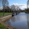
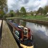
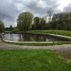
Mooring here is good (a nice place to moor), mooring rings or bollards are available. These are council moorings, not CRT, and are slightly beyond CRT's jurisdiction, which ends at Winsford Bridge (eastbound). They are round the corner, just before the bottom flash (lake). There is a water point on the east side near the slipway car park.
Facilities: showers, toilets and water point.
| River Weaver (Main Line) | ||
|---|---|---|
| Winsford Winding Hole | 3 furlongs | |
| Wharton Grinding Mills | 1½ furlongs | |
| Red Lion PH (Winsford) | ¼ furlongs | |
| Winsford Bridge (eastbound) | a few yards | |
| The Ark Inn | a few yards | |
| Winsford Bridge (westbound) | a few yards | |
| Winsford Marina | ||
| River Weaver (Winsford Bottom Flash) | ||
| Winsford Marina | ||
| Outlet of unnavigable upper River Weaver | a few yards | |
| Lakeside Caravan Park Pontoons | a few yards | |
| Winsford Flash Sailing Club | a few yards | |
Water point, usual CRT type. Plenty of mooring on rings. Facilities block contains toilets and showers and is on a BWB key.
Shops about 10 minutes walk in the town, convenience store nearer. Several Pubs nearby.
Quiet mooring while we were there midweek (April 2018).
- Discover the River Weaver Navigation — associated with River Weaver
- The Weaver Navigation
Mouseover for more information or show routes to facility
Nearest water point
In the direction of Delamere Dock Entrance
Nearest rubbish disposal
In the direction of Delamere Dock Entrance
Nearest chemical toilet disposal
In the direction of Delamere Dock Entrance
Nearest place to turn
In the direction of Delamere Dock Entrance
Nearest self-operated pump-out
In the direction of Delamere Dock Entrance
Nearest boatyard pump-out
In the direction of Delamere Dock Entrance
Vale Royal Visitor Moorings from Narrowboat Just Heaven posted Tuesday the 28th of May, 2019
There is no page on Wikipedia called “Winsford Marina”


![The navigable River Weaver, north of Bottom Flash. Looking downstream [locally north]. Under the control of the local council, not CRT. Navigable for full size narrowboats and links to a mooring basin provided by the local council. by Christine Johnstone – 14 September 2016](https://s3.geograph.org.uk/geophotos/05/18/18/5181855_12f22577_120x120.jpg)


![The River Weaver, between Winsford's two bridges. Looking downstream [locally north]. This section of the river is controlled by the local council, not CRT. by Christine Johnstone – 14 September 2016](https://s3.geograph.org.uk/geophotos/05/18/18/5181863_f7f70138_120x120.jpg)


![The northern of Winsford's two bridges over the Weaver. Carrying eastbound traffic on the A54. This bridge is the boundary of CRT's control of the navigation. Looking downstream [locally north]. by Christine Johnstone – 14 September 2016](https://s3.geograph.org.uk/geophotos/05/18/18/5181867_709dcfeb_120x120.jpg)


![Police guidance for salt lorries. Police segregate waiting salt lorries from regular traffic as queueing lorries from all over the country join the 2.5km queue extending from the Salt Union rock salt mine on Bradford Road [SJ6568] up Winsford High Street at noon on Wednesday 7th January 2009. The coldest start to a New Year for over seven years. by Andrew Fielding – 07 January 2009](https://s3.geograph.org.uk/geophotos/01/11/11/1111163_111d7d4b_120x120.jpg)


